un peu difficile
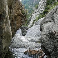
Estribiella
v4 a3 III
3h55
1h15
2h30
10min
1430m
1280m
150m
30m
1x30m+1x35m
13
1000m
à pied
Évaluation:
★★★★★
3.1 (2)
Info:
★★★
0 ()
Belay:
★★★
0 ()
Résumé:
traduction alternative
➜
Langue originale
Alpiner Abseilcanyon in großartiger Landschaft
Alpine rappel canyon in magnificent scenic surroundings
Est
Résumé:
traduction alternative
➜
Langue originale
Alpiner Abseilcanyon in großartiger Landschaft
Alpine rappel canyon in magnificent scenic surroundings
Accès:
traduction alternative
➜
Langue originale
Von Huesca auf der A 132 72 km Richtung Pamplona. Nach Erreichen der N 240 von Jaca bei Puente la Reina in's Hechotal abbiegen. 24 km weiter kommt man nach Hecho. Weiter geht es nordwärts, oben entlang am Boca Infierno, kommt man auf teilw. enger Straße nach Selva de Oza. Vor dem ersten verlassenen langgestreckten Haus Auto abstellen. Kurz vorher hat man den Estribiella überquert.
From Huesca on the A 132 72 km in the direction of Pamplona. After reaching the N 240 from Jaca, turn off at Puente la Reina into the Hecho Valley. 24 km further on you come to Hecho. Continue northwards, along the Boca Infierno, on a partly narrow road to Selva de Oza. Park your car in front of the first long abandoned house. Shortly before you have crossed the Estribiella.
Approche (1 h 15):
traduction alternative
➜
Langue originale
Vom Auto (1090 m ü.NN) über die Wiese aufwärts auf einem Wanderweg in den Wald hinein. Man folgt dem Weg, der später in Serpentinen steiler bergauf zieht. Nach Erreichen eines Hochtals links hinunter in das Bachbett des Estribiella (Steinmännchen).
From the car (1090 m above sea level) across the meadows uphill on a hiking trail into the forest. Follow the path, which later climbs more steeply in serpentines. After reaching a high valley, turn left down into the streambed of the Estribiella (cairn).
Tour (2 h 30):
traduction alternative
➜
Langue originale
13 Abseiler. Die ersten beiden höheren Stufen müssen (2007) in einem Zug durchgeseilt werden (25 m); die 'R20'-Abseiler im genannten Buch sind alle etwas knapp bemessen - oder ist das Folge der Seilschrumpfung?
13 Rappels. The first two higher steps have to be rappelled through in one go (2007) (25 m); the 'R20' rappels in the book mentioned are all a bit tight - or is that a result of rope shrinkage?
Retour (10 min):
traduction alternative
➜
Langue originale
Nach dem Abseiler mit dem kleinen Überhang noch ca. 150 m im Bachbett, den 5-m-Abseiler hinunter und dann auf Steigspuren links hinauf zum Anmarschweg. Auf diesem zurück zum Auto. Statt nach dem vertikalen Teil auszusteigen, wie hier beschrieben, kann man die Tour im Bachbett fortsetzen und erreicht dann nach 1,5 Std. die Straßenbrücke.
After the rappel with the small overhang, continue for approx. 150 m in the streambed, down the 5 m rappel and then on climbing tracks to the left up to the approach path. Follow this back to the car. Instead of getting out after the vertical part, as described here, you can continue the tour in the streambed and then reach the road bridge after 1.5 hours.
Coordonnées:
Départ du Canyon
Fin du Canyon
Littérature:
Livre Canyoning
Barranquismo en el Pirineo. Mapa 4. Cotiella - Ribagorza. Patrick Gimat, 1999
1999
Carte
http://www.wikiloc.com/wikiloc/view.do?id=13962928
Carte
IGN MTN50 144 (28-8) Ansó 1:50.000
Livre Canyoning
50 Barrancos del Pirineo: Los descensos mas bellos
José A. Ortega - Miguel A. Cebrián
DESNIVEL
2006
84-9829-034-1
50 Canyon-Beschreibungen
Livre Canyoning
Aragón. Gargantas y barrancos. 2. Pirineo Central.
Fernando Biarge / Ana Biarge
1996
Info canyon Cwiki
Info canyon Descente
Info canyon Ropewiki
14.07.2024
chesneau
⭐
★★★★★
📖
★★★
⚓
★★★
💧
Normale
Terminé ✔
pas de traduction disponible
Automatisch importiert von Descente-Canyon.com für Canyon Estribiella
magnifique..tout est ok
(Quelle: https://www.descente-canyon.com/canyoning/canyon-debit/21499/observations.html)
09.03.2023
System User
⭐
★★★★★
📖
★★★
⚓
★★★
pas de traduction disponible
Info: Teile der Canyonbeschreibung wurden automatisiert übernommen. Konkret die Felder Weblinks, Koordinaten, Rating, Länge des Canyon, Einfachseil Mindestens von https://www.descente-canyon.com/canyoning/canyon/21499
09.03.2023
System User
⭐
★★★★★
📖
★★★
⚓
★★★
pas de traduction disponible
Daten importiert von https://canyon.carto.net/cwiki/bin/view/Canyons/EstrebiellaCanyon.html
Hydrologie:
traduction alternative
➜
Langue originale
Pegel: http://www.saihebro.com/saihebro/index.php?url=/datos/ficha/estacion:P015
Level: http://www.saihebro.com/saihebro/index.php?url=/datos/ficha/estacion:P015


