moins difficile
Obergailer Bach
v3 a3 II
1h50
30min
1h15
5min
1350m
1140m
210m
17m
2x20m
400m
à pied
Évaluation:
★★★★★
1.5 (2)
Info:
★★★
0 ()
Belay:
★★★
0 ()
Résumé:
traduction alternative
➜
Langue originale
Kurzer Waldgraben zum Abseilen
Short forest canyon for rappeling
Nord
Résumé:
traduction alternative
➜
Langue originale
Kurzer Waldgraben zum Abseilen
Short forest canyon for rappeling
Accès:
traduction alternative
➜
Langue originale
Von Kötschach-Mauthen nehmen wir die B 111 und fahren ungefähr 19 km in westlicher Richtung das Lesachtal aufwärts bis zum Weiler Klebas. Etwa 400m weiter verlassen wir die B 111, fahren links hinunter über die Lesach und dann am Obergailer Bach entlang aufwärts. 4,1 km nach Verlassen der B 111 geht in einer scharfen Rechtskehre links ein Weg ab zum "Märchenland" und "Goldgräbercamp". Hier stellen wir unser Auto ab.
From Kötschach-Mauthen we take the B 111 and drive about 19 km in a westerly direction up the Lesach valley to the hamlet of Klebas. About 400m further on we leave the B 111, drive down to the left across the Lesach and then up along the Obergailer Bach stream. 4.1 km after leaving the B 111, in a sharp rightward haipin bend, a path turns off to the left to "Märchenland" and "Goldgräbercamp". Here we park our car.
Approche (30 min):
traduction alternative
➜
Langue originale
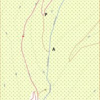
Wir folgen der Straße weiter aufwärts etwa 550m. Die Straße tritt nun aus dem Wald heraus. Hier kann man auf einem Steig zu einem Aussichtspunkt absteigen, wo die Wasserfälle teilweise einsehbar sind. Wieder zurück auf der Straße gehen wir noch einige Schritte weiter und suchen dann links einen Abstieg in das Bachbett.
We follow the road further uphill for about 550m. The road now emerges from the forest. Here you can descend on a path to a viewpoint where the waterfalls are partially visible. Back on the road, we continue for a few more steps and then look for a descent into the streambed on the left.
Tour (1 h 15):
traduction alternative
➜
Langue originale
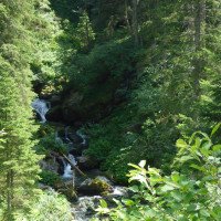
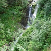
Folge von 5 Abseilern, dann im offenen Bachbett abwärts bis zu einer deutlichen Ausstiegsmöglichkeit nach links.
Sequence of 5 rappels, then down in the open streambed to a clear exit to the left.
Retour (5 min):
traduction alternative
➜
Langue originale
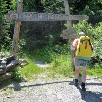
Durch das "Märchenland", vorbei am "Goldgräbercamp" zurück zur Straße und zum Auto.
Through the "Fairyland", past the "Gold Diggers Camp" back to the road and the car.
Coordonnées:
Départ du Canyon
46.6672°, 12.7896°
↓↑
DMS: 46° 40" 1.92', 12° 47" 22.56'
DM: 46° 40.032", 12° 47.376"
Google Maps
Autriche Topographique
DMS: 46° 40" 1.92', 12° 47" 22.56'
DM: 46° 40.032", 12° 47.376"
Google Maps
Autriche Topographique
Fin du Canyon
46.6698°, 12.7898°
↓↑
DMS: 46° 40" 11.28', 12° 47" 23.28'
DM: 46° 40.188", 12° 47.388"
Google Maps
Autriche Topographique
DMS: 46° 40" 11.28', 12° 47" 23.28'
DM: 46° 40.188", 12° 47.388"
Google Maps
Autriche Topographique
Littérature:
Carte
Freytag & Berndt WK 182, Lienzer Dolomiten, 1:50 000
Carte
ÖK50, Nr. 196, Obertilliach, 1:25 000
Info canyon Cwiki
Info canyon Descente
Info canyon Ropewiki
09.03.2023
System User
⭐
★★★★★
📖
★★★
⚓
★★★
pas de traduction disponible
Info: Teile der Canyonbeschreibung wurden automatisiert übernommen. Konkret die Felder Weblinks, Koordinaten, Rating, Länge des Canyon, Einfachseil Mindestens von https://www.descente-canyon.com/canyoning/canyon/22980
09.03.2023
System User
⭐
★★★★★
📖
★★★
⚓
★★★
pas de traduction disponible
Daten importiert von https://canyon.carto.net/cwiki/bin/view/Canyons/ObergailerBachCanyon.html
Hydrologie:


