un peu difficile
Scioperen
v4 a2 II
3h50
5min
2h45
1h
490m
200m
290m
50m
2x60m
9
900m
à pied
Évaluation:
★★★★★
2 (2)
Info:
★★★
0 ()
Belay:
★★★
0 ()
Résumé:
traduction alternative
➜
Langue originale
Waldgraben, teilweise vermüllt, mit aussichtsreichem Abstieg hinunter zum Lago di Mezzola
Forest canyon, partly muddy, with panoramic descent down to Lago di Mezzola
Résumé:
traduction alternative
➜
Langue originale
Waldgraben, teilweise vermüllt, mit aussichtsreichem Abstieg hinunter zum Lago di Mezzola
Forest canyon, partly muddy, with panoramic descent down to Lago di Mezzola
Accès:
traduction alternative
➜
Langue originale
Von Chavenna bzw. Lecco, Sondrio kommend überqueren wir den Fiume Mera auf der SS340dir am äußersten Nordausläufer des Lago di Como. Unmittelbar nach der Brücke biegen wir rechts ab, nehmen dann aber nicht rechts die Straße nach Dascio, sondern fahren links aufwärts nach Albonico (5,9 km bis zur Kirche). Von der Kirche fahren wir in Albonico noch 140 m in nördlicher Richtung bergauf und können dann linkerhand am Waldrand unser Auto abstellen.
Coming from Chavenna or Lecco, Sondrio, we cross the Fiume Mera on the SS340dir at the extreme northern foothills of Lago di Como. Immediately after the bridge we turn right, but then we do not take the road to Dascio on the right, but we go up on the left to Albonico (5.9 km to the church). From the church we go uphill in Albonico for another 140 m in a northerly direction and then we can park our car on the left at the edge of the woods.
Approche (5 min):
traduction alternative
➜
Langue originale
Wir folgen dem Wegweiser "S. Fedelino" und kommen in wenigen Minuten zur Brücke über "unseren" Bach (Einstieg re. unterhalb der Brücke).
We follow the sign "S. Fedelino" and in a few minutes we arrive at the bridge over "our" stream (entry on the right below the bridge).
Tour (2 h 45):
traduction alternative
➜
Langue originale
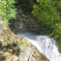
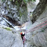
Zunächst zwei Abseiler mit 28 m und 31m, dann Waldgraben bis zu den beiden Fußgängerbrücken. Danach der attraktive Abstieg hinunter zum See.
First, two rappels of 28m and 31m, then forest canyon to the two footbridges. Then the attractive descent down to the lake.
Retour (1 h):
traduction alternative
➜
Langue originale
Weglos links hinauf klettern (ca. 140 Höhenmeter), nach Erreichen des Pfades links und hinauf nach Albonico.\nAlternativ kann man auch über den See am rechten Ufer entlang schwimmen,\neinige Häuser am Ufer passieren und bei einer etwas in den See ragendenden Felsplatte aussteigen. Ein kleiner Pfad führt hinauf zu einem Haus (Privatgrundstück). Von hier auf Wegen bzw. Teerstraße hinauf nach Albonico.
Climb up without a path on the left (about 140 meters of altitude), after reaching the path turn left and climb up to Albonico.\nAlternatively, you can swim across the lake along the right shore,\npass some houses on the shore and get off at a rocky plate that juts out a bit into the lake. A small path leads up to a house (private property). From here, follow the path or tarred road up to Albonico.
Coordonnées:
Départ du Canyon
Fin du Canyon
sortie à droite (sans sentier) vers le-haut et au sentier vers Albonico (descente)
Parking à l'entrée et à la sortie
(descente_3)
Point de repère
sortie à la sente privée (après nager) vers la villa au-dessus (descente)
Littérature:
Carte
CNS 277, Roveredo, 1:50 000
Carte
Kompass WK 91 Lago di Como-Lago di Lugano, 1:50 000
Carte
IGMI 25/V, 17 Novate Mezzola I-SE, 1:25 000
Livre Canyoning
Canyoning in Lombardia
Pascal van Duin
Edizioni TopCanyon
2005
978-8890175305
Livre Canyoning
Canyoning in Lombardia
Pascal van Duin
Edizioni TopCanyon
2005
978-8890175305
Info canyon Cwiki
Info canyon Descente
Info canyon Ropewiki
09.03.2023
System User
⭐
★★★★★
📖
★★★
⚓
★★★
pas de traduction disponible
Info: Teile der Canyonbeschreibung wurden automatisiert übernommen. Konkret die Felder Weblinks, Koordinaten, Rating, Länge des Canyon, Einfachseil Mindestens von https://www.descente-canyon.com/canyoning/canyon/23218
09.03.2023
System User
⭐
★★★★★
📖
★★★
⚓
★★★
pas de traduction disponible
Daten importiert von https://canyon.carto.net/cwiki/bin/view/Canyons/ScioperenCanyon.html
Hydrologie:

1 Ausgangspunkt

2 Blick über den Lago di M...

3 Lageplan

4 am Einstieg

5 Stand am ersten Abseiler...

6

7

8 zweiter Abseiler

9 dito

10 dito

11

12

13

14

15

16

17

18 der (Rück-)Weg kreuzt d...

19

20

21

22

23 Stand über der C50

24 c50

25 dito

26

27 letzter Abseiler

28

29 vom See aus Blick auf d...

30 auf dem Rückweg