moins difficile
Torrent Fondo 'Mortitx'
v3 a2 III
5h30
1h30
1h
3h
280m
5m
275m
20m
1x30m + 1x20m
8
400m
à pied
Évaluation:
★★★★★
4.3 (8)
Info:
★★★
2.3 (3)
Belay:
★★★
2.8 (5)
Résumé:
traduction alternative
➜
Langue originale
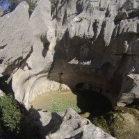
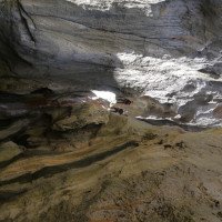
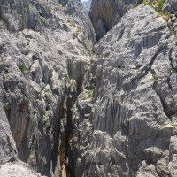
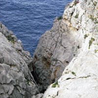
Zustieg führt durch einen Naturpark (Geier-Schonzeit von….bis…)! Beste Begehungszeit ist im Frühjahr (und nach Regen); 2 Ausstiegvarianten; schöne Auswaschungen, Sintervorhänge und Löcher; griffiges Gestein; einige Kletterpassagen; Schlucht mündet im Meer; landschaftlich sehr schön jedoch langer Zustieg/Rückweg; im hohen Gras ist der Weg nicht immer leicht erkennbar.
Seilstücke für Wiederaufstieg, falls Fixseile nicht vorhanden oder im schlechten Zustieg.
Access leads through a nature park (vulture closed season from....to...)! Best time is in spring (and after rain); 2 exit options; beautiful washouts, sinter curtains and holes; grippy rock; some climbing passages; canyon opens into the sea; scenic very beautiful but long access / return; in the high grass, the path is not always easy to recognize.
Pieces of rope for resumption, if fixed ropes are not available or in poor access.
Nord-Ouest
Résumé:
traduction alternative
➜
Langue originale
Zustieg führt durch einen Naturpark (Geier-Schonzeit von….bis…)! Beste Begehungszeit ist im Frühjahr (und nach Regen); 2 Ausstiegvarianten; schöne Auswaschungen, Sintervorhänge und Löcher; griffiges Gestein; einige Kletterpassagen; Schlucht mündet im Meer; landschaftlich sehr schön jedoch langer Zustieg/Rückweg; im hohen Gras ist der Weg nicht immer leicht erkennbar.
Seilstücke für Wiederaufstieg, falls Fixseile nicht vorhanden oder im schlechten Zustieg.
Access leads through a nature park (vulture closed season from....to...)! Best time is in spring (and after rain); 2 exit options; beautiful washouts, sinter curtains and holes; grippy rock; some climbing passages; canyon opens into the sea; scenic very beautiful but long access / return; in the high grass, the path is not always easy to recognize.
Pieces of rope for resumption, if fixed ropes are not available or in poor access.
Accès:
traduction alternative
➜
Langue originale
Von Port de Soller fährt man auf der Bundesstraße C711 Richtung Soller. Nach dem Tunnel kommt ein Kreisverkehr, wo man li in Richtung Pollenca abbiegt. Ab hier folgt man der langen kurvenreichen Bergstraße C710 auf 1000Hm, wo ein Tunnel zum 1. Stausee „Embassament de Cuber“ und nach kurzer Strecke zum 2. Stausee „Embassament des Gorge Blau“ , führt. Nach einem weiteren Tunnel folgt die Abzweigung nach „Sa Calobra“, mit einem Kiosk und großen Parkplatz davor. Hier fährt man weiter Richtung Pollenca. Am Restaurant „Escora“ vorbei gefahren, kommt nach einiger Zeit eine Kreuzung. Hier fährt man li weiter nach Pollenca hinunter. Nach ca. 10min bzw. kurz nach dem Pfosten (Km 11) kommt das Schild „Mortix“. Das eventuell offene Eisentor verleitet zum hineinfahren, genau das sollte aber nicht gemacht werden, da es sein kann dass es später geschlossen ist. Eine begrenzte Parkmöglichkeit findet man li vor dem Tor oder 50m weiter unten auf der re Straßenseite (hohe Straßenkante!!!)
From Port de Soller, take the C711 in the direction of Soller. After the tunnel there is a traffic circle where you turn left towards Pollenca. From here you follow the long winding mountain road C710 at 1000Hm, where a tunnel leads to the 1st reservoir "Embassament de Cuber" and after a short distance to the 2nd reservoir "Embassament des Gorge Blau" ,. After another tunnel follows the turnoff to "Sa Calobra", with a kiosk and large parking lot in front. Here you continue in the direction of Pollenca. After passing the restaurant "Escora", you will come to a crossroads. Here you drive down to the left to Pollenca. After about 10min or shortly after the post (Km 11) comes the sign "Mortix". The possibly open iron gate tempts to drive in, but exactly this should not be done, because it can be that it is closed later. A limited parking possibility can be found on the left side in front of the gate or 50m further down on the right side of the road (high road edge!!!).
Approche (1 h 30):
traduction alternative
➜
Langue originale
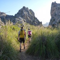
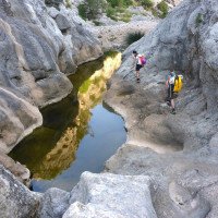
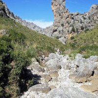
Durch das Tor, an einem Transformator und Tennisplatz vorbei immer am Hauptweg bleiben bis zu einem weiteren Tor vor einer (eventuell abgeschlossenen) als Refugio gekennzeichneten Steinhütte. Nach dem Überstieg folgt man der weiter der Strasse. Bald nachdem man ein trockenes Bachbett gequert hat, zweigt ein mit Steinmännern und roten Punkten gekennzeichneter Steig nach rechts ab (März 2009: Abzweigung gekennzeichnet durch grünes Schild an Olivenbaum)\n\nDieser Steig führt über eine mit Dissgras überwucherte Hochebene (Ses Comes) in Richtung NO in eine markante Scharte - ab hier kann der Steig nicht mehr verfehlt werden, es geht durchgehend durch die Schlucht abwärts bis zum Einstieg. Bei viel Wasser kann man den Neoprenanzug schon bei der Mündung des von links kommenden Torrent de s'Hort des Moli anlegen (Oberster Einstieg im Topo), ansonsten das erste Becken (Gorg Larg) rechts umklettern, das folgende Becken (Gorg del Bec d'Oca) dann links passieren und vorbei an einem markanten Felsturm, dem Entenschnabel (Bec d’Oca) am Beginn der finalen Einschluchtungeinsteigen - ab hier wird der Bach als Torrent Fondo bezeichnet..\n\nWer den langen Zustieg mit etwas Canyoning-Action würzen will, kann etwa 150m nach dem Abzweiger von der Strasse links ins meist trockene Bachbett den Torrent de s'Hort des Moli abzweigen. Nach etwas Blockhüpferei beginnt bald eine niedrige aber enge Klamm mit zwei Abseilern (4m und 15m) und einem unterhaltsamen Durchschlupf. In einer Talerweiterung kurz wandern (der von links kommende Bach soll auch begehbar sein) bevor eine zweite, tiefere Schlucht beginnt die mit 4 Abseilstellen und einigen Wasserbecken zum Standardabstieg führt. Abseilpunkte sind Bäume und dünne Sanduhrschlingen.
Through the gate, past a transformer and tennis court always stay on the main path until another gate in front of a stone hut (possibly locked) marked as a refugio. After crossing the gate, follow the road. Soon after crossing a dry streambed, a path marked with cairns and red dots branches off to the right (March 2009: branch marked by green sign on olive tree)\n\nThis path leads across a plateau overgrown with diss grass (Ses Comes) in the direction of NE to a prominent notch - from here on the path can no longer be missed, it goes continuously down through the canyon to the entry. If there is a lot of water, you can put on the wetsuit already at the mouth of the Torrent de s'Hort des Moli coming from the left (upper entry in the topographic view), otherwise climb around the first basin (Gorg Larg) on the right, pass the following basin (Gorg del Bec d'Oca) then on the left and past a prominent rock tower, the Duck's Beak (Bec d’Oca) at the beginning of the final canyon entry - from here on the stream is called Torrent Fondo.If you want to spice up the long access with some canyoning action, you can take the Torrent de s'Hort des Moli about 150m after the turnoff from the road to the left into the mostly dry streambed. After a bit of block hopping, a low but narrow gorge soon begins with two rappels (4m and 15m) and an entertaining passage. Hike briefly in a valley extension (the canyon coming from the left should also be walkable) before a second, deeper canyon begins which leads to the standard descent with 4 rappels and some pools of water. Anchors are trees and thin hourglass slings.
Tour (1 h):
traduction alternative
➜
Langue originale
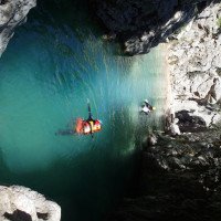
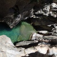
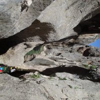
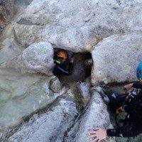
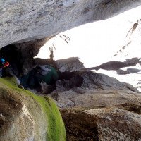
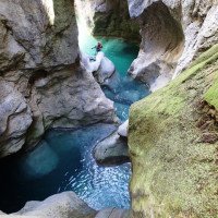
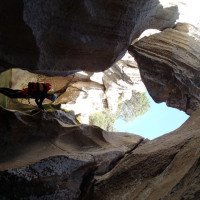
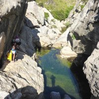
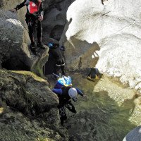
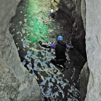
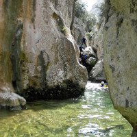
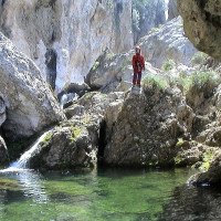
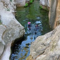
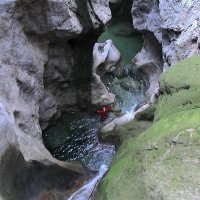
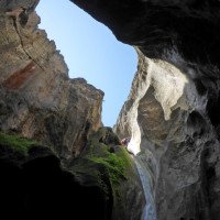
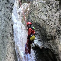
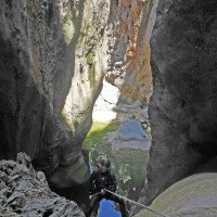
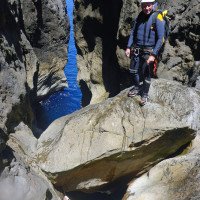
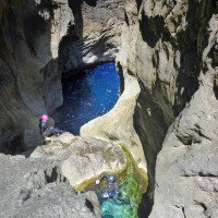
Die kurze aber beeindruckende und abwechslungsreiche Schlucht entschädigt den langen Zustieg und Rückweg. Allerdings sollte genügend fließend Wasser in den Gumpen sein. Zur Mittagzeit hat man am meisten Sonne in der Schlucht. Entscheidet man sich in der Schlucht wieder hoch zu steigen, sollte bei jeder Stufe abgeklärt werden ob ein Wiederaufsieg möglich ist. Besonders die letzten Stufen vor dem Meer sind sehr schön. Hier befindet sich auch die höchste Abseilstelle von ca. 20m. Danach entscheidet man sich für den Ausstieg re über die Felswand oder den Wiederaufstieg in der Schlucht.
1h
The short but impressive and varied canyon compensates for the long access and return. However, there should be enough running water in the pools. At lunchtime you have the most sun in the canyon. If you decide to climb back up in the canyons, you should check at each step whether it is possible to climb back up. Especially the last steps before the sea are very beautiful. Here is also the highest rappelling point of about 20m. After that, you can decide whether to exit to the right over the rock face or to climb back up the canyon.
Retour (3 h):
traduction alternative
➜
Langue originale
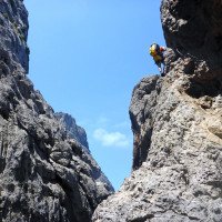
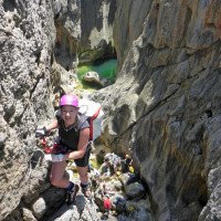
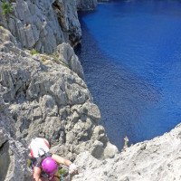
Es gibt 2 Möglichkeiten aus der Schlucht auszusteigen. 1. Möglichkeit (empfehlenswert!): Man steigt über die angebrachten Fixseile wieder in der Schlucht zum Einstieg hinauf. 2. Möglichkeit: Am Ende der Schlucht (beim Meer) hat man die Möglichkeit über die steilen schroffen Felswände re aus der Schlucht zu Klettern (3. Grad!). Klebehaken zur Nachsicherung vorhanden. Am Rand der Klippen angelangt muss noch ein sehr unübersichtliches Karrenfeld gequert werden (Steinmännchen und deutliche Kletterspuren). Wieder auf ebenen Boden angelangt kurz Richtung Osten in einen Sattel aufsteigen.
Auch hier hat man wieder zwei Möglichkeiten:
Variante 1: durch das breite Becken oberhalb der Steilküste oder wieder zurück ins Tal und den Mortitx wie beim Zustieg zurückgehen.
Variante 2: Über den Weg nahe an den Hexenhöhlen vorbei.
Variante 1: Geht man ins Tal folgt man am Einstieg der Mortix angekommen wieder den Wanderweg/Bachbett zurück zum Ausgangspunkt (Parkplatz)
Variante 2: Bald trifft man auf den mit Steinmännchen markierten Weg zu den im Nordosten gelegenen Hexenhöhlen den man kurz aufsteigend Richtung Südwest zu einem verlassenen Bauernhof folgt (am Weg gemauerter Brunnen). Durch das offene Tal zurück zum Bachbett und über den Zustiegsweg zurück zum Parkplatz. Ein (lohnender) alternativer Zustieg oder Rückweg über die Hochfläche ist im Rother Wanderführer Mallorca beschrieben. Es zahlt sich durchaus aus, den Zustieg und Rückweg im Zuge einer Wanderung zu den Hexenhöhlen auszukundschaften.
approx. 1,5h ascent again + 1,5-2h way back.
There are 2 possibilities to get out of the canyon. 1st possibility (recommended!): You climb over the fixed ropes back in the canyon to the entry. 2nd possibility: At the end of the canyon (near the sea) you have the possibility to climb over the steep craggy rock walls right out of the canyons (3rd degree!). Glued anchors are available for belaying. Arrived at the edge of the cliffs, a very unclear cart field must be crossed (cairns and clear climbing tracks). Back on level ground, briefly climb eastwards into a saddle.
Here again you have two options:
Variant 1: through the wide basin above the cliff or back down into the valley and return the Mortitx as for the access.
Variant 2: Via the path close to the witches' caves.
Variant 1: If you go down into the valley, you follow the path/streambed back to the starting point (parking lot) at the entry of the Mortix.
Alternative 2: Soon you meet the path marked with cairns to the witch caves located in the northeast, which you follow briefly ascending in a southwesterly direction to an abandoned farm (brick well on the path). Through the open valley back to the streambed and via the access path back to the parking lot.\nA (worthwhile) alternative access or return route across the plateau is described in the Rother hiking guide Mallorca. It is well worthwhile to explore the access and return route in the course of a hike to the witches' caves.
Coordonnées:
Départ du Canyon
Parking à l'entrée et à la sortie
Fin du Canyon
Point de repère
sentier direct (le-haut) (descente)
Point de repère
sentier direct (la-bas) (descente)
Départ alternatif du Canyon
Zustieg durch Bachbett, kleine Abseiler ein "Schlupfloch" und Bachwanderung.
Littérature:
Carte
1:50000
Livre Canyoning
Livre Canyoning
J. Barceló - M. Trias
2014
978-84-617-0643-3
48 Beschreibungen, sehr genau und umfassend
Livre Canyoning
Livre Canyoning
Livre Canyoning
Livre Canyoning
Livre Canyoning
Stéphane Coté / Caracal et les Sancho Panza
2007
124 Canyon-Beschreibungen
Livre Canyoning
Thierry Achmétoff
2004
- Sa Cova
- Valldemossa
- Salt
- Coanegra
- Biniaraix
- Almedra
- Namora
- Diners
- Comafreda
- Pareis
- Gorg Blau & Sa Fosca
- Esmolar
- Son Nebot
- Mortitx
- Molinet
Livre Canyoning
Eduardo Gómez - Laura Tejero
2004
Livre Canyoning
Corrado Conca / Paolo Madonia / Diego Leonardi
2002
Livre Canyoning
1999
Livre Canyoning
Livre Canyoning
Pere Miralles
1994
Livre Canyoning
Eduardo Gomez, Miquel Soro
Eigenverlag
1993
67 Canyon-Beschreibungen
Info canyon ACA
Info canyon Cwiki
Info canyon Descente
Info canyon Ropewiki
Autre info canyon
Autre info canyon
22.12.2024
gebu2
⭐
★★★★★
📖
★★★
⚓
★★★
💧
Faible
Terminé ✔
pas de traduction disponible
Automatisch importiert von Descente-Canyon.com für Canyon Mortitx
Clear, cold water from the Pool below Bec d'Oca. Many fixed ropes, Bolts perfect. The iron Rope of the via ferrata ist damaged in the second Vertical Part. (Gap of One Meter). Great but exhausting Trip.
(Quelle: https://www.descente-canyon.com/canyoning/canyon-debit/2836/observations.html)
22.12.2024
Rok
⭐
★★★★★
📖
★★★
⚓
★★★
💧
Faible
Terminé ✔
traduction alternative
➜
Langue originale
D'autres utilisateurs ont été: GeorgB
Alles tip top in der Schlucht. Mega Erlebnis. Beim Austiegsklettersteig (ganz dünner draht) fehlt ein Stück, aber kein großes Problem. Aktuell top Bedienungen. Anmeldung erforderlich…
Everything tip top in the canyon. A mega experience. The exit via ferrata (very thin wire) is missing a section, but not a big problem. Currently top service. Registration required...
D'autres utilisateurs ont été: GeorgB
21.10.2024
achoisy
⭐
★★★★★
📖
★★★
⚓
★★★
💧
Sèche
Terminé ✔
pas de traduction disponible
Automatisch importiert von Descente-Canyon.com für Canyon Mortitx
Quelques vasques remplies mais aucun écoulement. Quasi équipé intégralement en fixe sauf pour la C20
(Quelle: https://www.descente-canyon.com/canyoning/canyon-debit/2836/observations.html)
07.05.2024
descentecanyon1
⭐
★★★★★
📖
★★★
⚓
★★★
💧
Faible
Terminé ✔
pas de traduction disponible
Automatisch importiert von Descente-Canyon.com für Canyon Mortitx
(Quelle: https://www.descente-canyon.com/canyoning/canyon-debit/2836/observations.html)
03.05.2024
Martiiin
⭐
★★★★★
📖
★★★
⚓
★★★
💧
Faible
Terminé ✔
pas de traduction disponible
Automatisch importiert von Descente-Canyon.com für Canyon Mortitx
Mon dieu tous ces vélos sur la route!Sauts dans la mer bien douce extra au final.Manque une petite longueur de 3m de corde sur la via ferrata du retour à replacer.
(Quelle: https://www.descente-canyon.com/canyoning/canyon-debit/2836/observations.html)
02.05.2024
spacerouquin
⭐
★★★★★
📖
★★★
⚓
★★★
💧
Faible
Terminé ✔
pas de traduction disponible
Automatisch importiert von Descente-Canyon.com für Canyon Mortitx
canyon superbe, sortie par la via, pas possible d'approcher de la mer à cause de la houle
(Quelle: https://www.descente-canyon.com/canyoning/canyon-debit/2836/observations.html)
24.04.2024
Speleolus
⭐
★★★★★
📖
★★★
⚓
★★★
💧
Faible
Terminé ✔
pas de traduction disponible
Automatisch importiert von Descente-Canyon.com für Canyon Mortitx
Descente effectuée à 10 en 2h30. La mer était déchaînée, impossible de sauter après la dernière vasque. Remonté par la via, toujours aussi impressionnante mais quelle vue!!
(Quelle: https://www.descente-canyon.com/canyoning/canyon-debit/2836/observations.html)
02.04.2024
Joey CIA
⭐
★★★★★
📖
★★★
⚓
★★★
💧
Faible
Terminé ✔
traduction alternative
➜
Langue originale
Super schöne Tour in toller Landschaft! Zustieg durch den trockenen Graben dann ein paar Pools die man umklettern kann bis der Canyon startet. Ein Teil der Gruppe ist nach dem Sprung ins Meef vom Boot abgeholt worden der andere Teil über den "Klettersteig" an der Steilküste hoch und dann zurück gewandert...
Superiore tour in great scenic surroundings! Access through the dry ditch then a few pools that you can climb around until the canyon starts. One part of the group was picked up by the boat after the jump into the Meef, the other part hiked up the "via ferrata" on the steep coast and then back...
31.03.2024
lorenzgr
⭐
★★★★★
📖
★★★
⚓
★★★
💧
Faible
Terminé ✔
pas de traduction disponible
Automatisch importiert von Descente-Canyon.com für Canyon Mortitx
très petit filet d'eau, vasques ok, nombreuses cordes fixes, via ferrata difficile avec beaucoup d'escalade libre
(Quelle: https://www.descente-canyon.com/canyoning/canyon-debit/2836/observations.html)
25.03.2024
Klara Skopal
⭐
★★★★★
📖
★★★
⚓
★★★
Terminé ✔
traduction alternative
➜
Langue originale
Wasser recht kalt, super rutschig an vielen Stellen. Absicherung super, Fixseile fast überall vorhanden, wir haben unser Seil nur 2x gebraucht (20m Abseiler und am Schluss der optionale "Abkletterer" ins Meer)
Ausstieg nichts für schwache Nerven, Kletteraufstieg in luftigen Höhen teils ohne Absicherung bzw recht ausgesetzt, zwischenzeitig sehr dünnes Drahtseil, aber wenigstens was hihi würde ich für Anfänger/ Höhenempfindliche nicht unbedingt empfehlen. Sehr scharfer Stein -> auf jeden Fall Handschuhe mitnehmen!
Alles in allem, mega schön, vor allem die Aussicht aufs Meer vom Klettersteig aus :)
Water quite cold, super slippery in many places. Superiore protection, fixed ropes available almost everywhere, we only needed our rope twice (20m rappel and at the end the optional "downclimb" into the sea).
Exit not for the faint-hearted, climbing ascent at lofty heights partly without protection or quite exposed, in between very thin wire rope, but at least something hihi I would not necessarily recommend for beginners/sensitive to heights. Very sharp rock -> definitely take gloves!
All in all, mega beautiful, especially the view of the sea from the via ferrata :)
24.03.2024
Anaïs (Scooby)
⭐
★★★★★
📖
★★★
⚓
★★★
💧
Faible
Terminé ✔
pas de traduction disponible
Automatisch importiert von Descente-Canyon.com für Canyon Mortitx
L’incontournable Mortitx a encore un petit filet d’eau qui coule et ses belles vasques pleines. Mer bien agitée. Sortie par VF sans problème, mais ne pas compter sur la solidité du câble. MR on a opté pour le Mas Rafael. C’est plus long et un peu paumatoire mais la vue sur les lapiaz vaut largement le détour. 3h de « marche retour » depuis la fin du canyon.
(Quelle: https://www.descente-canyon.com/canyoning/canyon-debit/2836/observations.html)
15.03.2024
Nico-agl
⭐
★★★★★
📖
★★★
⚓
★★★
💧
Normale
Terminé ✔
pas de traduction disponible
Automatisch importiert von Descente-Canyon.com für Canyon Mortitx
Magnifique descente.Entre filet d'eau et débit correct.Sa coule du début à la fin, descente super ludique tout se saute sauf le plus grand ressaut.Retour par la via ferrata qui est plus psychologique que difficile.
(Quelle: https://www.descente-canyon.com/canyoning/canyon-debit/2836/observations.html)
02.05.2023
System User
⭐
★★★★★
📖
★★★
⚓
★★★
pas de traduction disponible
Der aktuelle Canyon wurde teilautomatisiert mit Canyon https://canyon.carto.net/cwiki/bin/view/Canyons/MortitxCanyon.html zusammengeführt.
09.03.2023
System User
⭐
★★★★★
📖
★★★
⚓
★★★
pas de traduction disponible
Daten importiert von https://canyon.carto.net/cwiki/bin/view/Canyons/MortitxCanyon.html
09.03.2023
System User
⭐
★★★★★
📖
★★★
⚓
★★★
pas de traduction disponible
Info: Teile der Canyonbeschreibung wurden automatisiert übernommen. Konkret die Felder Weblinks, Koordinaten, Rating, Länge des Canyon, Einfachseil Mindestens von https://www.descente-canyon.com/canyoning/canyon/2836
09.03.2023
System User
⭐
★★★★★
📖
★★★
⚓
★★★
pas de traduction disponible
Daten importiert von https://www.canyoning.or.at/index.php/liste-aller-canyons/109-torrente-fondo-mortix
31.10.2018
Christian Balla
⭐
★★★★★
📖
★★★
⚓
★★★
💧
Normale
Terminé ✔
traduction alternative
➜
Langue originale
Für eine super Canyoning Tour braucht man einen sensationellen Canyon, optionale Bedingungen, eine gute Truppe und einen möglichst komfortablen zustieg und Rückweg. Meistens. Für Mortitx gilt, dass man ehr gute Bedingungen (Sonne & optimale Wassermenge) und eine gute Truppe braucht. Wenn man dann noch mit der Einstellung herangeht, dass man eine ausgiebige Wanderung unternimmt, welche zwischendurch ein paar Stunden Canyoning enthält, dann darf man sich auf einen perfekten, sensationellen Tag freuen! Mit Wasser ist Mortitx ein traumhafter Canyon. Für den Rückweg empfehlt es sich, eine Taschenlampe und einen Kompass oder GPS dabei zu haben, da man auf dem Rückweg durch das Gras bei Dunkelheit potenziell die Orientierung verlieren kann.
Fotos zur Tour:
https://www.christian-balla.de/Mortitx
Video zur Tour:
https://www.youtube.com/watch?v=AWToeT0NcR8
For a superiore canyoning tour you need a sensational canyon, optional conditions, a good group and a comfortable access and return route. Most of the time. For Mortitx, you need good conditions (sun & optimal water quantity) and a good group. If you then approach it with the mindset that you are undertaking an extensive hike, which includes a few hours of canyoning in between, then you can look forward to a perfect, sensational day! With water, Mortitx is a fantastic canyon. For the way back, it is advisable to have a flashlight and a compass or GPS with you, as you can potentially lose your bearings on the way back through the grass in the dark.
Photos of the tour:
https://www.christian-balla.de/Mortitx
Video of the tour:
https://www.youtube.com/watch?v=AWToeT0NcR8
Nouveau rapport
Veuillez décrire brièvement et de manière concise les informations les plus importantes de la dernière visite ou les informations actuelles importantes sur le canyon. Si nécessaire avec des liens vers des vidéos, photos, etc.
*
*
*
Esc
Del
Hydrologie:
