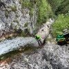
non così difficile
Rio Malimberg (Inferiore)
v3 a3 III
1h55
20min
1h30
5min
700m
560m
140m
20m
2x40m
10
400m
a piedi
Valutazione:
★★★★★
3.2 (13)
Info:
★★★
2.6 (13)
Belay:
★★★
3 (12)
Sintesi:
traduzione alternativa
➜
Lingua originale
Kleines Einzugsgebiet; gut kombinierbar mit Rio Pliz (Empfehlung: erst Rio Pliz dann Rio Malimberg); mehrere Abseilstellen bis 20m; schöne Einzellstellen; sauberes Wasser, kurzer Zustieg
Small catchment area; can be combined well with Rio Pliz (recommendation: first Rio Pliz then Rio Malimberg); several rappelling points up to 20m; nice single points; clean water, short access
Sud
Sintesi:
traduzione alternativa
➜
Lingua originale
Kleines Einzugsgebiet; gut kombinierbar mit Rio Pliz (Empfehlung: erst Rio Pliz dann Rio Malimberg); mehrere Abseilstellen bis 20m; schöne Einzellstellen; sauberes Wasser, kurzer Zustieg
Small catchment area; can be combined well with Rio Pliz (recommendation: first Rio Pliz then Rio Malimberg); several rappelling points up to 20m; nice single points; clean water, short access
Accesso:
traduzione alternativa
➜
Lingua originale
Von Hotel Carnia fährt man auf der SS13 Richtung Tarvisio. Am Ende der Ortschaft Chiusaforte biegt man re Richtung „Sella Nevea“/Raccolana ab. Diese Straße gerade aus folgen, durch die Lawinengalerie durch und weiter gerade aus. Ca. 4Km nach der Lawinengalerie kommt die Ortschaft „Saletto“. Hier biegt man li (über die Brücke) Richtung „Chiout Cali“ ab. Am Ortseingang überquert man „Rio Malimberg“. Gleich nach der Brücke re parken (neben dem Stromhäuschen).
From Hotel Carnia take the SS13 in the direction of Tarvisio. At the exit of Chiusaforte turn right towards "Sella Nevea"/Raccolana. Follow this road straight on, go through the avalanche gallery and continue straight on. About 4 km after the avalanche gallery you will reach the village of "Saletto". Here you turn left (over the bridge) towards "Chiout Cali". At the entrance of the village you cross "Rio Malimberg". Immediately after the bridge park on the right (next to the power house).
Avvicinamento (20 min):
traduzione alternativa
➜
Lingua originale
Am Stromhäuschen nach der Brücke sieht man schon die Wandermarkierung 641 (Achtung: in der Tabacco Karte ist der Wanderweg schon vor der Brücke eingezeichnet. Das ist aber falsch!) Gleich hinter dem Stromhäuschen folgt man der Zufahrtstraße zum 1. Haus hoch. Der Weg geht zwischen den Häusern durch bis man wieder auf Asphalt stößt. Hier re weiter in Richtung Strommasten, wo erneut eine Wandermarkierung 641 angebracht ist. Ab hier folgt man den Weg 641 bis zur Holzbrücke die über den Rio Malimberg führt. Achtung, gleich nach der Brücke geht ein unscheinbarer steiler Pfad li hoch. Mit schnellen Höhengewinn (auf der orographisch li Schluchtenseite) steht man in Kürze beim Einstieg, auf 690Hm.
At the power house after the bridge you can already see the hiking mark 641 (Attention: in the Tabacco map the hiking trail is already marked before the bridge. But this is wrong!) Immediately after the power house you follow the access road up to the 1st house. The path goes between the houses until you reach asphalt again. Here turn right in the direction of the electricity pylons, where there is again a trail marker 641. From here, follow path 641 until you reach the wooden bridge that crosses the Rio Malimberg. Attention, just after the bridge an inconspicuous steep path goes up on the left. With a quick gain in altitude (on the orographic left side of the gorge) you will soon be at the entry, at 690Hm.
Giro (1 h 30):
traduzione alternativa
➜
Lingua originale
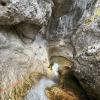
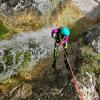
Die Rio Malimberg inferiore ist eine schöne, kurze, technisch nicht allzu schwere Tour, der auf jeden Fall einiges zu bieten hat. Aufgrund der Charakteristik ist die Schlucht auch für Einsteiger geeignet, hat aber auch genug Potential für erfahrenen Canyonauten. Die meisten Abseilstellen sind gut einsehbar und die Gumpen nicht tief. Einige Abseiler sind im Wasserlauf und sorgen für Erfrischung. Die Schlucht ist von Anfang bis Ende sehr kontinuierlich, mit nur kurzen Gehpassagen. Bei der Holzbrücke hat man die Möglichkeit auf den Weg 641 auszusteigen. Der weitere Abstieg zahlt sich aber auf jeden Fall aus (störend ist hier nur eine Wasserableitung, die plötzlich im Feld verschwindet).
The Rio Malimberg inferiore is a beautiful, short, technically not too difficult tour, which definitely has a lot to offer. Due to the characteristics, the canyon is also suitable for beginners, but also has enough potential for experienced canyoneers. Most of the rappels are easy to see and the pools are not deep. Some rappels are in the watercourse and provide refreshment. The canyon is very continuous from start to exit, with only short walking passages. At the wooden bridge you have the possibility to get off on path 641. However, the further descent pays off in any case (disturbing here is only a water drainage, which suddenly disappears in the field).
Ritorno (5 min):
traduzione alternativa
➜
Lingua originale
Auf ca. 570Hm vor der Straßenbrücke re zum Parkplatz/Stromhäuschen austeigen.
At approx. 570Hm before the road bridge, get off on the right to the parking lot/power house.
Coordinate:
Inizio del canyon
Parcheggio Entrata e uscita
Fine del canyon
Letteratura:
Mappa
Mappa
1:25000
Libro Canyoning
Franco Longo
2011
Italia: Zemola inf., Vinadia, Chiantone, Picchions,Lumiei, Novarza, Frondizzon,Leale inf., Pissanda,
Favarinis, Lavarie,Chiampeit, Stivane, Nero, Alba, Tralba inf.,Simon inf., Cuestis, Belepeit, Mulin,
Brussine, Patoc, Rivis, Costa Stretta, Sbrici, Lis Cladis, Malinberg, Pliz, Torto, Trincea
Slovenia: Predelica, Fratarica, Susec, Kozjak, Brus-Rocica, Smast, Sopotnica, Jerecica, Gremecica
(kein Inhalts- oder Stichwortverzeichnis, keine Seitenangaben)
Libro Canyoning
Associazione Italiana Canyoning
2009
Italien
Novarza
Lumiei
Torrente La Foce
Rio Picchions-Vinadia
Rio Chiantone
Rio Frondizzon
Rio Favarinis
Rio Pissanda
Rio Lavarie
Rio Chiampeit
Rio Tralba
Rio Simon
Rio Cuestis (Umschlagfoto)
Rio Belepeit
Rio del Mulin
Patoc
Lis Cladis – Impresis
Rio Malinberg
Rio Pliz
Slowenien
Globoski Potoc
Predelica
Fratarica
Mlinarica
Podolu
Österreich
Frauenbach
Steinerne Rinne
Silberbach
Info sul canyon Cwiki
Info sul canyon Descente
Info sul canyon Ropewiki
Altro info sul canyon
Info sul canyon ACA
Rapporto di viaggio (ad es. blogpost)
06.04.2025
Péter Bonczi
⭐
★★★★★
📖
★★★
⚓
★★★
💧
Normale
Completato ✔
traduzione alternativa
➜
Lingua originale
Ideális állapotban.
In ideal condition.
05.04.2025
Kris Klein
⭐
★★★★★
📖
★★★
⚓
★★★
💧
Normale
Completato ✔
traduzione alternativa
➜
Lingua originale
Die Holzbrücke aus der Beschreibung des Zustieges gibt es nicht mehr.
Stände alle super, nur Bohrhaken bei Abseiler 3 hängt noch raus. Hilfseile ebenfalls noch vorhanden und in gutem Zustand. Ab Mittag Sonne.
The wooden bridge from the description of the access no longer exists.
Stands all superiore, only bolts at rappel 3 are still hanging out. Auxiliary ropes also still present and in good condition. Sun from midday.
25.10.2024
Péter Bonczi
⭐
★★★★★
📖
★★★
⚓
★★★
💧
Alto
Completato ✔
traduzione alternativa
➜
Lingua originale
Felszerelés rendben. Az átlagosnál több víz.
Equipment OK. More water than average.
21.10.2024
Max H.
⭐
★★★★★
📖
★★★
⚓
★★★
💧
Normale
Completato ✔
traduzione alternativa
➜
Lingua originale
Altri utenti sono stati: Sebastian Hehenwarter Steffi Oe.
Erneut begangen als Ausweichbach da Favarinis und Pissanda noch etwas zuviel Wasser hatten.
Again used as an alternative stream as Favarinis and Pissanda still had a little too much water.
Altri utenti sono stati: Sebastian Hehenwarter Steffi Oe.
18.10.2024
Max H.
⭐
★★★★★
📖
★★★
⚓
★★★
💧
Alto
Completato ✔
traduzione alternativa
➜
Lingua originale
Altri utenti sono stati: Markus Gottwald
Als Nachmittagstour bei Regen eingeschoben. Ziemlich viel Wumps wenn man den Strahl erwischt aber meistens kann man rechts/links/darunter gehen. Geht auch noch bei mehr Wasser als wir hatten.
Inserted as an afternoon tour in the rain. Quite a lot of wumps if you catch the stream but you can usually go right/left/under it. Still possible with more water than we had.
Altri utenti sono stati: Markus Gottwald
03.10.2024
Manuel Reindl
⭐
★★★★★
📖
★★★
⚓
★★★
💧
Alto
Completato ✔
traduzione alternativa
➜
Lingua originale
Altri utenti sono stati: Paul Mistlbacher
Mehr Wasser als normal aber immer noch begehbar. Stände sind ok. Schnelle / nette Tour.
More water than normal but still walkable. Stands are ok. Fast / nice tour.
Altri utenti sono stati: Paul Mistlbacher
15.07.2024
Bina
⭐
★★★★★
📖
★★★
⚓
★★★
💧
Normale
Completato ✔
nessuna traduzione disponibile
Automatisch importiert von Descente-Canyon.com für Canyon Malinberg
Nice little canyon after Rio Pliz down part.
(Quelle: https://www.descente-canyon.com/canyoning/canyon-debit/22122/observations.html)
15.07.2024
Bina
⭐
★★★★★
📖
★★★
⚓
★★★
💧
Normale
Completato ✔
traduzione alternativa
➜
Lingua originale
Altri utenti sono stati: Patrik Bartel
Zustieg dank blauer Punke noch findbar.
Schöne, kurze Schlucht, die wir nach Pliz gemacht haben.
Access can still be found thanks to blue markers.
Beautiful, short canyon that we did after Pliz.
Altri utenti sono stati: Patrik Bartel
28.04.2024
Péter Bonczi
⭐
★★★★★
📖
★★★
⚓
★★★
💧
Normale
Completato ✔
traduzione alternativa
➜
Lingua originale
Minden rendben.
Everything is fine.
27.04.2024
Tjaz
⭐
★★★★★
📖
★★★
⚓
★★★
💧
Normale
Completato ✔
nessuna traduzione disponibile
Super nice canyon, short, easy, but still with some technical challenges.
I would definitely rate it more then 2,5 😊
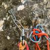
One anchor point number 3 is a little broken, but still OK. You can see on photo
22.08.2023
Wolfgang
⭐
★★★★★
📖
★★★
⚓
★★★
💧
Normale
Completato ✔
traduzione alternativa
➜
Lingua originale
Die kleinen Pools genützt um der Hitze zu entkommen. Alle Stände OK
Used the small pools to escape the heat. All stands OK
22.07.2023
Rok
⭐
★★★★★
📖
★★★
⚓
★★★
💧
Normale
Completato ✔
traduzione alternativa
➜
Lingua originale
Alles tip top. Wir haben ein Seilstück hängen lassen, da ein Stand im Nassen etwas heikel angeklettert werden musste. Beim letzten Abseiler (SOS1) über beide Wasserfälle abseilen.
Everything tip top. We left a piece of rope hanging, because a stand in the wet had to be climbed a bit tricky. On the last rappel (SOS1) rappel over both waterfalls.
11.04.2023
Daniel Sturm
⭐
★★★★★
📖
★★★
⚓
★★★
Completato ✕
traduzione alternativa
➜
Lingua originale
Koordinaten und Beschreibung bearbeitet.
Coordinates and description edited.
09.03.2023
System User
⭐
★★★★★
📖
★★★
⚓
★★★
nessuna traduzione disponibile
Daten importiert von https://canyon.carto.net/cwiki/bin/view/Canyons/MalinbergCanyon.html
13.08.2019
Christian Balla
⭐
★★★★★
📖
★★★
⚓
★★★
💧
Normale
Completato ✔
traduzione alternativa
➜
Lingua originale
Fotos und GPS Track vom Zustieg:
https://www.christian-balla.de/Malinberg
Video:
https://www.youtube.com/watch?v=v8nqXWDIi-g
Photos and GPS track of the access:
https://www.christian-balla.de/Malinberg
Video:
https://www.youtube.com/watch?v=v8nqXWDIi-g
Nuovo rapporto
Riportare brevemente e concisamente le informazioni più importanti dell'ultimo tour o importanti informazioni attuali sul canyon. Se necessario con link a video, foto, ecc..
*
*
*
Esc
Del
Idrologia:


