non così difficile
Rio Sfonderat
v3 a3 IV
5h30
2h
3h
30min
850m
542m
308m
30m
12
Valutazione:
★★★★★
3.1 (3)
Info:
★★★
3 (2)
Belay:
★★★
2.5 (2)
Sintesi:
traduzione alternativa
➜
Lingua originale
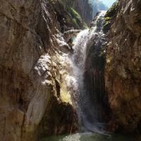
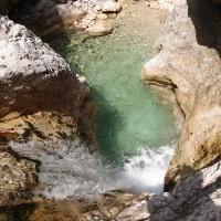
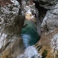
Abgelegener und abwechslungsreicher Canyon in enger aber meist sonniger Klamm
Remote and varied canyon in narrow but mostly sunny gorge
Nord
Sintesi:
traduzione alternativa
➜
Lingua originale
Abgelegener und abwechslungsreicher Canyon in enger aber meist sonniger Klamm
Remote and varied canyon in narrow but mostly sunny gorge
Accesso:
traduzione alternativa
➜
Lingua originale
Der SS13 durchs Kanaltal bis Dogna folgen, hier ins Dognatal abzweigen. Der Strasse folgen bis man den Rio Mas überquert (alte Brückenreste und Tunnel). Etwa 500m nach der Brücke Parkmöglichkeit bei einem gelben Wanderwegschild.
Follow the SS13 through the Canal Valley until Dogna, here turn off into the Dogna Valley. Follow the road until you cross the Rio Mas (old bridge remains and tunnel). About 500m after the bridge you can park at a yellow hiking trail sign.
Avvicinamento (2 h):
traduzione alternativa
➜
Lingua originale
Den teilweise abgerutschten Steig 640 etwa 100hm bis zum Torrente Dogna folgen. Den Bach durchwaten (die Brücke wurde 2007 weggespült) und am anderen Ufer mit vielen Kehren bis zu einer Hausruine aufsteigen. Hier weiter den Steig 640 durch schönen Buchenwald bergauf. Wenn der Steig eine Kehre nach links macht (Markierungen und Pfeile) den sehr undeutlichen Steigspuren geradeaus folgen. Anfangs steil dann nur mehr leicht steigend quert man hoch über der Klamm. Man erreicht bald ein trockenes Bachbett, der Steig verschwindet hier komplett. Weiter ansteigend queren bis man einen Waldsattel oberhalb der Klamm erreicht, ab hier ist der Steig wieder deutlich zu sehen. Weiter queren bis man ein meist wasserführendes Bachbett erreicht, den Bach überqueren und entlang der Felswand absteigen (zuletzt Drahtseil). Im Bachbett angelangt klettert man noch etwa 15min abwärts bis man oberhalb der ersten Abseilstelle steht.
Follow the partially slipped path 640 for about 100m to Torrente Dogna. Wade through the stream (the bridge was washed away in 2007) and climb up the other bank with many hairpin bends to a ruined house. Here, continue uphill along path 640 through beautiful beech woods. When the path makes a hairpin bend to the left (markings and arrows) follow the very indistinct trail straight ahead. At first steeply then only slightly ascending you cross high above the gorge. Soon you reach a dry streambed, the path disappears completely here. Continue climbing until you reach a forest saddle above the gorge, from here the path is clearly visible again. Continue traversing until you reach a streambed that usually carries water, cross the streambed and descend along the rock face (last wire rope). Once in the streambed, climb down for about 15min until you are above the first rappel point.
Giro (3 h):
traduzione alternativa
➜
Lingua originale
Sequenz:
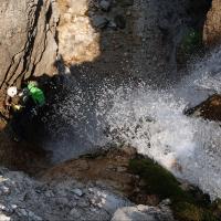
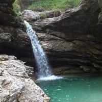
* 15m Abseiler, Schlinge rechts (Achtung Klemmblock in der Mitte des Wasserfalls)
* Wanderstrecke
* 4m Abseiler, Haken rechts
* 3m Rutsche
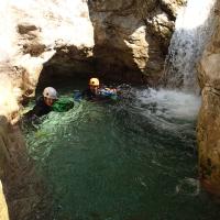
* längere Wanderpassage mit vielen Abkletterstellen in enger aber sonniger Umgebung
* 10m Abseiler, verkeilter Baumstamm rechts
* 100m Abklettern und Rutschen
* schöne 6m Rutsche/Sprung, Beginn einer Engklamm
* 12m Abseiler, Haken links
* 20m Abseiler über zwei Wasserfälle, Haken auf Felsblock in der Mitte
* 6m Abseiler, Haken links oben
* 2m Rutsche, Ende der Engklamm
* 300m Wandern und Rutschen in schöner Umgebung bis zur Querung des Wanderwegs 651 (Notausstieg)
* Unterhalb des Wanderwegs beginnt eine schön ausgewaschene Miniklamm mit Rutschen und Sprüngen bis 4m
* 200m Wandern und Abklettern in offenen Bachbett
* 30m Abseiler, 2 Haken links in Klemmblock
* 4m Sprung, wiederholbar
* 10m Sprung oder abseilen links von Baum - nicht von Haken rechts abseilen, das Gestein unterhalb der Kante ist extrem brüchig!
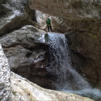
Sequence:\n\n * 15m rappel, sling right (watch out for clamping block in the middle of the waterfall)\n * hiking route\n * 4m rappel, hook right\n * 3m slide\n * longer hiking passage with lots of downclimbs in narrow but sunny surroundings\n * 10m rappel, 100m downclimb and slide\n * nice 6m slide/jump, beginning of a gorge\n * 12m rappel, anchor left\n * 20m rappel over two waterfalls, anchor on boulder in the middle\n * 6m rappel, Anchor left above\n * 2m slide, exit of the gorge\n * 300m hiking and sliding in beautiful surroundings until the crossing of the hiking trail 651 (emergency exit)\n * Below the hiking trail begins a beautifully washed out mini gorge with slides and jumps up to 4m\n * 200m hiking and downclimbing in open streambed\n * 30m rappel, 2 anchors left in clamping block\n * 4m jump, repeat rappel * 10m jump or rappel left from tree - do not rappel from anchor right, the rock below the edge is extremely brittle!\n
Ritorno (30 min):
traduzione alternativa
➜
Lingua originale
Ab besten im Torrente Dogna absteigen bis rechts eine zugewachsene Forststrasse sichtbar wird, hier zum Steig 640 aufsteigen und auf diesem zurück zum Parkplatz
From Torrente Dogna, descend until you see an overgrown forest road on the right. Climb up to path 640 and return to the parking area.
Coordinate:
Inizio del canyon
Parcheggio Entrata e uscita
Parkplatz nach Kehre
Fine del canyon
Letteratura:
Info sul canyon Cwiki
Info sul canyon Ropewiki
05.10.2023
Rick Paapy
⭐
★★★★★
📖
★★★
⚓
★★★
💧
Normale
Completato ✔
traduzione alternativa
➜
Lingua originale
Did the canyon today! Nice beautifull canyon too bad all the pools are shallow. Walked from parking to start of canyon in 1hr, would say for a normal fit person the walk is only 1,5 hrs.
Did the canyon today! Nice beautifull canyon too bad all the pools are shallow. Walked from parking to start of canyon in 1hr, would say for a normal fit person the walk is only 1,5 hrs.
08.04.2023
Horst Lambauer
⭐
★★★★★
📖
★★★
⚓
★★★
💧
Normale
Completato ✔
traduzione alternativa
➜
Lingua originale
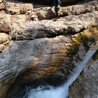
Wurde von uns begangen und renoviert. Der Weg zum Sfonderat ist wenn man den 640er Weg verlässt sehr rutschig durch das Buchenlaub und durchaus ausgesetzt (siehe Bilder). Der Pfad führt nicht mehr direkt in den Bach, sondern man geht bis man praktisch bei der Schlucht ist, hier kommt eine Quelle or. re. rein. Hier vom Baum ca 40m in die Schucht abseilen. Zuerst ist es trocken, aber nach ca 150m kommt Wasser dazu. Einige Sprünge, eine ca 8m Rutsche. Einige Abseiler Absolut schöner Canyon
Was walked and renovated by us. The path to Sfonderat is when you leave the 640 path very slippery through the beech leaves and quite exposed (see pictures). The path no longer leads directly into the stream, but you go until you are practically at the gorge, here comes a spring or. r. pure. Rappel down from the tree about 40m into the gorge. At first it is dry, but after about 150m water comes in. Some jumps, a slide of about 8m. Some rappels Absolutely beautiful canyon
09.03.2023
System User
⭐
★★★★★
📖
★★★
⚓
★★★
nessuna traduzione disponibile
Daten importiert von https://canyon.carto.net/cwiki/bin/view/Canyons/RioSfonderatCanyon.html
Nuovo rapporto
Riportare brevemente e concisamente le informazioni più importanti dell'ultimo tour o importanti informazioni attuali sul canyon. Se necessario con link a video, foto, ecc..
*
*
*
Esc
Del
Idrologia:


