un po' difficile
Vomper Loch
v2 a4 III
9h30
4h
5h
30min
1040m
670m
370m
7m
1x20m
1
8000m
a piedi
Valutazione:
★★★★★
2.7 (2)
Info:
★★★
0 ()
Belay:
★★★
0 ()
Sintesi:
traduzione alternativa
➜
Lingua originale
Wandercanyon
hiking canyon
settembre - ottobre
Est
Sintesi:
traduzione alternativa
➜
Lingua originale
Wandercanyon
hiking canyon
Accesso:
traduzione alternativa
➜
Lingua originale
Von Schwaz im Inntal nach Vomp und im Ort in der Nähe der Kirche nach Norden in Richtung Vomperberg. Bei den folgenden Abzweigungen immer links halten in Richtung Gasthaus Karwendelrast. Hier parken.
From Schwaz in the Inn valley to Vomp and in the village near the church north towards Vomperberg. At the following junctions always keep left in the direction of Gasthaus Karwendelrast. Park here.
Avvicinamento (4 h):
traduzione alternativa
➜
Lingua originale
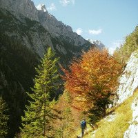
Vom Gasthaus Karwendelrast (860 m ü.NN) auf einer Forststraße ca. 1500 m in westl. Richtung, bis links ein Steig (Nr. 224) abgeht zum "Hallangerhaus". Bald kommt man zum Haag Bründl (Stub Bach). Links vorbei geht es auf dem nur schwach ansteigenden Pfad über dem Vomper Loch weiter westwärts. Nach etwa 45 Min. quert man den Kühsoachgraben (siehe Video). Es geht vorbei an der Wildfütterung oberhalb der Melans-Alm (1020 m ü.NN). Etwa zwei Stunden ab Karwendelrast biegt der Jägersteig nordwärts in das Zwerchloch, zieht vorbei an der Jagdhütte und quert den Bach. Dann führt er auf der Westseite über die sogenannte Katzenleiter aufwärts. Später geht es fast ganz hinunter zum Vomper Bach und da auf einem Holzsteg über den Ödkarbach. Hier kann man rechts oberhalb von der Wasserfallmündung des Ödkarbaches in den Vomper Bach hinunter, insbes. wenn man die evtl. unangenehmeEinstiegsrutsche vermeiden will.
Die Alternative führt weiter in Serpentinen steil im Wald hoch und umgehend unter der Triefenden Wand wieder hinab in das breite Kiesbett, unter dem der Vomper Bach - bis zum Einstieg unsichtbar - dahinfließt (1060 m ü.NN).
From the Karwendelrast inn (860 m above sea level) on a forest road for about 1500 m in a westerly direction until a path (No. 224) branches off to the left to the "Hallangerhaus". Soon you come to the Haag Bründl (Stub Bach). Pass it on the left and continue westwards on the only slightly ascending path above Vomper Loch. After about 45 minutes you cross the Kühsoachgraben (see video). It goes past the game feeding area above the Melans-Alm (1020 m above sea level). About two hours from Karwendelrast, the hunters path turns northward into the Zwerchloch, passes the hunting lodge and crosses the stream. Then it leads upwards on the west side via the so-called Katzenleiter. Later it goes almost all the way down to Vomper Bach and there on a wooden footbridge over the Ödkarbach. Here you can descend to the right above the mouth of the waterfall of the Ödkarbach into the Vomper Bach, especially if you want to avoid the possibly unpleasant entry slide.\nThe alternative leads further in serpentines steeply up in the forest and immediately below the Triefende Wand down again into the wide gravel bed, under which the Vomper Bach - invisible until the entry - flows along (1060 m above sea level).
Giro (5 h):
traduzione alternativa
➜
Lingua originale
Der Vomper Bach ist wegen seines reichlichen Wasserdurchsatzes am besten (und vor allem insoweit gefahrlos) im Herbst oder/und nach langen Trockenperioden zu begehen. Im Zweifelsfall den obersten (engen) Abschnitt auslassen und beim Ödkarbach einsteigen (vgl. oben)
Der erste Abschnitt ist allerdings der interessanteste. Die Schlucht ist etwas für Liebhaber kombinierter Touren mit besond. landschaftlichem Reiz.
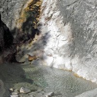
Im Okt. 2006 war unter der Rutsche zu Beginn etwa 1,30 m tiefes Wasser ohne größere Steine. Man könnte hier ggf. den Ersten mittels Seil zur Prüfung der Situation hinunterlassen (dafür 20m-Seil mitnehmen - aber kein Haken vorhanden - 2006)).
Ausstiegsmöglichkeiten nach etwa einem Drittel der Schlucht bei dem Steg links hinauf zum Anmarschweg, nach etwa einem weiteren Drittel li. hinauf zur Melansalm (schwer zu finden). Letzter Ausstieg (links) 100 m nach dem Kühsoachgraben weglos durch den Buchenwald hinauf zum Anmarschweg.
Nach gut der Hälfte der Schluchtwanderung wird das Wasser völlig abgeleitet, doch füllt sich das Bachbett bereits nach wenigen hundert Metern wieder mit der Menge, wie wir sie vor der Ableitung gewohnt waren.
Due to its abundant water flow, the Vomper Bach is best (and especially insofar safe) to walk in autumn or/and after long dry periods. In case of doubt, skip the uppermost (narrow) part and enter at the Ödkarbach (see above).\nThe first part, however, is the most interesting. The canyon is something for lovers of combined tours with special scenic appeal.\nIn Oct. 2006 was under the slide at the beginning about 1.30 m deep water without large stones. If necessary, one could let the first down here by means of ropes to test the situation (for this take 20m rope - but no anchor available - 2006)).\nExit possibilities after about a third of the canyon at the footbridge left up to the approach path, after about another third left up to the Melansalm (difficult to find). Last exit (left) 100 m after the Kühsoachgraben pathless through the beech forest up to the Anmarschweg.\nAfter a good half of the gorge hike, the water is completely diverted, but after a few hundred meters the streambed fills again with the amount that we were used to before the diversion.
Ritorno (30 min):
traduzione alternativa
➜
Lingua originale
Beim E-Werk (670 m ü.NN) rechts über die Leiter hinaus und links der Wasserfassung hinunter (das Absperr-Tor ist von innen zu öffnen - 2006). Von der z.T. betonierten ebenen Fläche zieht links ein Steig hinauf zum Gasthof Karwendelrast.
At the power station (670 m above sea level) right over the ladder and down to the left of the water intake (the gate can be opened from the inside - 2006). \nFrom the partly concreted flat area, a path leads up to the Gasthof Karwendelrast on the left.
Coordinate:
Fine del canyon
47.3453°, 11.6498°
↓↑
DMS: 47° 20" 43.08', 11° 38" 59.28'
DM: 47° 20.718", 11° 38.988"
Google Maps
Austria Topografica
DMS: 47° 20" 43.08', 11° 38" 59.28'
DM: 47° 20.718", 11° 38.988"
Google Maps
Austria Topografica
petite barrage (descente)
Inizio del canyon
47.3521°, 11.5587°
↓↑
DMS: 47° 21" 7.56', 11° 33" 31.32'
DM: 47° 21.126", 11° 33.522"
Google Maps
Austria Topografica
DMS: 47° 21" 7.56', 11° 33" 31.32'
DM: 47° 21.126", 11° 33.522"
Google Maps
Austria Topografica
Départ par toboggan ou rappel (5m) (descente)
Partenza alternativa del canyon
47.3499°, 11.5632°
↓↑
DMS: 47° 20" 59.64', 11° 33" 47.52'
DM: 47° 20.994", 11° 33.792"
Google Maps
Austria Topografica
DMS: 47° 20" 59.64', 11° 33" 47.52'
DM: 47° 20.994", 11° 33.792"
Google Maps
Austria Topografica
Départ alternatif sans les obstacles de l\'autre départ (descente)
Parcheggio in uscita
47.3395°, 11.6541°
↓↑
DMS: 47° 20" 22.2', 11° 39" 14.76'
DM: 47° 20.37", 11° 39.246"
Google Maps
Austria Topografica
DMS: 47° 20" 22.2', 11° 39" 14.76'
DM: 47° 20.37", 11° 39.246"
Google Maps
Austria Topografica
navette possible, mais pas necessaire (descente)
Parcheggio all'entrata
47.3458°, 11.6557°
↓↑
DMS: 47° 20" 44.88', 11° 39" 20.52'
DM: 47° 20.748", 11° 39.342"
Google Maps
Austria Topografica
DMS: 47° 20" 44.88', 11° 39" 20.52'
DM: 47° 20.748", 11° 39.342"
Google Maps
Austria Topografica
navette possible, mais pas necessaire (descente)
Punto di passaggio
47.3468°, 11.6551°
↓↑
DMS: 47° 20" 48.48', 11° 39" 18.36'
DM: 47° 20.808", 11° 39.306"
Google Maps
Austria Topografica
DMS: 47° 20" 48.48', 11° 39" 18.36'
DM: 47° 20.808", 11° 39.306"
Google Maps
Austria Topografica
1 prendre sentier "224" vers "Hallangerhaus" (descente)
Punto di passaggio
47.3515°, 11.6387°
↓↑
DMS: 47° 21" 5.4', 11° 38" 19.32'
DM: 47° 21.09", 11° 38.322"
Google Maps
Austria Topografica
DMS: 47° 21" 5.4', 11° 38" 19.32'
DM: 47° 21.09", 11° 38.322"
Google Maps
Austria Topografica
2 : traverser Stubbach (descente)
Punto di passaggio
47.3493°, 11.6266°
↓↑
DMS: 47° 20" 57.48', 11° 37" 35.76'
DM: 47° 20.958", 11° 37.596"
Google Maps
Austria Topografica
DMS: 47° 20" 57.48', 11° 37" 35.76'
DM: 47° 20.958", 11° 37.596"
Google Maps
Austria Topografica
3 : traverser Kühsoachgraben (descente)
Punto di passaggio
47.3485°, 11.6228°
↓↑
DMS: 47° 20" 54.6', 11° 37" 22.08'
DM: 47° 20.91", 11° 37.368"
Google Maps
Austria Topografica
DMS: 47° 20" 54.6', 11° 37" 22.08'
DM: 47° 20.91", 11° 37.368"
Google Maps
Austria Topografica
4 : passer au-dessus de Melans-Alm (1020m alt.) (descente)
Punto di passaggio
47.358°, 11.5951°
↓↑
DMS: 47° 21" 28.8', 11° 35" 42.36'
DM: 47° 21.48", 11° 35.706"
Google Maps
Austria Topografica
DMS: 47° 21" 28.8', 11° 35" 42.36'
DM: 47° 21.48", 11° 35.706"
Google Maps
Austria Topografica
6 : traverser Zwerchbach (descente)
Punto di passaggio
47.3566°, 11.5956°
↓↑
DMS: 47° 21" 23.76', 11° 35" 44.16'
DM: 47° 21.396", 11° 35.736"
Google Maps
Austria Topografica
DMS: 47° 21" 23.76', 11° 35" 44.16'
DM: 47° 21.396", 11° 35.736"
Google Maps
Austria Topografica
5 Jagdhütte (refuge de chasse) (descente)
Punto di passaggio
47.3499°, 11.5634°
↓↑
DMS: 47° 20" 59.64', 11° 33" 48.24'
DM: 47° 20.994", 11° 33.804"
Google Maps
Austria Topografica
DMS: 47° 20" 59.64', 11° 33" 48.24'
DM: 47° 20.994", 11° 33.804"
Google Maps
Austria Topografica
7 : traverser Ödkarbach (descente)
Punto di passaggio
47.3448°, 11.6503°
↓↑
DMS: 47° 20" 41.28', 11° 39" 1.08'
DM: 47° 20.688", 11° 39.018"
Google Maps
Austria Topografica
DMS: 47° 20" 41.28', 11° 39" 1.08'
DM: 47° 20.688", 11° 39.018"
Google Maps
Austria Topografica
sentier retour vers le haut (parking amont) (descente)
Uscita intermedia del canyon
47.3479°, 11.5855°
↓↑
DMS: 47° 20" 52.44', 11° 35" 7.8'
DM: 47° 20.874", 11° 35.13"
Google Maps
Austria Topografica
DMS: 47° 20" 52.44', 11° 35" 7.8'
DM: 47° 20.874", 11° 35.13"
Google Maps
Austria Topografica
sentier qui traverse Vomper Bach (échappatoire) (descente)
Uscita intermedia del canyon
47.3458°, 11.6084°
↓↑
DMS: 47° 20" 44.88', 11° 36" 30.24'
DM: 47° 20.748", 11° 36.504"
Google Maps
Austria Topografica
DMS: 47° 20" 44.88', 11° 36" 30.24'
DM: 47° 20.748", 11° 36.504"
Google Maps
Austria Topografica
barrage - echappatoire à droite sur la piste (descente)
Letteratura:
Mappa
1:25000
Mappa
1:50000
Mappa
1:50000
Libro Canyoning
Alexander Riml / Gunnar Amor
2012
Libro Canyoning
Werner Baumgarten
2013
Info sul canyon Cwiki
Info sul canyon Descente
Info sul canyon Ropewiki
09.03.2023
System User
⭐
★★★★★
📖
★★★
⚓
★★★
nessuna traduzione disponibile
Info: Teile der Canyonbeschreibung wurden automatisiert übernommen. Konkret die Felder Weblinks, Koordinaten, Rating, Länge des Canyon, Einfachseil Mindestens von https://www.descente-canyon.com/canyoning/canyon/23107
09.03.2023
System User
⭐
★★★★★
📖
★★★
⚓
★★★
nessuna traduzione disponibile
Daten importiert von https://canyon.carto.net/cwiki/bin/view/Canyons/VomperLochCanyon.html
Nuovo rapporto
Riportare brevemente e concisamente le informazioni più importanti dell'ultimo tour o importanti informazioni attuali sul canyon. Se necessario con link a video, foto, ecc..
*
*
*
Esc
Del
Idrologia:


