v5 a3 III
5h50
15min
5h30
5min
800m
280m
520m
50m
1x60m/ 1x50m
28
1400m
Auto necessaria
Valutazione:
★★★★★
3.8 (7)
Info:
★★★
2.5 (6)
Belay:
★★★
2.9 (6)
Sintesi:
traduzione alternativa
➜
Lingua originale
Der obere Teil der Schlucht führt mehr Wasser; ab der Hälfte Wasserableitung; hohe Abseilstellen im Wasserlauf; Vorsicht bei Seilabzug (Verklemmung!); ausgesetzte Standplätze (technisch anspruchsvoll); schöne Aussicht; sauberes Wasser; Ausstiegs- bzw. Einstiegsmöglichkeit bei der Wasserableitung.
The upper part of the canyon has more water; from the half water drainage; high rappels in the watercourse; be careful with rope retrival (jamming!); exposed belays (technically demanding); beautiful view; clean water; exit or entry possibility at the water drainage.
Parti
Sintesi:
traduzione alternativa
➜
Lingua originale
Der obere Teil der Schlucht führt mehr Wasser; ab der Hälfte Wasserableitung; hohe Abseilstellen im Wasserlauf; Vorsicht bei Seilabzug (Verklemmung!); ausgesetzte Standplätze (technisch anspruchsvoll); schöne Aussicht; sauberes Wasser; Ausstiegs- bzw. Einstiegsmöglichkeit bei der Wasserableitung.
The upper part of the canyon has more water; from the half water drainage; high rappels in the watercourse; be careful with rope retrival (jamming!); exposed belays (technically demanding); beautiful view; clean water; exit or entry possibility at the water drainage.
Accesso:
traduzione alternativa
➜
Lingua originale
Von Domaso (Camping Solarium) fährt man Richtung Chiavenna --> vor und nach der Ortschaft Novate Mezzola hat man die Möglichkeit li zu dem Ort Cassenda zu fahren --> am Südlichen Ortsrand von Casenda findet man eine Brücke die über den Bach geht (Ausstieg) --> hier hat man mehrere Parkmöglichkeiten -->mit den 2. PKW fährt man zurück in den Ort wo li eine Bergstraße Richtung Paiedo hochführt (auch von der nächsten Ortschaft Era führt eine Straße hinauf. Diese ist besser Beschildert und zweigt oberhalb vom Friedhof ab) --> hat man einmal die Straße gefunden führt diese in mehreren Serpentinen bis zur Häusergruppe von Paiedo (886Hm) --> kleiner Parkplatz li. Möchte man nur den unteren Teil (2. Hälfte) der Schlucht machen so biegt man noch vor der Ortschaft Paiedo in den von der Straße sichtbaren Schotterweg (loc. Cusciago) li ab --> dieser führt in Kürze zur Wasserableitung (ca. 600Hm).
Aktuelle Mautstraßenpreise 3,50€ (Automat wechselt NICHT)
From Domaso (Camping Solarium) you drive in the direction of Chiavenna --> before and after the village Novate Mezzola you have the possibility to drive left to the village Cassenda --> at the southern outskirts of Casenda you find a bridge that goes over the stream (exit) --> here you have several parking possibilities -->with the 2nd car you drive back to the village where a mountain road leads up to the left in the direction of Paiedo (also from the next village Era a road leads up. This is better signposted and branches off above the cemetery) --> once you have found the road, it leads in several serpentines up to the group of houses of Paiedo (886Hm) --> small parking lot on the left. If you only want to do the lower part (2nd half) of the canyon, turn left before the village of Paiedo into the gravel road (loc. Cusciago) visible from the road --> this leads shortly to the water drainage (approx. 600Hm).
Current toll road prices 3,50€ (machine does NOT change)
Avvicinamento (15 min):
traduzione alternativa
➜
Lingua originale
Vom Parkplatz geht man flach in Richtung Kirche --> dann weiter re -->durch den Ort --> vorbei am Brunnen und den letzten Häuser führt der Weg bergab --> an der Weggabelung haltet man sich li und gelangt so in Kürze zum Bach --> Einstieg auf ca. 800Hm.
From the parking lot you go flat in the direction of the church --> then further to the right --> through the village --> past the fountain and the last houses, the path leads downhill --> at the fork in the road you keep to the left and reach the stream shortly --> entry at about 800Hm.
Giro (5 h 30):
traduzione alternativa
➜
Lingua originale
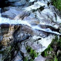
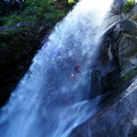
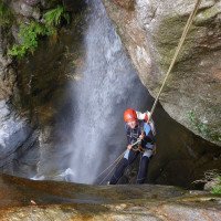
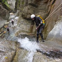
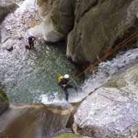
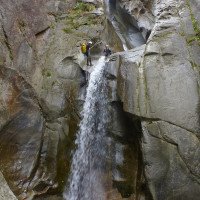
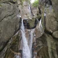
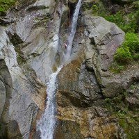
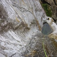
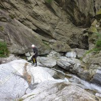
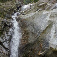
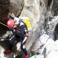
Die gesamte Schlucht ist sehr anspruchsvoll und abwechslungsreich --> es sollte daher unbedingt auch der Wasserstand für den oberen Teil kontrolliert werden --> hat man den Bach auf ca. 860Hm erreicht folgt man eine ca. 200m lange Gehstrecke mit einigen Stufen (diese können jedoch abgeklettert werden) --> erst jetzt trifft man auf die erste Abseilstelle --> ohne Gehstrecke und mit wunderbaren Aussicht ins Tal, folgen mehrere Abseilstellen im Wasser --> nach der spektakulären Kaskade kommt eine längere Geh- und Abkletterstrecke --> die hohe Felspassage kann li geschickt abgeklettert werden --> in der Mitte der Schlucht kommt eine Staumauer/Wasserableitung --> hier hätte man auf ca. 640Hm eine Ausstiegs- bzw. Einstiegsmöglichkeit --> man folgt den meist zugewucherten Weg auf der li Bachseite bis zur nächsten künstlichen Stufe (Abseilstelle re) --> die 2. Hälfte der Schlucht beginnt mit einer kurzen Gehstrecke und schöner Aussicht, bevor es schlagartig vertikaler wird --> von einen großen Felsblock seilt man sich in den sehr schönen und tief eingeschnittenen Teil der Schlucht ab --> es folgen mehrere Abseilstellen im Wasserverlauf bevor es wieder offener wird --> nach einer kurzen Abkletterpassage kommt eine hohe Abseiler die li unterteilbar ist --> eingeschlossen von der hohen Felswänden, wechseln sich Abseilstellen (von großen Klemmblöcke) und kurze Gehpassagen in atemberaubender Umgebung ab (Achtung! Seilverklemmung) --> an der letzten Abseiler befindet sich eine kleine Wasserableitung (Pumpe) --> jetzt öffnet sich die Schlucht wieder --> die nächsten Stufen können li vorsichtig abgeklettert werden --> auf ca. 280Hm steht man wieder im flachen Bachbett vor der Brücke (Ausstieg).
The entire canyon is very demanding and varied --> it should therefore necessarily also check the water level for the upper part --> has reached the stream at about 860Hm follows an approx. 200m long walking passages with some steps (these can be downclimbed) --> only now you meet the first rappelling point --> without walking and with a wonderful view into the valley, several rappelling points in the water follow --> after the spectacular cascade there is a longer walking and downclimbing section --> the high rock passage can be skillfully downclimbed --> in the middle of the canyon there is a dam wall/water drainage --> here you would have at approx. 640Hm you have an exit or entry possibility --> follow the mostly overgrown path on the left side of the creek to the next artificial step (abseil on the right) --> the 2nd step is on the right side of the creek. The second half of the canyon begins with a short walking passage and a beautiful view, before it suddenly becomes more vertical --> from a large rock you rappel down into the very beautiful and deeply cut part of the canyon --> several rappels follow in the water course before it becomes more open again --> after a short downclimb there is a high rappel that can be divided left --> enclosed by the high rock walls, rappels (from large clamping blocks) and short walking passages alternate in breathtaking surroundings (Attention! Rope jamming) --> at the last rappel is a small water drainage (pump) --> now the canyon opens again --> the next steps can be rappelled left carefully --> at about 280Hm you are back in the shallow streambed before the bridge (exit).
Ritorno (5 min):
traduzione alternativa
➜
Lingua originale
Nach der letzen Abseilstelle geht man auf der li Bachseite über den Schotterweg zurück zur Brücke (Parkplatz).
After the last rappelling point, go back to the bridge (parking lot) on the left side of the stream along the gravel path.
Coordinate:
Inizio del canyon
Fine del canyon
Parcheggio all'entrata
Parcheggio in uscita
Fine del canyon alternativo
Notausstieg bei der Wasserfassung
Sconosciuto
Ticketautomat für Straße hinauf
Info sul canyon ACA
Info sul canyon Cwiki
Info sul canyon Descente
Info sul canyon Ropewiki
Altro info sul canyon
Altro info sul canyon
25.08.2024
Pepijn Hoeksema
⭐
★★★★★
📖
★★★
⚓
★★★
💧
Basso
Completato ✔
nessuna traduzione disponibile
Good canyon, low water this day.
25.08.2024
Reach8399
⭐
★★★★★
📖
★★★
⚓
★★★
💧
Normale
Completato ✔
nessuna traduzione disponibile
Automatisch importiert von Descente-Canyon.com für Canyon Casenda
RAS
(Quelle: https://www.descente-canyon.com/canyoning/canyon-debit/22009/observations.html)
24.08.2024
zede63
⭐
★★★★★
📖
★★★
⚓
★★★
💧
Normale
Completato ✔
nessuna traduzione disponibile
Automatisch importiert von Descente-Canyon.com für Canyon Casenda
Intégrale débit Tranquille, la centrale est possiblement à l'arrêt. Equipement pas de soucis
(Quelle: https://www.descente-canyon.com/canyoning/canyon-debit/22009/observations.html)
30.06.2024
MirkoT
⭐
★★★★★
📖
★★★
⚓
★★★
💧
Alto
Completato ✔
nessuna traduzione disponibile
Automatisch importiert von Descente-Canyon.com für Canyon Casenda
Parte alta con flusso abbondante e acqua martellava bene.Parte bassa con meno flusso visto le quattro briglie e la quantità d'acqua era corretta per non creare grossi problemi.Armi tutti ok e doppi.Evitando ultima calata asciutta si esce sulla sx per arrivare alla strada sterrata così si evita una inutile risalita in proprietà private.
(Quelle: https://www.descente-canyon.com/canyoning/canyon-debit/22009/observations.html)
23.06.2024
Sandra66
⭐
★★★★★
📖
★★★
⚓
★★★
💧
Alto
Completato ✔
nessuna traduzione disponibile
Automatisch importiert von Descente-Canyon.com für Canyon Casenda
Gros débit après les pluies mais tout passe bien avec ce débit.Nous n'avons pas fait l'amont
(Quelle: https://www.descente-canyon.com/canyoning/canyon-debit/22009/observations.html)
02.06.2024
Clarissa Linder
⭐
★★★★★
📖
★★★
⚓
★★★
💧
Alto
Completato ✔
traduzione alternativa
➜
Lingua originale
Altri utenti sono stati: Peter Lampacher
Super Tour! Stände alle top.
Oberer Teil mit viel Wasser und abseilen meist im Wasserstrahl. Unterer Teil vom Wasser her unbedenklich.
Oben eine Rutsche und unten ein paar Sprünge möglich.
Parkplatz oben (gratis) wurde neu angelegt. Maut 3,50€.
Superiore tour! Stands all top.
Upper part with lots of water and rappels mostly in the water jet. Lower part safe from the water.
A slide at the top and a few jumps possible at the bottom.
New parking lot at the top (free). Toll 3,50€.
Altri utenti sono stati: Peter Lampacher
02.08.2023
Bastien P.
⭐
★★★★★
📖
★★★
⚓
★★★
💧
Normale
Completato ✔
traduzione alternativa
➜
Lingua originale
Nur den unteren Teil nach der Wasserfassung
Only the lower part after the water intake
02.08.2023
Christoph Cramer
⭐
★★★★★
📖
★★★
⚓
★★★
💧
Normale
Completato ✔
traduzione alternativa
➜
Lingua originale
Einstieg bei der Wasserfassung. Alle Stände OK. 3 Sprünge möglich. Mobilfunkempfang nur an der Stelle wo sich erstmals der Blick ins Tal öffnet. Ausstieg links beim Steinmännchen kurz nach dem letzten Abseiler.
Entry at the water intake. All stands OK. 3 jumps possible. Mobile phone reception only at the point where the view into the valley opens for the first time. Exit left at the cairn shortly after the last rappel.
30.07.2023
Inga
⭐
★★★★★
📖
★★★
⚓
★★★
💧
Normale
Completato ✔
traduzione alternativa
➜
Lingua originale
Alle Stände ok
Ausstieg links bei den Wasserleitungen
All stands ok
Exit left by the water pipes
07.06.2023
Wolfgang
⭐
★★★★★
📖
★★★
⚓
★★★
Completato ✔
traduzione alternativa
➜
Lingua originale
Beim Parkplatz oben ist (Stand anfang Juni 2023) gerade eine größere Baustellen. Parken NICHT möglich aber in den Kehren danach sollte man Platz finden.
Alle Stände OK ; die schöne Stelle am Beginn unterter Teil wo man in einen nassen rutschigen Dom abseilt (90° Kurve des Bachs)ist meinen einen zustätzliche Stand 3 m weiter unten ausgestatt.
Somit erspart man sich den schwer erreichbaren (rutschig; weit oben) Stand im Dom und kann gleich zum nächsten (in der Engstelle) abseilen > kein Abziehproblem
Rest wie immer sehr nett !
At the parking lot above is (as of early June 2023) just a major construction site. Parking NOT possible but in the bends afterwards you should find space.
All stands OK; the beautiful place at the beginning of the lower part where you abseil into a wet slippery dome (90° bend of the stream) is equipped with an additional stand 3 m further down.
Thus, one saves the difficult to reach (slippery; far above) stand in the dome and can immediately abseil to the next (in the narrows) > no pulling problem
Rest as always very nice !
03.04.2023
Daniel Sturm
⭐
★★★★★
📖
★★★
⚓
★★★
Completato ✕
traduzione alternativa
➜
Lingua originale
Koordinaten und Beschreibung angepasst.
Coordinates and description adjusted.
09.03.2023
System User
⭐
★★★★★
📖
★★★
⚓
★★★
nessuna traduzione disponibile
Info: Teile der Canyonbeschreibung wurden automatisiert übernommen. Konkret die Felder Weblinks, Koordinaten, Rating, Ort, Länge des Canyon, Einfachseil Mindestens von https://canyon.carto.net/cwiki/bin/view/Canyons/CasendaCanyon.html und https://www.descente-canyon.com/canyoning/canyon/22009
09.03.2023
System User
⭐
★★★★★
📖
★★★
⚓
★★★
nessuna traduzione disponibile
Daten importiert von https://www.canyoning.or.at/index.php/liste-aller-canyons/53-casenda
Nuovo rapporto
Riportare brevemente e concisamente le informazioni più importanti dell'ultimo tour o importanti informazioni attuali sul canyon. Se necessario con link a video, foto, ecc..
*
*
*
Esc
Del
Idrologia:


