v5 a4 V
7h40
2h30
5h
10min
1050m
500m
550m
75m
Valutazione:
★★★★★
2.9 (1)
Info:
★★★
0 ()
Belay:
★★★
0 ()
Sintesi:
traduzione alternativa
➜
Lingua originale
Lange, vertikale und wilde Tour in einem sehr abgelegenen Winkel Friauls
Long, vertical and wild tour in a very remote corner of Friuli
Sintesi:
traduzione alternativa
➜
Lingua originale
Lange, vertikale und wilde Tour in einem sehr abgelegenen Winkel Friauls
Long, vertical and wild tour in a very remote corner of Friuli
Accesso:
traduzione alternativa
➜
Lingua originale
A23 bis Ausfahrt Osoppo, dann über San Daniele, Ragona, Pinzano und Sequals nach Meduno. Von Hier Richtung Passo Rest. Bei einem Staudamm links über die Staukrone und durch Tamarat und Chievolis fahren. Nach der zweiten Ortschaft auf einer schmalen Straße hoch über der Schlucht des Torrente Silisa bis zu den Häusern von Selva. Hier links Richtung Forcella Clautana. Der schmalen, meist asphaltierten Strasse folgen bis diese erstmals wieder nah ans Bachbett kommt. Hier Parkmöglichkeit für 5 Autos.
A23 to Osoppo exit, then via San Daniele, Ragona, Pinzano and Sequals to Meduno. From here towards Passo Rest. At a dam turn left over the top of the dam and go through Tamarat and Chievolis. After the second village, take a narrow road high above the canyon of Torrente Silisa until you reach the houses of Selva. Here turn left towards Forcella Clautana. Follow the narrow, mostly asphalted road until it gets close to the streambed again for the first time. Here you can park 5 cars.
Avvicinamento (2 h 30):
traduzione alternativa
➜
Lingua originale
Über die Böschung absteigen und den Torrente Silisia überqueren. Im Mündungsspitz von Silisia und unserem Bachlauf aufsteigen und einen undeutlichen Steig am Kamm bis zu einem renovierten Haus (Stua) folgen (Hierher auch über einen zweiten Steig der etwa 300m bachaufwärts bei einem angelehnten Wellblechstück beginnt).
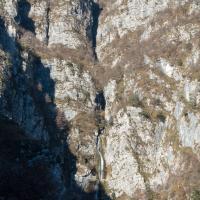
Hinter dem Haus erst flach dann kurz steil zu einem Serpentinensteig den man bis zu den Ruinen von Pecolat folgt. Hinter den Ruinen auf einen querführenden ehemaligen Maultiersteig und diesen zunächst ohne Höhengewinn folgen. Bei zwei Abzweigungen jeweils rechts aufsteigen, zuletzt sehr steil und auf kaum erkennbaren Weg zu einer Verflachung im Bergkamm aufsteigen (Ruinen einer Seilbahnstation). Am Schmalen Kamm entlang bis sich dieser wieder aufsteilt, hier rechts auf einen undeutlichen Steig abzweigen. Kurz durchs Gebüsch, dann sehr ausgesetzt oberhalb einer Felswand queren (gefährlich bei Nässe). Über Steigspuren aufsteigend queren, dabei immer wieder schöne Ausblicke zum großen Wasserfall des Fontanon del Tasseit (Steig im Wald einigermaßen sichtbar, auf den Wiesenrippen im Zweifel aufsteigen bis man wieder nach rechts queren kann). Absteigend in ein namenloses Seitental und über Schutt und ausgeschnittene Latschensteigerl bis zum Bachbett absteigen. Über den Bach und am anderen Ufer auf sehr undeutlichen Steig bis zu einem Wasserlauf von rechts empor (oberhalb am anderen Ufer großer Höhleneingang). Rechts vom Seitenbach sehr steil über Grashänge aufsteigen, dann rechtshaltend (Steigspuren) bis zu einem kleinen Waldsattel rauf. Nochmal 50hm sehr steil auf eine weitere Gratverflachung aufsteigen und bei einer kleinen Buche mit eingeritzten 'Font' nach Osten in ein klammartiges Bachbett querend absteigen (einzige Möglichkeit dieses Bachbett zu überwinden). Auf der anderen Seite kurz aufsteigen und immer knapp unter den Felswänden bleibend bis zum Beginn der Tour bei einer Karstquelle (Risorgiva del Randonneur).
Descend the embankment and cross the Torrente Silisia. In the mouth of Silisia and our stream go up and follow an indistinct path along the ridge until you reach a renovated house (Stua) (Here also via a second path that starts about 300m upstream at a piece of corrugated iron leaned). \Behind the house, first flat then steep for a short while to a serpentine path that you follow to the ruins of Pecolat. Behind the ruins on a transversal former mule track and follow it at first without gaining altitude. At two forks, climb up to the right, finally climbing very steeply and on a barely recognizable path to a flattening in the ridge (ruins of a cable car station). Follow the narrow ridge until it splits again, here turn right onto an indistinct path. Shortly through the bushes, then traverse very exposed above a rock face (dangerous in wet conditions). Cross the path ascending on the traces of the path, with beautiful views to the big waterfall of Fontanon del Tasseit (path in the woods somewhat visible, on the meadow ribs climb up in doubt until you can cross again to the right). Descending into a side valley without a name, descend over scree and cut mountain pine climbs to the streambed. Cross the stream and on the other bank on a very indistinct path up to a watercourse from the right (above on the other bank a large cave entrance). To the right of the side stream climb very steeply over grassy slopes, then keep to the right (trail tracks) up to a small forest saddle. Climb another 50m very steeply onto another ridge flattening and at a small beech with carved 'font' descend eastward crossing a gorge-like streambed (the only way to overcome this streambed). On the other side, climb briefly and always staying just below the rock walls until the beginning of the tour at a karst spring (Risorgiva del Randonneur).
Giro (5 h):
traduzione alternativa
➜
Lingua originale
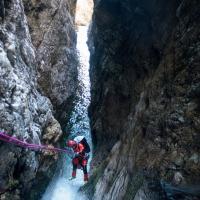
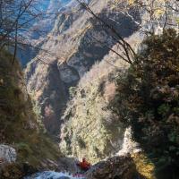
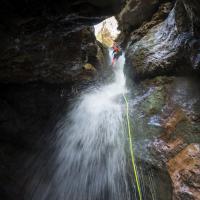
Zunächst 4 Abseilstellen bis 30m von Bäumen, dann zwei Abseilstellen in enger Klamm von Bohrhaken bevor man vor dem grossen Wasserfall steht. Abseilsequenz: 10m von Baum rechts, 40m von Kette links. 75m von Kette links (auch aufteilbar auf 25m u. 50m, Hängestand). Danach 5 Abseiler in enger Schlucht bevor der vorher überquerte Seitenbach mit einem schrägen 80m+ Wasserfall von rechts einmündet. Nach längerer Gehstrecke mit ein paar Sprungbecken schöner 25m Abseiler von rechts. Weitere- Geh und Abkletterstelle bis zu einem 5m Sprung gefolgt von einem drei Meter Abseiler. Die Schlucht endet mit einem 13m Sprung (abseilbar und wiederholbar) und einem 5m Sprung in ein recht seichtes Becken (rechts abkletterbar).
First 4 abseils to 30m from trees, then two abseils in narrow gorge from bolts before facing the big waterfall. Abseil sequence: 10m from tree right, 40m from chain left. 75m from chain left (can also be divided into 25m and 50m, hanging position). Then 5 rappels in narrow canyon before the previously crossed side creek with a sloping 80m+ waterfall coming in from the right. After longer walking passages with a few diving pools, nice 25m rappel from the right. Further- walking and downclimb to a 5m rappel followed by a three meter rappel. The canyon ends with a 13m jump (abseilable and repeatable) and a 5m jump into a fairly shallow pool (abseilable on the right).
Ritorno (10 min):
traduzione alternativa
➜
Lingua originale
Durchs Bachbett zurück zum Parkplatz
Through the streambed back to the parking lot
Coordinate:
Inizio del canyon
Parcheggio Entrata e uscita
Parkbuch links der Straße
Fine del canyon
Info sul canyon Cwiki
09.03.2023
System User
⭐
★★★★★
📖
★★★
⚓
★★★
nessuna traduzione disponibile
Daten importiert von https://canyon.carto.net/cwiki/bin/view/Canyons/FontanonDelTasseitCanyon.html
Idrologia:


