v4 a2 III
3h35
45min
2h30
20min
830m
620m
210m
50m
2x40m
10
Auto facoltativa
Valutazione:
★★★★★
2.6 (3)
Info:
★★★
3 (2)
Belay:
★★★
2 (2)
Sintesi:
traduzione alternativa
➜
Lingua originale
Schöne, meist wenig Wasserführende Kalkschlucht; ausreichend gut eingerichtet; Halbtagestour; gut kombinierbar mit Rio Cadramazzo inf., Patok, etc.; zum Teil ausgesetzter Zustieg (Pfad nicht immer gut sichtbar); sauberes Wasser; südseitige Exposition; 3mm Neopren ausreichend; Achtung! Im Frühjahr nisten hier viele Prozessionsraupen auf den Pinienbäumchen (Härchen sind Hautreizend und können beim einatmen sogar allergische Reaktionen auslösen); lohnend nach Regenfällen; Überstellungsfahrzeug (mit Bodenfreiheit) sehr empfehlenswert da der Zustieg sonst gleich lange dauern würde als die Tour selbst; Terra Rossa superiore auch möglich (Ganztagestour!)
Beautiful, mostly little water lime canyon; at present still very sparsely furnished; half-day tour; well combinable with Rio Cadramazzo inferiore, Patok, etc.; partly exposed access (path not always well visible); clean water; south exposure; 3mm neoprene sufficient; Attention! In spring, processionary caterpillars nest on the pine trees (hairs are skin-recent and can even cause allergic reactions when inhaled); worthwhile after rainfall; shuttle car recommended because the access would otherwise take almost as long as the tour itself; Terra Rossa superiore also possible (full-day tour!)
Parti
Nome
Difficoltà
Avvicinamento
Giro
Ritorno
Sud
Sintesi:
traduzione alternativa
➜
Lingua originale
Schöne, meist wenig Wasserführende Kalkschlucht; ausreichend gut eingerichtet; Halbtagestour; gut kombinierbar mit Rio Cadramazzo inf., Patok, etc.; zum Teil ausgesetzter Zustieg (Pfad nicht immer gut sichtbar); sauberes Wasser; südseitige Exposition; 3mm Neopren ausreichend; Achtung! Im Frühjahr nisten hier viele Prozessionsraupen auf den Pinienbäumchen (Härchen sind Hautreizend und können beim einatmen sogar allergische Reaktionen auslösen); lohnend nach Regenfällen; Überstellungsfahrzeug (mit Bodenfreiheit) sehr empfehlenswert da der Zustieg sonst gleich lange dauern würde als die Tour selbst; Terra Rossa superiore auch möglich (Ganztagestour!)
Beautiful, mostly little water lime canyon; at present still very sparsely furnished; half-day tour; well combinable with Rio Cadramazzo inferiore, Patok, etc.; partly exposed access (path not always well visible); clean water; south exposure; 3mm neoprene sufficient; Attention! In spring, processionary caterpillars nest on the pine trees (hairs are skin-recent and can even cause allergic reactions when inhaled); worthwhile after rainfall; shuttle car recommended because the access would otherwise take almost as long as the tour itself; Terra Rossa superiore also possible (full-day tour!)
Accesso:
traduzione alternativa
➜
Lingua originale
Von Tarvisio kommend fährt man entweder auf der SS13 (Kanaltal Bundestraße) bis zur Ortschaft Dogna oder über die Autobahn (Abfahrt Pontebba) + ein paar Km. Bundestraße. In der Ortschaft Dogna folgt man der Beschilderung/ Straße über die Fella Richtung Dognatal. Gleich nach der Brücke die über die Fella führt kommt rechts ein großer Schotterparkplatz (Holzlagerplatz). Hier folgt man der Straße weiter Taleinwärts durch den kleinen Tunnel bis in den Ort Roncheschin. Bei der Brücke mit einem kleinen Wasserkrafthäuschen die über den Rio Terra Rossa führt, kann der Wasserstand kontrolliert werden (Kommt das Wasser hier über die ganze Breite der letzten künstlichen Stufe, ist von einer Begehung eher abzuraten).
Nach der Kontrolle biegt man (vor dem Ortschild „Chiutdipupe“) rechts ab und fährt zur Häusergruppe Nähe des Torrente Dognas, wo man das erste Auto abstellt. Mit dem zweiten PKW fährt man zurück Richtung Dogna und kurz vor der Fellabrücke rechts. Nach 3-4 Häuser biegt man nochmals rechts Richtung „Chiout Pupin“ ab. Man folgt der steilen asphaltierten Bergstraße bis zum Ende (!wegen der tiefen Wasserrinnen braucht man etwas Bodenfreiheit). Am Ende der Straße bei Chiout Pupin gibt es nur begrenzte Parkmöglichkeiten (Rücksicht auf Einheimische nehmen!) Fahrzeugüberstellung ca. 3Km.
Coming from Tarvisio, you can either take the SS13 (Canal Valley federal road) to the village of Dogna or take the highway (Pontebba exit) + a few km. federal road. In Dogna follow the signs/road over the Fella towards the Dogna Valley. Immediately after the bridge over the Fella there is a large gravel parking place on the right. Here you follow the road further into the valley through the small tunnel to the village of Roncheschin. At the bridge with a small hydroelectric powerhouse that leads over the Rio Terra Rossa, you can check the water level (if the water comes over the entire width of the last artificial step, it is not advisable to go there).
After the check, turn right (before the sign "Chiutdipupe") and drive to the group of houses near Torrente Dognas, where you leave the first car. With the second car, go back towards Dogna and turn right just before the bridge over the Fell. After 3-4 houses turn right again towards "Chiout Pupin". Follow the steep asphalted mountain road until the exit (because of the deep water channels you need some ground clearance). At the exit of the road at Chiout Pupin there is limited parking (take care of locals!).(Vehicle transfer about 3Km).
Avvicinamento (45 min):
traduzione alternativa
➜
Lingua originale
Vom Parkplatz bei der kleinen Häusergruppe führt nun etwas oberhalb der Straße der Wanderweg 602 in den Wald hoch. Man folgt den Weg, vorbei an einer Materialseilbahnstütze und einer Ruine mit Wandermarkierung bis zur Felswand. Ab hier wurde der Weg im August 2024 mit blauen Markierungen versehen um die Wegfindung zu erleichtern. Hier führt ein Metallsteg über eine ausgesetzte Stelle. Danach kommt eine Abzweigung wo man den Hauptweg rechts verlässt. Ab hier folgt man mit wenig Höhenunterschied den nicht immer leicht sichtbaren Wasserfassungspfad bis zum ersten offenen (meist trockenen) Bachbett. Achtung dies ist noch nicht der Hauptbach. Auf der anderen Seite vom Bach findet man bei den kleineren Bäumen eine steile Rinne, die nicht lange aber etwas mühselig nach oben führt. Es folgt eine kurze ausgesetzte Querung mit schönem Blick ins Tal. Achtung, am offenen Bergrücken nicht weiter hochgehen sondern den Pfad (siehe Reepschnurmarkierung am Baum) leicht abfallend bis zum Hauptbach unterhalb der großen Felswand folgen. Einstieg auf ca. 830m.
From the parking lot near the small group of houses, hiking trail 602 now leads up into the forest slightly above the road. Follow the path, past a material ropeway support and a ruin with hiking markings to the rock face. Here a metal footbridge leads over an exposed area. Then there is a fork where you leave the main path to the right. From here you follow the not always easily visible water catchment path with little difference in altitude to the first open (mostly dry) streambed. Attention, this is not yet the main stream. On the other side of the stream, near the smaller trees, you will find a steep chute that does not take long but is a bit tedious to climb. A short exposed traverse follows with a beautiful view into the valley. Attention, do not continue up the open ridge but follow the path (see rope marking on the tree) slightly descending to the main stream below the large rock face. Entry at approx. 830m.
Giro (2 h 30):
traduzione alternativa
➜
Lingua originale
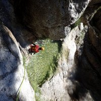
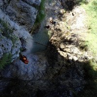
Der Rio Terra Rossa ist ein kurzer offener und südseitiger Abseilcanyon mit meist wenig Wasser. Zwischen den Abseilstellen gibt es nur wenig Abkletter-/Gehstrecken. Vor einer kurzen Engstelle mit Drahtseilgeländer gibt es links noch einen möglichen Notausstieg. Hier seilt man sich 5m in die Engstelle ab. Kurz darauf folgt eine 3m Abkletterstufe (! Evtl. beide Stufen gemeinsam abseilen). Nach der Engstelle öffnet sich die Schlucht und man steht vor einer 20m Stufe mit scharfer Kante (neuer Stand links außerhalb der Wasserführung) Es folgen zwei kürzere Abseilstufen bevor man zu der schönen 3-er Schlusskaskade (20m/35m/25m) kommt. Die Standplätze sind hier etwas exponiert angebracht. Nach dem letzten 25m Wasserfall steht man im zu geschotterten Wasserableitungsbecken auf ca. 620m. Von hier sind es ca. 20min. bis zur Straße. Es wird bei der Mauer zuerst rechts und dann auf der linken Bachseite über ein hilfreiches Drahtseil abgestiegen. Der Rest der Strecke verläuft kurz im Bachbett bevor man rechts auf den Kraftwerksweg wechselt. Auf diesem gelangt man gemütlich zur Straßenbrücke/Überstellungsfahrzeug.
Rio Terra Rossa is a short open and south-facing rappel canyon with mostly little water. There are few downclimb/walking passages between the rappels. Before a short narrow section with wire railing, there is a possible emergency exit on the left. Here you rappel 5m into the narrows. Shortly after, there is a 3m rappel (! Possibly rappel both steps together). After the narrows the canyon opens up and you are faced with a 20m rappel with a sharp edge (or new belaystation on the left outside the watercourse). Two shorter rappel steps follow before you come to the beautiful 3-person final cascade (20m/35m/25m). The belay stations are placed a bit exposed here. After the last 25m waterfall you stand in the gravelled water drainage basin at about 620m. From here it is about 20min. to the road. It is descended at the wall first on the right and then on the left side of the stream over a helpful wire rope. The rest of the route is first in the streambed and from an artificial step right on a path that leads in a short time to the road bridge / shuttle car.
Ritorno (20 min):
traduzione alternativa
➜
Lingua originale
Kurz vor der Straße/Brücke steigt man links aus dem Bach aus. Dann folgt man der Straße kurz hinunter bis zum Überstellungsfahrzeug am Dogna Bach .
Just before the road/bridge you get out of the creek on the left. Then follow the road briefly down to the shuttle car at the Dogna stream .
Coordinate:
Inizio del canyon
Parcheggio in uscita
Ausstiegsparkplatz bei Holzlagerplatz
Parcheggio all'entrata
Einstiegsparkplatz bei Chiout Pupin
Fine del canyon
Letteratura:
Mappa
Tabacco Nr. 18; Alpi Carniche Orientali - Canal del Ferro; 1/25 000
Mappa
IGMI 25/V, 14 Dogna II-NO, 1:25 000
1:25 000
Mappa
IGMI 25/V, 14 Jof di Montasio II-NE, 1:25 000
Info sul canyon Cwiki
Info sul canyon ACA
03.08.2024
Horst Lambauer
⭐
★★★★★
📖
★★★
⚓
★★★
💧
Basso
Completato ✔
traduzione alternativa
➜
Lingua originale
Haben den Weg mit blauen Punkten markiert, damit der Zugang offensichtlicher ist. Alle Stände ok
Have marked the path with blue dots to make access more obvious. All stands ok
01.06.2024
Thomas Fras
⭐
★★★★★
📖
★★★
⚓
★★★
💧
Alto
Completato ✔
traduzione alternativa
➜
Lingua originale
Alle Standplätze soweit ok (Edelrid Armid Schlinge bei C35 neu), wie immer im Frühjahr einige fette Nester der Raupen
All pitches ok so far (Edelrid Armid sling at C35 new), as always in spring some fat nests of caterpillars
09.03.2023
System User
⭐
★★★★★
📖
★★★
⚓
★★★
nessuna traduzione disponibile
Daten importiert von https://canyon.carto.net/cwiki/bin/view/Canyons/RioTerrarossaCanyon.html
Idrologia:


