facile
Lafargue
v2 a2 II
2h25
15min
1h20
50min
460m
420m
40m
8m
1x20m
2
550m
a piedi
Valutazione:
★★★★★
1.4 (1)
Info:
★★★
0 ()
Belay:
★★★
0 ()
Sintesi:
traduzione alternativa
➜
Lingua originale
Wander-Canyon
Hiking canyon
Nord
Calcare
Sintesi:
traduzione alternativa
➜
Lingua originale
Wander-Canyon
Hiking canyon
Accesso:
traduzione alternativa
➜
Lingua originale
Die A-9 'la Languedocienne/la Catalane' (Montpellier-Barcelona) bei der Ausfahrt 41, kurz vor Perpignan verlassen und durch Rivesaltes auf der D-117 in Richtung Quillan fahren. Ca. 35 km ab Rivesaltes errreicht man Saint Paul de Fenouillet, wo es rechts (nach Norden) ab geht auf die D-7 in Richtung Camp sur l'Agly. Dabei durchquert man auf einer in den Fels gesprengten Straße die Gorges de Galamus, bevor man Cubières sur Cinoble erreicht. Es geht ostwärts weiter auf der D-14 in Richtung Bugarach. Man fährt hinauf zum Col de Bancarel. Unmittelbar jenseits zieht links eine Piste hinunter.In Nähe der Teerstraße das Auto abstellen.
Leave the A-9 'la Languedocienne/la Catalane' (Montpellier-Barcelona) at exit 41, just before Perpignan and drive through Rivesaltes on the D-117 towards Quillan. About 35 km from Rivesaltes you reach Saint Paul de Fenouillet, where you turn right (north) onto the D-7 in the direction of Camp sur l'Agly. You cross the Gorges de Galamus on a road cut into the rock before reaching Cubières sur Cinoble. The route continues eastwards on the D-14 towards Bugarach. One goes up to the Col de Bancarel. Immediately beyond, a dirt road descends on the left.Park the car near the tarred road.
Avvicinamento (15 min):
traduzione alternativa
➜
Lingua originale
Der Piste bergab weiter folgen zu der Stelle, wo sich das breite Wiesental zur Felsschlucht verengt. Hier Einstieg
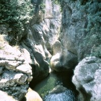
Follow the slope downhill to the place where the wide meadow valley narrows into a rocky gorge. Here entry
Giro (1 h 20):
traduzione alternativa
➜
Lingua originale
Kontinuierliche Einschluchtung mit lediglich 2 Abseilern
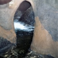
Continuous gorge with only 2 rappels
Ritorno (50 min):
traduzione alternativa
➜
Lingua originale
Nachdem sich die 2. Verengung aufweitet, folgen wir einem Pfad, der zuerst weiter den Bach begleitet, später über offenes Feld von diesem wegzieht. Über eine Piste erreicht man Camp sur l'Agly und die Anfahrtsstraße. Auf dieser zum Auto,
After the 2nd narrowing widens, we follow a path that first continues to accompany the stream, later moving away from it across open fields. Via a dirt road we reach Camp sur l'Agly and the approach road. On this to the car,
Coordinate:
Inizio del canyon
Parcheggio Entrata e uscita
Fine del canyon
Letteratura:
Mappa
IGN 2349 ET, Massif du Canigou, 1/25 000
Mappa
IGN TOP25 2447 OT, Tuchan - Massif des Corbieres, 1:25 000
Libro Canyoning
Gorges et Canyons en Languedoc Roussillon, Jean-Pierre Lucot et Richard Quintilla, 1990
J.P. Lucot - R. Quintanilla
Edisud
1990
Info sul canyon Cwiki
Info sul canyon Descente
Info sul canyon Ropewiki
Info sul canyon FFME
09.03.2023
System User
⭐
★★★★★
📖
★★★
⚓
★★★
nessuna traduzione disponibile
Daten importiert von https://canyon.carto.net/cwiki/bin/view/Canyons/LafargueCanyon.html
Idrologia:


