un po' difficile
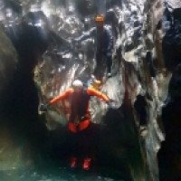
Dorferbach
Paese:
Österreich / Austria
Regione: Tirol
Sottoregione: Bezirk Lienz
Città: Prägraten am Großvenediger
v3 a4 III
4h17
10min
3h30
37min
2160m
1650m
510m
20m
2x40
14
a piedi
Specialità:
Canyon invernale
Canyon invernale
Valutazione:
★★★★★
4.6 (5)
Info:
★★★
3 (3)
Belay:
★★★
1.7 (4)
Sintesi:
traduzione alternativa
➜
Lingua originale
Der Dorferbach ist ein Bach, der nur ab Ende Oktober Anfang November begangen werden kann. Er wird durch einen Gletscher gespeist und hat im Sommer zu viel Wasser um begehbar zu sein. Erst im Oktober/November, wenn die Temperatur in der Nacht auf 2000m an bzw unter 0° liegt wird der Dorferbach begehbar. Dementsprechend sollte man bei der Begehung ausgerüstet sein!
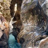
Der Bach hat mehrere Klammen, die durch längere Gehstrecken im Bachbett unterbrochen sind. Er besticht vor allem geologisch, da er sich durch schön gemaserten Serpentin „gefressen“ hat, teilweisen mit wunderschönen Quarzadern durchzogen.
Es ist ein traumhafter Gletschercanyon, der geologisch höchst eindrucksvoll ist. Wunderschöne vom Bach durchfressene Quarzader. Mehrere Felstore/Felsbrücken. Einzigartiger Schluchtabschnitt unter dem Bergsturz durch unterhalb vom Gumpachkreuz.
Begehung nur möglich wenn es über 2000m in der Nacht friert, da sonst unbegehbar wegen zu hohem Wasserstand, dementsprechende Ausrüstung und möglicherweise wärmendende Getränke notwendig.
Nichts für Personen die mit Kälte, Enge und Dunkelheit nichts anfangen können. Südausrichtung, somit bei Sonnenschein auch im Spätherbst gute Lichtverhältnisse
The Dorferbach is a stream that can only be walked from the exit of October to the beginning of November. It is fed by a glacier and has too much water in summer to be passable. Only in October/November, when the temperature at night at 2000m is at or below 0°, the Dorferbach becomes passable. Accordingly, you should be equipped for the walk!
The gorge has several gorges, which are interrupted by longer walking passages in the streambed. He impresses especially geologically, because he has "eaten" through beautifully grained serpentine, partly interspersed with beautiful quartz veins.
It is a gorgeous glacial canyon that is highly impressive geologically. Beautiful quartz vein eaten through by the stream. Several rock gates/rock bridges. Unique canyon section under the landslide through below the Gumpachkreuz.
Can only be done when it is freezing above 2000m at night, otherwise impassable due to high water level, appropriate equipment and possibly warming drinks necessary.
Not for people who can not deal with cold, narrowness and darkness. South exposure, thus in sunshine even in late autumn good lighting conditions
Accesso:
traduzione alternativa
➜
Lingua originale
Nach Lienz in Osttirol fahren und dann weiter ca 26km auf der B108 nach Matrei. Bei Matrei in das Virgental abbiegen und ca 17km nach Hinterbichl fahren. Man fährt durch Hinterbichl durch und über die Brücke des Dorferbachs (rechts sieht man eine alte Mühle). 700m nach der Brücke nimmt man die erste mögliche Abbiegung nach rechts, rauf auf den Berg. Nach weiteren 1,3km kommt man zum Parkplatz „Johannishütte“. Hier parken.
Um den Zustieg zur Johannishütte angenehm zu gestalten, was vor allem zu der Jahreszeit an dem der Dorferbach nur begehbar ist empfehlenswert ist, kann man am Tag zuvor das Venedigertaxi reservieren. Das Taxi führt einen den Berg rauf zur Johannishütte, was den Zustieg von ca 2h auf ca 10min verkürzt.
Venedigertaxi:
Telefon +43 4877 5369
E-Mail: info@huettentaxi.at
www.huettentaxi.at
Drive to Lienz in Osttirol and then continue about 26km on the B108 to Matrei. At Matrei turn into the Virgental and drive about 17km to Hinterbichl. Drive through Hinterbichl and over the bridge of the Dorferbach (on the right you can see an old mill). 700m after the bridge you take the first possible turn to the right, up the mountain. After another 1,3km you come to the parking lot "Johannishütte". Park here.
To make the access to the Johannishütte comfortable, which is especially recommended at the time of year when the Dorferbach is only passable, you can book the Venedigertaxi the day before. The cab takes you up the mountain to the Johannishütte, which shortens the access from about 2h to about 10min.
Venedigertaxi:
Phone +43 4877 5369
E-Mail: info@huettentaxi.at
www.huettentaxi.at
Avvicinamento (10 min):
traduzione alternativa
➜
Lingua originale
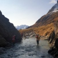
Von der Johannishütte geht man die Schotterstraße bergauf und quert nach ca 100m den Zettalunitzbach in Richtung „Bouldergebiet“. Man folgt dem zuerst klar erkennbaren Pfad bis man beim Dorferbach ankommt. Diesen folgt man bachaufwärts bis man zu einer kleinen Holzbrücke am Anfang der Engklamm des Dorferbaches kommt auf ca 2160m.
10min
From the Johannishütte you walk uphill along the gravel road and after about 100m cross the Zettalunitzbach stream in the direction of the "bouldering area". Follow the first clearly recognizable path until you reach the Dorferbach. Follow this upstream until you reach a small wooden bridge at the beginning of the gorge of the Dorferbach at about 2160m.
Giro (3 h 30):
traduzione alternativa
➜
Lingua originale
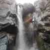
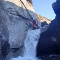
Die Erste Engklamm beginnt bei 2160m direkt bei einer Holzbrücke unter der sich ein Felsbogen befindet. Der erste Abbruch ist entweder ein 6m-Abseiler oder ein 4m-Sprung. Es folgt noch ein kleiner Abseiler gefolgt von einer schönen Abkletter-, kurzen Schwimm- und Gehpassagen ehe der Bach eine 90° Linkskurve macht, wieder offen wird und man an der Johannishütte vorbei geht.
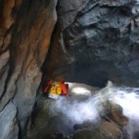
Nach einer längeren Gehpassage im Bachbett, an der Johannishütte vorbei, kommt man zur nächsten Engklamm, die wieder an einer Holzbrücke beginnt. Hier findet man wohl eine der größten offenliegenden Quarzadern, die mitten durch einen Bach gehen. Der Dorferbach hat die Quarzader richtiggehend ausgehölt – alleine diese Stelle wäre es schon wert den Bach zu machen – jedoch das spannende kommt noch.
An der schönen Quarzader vorbei folgt eine kleine Schwimmpassage und man kommt zu einem markanten Klemmblock unter dem man unten durch geht. Es wird zunehmend enger und man steht vor dem nächsten wunderschönen Felsbogen, der in den Stein gefressen wurde. Hier seilt man sich 5m ab ehe man nach ca 50m Geh- und Abkletterpassage zum nächsten wunderschönen Felsbogen kommt. Hier sollte mit Köpersicherung der erste in den Gumpen abseilen und checken ob gesprungen werden kann. Bei unserer Begehung war dieser Gumpen springbar.
Es folgt eine offene Gehpassage, unter einem weiteren Felsbogen unten durch, bis zum ersten höheren Abseiler (ca 17m). Nach einer weiteren Gehstrecke folgt noch ein Sprung ehe man dann nach einer weiteren Gehstrecke bei der Staumauer des Kleinkraftwerkes ankommt. Bis hier ist man ca 1,5h unterwegs.
Hier verlässt man den Bach und geht der Forststraße entlang bis zum Gumpachkreuz.
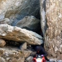
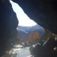
Beim Gumpachkreuz geht man dem Wanderweg bergab in Richtung Dorferbach. Der 3. Klammabschnitt beginnt direkt vor dem Felschaos. Hier beginnt ein einzigartiger dunkler Schluchtabschnitt mit traumhaften geologischen Formen! Der Dorferbach wurde hier von einem großen Bergsturz verschüttet und hat sich unter dem Bergsturz weiter in den Stein gefressen. Der Einstieg in das Felschaos befindet sich or. links wo man sich durch ein kleines Loch in das Felschaos quetsch. Es folgt ein Klemmblock durch den man unterhalb durch robben muss. Es folgt eine extrem dunkle Schwimmpassage rechts! an einem Klemmblock vorbei. Nach einer weiteren engen Stelle an der man sich links vorbei quetsch sieht man wieder Tageslicht und li oberhalb sieht man die Straße. Es folgt der erste 8m-Abseiler in diesem Abschnitt unter einen weiteren riesigen Klemmblock. Hier kommt an eine wunderschöne Passage aus der Dunkelheit raus und man sieht das traumhafte Panorama aus dem Dorfertal hinaus. Es folgt ein weiterer trockenen Abseiler bei einem Klemmblock wieder in die Finsternis. Nach einem weiteren Abseiler zwingend im Wasser folgt eine kleine Abkletterpassage oder 5m-Abseiler rechts, danach ein weiterer 15m-Abseiler ehe man wieder for der nächsten schönen Felsbrücke in der Finsternis steht. Hier führt ein weiter 15m-Abseiler zu einer weiteren Geh- und Abkletterpassage, sowie einer kleinen Schwimmstrecke von ca 20m ehe man am Ende des 3. und wohl eine der einzigartigsten Schluchtabschnitten in Österreich kommt. Direkt über einem ist die Brücke der Straße zur Johannishütte.
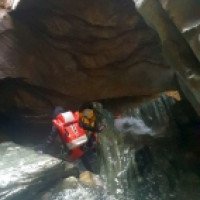
Der 4. Abschnitt ist relativ diskontinuierlich und offen. Er beginnt mit einer Abkletterpassage und einem Zufluss or. li. Nach einer weiteren Gehstrecke kommt man zu einem 5m-Sprung. Nach einer kleinen Gehpassage steht man vor einem großen Block. Hier klettert man entweder or. re. ab oder dreht sich nach links, klettert unter den großen Block in die kleine Höhle und kommt dann unten unter dem kleinen Wasserfall raus (lohnenswert). Es folgt ein kleiner 4m-Abseiler gefolgt von einer größeren Abseilkaskade von 18m, 15m und 7m. Nach einer Abkletterpassage verlässt man den Dorferbach or. li. bei dem Serpentin-Steinbruch (1760Hm).
Um zum letzten Mini-Abschnitt zu gelangen geht man die Straße entlang bis man zu einer großen Brücke über den Dorferbach kommt. Diese überquert man auf das or. re. Ufer und steigt dann ca 100m Bach-aufwärts in den Dorferbach. Direkt unter der Brücke befindet sich der Haken für den 10m-Abseiler. Wahrscheinlich ist dieser Gumpen auch springbar. Es empfiehlt sich nach den weiteren Becken den Dorferbach or. li. zu verlassen, da ab jetzt nur noch Bachwanderung folgt. Ausstieg or.li. bei ca 1650 Hm
Ca 3,5h
Tour description: ca 3,5h
The first gorge begins at 2160m directly at a wooden bridge under which there is a rock arch. The first rappel is either a 6m rappel or a 4m jump. There is a small rappel followed by a nice downclimb, short swim and walking passages before the stream makes a 90° left turn, becomes open again and you pass the Johannishütte.
After a longer walking passage in the streambed, past the Johannishütte, you come to the next gorge, which again starts at a wooden bridge. Here you will find probably one of the largest exposed quartz veins going through the middle of a stream. The village stream has really hollowed out the quartz vein - this place alone would be worth doing the stream - however, the exciting is yet to come.
Past the beautiful quartz vein follows a small swimming passage and you come to a striking clamping block under which you go below. It becomes increasingly narrow and you are in front of the next beautiful rock arch, which was eaten into the stone. Here you rappel 5m before you come after about 50m walking and downclimb to the next beautiful rock arch. Here the first person should rappel into the pool and check if it is possible to jump. During our ascent, this pool was jumpable.
There follows an open walking passage, under another rock arch below, to the first higher rappel (about 17m). After another walking passages follows another jump before one arrives after another walking passages at the dam wall of the small power station. Up to here you are on the way for about 1.5 hours.
Here you leave the stream and walk along the forest road to the Gumpachkreuz.
At the Gumpach cross, follow the hiking trail downhill in the direction of Dorferbach. The 3rd gorge section begins directly in front of the Felschaos. Here begins a unique dark gorge section with fantastic geological forms! The Dorferbach was buried here by a large landslide and has eaten its way further into the rock under the landslide. The entry into the rock chaos is located or. left where you squeeze through a small hole in the rock chaos. A clamping block follows through which you have to crawl underneath. An extremely dark swimming passage follows on the right! past a clamping block. After another narrow passage where you squeeze past to the left, you see daylight again and to the left above you see the road. The first 8m rappel in this part follows under another huge clamping block. Here comes to a beautiful passage out of the darkness and you can see the fantastic panorama out of the village valley. There follows another dry rappel at a clamping block again into the darkness. After another rappel compellingly in the water follows a small downclimb or 5m rappel on the right, then another 15m rappel before one stands again for the next beautiful rock bridge in the darkness. Here another 15m rappel leads to another walk and downclimb, as well as a small swim of about 20m before you come to the exit of the 3rd and probably one of the most unique gorge sections in Austria. Directly above you is the bridge of the road to the Johannishütte.
The 4th part is relatively discontinuous and open. It begins with a downclimb and a tributary or. left. After another walking passages you come to a 5m jump. After a small walking passage, one stands in front of a large block. Here you either climb down orographic right or turn left, climb under the big block into the small cave and come out below the small waterfall (worthwhile). There is a small 4m rappel followed by a larger rappel cascade of 18m, 15m and 7m. After a downclimb you leave the village stream or. left at the serpentine quarry (1760Hm).
To get to the last mini-part, walk along the road until you reach a large bridge over the Dorferbach. Cross this to the ortographic right bank and then climb about 100m up the stream into the Dorferbach. Directly under the bridge is the anchor for the 10m rappel. Probably this pool is also jumpable. It is recommended to leave the Dorferbach or. left after the further pools, because from now on only river walk follows. Exit ortographic left at about 1650 Hm
Ritorno (37 min):
traduzione alternativa
➜
Lingua originale
Man bleibt auf der Forststraße für ca 30-45min bis man wieder beim Parkplatz Johannishütte ist.
30-45min
Stay on the forest road for about 30-45min until you get back to the Johannishütte parking lot.
Coordinate:
Parcheggio Entrata e uscita
47.02388°, 12.332003°
↓↑
DMS: 47° 1" 25.97', 12° 19" 55.21'
DM: 47° 1.433", 12° 19.92"
Google Maps
Austria Topografica
DMS: 47° 1" 25.97', 12° 19" 55.21'
DM: 47° 1.433", 12° 19.92"
Google Maps
Austria Topografica
Parkticket in Höhe von 8,-€ pro Tag ist zu lösen
Sito del contatore del livello dell'acqua
47.024995°, 12.33254°
↓↑
DMS: 47° 1" 29.98', 12° 19" 57.14'
DM: 47° 1.5", 12° 19.952"
Google Maps
Austria Topografica
DMS: 47° 1" 29.98', 12° 19" 57.14'
DM: 47° 1.5", 12° 19.952"
Google Maps
Austria Topografica
Inizio del canyon
47.062064°, 12.33352°
↓↑
DMS: 47° 3" 43.43', 12° 20" 0.67'
DM: 47° 3.724", 12° 20.011"
Google Maps
Austria Topografica
DMS: 47° 3" 43.43', 12° 20" 0.67'
DM: 47° 3.724", 12° 20.011"
Google Maps
Austria Topografica
Fine del canyon
47.034603°, 12.332247°
↓↑
DMS: 47° 2" 4.57', 12° 19" 56.09'
DM: 47° 2.076", 12° 19.935"
Google Maps
Austria Topografica
DMS: 47° 2" 4.57', 12° 19" 56.09'
DM: 47° 2.076", 12° 19.935"
Google Maps
Austria Topografica
Uscita intermedia del canyon
47.059733°, 12.33313°
↓↑
DMS: 47° 3" 35.04', 12° 19" 59.27'
DM: 47° 3.584", 12° 19.988"
Google Maps
Austria Topografica
DMS: 47° 3" 35.04', 12° 19" 59.27'
DM: 47° 3.584", 12° 19.988"
Google Maps
Austria Topografica
Uscita intermedia del canyon
47.044801°, 12.331988°
↓↑
DMS: 47° 2" 41.28', 12° 19" 55.16'
DM: 47° 2.688", 12° 19.919"
Google Maps
Austria Topografica
DMS: 47° 2" 41.28', 12° 19" 55.16'
DM: 47° 2.688", 12° 19.919"
Google Maps
Austria Topografica
Uscita intermedia del canyon
47.039892°, 12.332797°
↓↑
DMS: 47° 2" 23.61', 12° 19" 58.07'
DM: 47° 2.393", 12° 19.968"
Google Maps
Austria Topografica
DMS: 47° 2" 23.61', 12° 19" 58.07'
DM: 47° 2.393", 12° 19.968"
Google Maps
Austria Topografica
Uscita intermedia del canyon
47.050711°, 12.331512°
↓↑
DMS: 47° 3" 2.56', 12° 19" 53.44'
DM: 47° 3.043", 12° 19.891"
Google Maps
Austria Topografica
DMS: 47° 3" 2.56', 12° 19" 53.44'
DM: 47° 3.043", 12° 19.891"
Google Maps
Austria Topografica
Hier am besten aussteigen und beim Kreuz (Einstieg Teil 3) wieder in den Bach einsteigen
Info sul canyon ACA
02.11.2024
PeterAlbertini
⭐
★★★★★
📖
★★★
⚓
★★★
💧
Normale
Completato ✔
Schöne Gletscherschlucht. Ausgezeichnete Bedingungen! Obwohl ein heißer Tag. Auch im oberen Teil hervorragende Bedingungen. Route von 3 Personen aus der CanyonEast Gruppe
13.10.2024
Joey CIA
⭐
★★★★★
📖
★★★
⚓
★★★
💧
Normale
Completato ✔
traduzione alternativa
➜
Lingua originale
Altri utenti sono stati: Bavarian Canyoning
Teil 1-5 begangen. Wasserstand Ok bzw. Bei Teil 1+2 recht sportlich nach zahlreichen Zuläufen, aber machbar. Dann nach dem Kraftwerk und Wasserableitung zum Start Teil 3 super Bedingungen. Teil 3 sehr zu empfehlen wenn der Wasserstand passt. Einige lockere Haken nachgezogen. Super Tag. Zustieg mit Taxi.
Part 1-5 walked. Water level ok or rather quite sporty in parts 1+2 after numerous inflows, but doable. Then after the power station and water drainage to the start part 3 superiore conditions. Part 3 is highly recommended if the water level passes. A few loose anchors pulled up. Superiore day. Access by cab.
Altri utenti sono stati: Bavarian Canyoning
06.10.2024
Peter Lampacher
⭐
★★★★★
📖
★★★
⚓
★★★
💧
Normale
Completato ✔
traduzione alternativa
➜
Lingua originale
Altri utenti sono stati: David Greinhofer
Teile 2 bis 5 begangen, sehr gute Bedingungen.
Parts 2 to 5 walked, very good conditions.
Altri utenti sono stati: David Greinhofer
04.02.2024
Peter Lampacher
⭐
★★★★★
📖
★★★
⚓
★★★
💧
Basso
Completato ✔
traduzione alternativa
➜
Lingua originale
Winterbegehung von Teilstücken:
1. und 2. Teil nicht begangen (zu viel Schnee)
3. Teil begangen, eine Stelle mussten wir umgehen (blockiert mit Schnee)
4. Teil nicht begangen, zuviel Schnee in der Schlucht und halb abgebrochene Wechten oberhalb
5. Teil begangen
Wasserstand ideal.
Zustieg und Tour von zahlreichen Lawinenstrichen bedroht. Wir haben mind. 5 größere Lawinenkegel gequert. Besser im Spätherbst, vor größeren Schneefällen.
Winter ascent of sections:
1st and 2nd part not walked (too much snow)
3rd section climbed, we had to bypass one section (blocked with snow)
4th part not climbed, too much snow in the canyon and half-broken cornices above
5th part climbed
Water level ideal.
Access and tour threatened by numerous avalanche tracks. We crossed at least 5 large avalanche cones. Better in late fall, before major snowfalls.
09.03.2023
System User
⭐
★★★★★
📖
★★★
⚓
★★★
nessuna traduzione disponibile
Daten importiert von https://www.canyoning.or.at/index.php/liste-aller-canyons/519-dorferbach
Nuovo rapporto
Riportare brevemente e concisamente le informazioni più importanti dell'ultimo tour o importanti informazioni attuali sul canyon. Se necessario con link a video, foto, ecc..
*
*
*
Esc
Del
Idrologia:
nessuna traduzione disponibile
Begehung nur möglich wenn es über 2000m in der Nacht friert, da sonst unbegehbar wegen zu hohem Wasserstand, dementsprechende Ausrüstung und möglicherweise wärmendende Getränke notwendig.
Gute Zeit zum Begehen wäre Ende Oktober bis Anfang November.
Sito del contatore del livello dell'acqua


