non così difficile
Schwarzenbach (Reutte)
v3 a2 II
3h
50min
2h
10min
1250m
950m
300m
25m
2x30m
9
1000m
a piedi
Valutazione:
★★★★★
2.7 (4)
Info:
★★★
2 (2)
Belay:
★★★
2 (2)
Sintesi:
traduzione alternativa
➜
Lingua originale
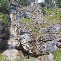
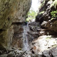
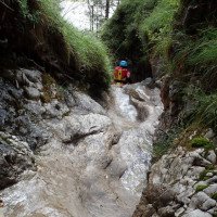
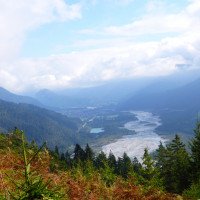
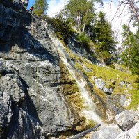
Schöner Ausblick auf den Lech; oberer Teil sehr offen, unterer Teil im Wald eingeschnittener; viele rutschig Stellen; meist wenig Wasser; viele Ausstiegsmöglichkeiten; kurzer, steiler Aufstieg; Exposition S/O; oft noch möglich nach Niederschlag; brüchiges Sedimentgestein; Standplätze gut; Gut kombinierbar mit dem Wiesbach bei Stanzach; Grillplatz bei Hängebrücke; Einzugsgebiet ca. 1Km².
Beautiful view of the Lech; upper part very open, lower part cut in the forest; many slippery places; mostly little water; many exit possibilities; short, steep ascent; exposure S/O; often still possible after precipitation; brittle sedimentary rock; standings good; Can be well combined with the Wiesbach near Stanzach; barbecue area at suspension bridge; catchment area about 1Km².
Accesso:
traduzione alternativa
➜
Lingua originale
Von Reutte bis zur Ortschaft Forchach. Hier gleich rechts von der Bundesstraße ablegen und zum Gewerbegebiet/Sportplatz fahren. Vor der Metalfirma gibt es einen großen Schotterparkplatz.
15min
From Reutte to the village of Forchach. Turn right off the main road and drive to the industrial park/sports ground. There is a large gravel parking place in front of the metal company.
Avvicinamento (50 min):
traduzione alternativa
➜
Lingua originale
Vom Parkplatz aus am Sportplatz vorbei bis zur Lech. Hier über die leicht schwingende Metall-Hängebrücke. Direkt nach der Brücke steht man schon vor dem Ausstieg der Tour. Ab hier führen ca. 20m orographisch links neben dem Bach Steigspuren steil den lichten Wald hoch bis zu einer steilen Felswand. Die Felswand wird rechts umwandert bis man zu einem kleinen steilen Durchstieg mit alten Holzstempen kommt. Kurz nach dem steilen Durchstieg trifft man auf eine Forststraße die links folgend zu einer Wildfütterungsstelle führt. Ab hier geht es nochmals steil über Steigspuren im Zickzack hoch bis man dann im offenen Gelände zum Bach quert (weiterer Aufstieg bis zur zweiten Forststraße nicht lohnenswert).
50min
From the parking lot past the sports field to the Lech. Here over the slightly swinging metal suspension bridge. Directly after the bridge you are already in front of the exit of the tour. From here, about 20m orographically to the left of the stream, steep tracks lead up the sparse forest to a steep rock face. The rock face is hiked around to the right until you come to a small steep passage with old wooden stamps. Shortly after the steep passage you meet a forest road that leads to a wildlife feeding station on the left. From here, the trail zigzags steeply uphill until you cross the open terrain to the stream (further ascent to the second forest road is not worthwhile).
Giro (2 h):
traduzione alternativa
➜
Lingua originale
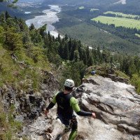
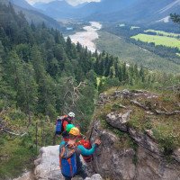
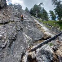
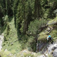
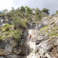
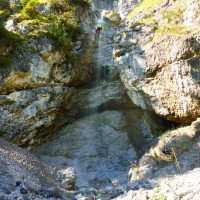
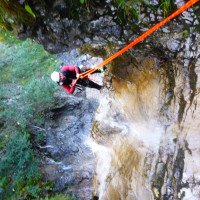
Die kurze Tour bietet nach dem steilen Zustieg eine schöne Aussicht auf den Lech und zwei schöne 25m Abseilstellen im oberen Teil der Schlucht. Nach kurzen Gehgelände in der Mitte der Schlucht folgt der untere Teil, der in der vegetationsreichen Umgebung auch rutschigere Abseilstellen hat. Die Abseilstellen (16-25m) folgen ohne große Wegstrecke kurz aufeinander bevor man am Lech Radweg ankommt.
2h
The short tour offers after the steep access a beautiful view of the Lech and two nice 25m abseils in the upper part of the canyon. After short walking terrain in the middle of the canyon follows the lower part, which also has more slippery abseils in the vegetated surroundings. The abseils (16-25m) follow each other without much distance before arriving at the Lech bike path.
Ritorno (10 min):
traduzione alternativa
➜
Lingua originale
Entweder steigt man gleich beim Radweg auf ca. 950m aus und folgt dem Weg über die Hängebrücke zurück zum Parkplatz oder man steigt weiter ab bis zur Einmündung in die Lech und überquert den Fluss um dann auf der anderen Seite zurück zum Parkplatz zu gelangen (Achtung Wasserstand Lech!)
10min
Either get off right at the bike path at approx. 950m and follow the path over the suspension bridge back to the parking lot or continue descending until you reach the confluence with the Lech and cross the river to get back to the parking lot on the other side (watch out for the water level of the Lech!).
Coordinate:
Inizio del canyon
47.428°, 10.5759°
↓↑
DMS: 47° 25" 40.8', 10° 34" 33.24'
DM: 47° 25.68", 10° 34.554"
Google Maps
Austria Topografica
DMS: 47° 25" 40.8', 10° 34" 33.24'
DM: 47° 25.68", 10° 34.554"
Google Maps
Austria Topografica
(descente_1)
Fine del canyon
47.4258°, 10.5811°
↓↑
DMS: 47° 25" 32.88', 10° 34" 51.96'
DM: 47° 25.548", 10° 34.866"
Google Maps
Austria Topografica
DMS: 47° 25" 32.88', 10° 34" 51.96'
DM: 47° 25.548", 10° 34.866"
Google Maps
Austria Topografica
(descente_2)
Parcheggio Entrata e uscita
47.4226°, 10.5832°
↓↑
DMS: 47° 25" 21.36', 10° 34" 59.52'
DM: 47° 25.356", 10° 34.992"
Google Maps
Austria Topografica
DMS: 47° 25" 21.36', 10° 34" 59.52'
DM: 47° 25.356", 10° 34.992"
Google Maps
Austria Topografica
(descente_3)
Punto di passaggio
47.426°, 10.5813°
↓↑
DMS: 47° 25" 33.6', 10° 34" 52.68'
DM: 47° 25.56", 10° 34.878"
Google Maps
Austria Topografica
DMS: 47° 25" 33.6', 10° 34" 52.68'
DM: 47° 25.56", 10° 34.878"
Google Maps
Austria Topografica
1. départ du sentier d\'approche (descente)
Punto di passaggio
47.4285°, 10.5794°
↓↑
DMS: 47° 25" 42.6', 10° 34" 45.84'
DM: 47° 25.71", 10° 34.764"
Google Maps
Austria Topografica
DMS: 47° 25" 42.6', 10° 34" 45.84'
DM: 47° 25.71", 10° 34.764"
Google Maps
Austria Topografica
2 : ...jusqu\'à refuge. (descente)
Punto di passaggio
47.4279°, 10.5779°
↓↑
DMS: 47° 25" 40.44', 10° 34" 40.44'
DM: 47° 25.674", 10° 34.674"
Google Maps
Austria Topografica
DMS: 47° 25" 40.44', 10° 34" 40.44'
DM: 47° 25.674", 10° 34.674"
Google Maps
Austria Topografica
3 : de la piste, tirer vers le-haut jusqu\'à l\'entrée (descente)
Letteratura:
Info sul canyon ACA
Info sul canyon Cwiki
Info sul canyon Descente
Info sul canyon Ropewiki
29.07.2024
Fred
⭐
★★★★★
📖
★★★
⚓
★★★
💧
Basso
Completato ✔
traduzione alternativa
➜
Lingua originale
Verankerungen ok, viele neu, ein paar Maillons sind etwas rötlich. Wenig Holz.
Die Zustiegspfade sind aber trotz intensiver Suche nicht mehr auffindbar/vorhanden. Wir mussten querfeldein gehen. Die Felswand beim ersten Abschnitt kann man rechts unterwandern bis man zum Forstweg gelangt oder einen Durchstieg auf https://goo.gl/maps/nMsGZA18N6DkiqnZ9
nutzen. Danach durch das Farnfeld hoch bis man zur Straße gelangt. Dann nach links bis zum Bach und orographisch links vom Bach (also nicht queren) hoch bis zum Einstiegspunkt.
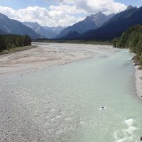
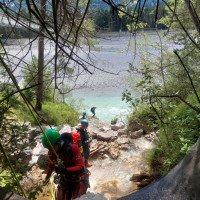
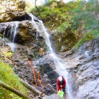
Foto: Checkpoint am Ende (direkt hinter der Brücke) - niedriger Wasserstand.
Anchorages ok, many new, a few maillons are a little reddish. Little wood.
Despite an intensive search, the access paths can no longer be found/exist. We had to go cross-country. You can hike under the rock face on the first part to the right until you reach the forest path or use a passage at https://goo.gl/maps/nMsGZA18N6DkiqnZ9
use. Then up through the fern field until you reach the road. Then turn left to the stream and orographically left of the stream (i.e. do not cross) up to the entry point.
Photo: Checkpoint at the exit (directly behind the bridge) - low water level.
31.07.2023
Ralf Breitenstein
⭐
★★★★★
📖
★★★
⚓
★★★
💧
Normale
Completato ✔
traduzione alternativa
➜
Lingua originale
Lasche/Mutter am ersten Abseiler locker, ansonsten alles in Ordnung. Schöne kurze Tour.
Lash/nut loose on first rappel, otherwise everything fine. Nice short tour.
09.03.2023
System User
⭐
★★★★★
📖
★★★
⚓
★★★
nessuna traduzione disponibile
Info: Teile der Canyonbeschreibung wurden automatisiert übernommen. Konkret die Felder Weblinks, Koordinaten, Rating, Ort, Länge des Canyon, Einfachseil Mindestens von https://canyon.carto.net/cwiki/bin/view/Canyons/SchwarzenbachCanyon.html und https://www.descente-canyon.com/canyoning/canyon/23097
09.03.2023
System User
⭐
★★★★★
📖
★★★
⚓
★★★
nessuna traduzione disponibile
Daten importiert von https://www.canyoning.or.at/index.php/liste-aller-canyons/586-schwarzenbach
Nuovo rapporto
Riportare brevemente e concisamente le informazioni più importanti dell'ultimo tour o importanti informazioni attuali sul canyon. Se necessario con link a video, foto, ecc..
*
*
*
Esc
Del
Idrologia:
