non così difficile
Molino Drago
v3 a2 II
3h10
10min
2h30
30min
475m
370m
105m
20m
2x20m
8
a piedi
Valutazione:
★★★★★
2.6 (2)
Info:
★★★
1 (1)
Belay:
★★★
1 (1)
Sintesi:
traduzione alternativa
➜
Lingua originale
Kurzer Canyon in schön ausgeschliffenem Fels. Sollte im Frühjahr begangen werden, wenn noch Wasserdurchsatz vorhanden ist.
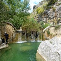
Short canyon in beautifully polished rock. Should be done in spring when there is still water flow.
dicembre - aprile
Sud
Sintesi:
traduzione alternativa
➜
Lingua originale
Kurzer Canyon in schön ausgeschliffenem Fels. Sollte im Frühjahr begangen werden, wenn noch Wasserdurchsatz vorhanden ist.
Short canyon in beautifully polished rock. Should be done in spring when there is still water flow.
Accesso:
traduzione alternativa
➜
Lingua originale
Wir steuern die Stadt Corleone an, die 35 km - Luftlinie - südlich von Palermo liegt. Corleone galt zum Ende des 20. Jahrhunderts als Mafiahochburg in Sizilien. Von Corleone fahren wir auf der SS 118 nordwärts Richtung Palermo. 5,2 km, nachdem wir das Zentrum von Corleone verlassen haben, quert die SS 118 in einem weiten Linksbogen einen kleinen Fluss. 3,4 km weiter biegen wir von der SS 118 links ab, um sofort wieder links eine Piste zu nehmen (ehemalige Eisenbahntrasse - 2017 Autos auf dieser Teilstrecke nicht mehr erwünscht), die uns nach 650 Metern an die Brücke über den Fluss führt.
We head for the town of Corleone, which is 35 km - as the crow flies - south of Palermo. At the exit of the 20th century, Corleone was considered a mafia stronghold in Sicily. From Corleone, we head north on the SS 118 towards Palermo. 5.2 km after leaving the center of Corleone, the SS 118 crosses a small river in a wide left-hand bend. 3.4 km further on, we turn left off the SS 118 and immediately turn left again onto a dirt road (former railroad line - cars are no longer allowed on this section in 2017), which leads us to the bridge over the river after 650 meters.
Avvicinamento (10 min):
traduzione alternativa
➜
Lingua originale
Bei der Brücke steigen wir vom rechten Ufer aus ein.
At the bridge we enter from the right bank.
Giro (2 h 30):
traduzione alternativa
➜
Lingua originale
Nach dem letzten Abseiler von 20 m ist ein Ausstieg nach rechts markiert.
After the last rappel of 20 m, an exit to the right is marked.
Ritorno (30 min):
traduzione alternativa
➜
Lingua originale
Rechts aus dem Canyon hinaus kommen wir in westlicher Richtung zu einem Feldweg, der uns zurück zur Brücke und zum Auto bringt.
We leave the canyon to the right and head west along a dirt road that takes us back to the bridge and the car.
Coordinate:
Inizio del canyon
Fine del canyon
Parcheggio Entrata e uscita
Letteratura:
Mappa
IGMI 25/V, 258 Rocche di Rao I-SO, 1:25 000
Mappa
IGM 607, Corleone, 1:50 000
Libro Canyoning
Canyoning nel Mediterraneo. Sardegna, Sicilia, Corsica
Corrado Conca / Paolo Madonia / Diego Leonardi
2002
Libro Canyoning
Le tour de l´Europe en Canyon. T2 - Ligurie, Italia centrale et du sud, Sicile, Sardaigne, Balkans....
Stéphane Coté / Caracal et les Sancho Panza
2009
Info sul canyon Cwiki
Info sul canyon Descente
Info sul canyon Ropewiki
18.10.2024
Jordi Ibañez Rius
⭐
★★★★★
📖
★★★
⚓
★★★
💧
Secco
Completato ✕
traduzione alternativa
➜
Lingua originale
El barranco estaba seco con pozas de agua estancada.
The ravine was dry with pools of stagnant water.
09.03.2023
System User
⭐
★★★★★
📖
★★★
⚓
★★★
nessuna traduzione disponibile
Daten importiert von https://canyon.carto.net/cwiki/bin/view/Canyons/MolinoDragoCanyon.html
Idrologia:


