difficile
Rasiga
v4 a5 V
6h50
30min
6h
20min
1220m
620m
600m
68m
1x70m (inf.), 2x35m
39
3900m
Auto facoltativa
Valutazione:
★★★★★
4.3 (3)
Info:
★★★
3 (1)
Belay:
★★★
3 (1)
Sintesi:
traduzione alternativa
➜
Lingua originale
Langer und wasserreicher Abseilcanyon
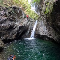
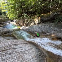
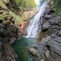
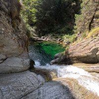
Long and watery rappel canyon
Sud
Sintesi:
traduzione alternativa
➜
Lingua originale
Langer und wasserreicher Abseilcanyon
Long and watery rappel canyon
Accesso:
traduzione alternativa
➜
Lingua originale
Von Domodossola fährt man westwärts ins Bogna-Tal in Richtung Fonti. Nach ca. 7 km passiert man eine lange Brücke, von der man die letzten Kaskaden des Variola sehen kann. 850 m weiter geht links die Straße nach Pioi weg. Hier parkt man ein Auto. \nSofern man vor der Passage mit dem 68 m - Abseiler und längerer Laufstrecke aussteigen will (wird empfohlen, da der letzte Abschnitt nicht sehr lohnend ist und dann 2x30m Seil für einen höchsten Abseiler von nicht ganz 25m genügen), stellt man das untere Auto 570m weiter auf der Zufahrtsstraße am Ortseingang von Fonti ab, direkt vor der Brücke über die Bogna. Gleich nach der Brücke kommt rechts der Wanderweg aus Richtung Monsignore, auf dem wir zurückkommen werden..\nMit dem zweiten Auto fährt man weiter, durch den Ort Fonti und dann die Straße in Serpentinen aufwärts über San Lorenzo, Graniga, Pianzola. Nach insgesamt 8,7 km (gerechnet vom unteren Auto an der Straßenabzweigung nach Pioi) kommen wir an einer 90°-Linkskurve zu einigen am Hang verstreuten Häusern (1290 m üNN). Hier sieht man einen Pfosten mit Wegweisern. In der Nähe stellen wir das zweite Auto ab.\n\nWill man nur den Abschnitt nach der Wasserableitung gehen zweigt man in Richtung Mulera ab und parkt hinter der kleinen Kirche.
From Domodossola, head west towards the Bogna Valley in the direction of Fonti. After about 7 km you pass a long bridge from which you can see the last cascades of the Variola. 850 m further on, the road to Pioi leaves to the left. Here you can park a car. \If you want to get off before the passage with the 68 m rappel and longer walk (recommended, because the last part is not very rewarding and then 2x30m of rope are enough for a highest rappel of not quite 25m), park the lower car 570m further on the access road at the entrance to Fonti, just before the bridge over the Bogna. Just after the bridge, on the right, there is the path coming from Monsignore, on which we will return..\nWith the second car, you continue, passing through the village of Fonti and then up the road in serpentines through San Lorenzo, Graniga, Pianzola. After a total of 8.7 km (calculated from the lower car at the road junction for Pioi), at a 90° left turn, we come to some houses scattered on the hillside (1290 m a.s.l.). Here we see a post with signposts. Nearby we park the second car.\n\nIf you want to go only the part after the water drainage, you branch off in the direction of Mulera and park behind the small church.
Avvicinamento (30 min):
traduzione alternativa
➜
Lingua originale
Wir folgen dem Wegweiser "Ponte Alpe Baim" auf einem Pfad in horizontaler Nordrichtung. Nach einiger Zeit kommen wir zu einem Baumstamm mit großer Schrift. Hier geht der Hauptweg rechts hinunter zur Brücke (1100) - unterer Zustieg (Zeitersparnis gegenüber oberem Zustieg gut 1 Stunde).\nDer Weg zum oberen Einstieg geht hier links und ist mit roten Markierungen gekennzeichnet. Ihnen folgen wir an einer Hausruine vorbei bis zum Bach.\n\nMittlerer Einstieg:\nVon der Kirche am Forstweg abwärts bis man das Kraftwerk erreicht. Hier zwischen den beiden Gebäuden durch und hinter dem rechten Gebäude auf die Röhre absteigen. Der Röhre entlang bis man nach dem ersten Tunnel nach rechts zum Bachbett absteigen kann. (Dauer 20-30min)
We follow the sign "Ponte Alpe Baim" on a path in horizontal north direction. After some time we come to a tree trunk with large writing. Here the main trail goes down to the right to the bridge (1100) - lower entry (time saving compared to upper entry a good 1 hour).\nThe trail to the upper entry goes here on the left and is marked with red markings. Follow them past the ruins of a house to the stream. Middle entry:\nFrom the church along the forest road downhill until you reach the power station. Here, pass between the two buildings and descend behind the right building onto the tube. Follow the tube until after the first tunnel you can descend to the streambed on the right. (Duration 20-30min)
Giro (6 h):
traduzione alternativa
➜
Lingua originale
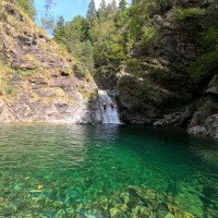
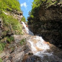
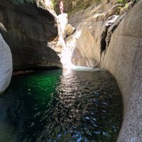
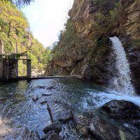
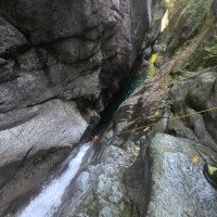
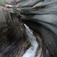
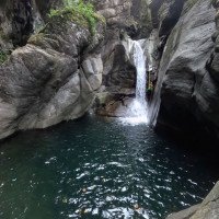
Langer und großartiger Abstieg mit Rutschen, Sprungmöglichkeiten, Engstellen und sonnendurchfluteten Gumpen (so die Sonne scheint). Bei der Wasserableitung kann man notfalls aussteigen, wenn der Wasserdurchsatz für die folgenden Engpassagen zu stark erscheint.
Wenn wir auch den unteren Abschnitt anhängen wollen, müssen wir neben 2x30m Seil auch ein 60m-Seil mit führen.
Long and great descent with slides, possible jumps, bottlenecks and pools flooded with sun (if the sun shines). At the water drainage you can get out if necessary, if the water flow seems too strong for the following bottlenecks.
If we also want to hook the lower part, we have to carry a 60m rope in addition to 2x30m rope.
Ritorno (20 min):
traduzione alternativa
➜
Lingua originale
Vor der alten Steinbrücke links hinaus und über die Brücke rechts den Wanderweg nach Fonti.\nFalls der letzte Abschnitt mit dem 68m-Seiler (kann gebrochen werden 50/20) auch noch gegangen wird, bei der Staustufe auf der orograf. linken Seite des Rio Bogna einige hundert Meter aufwärts, bis man auf der gegenüberliegenden Seite einen Weg sieht, der hinauf zum unteren Auto führt.
Before the old stone bridge left out and over the bridge to the right the trail to Fonti.\nIf the last part with the 68m rope (can be broken 50/20) is also walked, at the barrage on the orographic left side of the Rio Bogna up a few hundred meters until you see on the opposite side a path that leads up to the lower car.
Coordinate:
Inizio del canyon
Partenza alternativa del canyon
(descente_1)
Fine del canyon
(descente_2)
Parcheggio all'entrata
(descente_3)
Parcheggio in uscita
(descente_4)
Letteratura:
Mappa
1:50 000
Mappa
1:50000
Mappa
1:25000
Mappa
1:50000
Libro Canyoning
Spéléo Club de la Vallée de la Vis
2015
Libro Canyoning
Libro Canyoning
Simon Flower
Cicerone
2012
Northern Italy and Ticino
Libro Canyoning
Pascal van Duin
2011
Libro Canyoning
Libro Canyoning
Daniele Geuna, Dina Ruotolo
Versante Sud
2010
978-88-87890-94-5
Libro Canyoning
Pascal van Duin
Edizioni TopCanyon
2009
100 Beschreibungen
Libro Canyoning
Francesco Cacace / Roberto Jarre / Dino Ruotolo / Roberto Schenone
2003
Libro Canyoning
Info sul canyon Cwiki
Info sul canyon Descente
Info sul canyon Ropewiki
Altro info sul canyon
Altro info sul canyon
18.09.2024
Alex_tatavovitchTommogAdadasurmonbidet
⭐
★★★★★
📖
★★★
⚓
★★★
💧
Normale
Completato ✔
nessuna traduzione disponibile
Automatisch importiert von Descente-Canyon.com für Canyon Rasiga
Beaucoup de marche et de nage. Jolie canyon. Tous les rappels sont numérotés mais très dur à trouver.
(Quelle: https://www.descente-canyon.com/canyoning/canyon-debit/2572/observations.html)
18.09.2024
Alex_tatavovitchTommog
⭐
★★★★★
📖
★★★
⚓
★★★
💧
Normale
Completato ✔
nessuna traduzione disponibile
Automatisch importiert von Descente-Canyon.com für Canyon Rasiga
Glisse beaucoup, et beaucoup de marche
(Quelle: https://www.descente-canyon.com/canyoning/canyon-debit/2572/observations.html)
16.09.2024
stefarverne
⭐
★★★★★
📖
★★★
⚓
★★★
💧
Normale
Completato ✔
nessuna traduzione disponibile
Automatisch importiert von Descente-Canyon.com für Canyon Rasiga
Très ludique jusqu'à la prise d'eau. Très esthétique ensuite. Les obstacles sont numérotés et le dernier rappel de la partie avant le pont doit être le numéro 30. S'ensuit 20' de marche en bloc jusqu'au pont où on peut sortir si on veut éviter les grandes cascades.
(Quelle: https://www.descente-canyon.com/canyoning/canyon-debit/2572/observations.html)
31.08.2024
michel
⭐
★★★★★
📖
★★★
⚓
★★★
💧
Normale
Completato ✕
nessuna traduzione disponibile
Automatisch importiert von Descente-Canyon.com für Canyon Rasiga
Toujours aussi sympa. Le meilleur canyon du coin pour nous.
(Quelle: https://www.descente-canyon.com/canyoning/canyon-debit/2572/observations.html)
31.08.2024
Jeanne
⭐
★★★★★
📖
★★★
⚓
★★★
💧
Normale
Completato ✔
nessuna traduzione disponibile
Automatisch importiert von Descente-Canyon.com für Canyon Rasiga
DC + après le pont, la 35 après la 50 ne doit pas être sous estimée. Tous les sauts et toboggans ok. On a fait 7h de voiture à voiture sans navette (à 2). A choisir après cette intégrale, si on fait depuis le barrage et qu'on sort avant la 50m(chemin rive gauche avant le pont), on a vraiment le meilleur du canyon !
(Quelle: https://www.descente-canyon.com/canyoning/canyon-debit/2572/observations.html)
15.08.2024
apalomer
⭐
★★★★★
📖
★★★
⚓
★★★
💧
Normale
Completato ✔
nessuna traduzione disponibile
Automatisch importiert von Descente-Canyon.com für Canyon Rasiga
(Quelle: https://www.descente-canyon.com/canyoning/canyon-debit/2572/observations.html)
04.08.2024
Adrien_La_Commune
⭐
★★★★★
📖
★★★
⚓
★★★
💧
Normale
Completato ✔
nessuna traduzione disponibile
Automatisch importiert von Descente-Canyon.com für Canyon Rasiga
Partie inférieure parcourue, très beau. On est sorti au niveau du pont.
(Quelle: https://www.descente-canyon.com/canyoning/canyon-debit/2572/observations.html)
02.08.2024
Brocoli
⭐
★★★★★
📖
★★★
⚓
★★★
💧
Normale
Completato ✔
nessuna traduzione disponibile
Automatisch importiert von Descente-Canyon.com für Canyon Rasiga
(Quelle: https://www.descente-canyon.com/canyoning/canyon-debit/2572/observations.html)
01.08.2024
Hugoze
⭐
★★★★★
📖
★★★
⚓
★★★
💧
Normale
Completato ✔
nessuna traduzione disponibile
Automatisch importiert von Descente-Canyon.com für Canyon Rasiga
5h jusqu'à prise d eau à 6. 2h30 prise d eau jusqu au pont à 4.DC jusqu a prise d eau (ressaut 25) puis DC+ jusqu au pont (ressaut 40)Très joli très joueur et lisible. Les tobs et les sauts passent. Ancrages ok. Première partie ouverte avec bcp de gros tob. 2 ème partie plus encaissée très jolieSi on fait pas les cascades sous le pont (C70) 35m (×3) de corde suffisent.Lorsque le canyon s ouvre après l etroiture une sente est présenté RG pour rejoindre le pont.
(Quelle: https://www.descente-canyon.com/canyoning/canyon-debit/2572/observations.html)
02.09.2023
Patrick Summerer
⭐
★★★★★
📖
★★★
⚓
★★★
💧
Normale
Completato ✔
traduzione alternativa
➜
Lingua originale
Alle Stände super, sehr viele Rutschen und Sprünge in smaragdgrüne Pools möglich.
All stands super, very many slides and jumps in emerald pools possible.
09.03.2023
System User
⭐
★★★★★
📖
★★★
⚓
★★★
nessuna traduzione disponibile
Info: Teile der Canyonbeschreibung wurden automatisiert übernommen. Konkret die Felder Weblinks, Koordinaten, Rating, Länge des Canyon, Einfachseil Mindestens von https://www.descente-canyon.com/canyoning/canyon/2572
09.03.2023
System User
⭐
★★★★★
📖
★★★
⚓
★★★
nessuna traduzione disponibile
Daten importiert von https://canyon.carto.net/cwiki/bin/view/Canyons/RasigaCanyon.html
Nuovo rapporto
Riportare brevemente e concisamente le informazioni più importanti dell'ultimo tour o importanti informazioni attuali sul canyon. Se necessario con link a video, foto, ecc..
*
*
*
Esc
Del
Idrologia:
