non così difficile
Noire Fontaine
v3 a1 I
1h42
10min
1h20
12min
450m
320m
130m
18m
2x20m
8
650m
Auto facoltativa
Valutazione:
★★★★★
1.3 (2)
Info:
★★★
0 ()
Belay:
★★★
0 ()
Sintesi:
traduzione alternativa
➜
Lingua originale
Waldgraben
forest canyon
Nord
Sintesi:
traduzione alternativa
➜
Lingua originale
Waldgraben
forest canyon
Accesso:
traduzione alternativa
➜
Lingua originale
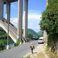
Von Genf auf der Autobahn A 40 etwa 65 km in Richtung Lyon. Nach 3 kürzeren Tunneln passiert man die Kleinstadt Nantua (rechts unterhalb eines hohen Viadukts) und durchfährt anschließend ein etwa 3 km langes Tunnel. Die Autobahn verzweigt sich und wir nehmen die nordwärts (Richtung Oyonnax) in den französischen Jura hineinführende A404. 5 km nach dem Autobahnkreuz verlassen wir auch die A404 und wechseln auf die westwärts in Richtung Bourg-en-Bresse führende D979. Von hier fahren wir noch etqa 14 km bis zu der am Fluss Ain gelegenen Ortschaft Derrières-sur-Ain. Wir biegen von der D979 rechts ab, durchfahren die genannte Ortschaft, stoßen auf die D91, die dem Fluss Ain folgt. Links geht es unter der hohen Straßenbrücke hindurch, dann haben wir den Platz erreicht, wo wir das untere Auto abstellen.
Mit dem zweiten Auto fahren wir noch gut 1 km auf der D91 (Richtung Poncin) flussabwärts, um kurz vor Erreichen des Weilers Merpuis links hinauf abzubiegen in Richtung Chales-la-Montagne. Es geht etwa 2,4 km in Kurven bergauf, dann erreichen wir eine Lichtung kurz bevor das Strässchen den Wald verlässt. Hier das obere Auto abstellen.
From Geneva on the highway A 40 about 65 km in the direction of Lyon. After 3 shorter tunnels, you pass the small town of Nantua (on the right below a high viaduct) and then go through a tunnel about 3 km long. The highway branches and we take the A404 heading north (towards Oyonnax) into the French Jura. 5 km after the interchange we also leave the A404 and change to the D979 leading westwards in the direction of Bourg-en-Bresse. From here we drive about 14 km to the village of Derrières-sur-Ain, situated on the river Ain. We turn right from the D979, pass through the mentioned village, meet the D91, which follows the river Ain. On the left we go under the high road bridge, then we have reached the place where we park the lower car.\nWith the second car we go downstream on the D91 (direction Poncin) for a good 1 km, to turn left uphill in the direction of Chales-la-Montagne just before reaching the hamlet of Merpuis. It goes uphill in bends for about 2.4 km, then we reach a clearing just before the road leaves the forest. Park the upper car here.
Avvicinamento (10 min):
traduzione alternativa
➜
Lingua originale
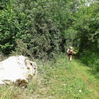
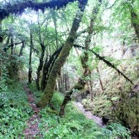
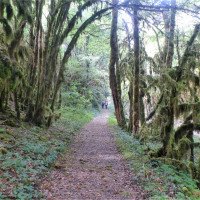
Wir nehmen den Forstweg, der in nördlicher Richtung am Waldrand (aber innerhalb desselben) entlangführt. Nach etwa 500m erreicht man den Bach.
We take the forest road that runs north along the edge of the forest (but within it). After about 500m you reach the stream.
Giro (1 h 20):
traduzione alternativa
➜
Lingua originale
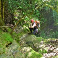
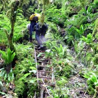
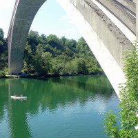
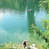
Abseilcanyon, bei fehlendem Wasserdurchsatz nur für Sammler. Am Ende der Tour Bademöglichkeit in der Ain.
Rappel canyon, in the absence of water flow only for collectors. At the exit of the tour swimming possibility in the Ain.
Ritorno (12 min):
traduzione alternativa
➜
Lingua originale
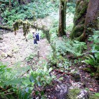
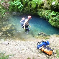
Nach dem letzten Abseiler folgt man dem bachabwärts laufenden und manchmal undeutlichen Pfad, kann sich bei Bedarf an einer kalten Karstquelle erfrischen und kommt direkt am Auto auf die D 91. Hier kann man im Fluss Ain seinen Neo sauber baden.
After the last rappel, follow the path that runs downstream and sometimes indistinct, you can refresh yourself at a cold karst spring, if necessary, and come directly to the car on the D 91. Here you can cleanly bathe your neo in the river Ain.
Coordinate:
Inizio del canyon
Fine del canyon
Parcheggio all'entrata
Parcheggio in uscita
Letteratura:
Mappa
3231 OT, Ambérieu-en-Bugey, 1:25 000
Mappa
IGN Série Orange 3229, Nantua, 1:50 000
Mappa
IGN TOP25 3230 OT, Nantua - Hauteville-Lompnes/Nord Bugey, 1:25 000
Libro Canyoning
Canyons et cascades de l'Ain. Groupe Speleo Hauteville-Lompnes, B. Hugon, D. Gritti, P. Flochon, 2002
2002
Info sul canyon Cwiki
Info sul canyon Descente
Info sul canyon Ropewiki
Gallería
Info sul canyon FFME
01.06.2024
Agat
⭐
★★★★★
📖
★★★
⚓
★★★
💧
Normale
Completato ✕
nessuna traduzione disponibile
Automatisch importiert von Descente-Canyon.com für Canyon Noire Fontaine
Parcouru sans navette, le chemin qui longe le canyon permet d'aller à l'amont. Raide mais sans difficulté.Jolo débit aujourd'hui, qui permet, pour une fois de jouer dans les cascades.
(Quelle: https://www.descente-canyon.com/canyoning/canyon-debit/2178/observations.html)
02.05.2024
Tisserand johann
⭐
★★★★★
📖
★★★
⚓
★★★
🌊
Folle
Completato ✕
nessuna traduzione disponibile
Automatisch importiert von Descente-Canyon.com für Canyon Noire Fontaine
Pour une fois qu'il y a de l'eau dans ce canyon, je conseille à tout le monde d'y aller ces prochains jours. La décrue peut être rapide et ça reste une descente qui vaut le coup. Je mets une photo de la dernière cascade. Toute les autres cascades du secteur où il n'y a pas trop d'eau d'habitude sont bien en eau aujourd'hui (monts d'eau, grand pichet...)
(Quelle: https://www.descente-canyon.com/canyoning/canyon-debit/2178/observations.html)
22.10.2023
steph758
⭐
★★★★★
📖
★★★
⚓
★★★
💧
Secco
Completato ✔
nessuna traduzione disponibile
Automatisch importiert von Descente-Canyon.com für Canyon Noire Fontaine
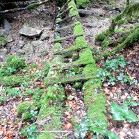
Malgré les pluies importantes de la semaine, rien ne coule mais les vasques ont été lavées On a rencontré l’inventeur du canyon sur le parking très sympa Chemin à gauche après avant dernière cascade, avant les passage de l’échelle et mains courantes fixe pvc, ce chemin permet de remonter à l’aval en 20min Moyen ainsi d éviter une navette Résurgence toujours aussi froide et en bon débit
(Quelle: https://www.descente-canyon.com/canyoning/canyon-debit/2178/observations.html)
09.03.2023
System User
⭐
★★★★★
📖
★★★
⚓
★★★
nessuna traduzione disponibile
Info: Teile der Canyonbeschreibung wurden automatisiert übernommen. Konkret die Felder Weblinks, Koordinaten, Rating, Länge des Canyon, Einfachseil Mindestens von https://www.descente-canyon.com/canyoning/canyon/2178
09.03.2023
System User
⭐
★★★★★
📖
★★★
⚓
★★★
nessuna traduzione disponibile
Daten importiert von https://canyon.carto.net/cwiki/bin/view/Canyons/NoireFontaineCanyon.html
Idrologia:
