un po' difficile
Costalunga
v4 a3 IV
4h45
1h
3h30
15min
640m
440m
200m
34m
800m
Specialità:
§ Divieto
§ Divieto
Valutazione:
★★★★★
3.5 (2)
Info:
★★★
2 (1)
Belay:
★★★
1 (1)
Sintesi:
traduzione alternativa
➜
Lingua originale
Sehr schöner Abseilcanyon, derzeit nur sehr wenige Sprünge möglich (Mai 2024). Eine gute Alternative, wenn in der Soffia zu viel Wasser fließt. Achtung, im Frühjahr und / oder nach Regenfällen kann der Torrente Mis, der zwingend überquert werden muss hüfttief und gefährlich sein.
Rappel canyon with a few small jumps
2.30km²
Sintesi:
traduzione alternativa
➜
Lingua originale
Sehr schöner Abseilcanyon, derzeit nur sehr wenige Sprünge möglich (Mai 2024). Eine gute Alternative, wenn in der Soffia zu viel Wasser fließt. Achtung, im Frühjahr und / oder nach Regenfällen kann der Torrente Mis, der zwingend überquert werden muss hüfttief und gefährlich sein.
Rappel canyon with a few small jumps
Accesso:
traduzione alternativa
➜
Lingua originale
Von Belluno auf der 203 d in Richtung Agordo. Nach 8km (bei Mas) li. ab und westlich über Gron nach Sospirolo (4,5 km). Dort re. und in Richtung NNO zum Lago di Mis. Am Ende des Sees (an der Stauwurzel, bis dahin etwa 7 km von Sospirolo), den Torrente de Mis überqueren, dann die Straße links in Richtung NNW und nach 1400 m re. an der Straße Auto abstellen. (Zur Gole de Soffia gleiche Zufahrt, aber nach der Brücke re. ab zum Restaurant am See.)
From Belluno on the 203 d in the direction of Agordo. After 8km (at Mas) turn left and go west via Gron to Sospirolo (4.5km). There turn right and head NNO to Lago di Mis. At the end of the lake (at the root of the dam, until then about 7 km from Sospirolo), cross the Torrente de Mis, then take the road on the left towards NNW and after 1400 m on the right park your car at the road. (To Gole de Soffia same access, but after the bridge right off to the restaurant on the lake).
Avvicinamento (1 h):
traduzione alternativa
➜
Lingua originale
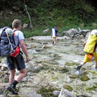
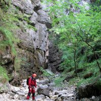
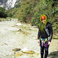
Gut 50 Meter zurück besteht die Vegetation aus kleinen Sträuchern, das Ufer ist mit großen Steinblöcken befestigt. Hier kann man zum Fluss absteigen. Diesen überqueren und dann auf das Ende des gegenüberliegenden Val Costalunga zuhalten. Dort erst weglos (eventuell Tierspuren) hinauf auf eine freie Fläche, an deren Nordwestende man auf zwei Hausruinen stößt. Hinter dem nördlicheren Haus startet ein schlecht erkennbarer Weg, der sich in steilen Serpentinen teilweise sehr ausgesetzt durch die Bergwand schlängelt. Im Zweifel weglos durch den Wald nach oben gehen, bis man auf den oben genannten Pfad trifft. Diesem folgt man gute 40 Minuten, bis man auf die Reste einer verfallene (Haus-) Ruine trifft (680 m ü.NN). Hier verliert sich der Weg, ein schmaler Pfad führt weiter nach oben, eine kaum noch erkennbare, gemauerte Rinne führt leicht nach links bergauf. An ihrem Beginn sind zwei große Bäume umgestürzt. Etwas weiter ist über ihr ein rostiges Stahlseil gespannt. Ab hier folgt man der Wegrinne etwa 50m, dann ist ein ebener Pfad erkennbar, der früher wahrscheinlich zum Wasserholen benutzt wurde. Zuerst horizontal über einen trockenen und steilen Nebengraben queren, später etwas exponiert steiler hinunter kommt man zum Bach.
Der Zustiegspfad ist in Open Street Map eingezeichnet, allerdings sind die Serpentinen "geglättet", das heißt dass man sich am Anfang zu weit unten wähnt und später zu weit oben.
On the right, next to an open corrugated iron trench, go down to the river, cross it and then head for the exit of the opposite Val Costalunga. There to the left (southwest) up to an open area, at the northwest end of which you come across two ruined houses. Behind the more northerly house, go down again on an old path to the stream (430 m a.s.l.) and on the other side up over the orographic left bank. There, after a few meters, you meet an old but easily recognizable path. \Alternatively, you can hike through the streambed to the mostly dry exit of Costalunga and then look for the path orographic left. The correct path is a rather wide old donkey path that leads up the mountain slope to the NW.\n\nOnce you have found the path, follow it uphill in serpentines for about 40 minutes until you reach a ruined house (680 m a.s.l.). A path next to the ruin goes straight up the mountain, a path in a brick gully goes up keeping slightly to the left. Follow the path in the gully for about 50m until a flat path branches off to the left, which was probably used to fetch water in the past. First cross horizontally over a side ditch, later a little exposed steeper down you come to the stream.
Giro (3 h 30):
traduzione alternativa
➜
Lingua originale
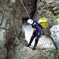
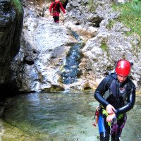
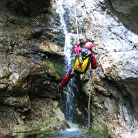
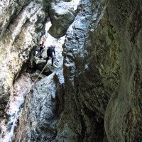
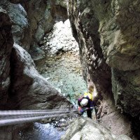
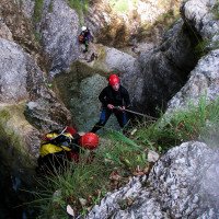
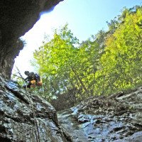
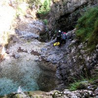
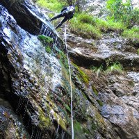
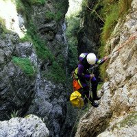
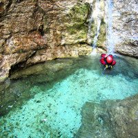
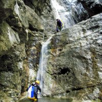
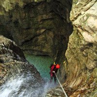
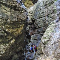
Zuerst eine Folge kleinerer Abseiler (bis maximal 12m) sowie derzeit (Mai 2024) keine Sprungmöglichkeit. Die Schlucht öffnet sich kurz, um einen vertikalen Abschnitt mit einer C6, C30 Kombi (neu eingebohrt Mai 2024, früher C34) zu präsentieren. Die Schlucht wird wieder enger und es folgt ein schöner 20 Meter Wasserfall, der bei hohem Wasserstand problematisch wird. Noch ein paar kurze Stufen in einem märchenartigen Ambiente und man kann sich wundern, dass das komlette Wasser im Kiesbett versickert. Schon steht man wieder am Torrente Mis.
Das Valle Costalunga liegt im Parco Nazionale Dolomiti; die Begehung von Canyons wurde bisher geduldet,doch sollte man es nicht auf eine Begegnung mit den Rangern anlegen. Die Führung des A.I.C. verhandelt diesbezüglich schon geraume Zeit mit der Nationalparkverwaltung.
First a succession of smaller rappels (all around 10m) and some possible jumps, then the more vertical part with the C 34 and a C 18, finally a run.\nThe Valle Costalunga is located in the Parco Nazionale Dolomiti; the ascent of canyons has been tolerated so far,but it should not be aimed at an encounter with the rangers. The leadership of the A.I.C. has been negotiating for some time with the National Park Administration.
Ritorno (15 min):
traduzione alternativa
➜
Lingua originale
Den Mis wieder überqueren, an der bekannten Stelle zur Straße aufsteigen und zurück zum Auto.
After the last rappel down the stream to the Mis, cross it keeping to the right and on the other side up the slope to the car.
Coordinate:
Inizio del canyon
Fine del canyon
Letteratura:
Mappa
IGMI 25/V - 23 Gosaldo IV-SO, 1:25 000
Mappa
Tabacco nº 22 Pale di San Martino, 1:25 000
Libro Canyoning
Canyoning IN DOLOMITI e DINTORNI
Matteo Bortot, Roberto Sartor
ViviDolomiti
2019
978-8899106669
45 Canyon-Beschreibungen
Info sul canyon Cwiki
Info sul canyon Descente
Info sul canyon Ropewiki
Gallería
20.05.2024
Casa Vento Madeira
⭐
★★★★★
📖
★★★
⚓
★★★
💧
Normale
Completato ✔
traduzione alternativa
➜
Lingua originale
Aufgrund der Regefälle der letzten Woche ein toller Wasserstand. Faustregel: Wenn das Wasser des Costalunga nicht vor dem Torrente Mis vollständig versickert, dann sollte man sich die letzte Stufe ansehen (10 Minuten flussaufwärts). Eine wunderschöne, zu Beginn strahlend weiße Schlucht, die sich toll verengt und einige sehr schöne Abseilstellen präsentiert. Die Ausrüstung schien überwiegend noch aus den Anfängen des Canyoning zu stammen, wir haben drei neue Einzelanker ergänzt und einen Kettenstand neu eingebohrt. Dadurch kann man den ehemaligen C34 jetzt in 2 Stufen gehen, C6 und C30.
Das heißt es reichen 30er Seile. Im oberen Abschnitt ist die ideale Seillänge 25 m.
A great water level due to the rainfall of the last week. Rule of thumb: If the water of the Costalunga doesn't completely disappear before the Torrente Mis, then you should take a look at the last step (10 minutes upstream). A beautiful canyon, bright white at the start, which narrows out nicely and presents some very nice abseils. Most of the equipment seemed to date back to the early days of canyoning, we added three new single anchors and redrilled a chain anchor. As a result, the former C34 can now be done in 2 steps, C6 and C30.
This means that 30 ropes are sufficient. In the upper parts, the ideal rope length is 25 m.
09.03.2023
System User
⭐
★★★★★
📖
★★★
⚓
★★★
nessuna traduzione disponibile
Info: Teile der Canyonbeschreibung wurden automatisiert übernommen. Konkret die Felder Weblinks, Koordinaten, Rating, Länge des Canyon, Einfachseil Mindestens von https://www.descente-canyon.com/canyoning/canyon/22154
09.03.2023
System User
⭐
★★★★★
📖
★★★
⚓
★★★
nessuna traduzione disponibile
Daten importiert von https://canyon.carto.net/cwiki/bin/view/Canyons/ValleCostalungaCanyon.html
Idrologia:

