non così difficile
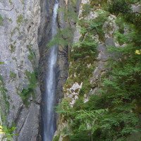
Silbergraben
Paese:
Österreich / Austria
Regione: Kärnten
Sottoregione: Bezirk Spittal an der Drau
Città: Oberdrauburg
v3 a3 IV
1h50
10min
1h30
10min
850m
720m
130m
50m
2x60m
600m
Auto facoltativa
Valutazione:
★★★★★
3.1 (4)
Info:
★★★
2.5 (2)
Belay:
★★★
1 (1)
Sintesi:
traduzione alternativa
➜
Lingua originale
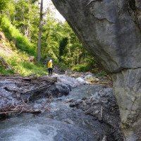
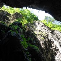
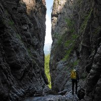
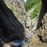
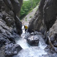
Der Silbergraben ist eine ganz nette Schlucht, deren Quarzdurchzogener Kalk ästhetische Formen bildet. Aquatischer Abseilcanyon ohne Sprungmöglichkeiten.
Silbergraben is quite a nice canyon, with quartz-streaked limestone forming aesthetic shapes. Aquatic rappel canyon without possible jumps.
Nord
Sintesi:
traduzione alternativa
➜
Lingua originale
Der Silbergraben ist eine ganz nette Schlucht, deren Quarzdurchzogener Kalk ästhetische Formen bildet. Aquatischer Abseilcanyon ohne Sprungmöglichkeiten.
Silbergraben is quite a nice canyon, with quartz-streaked limestone forming aesthetic shapes. Aquatic rappel canyon without possible jumps.
Accesso:
traduzione alternativa
➜
Lingua originale
Die B100 verbindet Spittal an der Drau und Lienz. In Oberdrauburg nach Süden auf die 110-er Richtung Kötschach abbiegen. Nach den Serpentinen des Gailbergsattels zweigt in einer Linkskurve mit Bushaltestelle eine Forststrasse ab. Hier oder 50m weiter rechts parken (grünes Karo in der Karte).
The B100 connects Spittal an der Drau and Lienz. In Oberdrauburg turn south onto the 110 towards Kötschach. After the serpentines of the Gailbergsattel, a forest road branches off in a left-hand bend with a bus stop. Park here or 50m further on the right (green check in the map).
Avvicinamento (10 min):
traduzione alternativa
➜
Lingua originale
Ganz einfach der Forstsrasse folgen und dann die steile Wiese absteigen (rot punktiert in der Karte).
Simply follow the forest road and then descend the steep meadow (dotted red on the map).
Giro (1 h 30):
traduzione alternativa
➜
Lingua originale
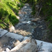
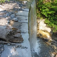
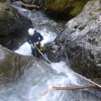
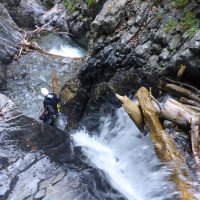
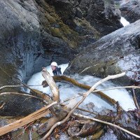
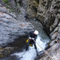
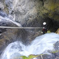
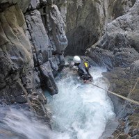
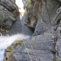
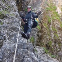
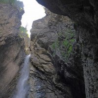
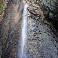
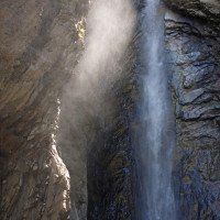
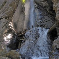
Der Silbergraben bietet 8 Abseilstellen mit starkem Wasserkontakt in tosende Becken. Aber keine Sorge, die Gumpen sind nicht tief und stellen bei normalem Wasserstand kein Problem dar.Das Finale bildet ein fast 50 Meter hoher Wasserfall der erhebliche Steinschlaggefahr aufweist. Notausstiege gibt es nicht.
The Silbergraben offers 8 rappelling points with strong water contact in roaring pools. But do not worry, the pools are not deep and do not pose a problem at normal water levels.The finale is an almost 50-meter high waterfall that has considerable risk of falling rocks. There are no emergency exits.
Ritorno (10 min):
traduzione alternativa
➜
Lingua originale
Rechts, kurz nach der letzten Kaskade führt ein Pfad den Bachlauf entlang. Um sich den Mühsamen Rückweg entlang der Strasse zu ersparen, ist es ratsam in Waidach bei der Abzweigung zum Silberwasserfall ein zweites Auto abzustellen. Alternativ bietet sich der Autostopp an. Also trockene Sachen mitnehmen.
On the right, shortly after the last cascade, a path leads along the stream. To save yourself the tedious way back along the road, it is advisable to park a second car in Waidach at the turnoff to the silver waterfall. Alternatively, you can stop at the car stop. So take dry clothes with you.
Coordinate:
Inizio del canyon
46.7315°, 12.9672°
↓↑
DMS: 46° 43" 53.4', 12° 58" 1.92'
DM: 46° 43.89", 12° 58.032"
Google Maps
Austria Topografica
DMS: 46° 43" 53.4', 12° 58" 1.92'
DM: 46° 43.89", 12° 58.032"
Google Maps
Austria Topografica
Fine del canyon
46.7361°, 12.966°
↓↑
DMS: 46° 44" 9.96', 12° 57" 57.6'
DM: 46° 44.166", 12° 57.96"
Google Maps
Austria Topografica
DMS: 46° 44" 9.96', 12° 57" 57.6'
DM: 46° 44.166", 12° 57.96"
Google Maps
Austria Topografica
Partenza alternativa del canyon
46.7295°, 12.9657°
↓↑
DMS: 46° 43" 46.2', 12° 57" 56.52'
DM: 46° 43.77", 12° 57.942"
Google Maps
Austria Topografica
DMS: 46° 43" 46.2', 12° 57" 56.52'
DM: 46° 43.77", 12° 57.942"
Google Maps
Austria Topografica
(descente_1)
Parcheggio all'entrata
46.7275°, 12.966°
↓↑
DMS: 46° 43" 39', 12° 57" 57.6'
DM: 46° 43.65", 12° 57.96"
Google Maps
Austria Topografica
DMS: 46° 43" 39', 12° 57" 57.6'
DM: 46° 43.65", 12° 57.96"
Google Maps
Austria Topografica
(descente_3)
Parcheggio in uscita
46.7407°, 12.9677°
↓↑
DMS: 46° 44" 26.52', 12° 58" 3.72'
DM: 46° 44.442", 12° 58.062"
Google Maps
Austria Topografica
DMS: 46° 44" 26.52', 12° 58" 3.72'
DM: 46° 44.442", 12° 58.062"
Google Maps
Austria Topografica
Auf Privatgrund: beim Besitzer um Erlaubnis bitten.
Letteratura:
Mappa
Mappa
1:50000
Mappa
1:25000
Libro Canyoning
Associazione Italiana Canyoning
2009
Italien
Novarza
Lumiei
Torrente La Foce
Rio Picchions-Vinadia
Rio Chiantone
Rio Frondizzon
Rio Favarinis
Rio Pissanda
Rio Lavarie
Rio Chiampeit
Rio Tralba
Rio Simon
Rio Cuestis (Umschlagfoto)
Rio Belepeit
Rio del Mulin
Patoc
Lis Cladis – Impresis
Rio Malinberg
Rio Pliz
Slowenien
Globoski Potoc
Predelica
Fratarica
Mlinarica
Podolu
Österreich
Frauenbach
Steinerne Rinne
Silberbach
Libro Canyoning
Ingo Neumann / Alfred Wieser / Franz Karger / Reinhard Ranner
2004
http://www.edition-neumann.com
Info sul canyon Cwiki
Info sul canyon Descente
Info sul canyon Ropewiki
Altro info sul canyon
Sconosciuto
22.03.2025
Clarissa Linder
⭐
★★★★★
📖
★★★
⚓
★★★
💧
Normale
Completato ✔
traduzione alternativa
➜
Lingua originale
Altri utenti sono stati: David Greinhofer
Stände in schlechter Qualität, der beim hohen Abseiler passt.
Der untere beschriebene Parkplatz ist auf Privatgrund. Haben nett mit den Besitzern gequatscht, war dann kein Problem.
Stands in poor quality, which fits at the high rappel.
The parking lot described below is on private land. We had a nice chat with the owners and it was no problem.
Altri utenti sono stati: David Greinhofer
03.11.2024
PeterAlbertini
⭐
★★★★★
📖
★★★
⚓
★★★
Completato ✔
Unerwartete, schöne, kurze und bequeme Schlucht... gute Wasserführung. Bessere Ausrüstung sollte nachgerüstet werden. Unzureichende Waffen. Route von 3 Personen aus der CanyonEast-Gruppe
09.03.2023
System User
⭐
★★★★★
📖
★★★
⚓
★★★
nessuna traduzione disponibile
Info: Teile der Canyonbeschreibung wurden automatisiert übernommen. Konkret die Felder Weblinks, Koordinaten, Rating, Länge des Canyon, Einfachseil Mindestens von https://www.descente-canyon.com/canyoning/canyon/22069
09.03.2023
System User
⭐
★★★★★
📖
★★★
⚓
★★★
nessuna traduzione disponibile
Daten importiert von https://canyon.carto.net/cwiki/bin/view/Canyons/SilbergrabenCanyon.html
Nuovo rapporto
Riportare brevemente e concisamente le informazioni più importanti dell'ultimo tour o importanti informazioni attuali sul canyon. Se necessario con link a video, foto, ecc..
*
*
*
Esc
Del
Idrologia:


