non così difficile
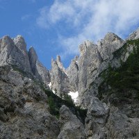
Canale della Trincea
v3 a1 I
1h41
20min
1h15
6min
1200m
1000m
200m
35m
2x40
6
500m
a piedi
Valutazione:
★★★★★
0.9 (2)
Info:
★★★
0 ()
Belay:
★★★
0 ()
Sintesi:
traduzione alternativa
➜
Lingua originale
Brüchiges Kalkgestein; anfangs Einzellbohrhaken; gut kombinierbar mit Canale della Malga; wenige bekannt jedoch gute Alternative wenn andere Schluchten zu viel Wasser führen; kurzer Zu-und Abstieg; mehrere Geh- und Abkletterpassagen; sauberes Wasser.
Fractured limestone; initially single pitons; well combinable with Canale della Malga; few known but good alternative when other canyons have too much water; short ascent and descent; several walking and downclimb; clean water.
Sud-Est
Sintesi:
traduzione alternativa
➜
Lingua originale
Brüchiges Kalkgestein; anfangs Einzellbohrhaken; gut kombinierbar mit Canale della Malga; wenige bekannt jedoch gute Alternative wenn andere Schluchten zu viel Wasser führen; kurzer Zu-und Abstieg; mehrere Geh- und Abkletterpassagen; sauberes Wasser.
Fractured limestone; initially single pitons; well combinable with Canale della Malga; few known but good alternative when other canyons have too much water; short ascent and descent; several walking and downclimb; clean water.
Accesso:
traduzione alternativa
➜
Lingua originale
Von der Autobahnabfahrt Tarvisio Nord fährt man Richtung Passo del Predil. Nach dem Ort Cave del Predil Rabil biegt man re Richtung Sella Nevea/Lago del Predil ab. Ab hier folgt man der Straße ca. 4,3Km bis zu eine Brücke vor der sich ein Schotterparkplatz auf der li Seite.
From the Tarvisio Nord freeway exit, head towards Passo del Predil. After the village Cave del Predil Rabil turn right towards Sella Nevea/Lago del Predil. From here follow the road for about 4.3 km until you reach a bridge before which there is a gravel parking place on the left.
Avvicinamento (20 min):
traduzione alternativa
➜
Lingua originale
Vom Parkplatz aus geht man über die Brücke. Schon nach wenigen Metern kommt re eine Wandertafel mit der Aufschrift „Rifugio Corsi“ 650-629. Diesen Wanderweg folgt man steil bergauf für ca. 20min bis auf 1200m. Kurz nach der Stelle wo der Wanderweg flacher wird, kommt ein markanter Zufluss. Hier den Wanderweg re verlassen und über den Zufluss (Geröll) 40Hm bis zum 1. Bohrhaken re absteigen.
From the parking lot, cross the bridge. After a few meters on the right there is a hiking sign with the inscription "Rifugio Corsi" 650-629. Follow this trail steeply uphill for about 20min until 1200m. Shortly after the trail flattens out, there is a prominent tributary. Here leave the trail to the right and descend over the tributary (scree) 40Hm to the 1st piton to the right.
Giro (1 h 15):
traduzione alternativa
➜
Lingua originale
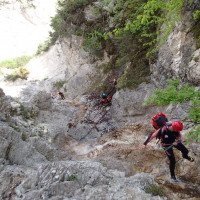
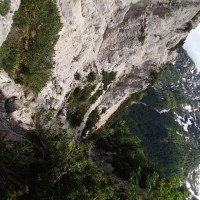
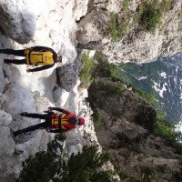
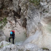
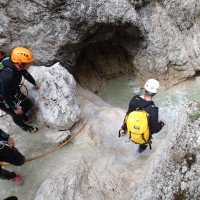
Die Tour beginnt in einem meist trockenen Zufluss. Über mehrere kurze Abseilstellen (Einzellbohrhaken) gelangt man zum Hauptbach. Ab hier wird es aquatischer. Es folgt einem ca. 200m lange Abschnitt mit Geh- und Abkletterpassagen, danach kommt eine 15m Abseilseilstelle. Nach einem weiteren ca. 200m langen Abschnitt mit Geh- und Abkletterstellen kommt die letzte und höchste Abseilstelle von 35m. Abkletterend über kleine Stufen erreicht man nach ca. 100m die Brücke, wo man li auf ca. 1000m aussteigt.
The tour begins in a mostly dry tributary. Via several short abseils (single pitons) you reach the main stream. From here it becomes more aquatic. There is a 200m long part with walking and downclimb, followed by a 15m rappel. After another 200m long part with walking and downclimbing passages comes the last and highest rappel of 35m. Climbing down small steps, after about 100m you reach the bridge, where you get off to the left at about 1000m.
Ritorno (6 min):
traduzione alternativa
➜
Lingua originale
Vom Bach, vor oder nach der Brücke, li direkt zum Parkplatz aussteigen.
From the creek, before or after the bridge, exit li directly to the parking lot.
Coordinate:
Inizio del canyon
Parcheggio Entrata e uscita
Brücke über den Canale della Trincea
Fine del canyon
Letteratura:
Mappa
IGMI 25/V, 14A Sella Nevea III-SO, 1:25 000
Mappa
Tabacco 19
Libro Canyoning
Canyoning Alpi Giulie
Franco Longo
2011
Italia: Zemola inf., Vinadia, Chiantone, Picchions,Lumiei, Novarza, Frondizzon,Leale inf., Pissanda,
Favarinis, Lavarie,Chiampeit, Stivane, Nero, Alba, Tralba inf.,Simon inf., Cuestis, Belepeit, Mulin,
Brussine, Patoc, Rivis, Costa Stretta, Sbrici, Lis Cladis, Malinberg, Pliz, Torto, Trincea
Slovenia: Predelica, Fratarica, Susec, Kozjak, Brus-Rocica, Smast, Sopotnica, Jerecica, Gremecica
(kein Inhalts- oder Stichwortverzeichnis, keine Seitenangaben)
Info sul canyon ACA
Info sul canyon Cwiki
Info sul canyon Descente
Info sul canyon Ropewiki
AIC Catasto
02.05.2023
System User
⭐
★★★★★
📖
★★★
⚓
★★★
nessuna traduzione disponibile
Der aktuelle Canyon wurde teilautomatisiert mit Canyon https://canyon.carto.net/cwiki/bin/view/Canyons/CanaleDellaTrinceaCanyon.html zusammengeführt.
09.03.2023
System User
⭐
★★★★★
📖
★★★
⚓
★★★
nessuna traduzione disponibile
Daten importiert von https://canyon.carto.net/cwiki/bin/view/Canyons/CanaleDellaTrinceaCanyon.html
09.03.2023
System User
⭐
★★★★★
📖
★★★
⚓
★★★
nessuna traduzione disponibile
Info: Teile der Canyonbeschreibung wurden automatisiert übernommen. Konkret die Felder Weblinks, Koordinaten, Rating, Länge des Canyon, Einfachseil Mindestens von https://www.descente-canyon.com/canyoning/canyon/23765
09.03.2023
System User
⭐
★★★★★
📖
★★★
⚓
★★★
nessuna traduzione disponibile
Daten importiert von https://www.canyoning.or.at/index.php/liste-aller-canyons/340-canale-della-trincea
Idrologia:

