non così difficile
Brize
v3 a2 I
1h55
5min
1h30
20min
635m
510m
125m
15m
1x30m
6
850m
a piedi
Specialità:
§ Regulated
§ Regulated
Valutazione:
★★★★★
2.1 (2)
Info:
★★★
0 ()
Belay:
★★★
0 ()
Sintesi:
traduzione alternativa
➜
Lingua originale
Offene Waldschlucht
Open forest gorge
Sud
Calcare
Sintesi:
traduzione alternativa
➜
Lingua originale
Offene Waldschlucht
Open forest gorge
Accesso:
traduzione alternativa
➜
Lingua originale
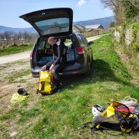
Von Artemare (der Weg dorthin beim Canyon Groin beschrieben) und dort vom Place de la Liberté auf die in nördlicher Richtung verlaufende D 31 (Cote d'Yon). In Serpentinen geht es hinauf zum Weiler Don. Die erste Brücke über den Groin lassen wir links liegen. Über die 2. Brücke (Pont du Diable) fahren wir dann auf die orograf. rechte Seite des Groin. Nun fahren wir kontinuierlich Richtung NNW und kommen nach Champagne-en-Valromey. In der Ortsmitte halten wir uns rechts, verlassen den Ort über die Grande Rue (D 30) und kommen (bei der nächsten Straßenverzweigung links bleibend) zu den Häusern von Poisieu. Hier an der T-Kreuzung rechts erreichen wir nach etwa 1,5 km einen Parkplatz rechts der Straße ("Pain du Sucre" - Tafel). Hier Auto abstellen.
From Artemare (the way there described at Canyon Groin) and there from the Place de la Liberté on the D 31 running north (Cote d'Yon). In serpentines it goes up to the hamlet Don. We leave the first bridge over the Groin to the left. Over the 2nd bridge (Pont du Diable) we drive on the orographic right side of the Groin. Now we drive continuously in direction NNW and come to Champagne-en-Valromey. In the center of the village we keep to the right, leave the village via Grande Rue (D 30) and come (staying left at the next road junction) to the houses of Poisieu. Here, at the T-junction on the right, after about 1.5 km, we reach a parking lot on the right of the road ("Pain du Sucre" - sign). Park the car here.
Avvicinamento (5 min):
traduzione alternativa
➜
Lingua originale
Vom Parkplatz den Fußweg hinunter zum Bach (ein Abseilen über den Pain du Sucre - der große Stalagmit im Wasserlauf - ist verboten).
From the parking lot down the footpath to the stream (rappeling over the Pain du Sucre - the large stalagmite in the stream - is prohibited).
Giro (1 h 30):
traduzione alternativa
➜
Lingua originale
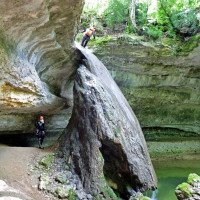
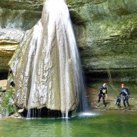
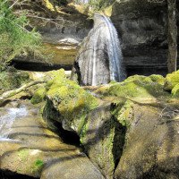
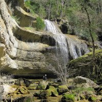
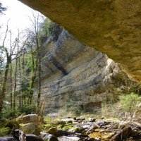
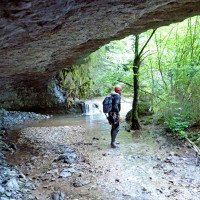
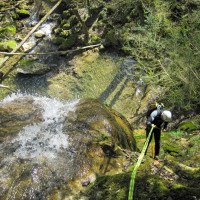
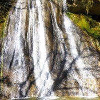
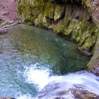
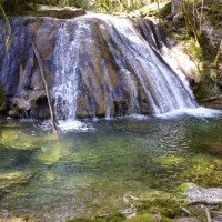
Der Blick auf den Pain du Sucre in dem Felsenkessel ist das Beste an dieser Tour - auch wenn man nicht über ihn abseilen darf. Obwohl beim Zustieg in den Kessel mit dem Pain du Sucre auf einem Schild "Canyoning interdit" zu lesen ist, betrifft das tatsächlich bestehende Verbot nur das Abseilen über den Pain du Sucre. Generell Versinterungen vorsichtig begehen.
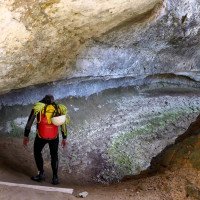
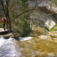
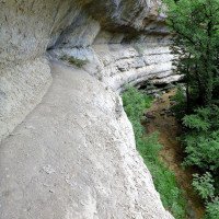
Nach der ersten C 15 läuft man unter einer Felswand entlang, deren Sims als "Banc des Dames" auch von oben her (zumindest teilweise) begangen werden kann (entsprechendes Hinweisschild rechts der Aufstiegs-Piste, bevor sie den Knick in westlicher Richtung zur Teerstraße hin macht). Auch an diesem Knick kann man das (oder ein zweites) Auto abstellen.
The view of the Pain du Sucre in the rock basin is the best thing about this tour - even if you are not allowed to rappel over it. Although at the access to the basin with the Pain du Sucre on a sign "Canyoning interdit" is to be read, the actually existing prohibition concerns only the rappel over the Pain du Sucre. After the first C15, you walk under a rock wall, whose ledge can also be climbed (at least partially) from above as the "Banc des Dames" (corresponding sign on the right of the ascent slope, before it makes the bend in a westerly direction towards the tarred road). Also at this bend you could park the (or a second) car.
Ritorno (20 min):
traduzione alternativa
➜
Lingua originale
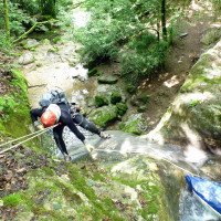
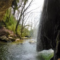
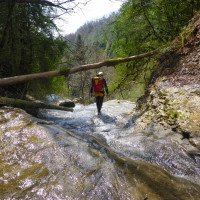
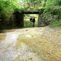
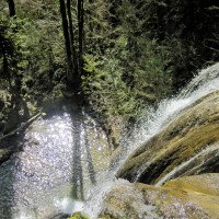
Nachdem man unter der Brücke durch ist, erwarten uns noch eine C 15 und nach einer Laufstrecke von 300 m noch 5 kleinere Schrägabseiler (z.T. rutschbar).
Nach dem letzten führt am rechten Ufer ein Pfad steil hinauf. Man kommt auf eine Piste, die man nach links aufwärts steigt. Man stößt auf einen weiteren Feldweg, dem man nach rechts folgt, bis man die Teerstraße sieht und auf dieser rechts zum Auto kommt.
After passing under the bridge, another C 15 awaits us and after a run of 300 m, 5 smaller sloping ropes (partly slippery).\nAfter the last one, a path leads steeply up on the right bank. One comes to a path that one climbs up to the left. You come across another dirt road, which you follow to the right until you see the tarred road and come to the car on the right.
Coordinate:
Inizio del canyon
Fine del canyon
Parcheggio Entrata e uscita
von da auf dem Wanderweg zum Pain du Sucre
Letteratura:
Mappa
IGN 331 OT, Rumilly, Sessel, 1:25 000
Mappa
IGN TOP25 3231 OT, Amberieu-en-Bugey, 1:25 000
Libro Canyoning
Canyons et cascades de l'Ain. Groupe Speleo Hauteville-Lompnes, B. Hugon, D. Gritti, P. Flochon, 2002
2002
Info sul canyon Cwiki
Info sul canyon Descente
Info sul canyon Ropewiki
Gallería
Info sul canyon FFME
29.09.2024
Denis F
⭐
★★★★★
📖
★★★
⚓
★★★
💧
Alto
Completato ✔
nessuna traduzione disponibile
Automatisch importiert von Descente-Canyon.com für Canyon Brize
Beaucoup d'eau mais il y toujours moyen de descendre. Beaucoup d'ANChemin de retour décrit précédement en partie testé mais on est vite retombé sur les panneaux de propriétée privé, il faudrait sans doute plus rester au niveau de la rivière. Vu personne.
(Quelle: https://www.descente-canyon.com/canyoning/canyon-debit/222/observations.html)
10.09.2024
Sadora
⭐
★★★★★
📖
★★★
⚓
★★★
💧
Basso
Completato ✔
nessuna traduzione disponibile
Automatisch importiert von Descente-Canyon.com für Canyon Brize
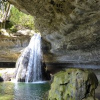
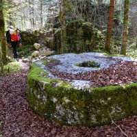
Avec les pluies de la veille : Petit filet d'eau à la cascade du Pain de Sucre et DC - à la dernière C8.Pour l'accès au premier rappel, cela serait idéal de mettre en place un ancrage pour faire une MC en RG.Les relais sont sur amarage naturel sauf C15 doté de deux plaquettes. Concernant la dernière C8, nous n'avons pas trouvé de relais sur AN. On est déscendu avec un arbre RD (environ 35m de corde à prévoir)Les toboggans sont ok mais ne glissent pas trop avec ce debit mais cela peut se sauter :)Concernant le retour, il y a deux affichettes avec "propriété privé" + une pancarte avec canyonning interdit. Pour éviter tout malentendu avec le propriétaire, je pense qu'il faudrait remonter en longeant la rivière RD, passer devant l'ancienne meule en pierre, pour rejoindre le pont. Et ensuite reprendre le chemin forestier jusqu'au parking des dames (à voir si cela est vraiment possible ?)
(Quelle: https://www.descente-canyon.com/canyoning/canyon-debit/222/observations.html)
03.08.2024
Simon_BTL
⭐
★★★★★
📖
★★★
⚓
★★★
💧
Secco
Completato ✕
nessuna traduzione disponibile
Automatisch importiert von Descente-Canyon.com für Canyon Brize
(Quelle: https://www.descente-canyon.com/canyoning/canyon-debit/222/observations.html)
20.05.2024
Petrucci71
⭐
★★★★★
📖
★★★
⚓
★★★
💧
Normale
Completato ✔
nessuna traduzione disponibile
Automatisch importiert von Descente-Canyon.com für Canyon Brize
(Quelle: https://www.descente-canyon.com/canyoning/canyon-debit/222/observations.html)
08.05.2024
luluberlu 73
⭐
★★★★★
📖
★★★
⚓
★★★
💧
Alto
Completato ✔
nessuna traduzione disponibile
Automatisch importiert von Descente-Canyon.com für Canyon Brize
GD qui ne pose pas de problème au niveau des obstacles. Sortie club à 7.
(Quelle: https://www.descente-canyon.com/canyoning/canyon-debit/222/observations.html)
09.03.2023
System User
⭐
★★★★★
📖
★★★
⚓
★★★
nessuna traduzione disponibile
Info: Teile der Canyonbeschreibung wurden automatisiert übernommen. Konkret die Felder Weblinks, Koordinaten, Rating, Länge des Canyon, Einfachseil Mindestens von https://www.descente-canyon.com/canyoning/canyon/222
09.03.2023
System User
⭐
★★★★★
📖
★★★
⚓
★★★
nessuna traduzione disponibile
Daten importiert von https://canyon.carto.net/cwiki/bin/view/Canyons/BrizeCanyon.html
Idrologia:
