un po' difficile
Rio dell‘Ambruseit
v4 a4 III
4h
0min
3h15
45min
800m
440m
360m
40m
2x40m
9
800m
Auto facoltativa
Valutazione:
★★★★★
3.7 (8)
Info:
★★★
3 (5)
Belay:
★★★
2.7 (6)
Sintesi:
traduzione alternativa
➜
Lingua originale
Schöne aquatische Schlucht in brüchigen Kalkgestein; Kaltes sauberes Wasser; großes Einzugsgebiet; bei hohen Wasserstand anspruchsvolle Einzellpassagen; möglicher Ausstieg ca. 550m.
Beautiful aquatic canyon in friable limestone; standings need improvement; cold clean water; large catchment area; challenging single passages at high water levels; possible exit about 550m.
Accesso:
traduzione alternativa
➜
Lingua originale
Von Tolmezzo fährt man auf der SS52b Richtung Arta Terme/Austria. Ca. 4,5Km nach der Tankstelle (bei Tolmezzo) re Richtung Paularo ins Chiarzotal abbiegen (SP23). In der Ortschaft Piedim re über die Brücke die Torrente Chiarzo überqueren. Nach der Brücke gleich li und auf der Schotterstraße bis zum Rio dell’Ambruseit fahren. Das Überstellungsfahrzeug kann direkt neben dem Bach geparkt werden. Mit dem 2.Pkw. fährt man zurück zur Hauptstraße. Hier re weiter Flussaufwärts fahren. Nach kurzer Strecke li Richtung Lovea abbiegen. Der kurvenreiche Straße Richtung Lovea folgen. Kurz vor der Ortschaft Lovea li weiter hoch fahren (Fahrverbotsschild). Bei der nächsten Abzweigung wieder li halten und der Straße bis zum Bach (Rio dell’Ambruseit) folgen. Direkt vor dem Bach parken (ca. 800m).
Alternative wo man sich ca 45min Bachwanderung erspart aber mit 25min Aufstieg:
Man parkt das Auto nicht wie oben beschrieben, sondern fährt gleich nach Lovea. Kurz vor der Ortschaft li weiter hoch fahren (Fahrverbotsschild). Nach 4 kehren kommt eine kleine Ausweiche und es geht rechts eine kleine asphaltierte Straße weg. Man kommt hier zur kleinen Häusergruppe "Stavoli Nivuae". Hier befindet sich gleich bei den ersten Häusern ein asphaltierter Parkplatz (rechts), wo die Einheimischen nicht gestört werden. Hier die meisten Autos parken und mit so wenig Autos wie möglich wieder die kleine Straße retour wo man vorher rechts abgebogen ist. Hier rechts weiter rauf bis man direkt zum Bach kommt. Hier parken.
about 30min.
From Tolmezzo take the SS52b direction Arta Terme/Austria. Approx. 4,5Km after the gas station (near Tolmezzo) turn right towards Paularo into the Chiarzo Valley (SP23). In the village of Piedim, cross the bridge over the Torrente Chiarzo on the right. After the bridge, immediately turn left and follow the dirt road until you reach Rio dell'Ambruseit. The shuttle car can be parked right next to the stream. Take the 2nd car back to the main road. Here continue upstream on the right. After a short distance turn left towards Lovea. Follow the winding road towards Lovea. Shortly before Lovea turn left and drive uphill (no driving sign). At the next fork, turn left again and follow the road to the stream (Rio dell'Ambruseit). Park directly in front of the stream (approx. 800m).
Alternative where you save about 45min river walk but with 25min ascent:
You don't park the car as described above, but go straight to Lovea. Shortly before the village drive up on the left (no driving sign). After 4 haipin bends there is a small turnout and a small asphalted road on the right. Here you come to the small group of houses "Stavoli Nivuae". Here, right by the first houses, there is an asphalt parking lot (on the right) where the locals are not disturbed. Park here most of the cars and with as few cars as possible return to the small road where you turned right before. Continue uphill to the right until you reach the creek. Park here.
Avvicinamento (0 min):
traduzione alternativa
➜
Lingua originale
Vom Parkplatz direkt in den Bach einsteigen.
approx. 0min
From the parking lot enter directly into the stream.
Giro (3 h 15):
traduzione alternativa
➜
Lingua originale
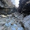
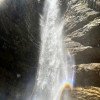
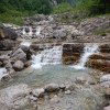
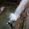
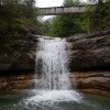
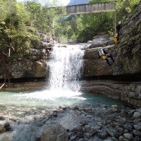
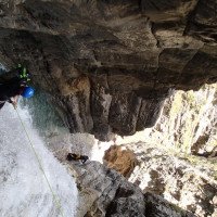
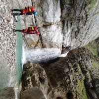
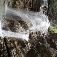
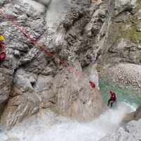
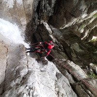
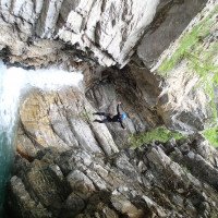
Der Rio dell’Ambruseit wird von 2 größere und mehrere kleinere Zuläufe gespeist und hat daher immer gut Wasser. Der Wasserstand wird am besten bei der ersten 5m Stufe, am Einstieg beurteilt. Hier sollte das Wasser nicht mehr wie 2/3 der Stufenbreite über die Kante laufen. Nach der ersten Stufe folgt ein ca. 200m Blockgelände bis zu den nächsten Abbrüchen von 25 und 40m. Beim 40m Wasserfall kann ein Zwischenstand re nützlich sein um nicht die volle Wasserladung ab zu bekommen. Danach kommen mehrere kleine Stufen (max 10m) die nach eigener Einschätzung abgeseilt, abgeklettert oder gesprungen werden können. Markant ist eine Abseilstelle von 25m die zuerst in ein tiefes Becken führt um dann erfrischt weiter abzuseilen. Es folgt eine längere Gehstrecke über Blockgelände die von einer kleinen Stufe (8m abseilen oder 2m Sprung) unterbrochen wird. Beim nächsten 30m Abseiler ist man wieder direkt im Wasserlauf (hier kann alternativ re von einem Baum abgeseilt werden). Je nach Wasserstand hat der tiefe Gumpen eine rückläufige Strömung. Nach dieser Stelle kommt eine längere Gehstrecke über Blockgelände bevor sich die Schlucht verengt. Die letzten 4 Stufen vom engeren Schluchtenabschnitt sind schnell gemeistert (2x abseilen, 1x Sprung, 1x abklettern). Nun folgt man den Bachverlauf für ca. 45min ohne große Schwierigkeit bis zum Ausstieg/Schuttelauto auf 440m (Alternative: siehe Ausstieg/Rückweg).
about 3-3,5h
The Rio dell'Ambruseit is fed by 2 larger and several smaller tributaries and therefore always has good water. The water level is best judged at the first 5m step, at the entry. Here the water should not walk more than 2/3 of the width of the step over the edges. After the first step follows about 200m of block terrain to the next drops of 25 and 40m. At the 40m waterfall an intermediate stand right can be useful to not get the full water load off. After that there are several small steps (max 10m) which can be rappelled, downclimbed or jumped according to your own assessment. A rappeling point of 25m is striking, which first leads into a deep pool in order to continue rappelling refreshed. This is followed by a longer walking passages over block terrain which is interrupted by a small step (8m rappel or 2m jump). At the next 30m rappel you are again directly in the watercourse (here you can alternatively rappel right from a tree). Depending on the water level, the deep pool has a receding current. After this point comes a longer walking passages over boulder terrain before the canyon narrows. The last 4 steps of the narrower gorge section are quickly mastered (2x rappel, 1x jump, 1x downclimb). Now you follow the course of the stream for about 45min without great difficulty to the exit / shuttle car at 440m (alternative: see exit / way back).
Ritorno (45 min):
traduzione alternativa
➜
Lingua originale
1. Möglichkeit (50 min): In der Schlucht bleiben und das Bachbett hinaus wandern für ca 50 min ab dem letzten Abseiler
2. Möglichkeit (45 min): Auf ca. 550m trifft man im Bachbett rechts an der Böschung auf einen großen Fels mit blauer Pfleilmarkierung (nach ca 20 min Gehstrecke in der Schlucht nach dem letzten Abseiler). Die Böschung hoch sieht man links eine alte Ruine. Der Pfad wurde im Mai 2022 neu mit blauen Markierungen an den Bäumen ausgestattet. Man folgt zuerst ca 50m im Wald dem Bachbett stromaufwärts und folgt den blauen Markierungen zuerst steil nach oben. Danach kommt man auf einen erkennbaren Pfad der nach ca. 25min zu der Häusergruppe St. Nivuae wo vorher die Überstellungsfahrzeuge geparkt werden sollten.
approx. 45min/50min
1st option (50 min): Stay in the canyon and hike out the streambed for about 50min from the last rappel.
2nd possibility (45 min): At about 550m, in the streambed on the right side of the slope, you will come across a large rock with blue rappel markings (after about 20 min of walking in the canyon after the last rappel). Up the slope you can see an old ruin on the left. The path was newly equipped with blue markings on the trees in May 2022. You first follow the streambed upstream for about 50m in the forest and follow the blue markings steeply uphill at first. After that you come to a recognizable path that after about 25min leads to the group of houses St. Nivuae where previously the shuttle cars should be parked.
Coordinate:
Inizio del canyon
(cwiki_1)
Parcheggio in uscita
Kiesbank an der Mündung des Rio dell' Ambruseit in den Chiarzo (cwiki)
Parcheggio all'entrata
Wandererparkplatz vor Fahrverbot (cwiki)
Fine del canyon
(cwiki_1)
Info sul canyon ACA
Info sul canyon Cwiki
Info sul canyon Descente
Info sul canyon Ropewiki
AIC Catasto
Altro info sul canyon
30.12.2024
Wolfgang
⭐
★★★★★
📖
★★★
⚓
★★★
💧
Basso
Completato ✔
traduzione alternativa
➜
Lingua originale
Altri utenti sono stati: Horst Lambauer Pavel Urbanek
Zu dieser Jahreszeit praktisch keine Sonne in der Schlucht; daher viel Eis bzw mit einen Eisfilm überzogene Steine ,...da ist das bissi rutschig schon das kleiner Übel.
Wegen der andauernten "Rutschgefahr" anstrengend ,..hat aber wiedermal Spaß gemacht
At this time of year practically no sun in the canyon; therefore a lot of ice or stones covered with an ice film,...so the bit slippery is already the lesser evil.
Because of the constant "danger of slipping" it was exhausting, but once again it was fun
Altri utenti sono stati: Horst Lambauer Pavel Urbanek
27.06.2024
Bernhard
⭐
★★★★★
📖
★★★
⚓
★★★
💧
Alto
Completato ✔
traduzione alternativa
➜
Lingua originale
Sehr rutschig teilweise
Viele Sprünge machbar (wir sind den 15er?! gesprungen)
Netter offener Spaß Canyon der zum Schluss eine sehr zache Gehstrecke hat
Wasserstand kein Problem da die stände immer außerhalb der Wasserführung bzw möglich sind (oft einer direkt und einer Umgehung)
Very slippery in places
Many jumps doable (we jumped the 15?!)
Nice open fun canyon which has a very tough walking passages at the end
Water level no problem as the stands are always outside the water flow or possible (often one direct and one bypass)
30.12.2023
Rok
⭐
★★★★★
📖
★★★
⚓
★★★
💧
Normale
Completato ✔
traduzione alternativa
➜
Lingua originale
Durch die Hochwasser im Friaul jetzt überhaupt nicht rutschig. Die Pools, die im Juli noch alle ohne Probleme springbar waren, sind jetzt teilweise voll mit Schotter. Bei der letzten Engpassage gab es einen großen Felssturz (es hängt noch ein großer Felsen direkt bei der 90 Grad Kurve wo man eigentlich direkt darunter abseilt (siehe Foto). Sonst alles top.
Not at all slippery now due to the floods in Friuli. The pools, which were still all jumpable without any problems in July, are now partly full of gravel. At the last narrow passage there was a large rockfall (there is still a large rock hanging directly at the 90 degree bend where you actually abseil directly underneath (see photo). Otherwise everything is great.
30.12.2023
Horst Lambauer
⭐
★★★★★
📖
★★★
⚓
★★★
💧
Normale
Completato ✔
nessuna traduzione disponibile
Alles tip top
17.07.2023
Rok
⭐
★★★★★
📖
★★★
⚓
★★★
💧
Normale
Completato ✔
traduzione alternativa
➜
Lingua originale
Aktuell sowas von rutschig und glitschig, aber super Wasserdurchsatz. Beim 3ten Stand mussten wir uns wirklich anstrengen um aus dem Wasser zum Stand zu kommen. Alle Stände ok. Abseiler teilweise nur an 1 Haken, diese aber perfekt gesetzt und sehr guter Zustand. Tolle Schlucht.
Currently so of slippery and slippery, but super water throughput. At the 3rd stand we had to really strain to get out of the water to the stand. All stands ok. Abseiling partly only on 1 hook, but these perfectly set and very good condition. Great canyon.
04.06.2023
Horst Lambauer
⭐
★★★★★
📖
★★★
⚓
★★★
💧
Normale
Completato ✔
traduzione alternativa
➜
Lingua originale
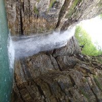
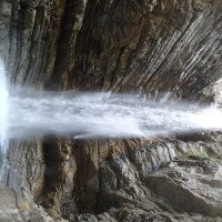
Ausstiegsbeschreibung auf tatsächliche Gegenbenheiten angepasst (Zeitangaben waren nicht korrekt). Meine Empfehlung im Bachbett bleiben, man hat 5 min länger zu gehen, dafür nicht bergauf im Gebüsch. Einziger Nachteil ist, dass man um ca 10min länger shutteln muss. Haben beim 40m Abseiler unten einen Ring eingebohrt um eine Seilbahn bauen zu können (der alte war weg). Ansonsten alles Tiptop. Fotos hinzugefügt vom ersten Abseiler bezüglich Wasserstandskontrolle. Hier war die Begehung ok, nur beim 40m-Abseiler haben wir für nicht so erfahrene die Seilbahn aufgebaut, weil doch viel Wasserdruck während das Abseilens war.
Exit description adapted to actual Gegenbenheiten (time information was not correct). My recommendation to stay in the creek bed, you have 5 min longer to go, but not uphill in the bushes. The only disadvantage is that you have to shutteln about 10min longer. Have drilled at the 40m rappel below a ring to be able to build a cable car (the old one was gone). Otherwise everything Tiptop. Photos added of the first rappel regarding water level control. Here the walk was ok, only at the 40m rappel we have built the ropeway for not so experienced, because but much water pressure was during the abseiling.
09.03.2023
System User
⭐
★★★★★
📖
★★★
⚓
★★★
nessuna traduzione disponibile
Info: Teile der Canyonbeschreibung wurden automatisiert übernommen. Konkret die Felder Weblinks, Koordinaten, Rating, Ort, Länge des Canyon, Einfachseil Mindestens von https://canyon.carto.net/cwiki/bin/view/Canyons/RioDellAmbruseitCanyon.html und https://www.descente-canyon.com/canyoning/canyon/23459
09.03.2023
System User
⭐
★★★★★
📖
★★★
⚓
★★★
nessuna traduzione disponibile
Daten importiert von https://www.canyoning.or.at/index.php/liste-aller-canyons/361-rio-dell-ambruseit
Nuovo rapporto
Riportare brevemente e concisamente le informazioni più importanti dell'ultimo tour o importanti informazioni attuali sul canyon. Se necessario con link a video, foto, ecc..
*
*
*
Esc
Del
Idrologia:
