non così difficile
Tine de Mayen
Paese:
Schweiz / Switzerland
Regione: Kanton Wallis / Canton du Valais
Sottoregione: Bezirk Monthey
Città: Vionnaz
v3 a3 IV
2h
45min
1h10
5min
760m
590m
170m
25m
2x 25m
10
430m
Auto facoltativa
Valutazione:
★★★★★
3.2 (4)
Info:
★★★
2 (2)
Belay:
★★★
2 (2)
Sintesi:
traduzione alternativa
➜
Lingua originale
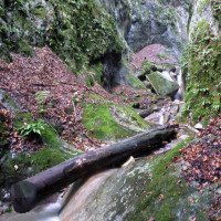
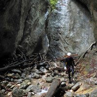
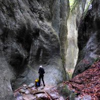
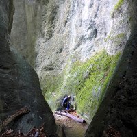
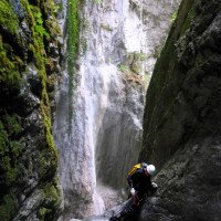
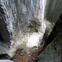
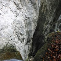
Dunkle Schlucht mit hoch aufragenden glatt geschliffenen Wänden
Dark canyon with towering smooth polished walls
maggio - ottobre
Est
2.80km²
Sintesi:
traduzione alternativa
➜
Lingua originale
Dunkle Schlucht mit hoch aufragenden glatt geschliffenen Wänden
Dark canyon with towering smooth polished walls
Accesso:
traduzione alternativa
➜
Lingua originale
Vom Ostufer des Genfersees - Montreux - das Tal der Rhone in südlicher Richtung aufwärts. Nach etwa 17 km erreicht man auf der N9/A9 die Ausfahrt Aigle (Nr. 17) und fährt von hier in westlicher Richtung geradeaus nach Vionnaz (ab Ausfahrt bis zum Kreisverkehr in Vionnaz) etwa 3 km.\nSofern man Rhoneabwärts kommt, liegt die genannte Ausfahrt Aigle etwa 21,5 km südlich Martigny auf der Autoroute de Rhône.\nVom Kreisverkehr in Vionnaz fahren wir 60m in Richtung Ortsmitte und biegen dann nach 60m halblinks ab auf die Route de Torgon, die zum gleichnamigen Ort hinaufführt.
Wir fahren nun in vielen Serpentinen bergauf. 150m nach der 5. Serpentine und 2,1 km ab Beginn der Route de Torgon biegt rechts in spitzem Winkel eine Piste in nördlicher Richtung ab. Sofern sie fahrbar ist, gelangen wir auf diesem Forstweg nach etwa 500m zur Tine de Mayen am Ausstieg. Etwas jenseits des Baches finden wir Platz zum Abstellen des Autos.
Hat man 2 Autos zur Verfügung kann man mit dem zweiten Auto weitere 5 km aufwärts fahren (noch einmal 7 Serpentinen) und kommen dann zu einem großen Parkplatz (2015 war hier Müllsammelstelle) unmittelbar vor der Brücke über den Torrent de Mayen. Hier stellen wir dann das 2. Auto ab.
From the eastern shore of Lake Geneva - Montreux - up the Rhone valley in a southerly direction. After about 17 km on the N9/A9 you reach the exit Aigle (No. 17) and from here go straight west to Vionnaz (from the exit to the traffic circle in Vionnaz) about 3 km.\nIf you are coming down the Rhone, the aforementioned exit Aigle is about 21.5 km south of Martigny on the Autoroute de Rhône.\nFrom the traffic circle in Vionnaz we drive 60m in the direction of the center of the village and then after 60m turn half-left onto the Route de Torgon, which leads up to the village of the same name.\nWe now drive uphill in many serpentines. 150m after the 5th serpentine and 2.1 km from the beginning of the Route de Torgon, a dirt road turns off to the right at an acute angle in a northerly direction. Provided it is rideable, this forest road will take us to the Tine de Mayen at the exit after about 500m. A little beyond the stream we find space to park the car. \nIf you have 2 cars available you can drive up another 5 km with the second car (another 7 switchbacks) and then come to a large parking lot (2015 was here garbage collection point) just before the bridge over the Torrent de Mayen. Here we then park the 2nd car.
Avvicinamento (45 min):
traduzione alternativa
➜
Lingua originale
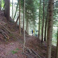
Sofern wir nur anm Ende des Schluchtabstiegs unser(e) Auto(s) stehen haben, zB auch in dem Fall, dass wir auf eine Umsetzung verzichten, gehen wir vom Auto auf der Piste etwa 100m weiter und biegen dann links in offenem Winkel auf einen alten Militär-Pfad ab. Dieser schlägt einen weiten Bogen nach links. Bei einer Rechtsserpentine auf 775m üNN nehmen wir den Pfad, der geradeaus weiter führt und gehen fast eben etwa 300m in Richtung Bach. Wir versuchen auf den undeutlichen Spuren in etwa gleichbleibeder Höhe weiter zu gehen. Wir passieren eine kleine Steinmauer. Hinter dieser stoßen nun auf einen ziemlich zugewachsenen Weg, der in Richtung Canyon führt. Ihn gehen wir ca. 100m abwärts, queren eine Wiese und biegen 50m nach deren Ende - die Piste steigt nun wieder leicht bergan - links auf eine dünne Spur ab, die uns in das Bachbett führt, direkt am Einstieg (750m üNN - vgl. Skizze: http://www.swestcanyon.ch/Canyons/Tine/AccesTine.pdf).
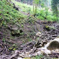
Sofern wir mit einem zweiten Auto oben geparkt haben (zB., weil uns diese Zustiegsbeschreibung verunsichert hat), laufen wir zuerst auf dem breiten Weg rechts des Baches bergab. Bei einer Verzweigung nach etwa 150m halten wir weiter bergab. Etwa in diesem Bereich kann man ohne Schwierigkeiten in das Bachbett absteigen, muss dann aber ein gutes Stück im Bachbett abwärts bis zum Beginn der Einschluchtung. Alternativ kann man den breiten Weg weiter bergab gehen (noch etwa 400m); hier biegt dann ein breiter Weg links in Richtung Bach ab. Er verliert sich jedoch, wird dann wieder erkennbar und ermöglicht uns den Abstieg in den Bach nur wenige Meter oberhalb des Schluchtbeginns, 770m üNN. Skizze dieser Zustiegsmöglichkeiten bei Brunner/Betrisey S. 162.
If we have our car(s) only at the end of the gorge descent, e.g. also in the case that we do without a conversion, we continue from the car on the slope for about 100m and then turn left at an open angle onto an old military path. This makes a wide turn to the left. At a right serpentine at 775m a.s.l. we take the path that continues straight ahead and go almost level for about 300m towards the stream. We try to continue on the indistinct tracks at about the same altitude. We pass a small stone wall. Behind it we come across a rather overgrown path that leads towards the canyon. We walk downhill for about 100m, cross a meadow and turn left 50m after the exit - the track now climbs slightly uphill again - onto a thin track that leads us into the streambed, directly at the entry (750m a.s.l. - cf. sketch: http://www.swestcanyon.ch/Canyons/Tine/AccesTine.pdf).\nIf we have parked with a second car at the top (e.g. because we were unsure about this description of the entry), we first walk downhill on the wide path to the right of the stream. At a fork after about 150m we continue downhill. At about this point you can descend into the streambed without difficulty, but then you have to walk downhill in the streambed for a good distance until you reach the beginning of the gorge. Alternatively, you can continue downhill along the wide path (about 400m more); here a wide path turns left towards the stream. However, it gets lost, then becomes recognizable again and allows us to descend into the stream just a few meters above the beginning of the gorge, 770m above sea level. Sketch of these access possibilities at Brunner/Betrisey p. 162.\n
Giro (1 h 10):
traduzione alternativa
➜
Lingua originale
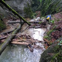
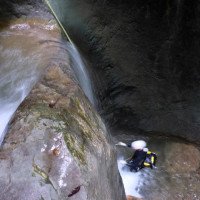
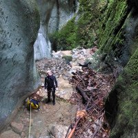
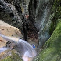
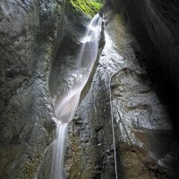
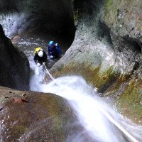
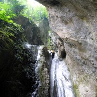
In düsterer Atmosphäre - wenn nicht gerade die Sonne ihre Strahlen in die Schlucht wirft - nehmen wir einen Abseiler nach dem anderen. Ab und zu kleinere Rutschmöglichkeiten. Wasserdurchsatz idR. mäßig.
In gloomy atmosphere - when the sun is not throwing its rays into the canyon - we take one rappel after the other. Now and then smaller slides. Water flow idR. moderate.
Ritorno (5 min):
traduzione alternativa
➜
Lingua originale
Am Schluchtausgang im Bach oder re. daneben bis zur Piste und dann li. zum Auto
At the canyon exit in the creek or on the right next to it to the slope and then on the left to the car
Coordinate:
Inizio del canyon
46.3121°, 6.88359°
↓↑
DMS: 46° 18" 43.56', 6° 53" 0.92'
DM: 46° 18.726", 6° 53.015"
Google Maps
Svizzera Topografica
DMS: 46° 18" 43.56', 6° 53" 0.92'
DM: 46° 18.726", 6° 53.015"
Google Maps
Svizzera Topografica
Fine del canyon
46.3123°, 6.8877°
↓↑
DMS: 46° 18" 44.28', 6° 53" 15.72'
DM: 46° 18.738", 6° 53.262"
Google Maps
Svizzera Topografica
DMS: 46° 18" 44.28', 6° 53" 15.72'
DM: 46° 18.738", 6° 53.262"
Google Maps
Svizzera Topografica
Parcheggio all'entrata
46.3114°, 6.87802°
↓↑
DMS: 46° 18" 41.04', 6° 52" 40.87'
DM: 46° 18.684", 6° 52.681"
Google Maps
Svizzera Topografica
DMS: 46° 18" 41.04', 6° 52" 40.87'
DM: 46° 18.684", 6° 52.681"
Google Maps
Svizzera Topografica
(descente_3)
Parcheggio in uscita
46.3128°, 6.89405°
↓↑
DMS: 46° 18" 46.08', 6° 53" 38.58'
DM: 46° 18.768", 6° 53.643"
Google Maps
Svizzera Topografica
DMS: 46° 18" 46.08', 6° 53" 38.58'
DM: 46° 18.768", 6° 53.643"
Google Maps
Svizzera Topografica
(descente_4)
Letteratura:
Mappa
1:25000
Libro Canyoning
Emmanuel Belut / Laurence Boyé / Thomas Guigon
Association Openbach
2015
9782746679450
Libro Canyoning
Andreas Brunner / Frédéric Bétrisey
SAC Schweizer Alpenclub
2001
978-3859021952
Info sul canyon Cwiki
Info sul canyon Descente
Sconosciuto
Sconosciuto
Info sul canyon Schlucht.ch
10.11.2024
Carog
⭐
★★★★★
📖
★★★
⚓
★★★
💧
Basso
Completato ✔
nessuna traduzione disponibile
Automatisch importiert von Descente-Canyon.com für Canyon Mayen
On a eu du mal à trouver le début du canyon, on a commencé bien plus haut et on a donc dû marcher un bon moment avant d'arriver au début..Sympathique canyon malgré les nombreux troncs qui traînent un peu partout
(Quelle: https://www.descente-canyon.com/canyoning/canyon-debit/21034/observations.html)
14.07.2024
Brocoli
⭐
★★★★★
📖
★★★
⚓
★★★
💧
Normale
Completato ✔
nessuna traduzione disponibile
Automatisch importiert von Descente-Canyon.com für Canyon Mayen
Bel encaissement mais plus une heure de descente que deux heures
(Quelle: https://www.descente-canyon.com/canyoning/canyon-debit/21034/observations.html)
01.05.2024
NicoSimon
⭐
★★★★★
📖
★★★
⚓
★★★
💧
Normale
Completato ✔
nessuna traduzione disponibile
Automatisch importiert von Descente-Canyon.com für Canyon Mayen
DC- eau un peu sale (rien d'affolant mais ça sent un peu la lessive en haut et on aurait pas envie de boire la tasse quoi...), ambiance assez sympa malgré la présence de pas mal de bois.
(Quelle: https://www.descente-canyon.com/canyoning/canyon-debit/21034/observations.html)
04.11.2023
TahitibobK1000
⭐
★★★★★
📖
★★★
⚓
★★★
💧
Alto
Completato ✔
nessuna traduzione disponibile
Automatisch importiert von Descente-Canyon.com für Canyon Mayen
Équipement RAS. Beaucoup de bois tout au long du canyon.
(Quelle: https://www.descente-canyon.com/canyoning/canyon-debit/21034/observations.html)
09.03.2023
System User
⭐
★★★★★
📖
★★★
⚓
★★★
nessuna traduzione disponibile
Info: Teile der Canyonbeschreibung wurden automatisiert übernommen. Konkret die Felder Weblinks, Koordinaten, Rating, Länge des Canyon, Einfachseil Mindestens von https://www.descente-canyon.com/canyoning/canyon/21034
09.03.2023
System User
⭐
★★★★★
📖
★★★
⚓
★★★
nessuna traduzione disponibile
Daten importiert von https://canyon.carto.net/cwiki/bin/view/Canyons/TinedeMayenCanyon.html
12.06.2021
Bubtore
⭐
★★★★★
📖
★★★
⚓
★★★
💧
Alto
Completato ✔
traduzione alternativa
➜
Lingua originale
Als zweite Tour des Tages gemacht, eignet sich gut dafür.
Made as the second tour of the day, it is well suited for this.
28.08.2020
Bubtore
⭐
★★★★★
📖
★★★
⚓
★★★
💧
Basso
Completato ✔
traduzione alternativa
➜
Lingua originale
Nicht so viel Wasser.
Not so much water.
Nuovo rapporto
Riportare brevemente e concisamente le informazioni più importanti dell'ultimo tour o importanti informazioni attuali sul canyon. Se necessario con link a video, foto, ecc..
*
*
*
Esc
Del
Idrologia:

