non così difficile
Orlias, Φαράγγι Ορλιά
v3 a3 II
4h55
1h15
3h30
10min
590m
310m
280m
28m
2x30m
20
2000m
Valutazione:
★★★★★
3.1 (3)
Info:
★★★
0 ()
Belay:
★★★
2 (1)
Sintesi:
traduzione alternativa
➜
Lingua originale
Abseilcanyon mit Sprungmöglichkeiten
Rappel canyon with possible jumps
Nord-Est
Sintesi:
traduzione alternativa
➜
Lingua originale
Abseilcanyon mit Sprungmöglichkeiten
Rappel canyon with possible jumps
Accesso:
traduzione alternativa
➜
Lingua originale
Wir verlassen die Autobahn A 1, die an der Ostküste Nordgriechenlands von Lamia nach Norden zieht (in Richtung Katerini, Thessaloniki) bei Dion, das wegen seiner Ausgrabungen als Autobahnabfahrt beschildert ist. Wir fahren durch Dion hindurch und verlassen es am Südwestrand, wo die Zufahrt zum Orlias beschildert ist. Wir fahren die Teerstraße etwa 3 km in südwestlicher Richtung; nun beginnt die Straße in Serpentinen aufwärts zu führen. Dann taucht rechterhand die Kapelle Hagios Konstantinos auf und die Teerstraße geht an der nächsten Linkskurve in eine Staubpiste über. Hier parken wir unser Auto.
We leave the A1 freeway, which runs north from Lamia on the east coast of northern Greece (towards Katerini, Thessaloniki) at Dion, which is signposted as a freeway exit because of its excavations. We drive through Dion and leave it at the southwestern edge, where the access road to Orlias is signposted. We drive the tarred road in a southwesterly direction for about 3 km; now the road starts to go up in serpentines. Then the chapel of Hagios Konstantinos appears on the righthand side and the tarred road turns into a dust road at the next left turn. Here we park our car.
Avvicinamento (1 h 15):
traduzione alternativa
➜
Lingua originale
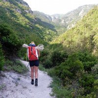
In der erwähnten Kurve beginnt ein Fußweg, der in Richtung SSW rechtsuferig (orograf.) am Bach Orlias aufwärts führt. Abzweigungen nach rechts (zum Bach) innerhalb der nächsten Stunde ignorieren wir. Nach etwa 1 Stunde erreichen wir einen Sattel, wo der Weg nach links (in östliche Richtung) schwenkt. Hier finden wir an einem dünnen Stamm ein kleines Blechschild, das einst rot war und rechts an den Stamm genagelt ein Plastikschild mit großer roter Markierung. Zwischen diesen Schildern zweigt der Pfad ab, der uns nach weiteren 15 Minuten zum Bachlauf bringt, die letzten Meter allerdings weglos.
In the mentioned bend a footpath begins, which leads in the direction of SSW right bank (orographic.) at the brook Orlias upwards. We ignore forks to the right (to the stream) within the next hour. After about 1 hour we reach a saddle where the path turns to the left (in eastern direction). Here we find a small tin sign on a thin trunk that was once red, and a plastic sign with a large red marker nailed to the trunk on the right. Between these signs the path branches off, which after another 15 minutes brings us to the stream, but the last meters pathless.
Giro (3 h 30):
traduzione alternativa
➜
Lingua originale
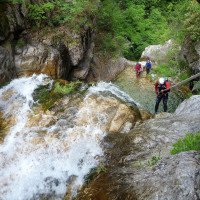
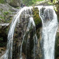
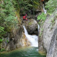
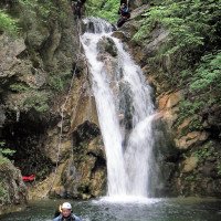
Zu Beginn überwiegen schöne Abseiler (insgesamt 20), später vergnügliche Sprünge.
At the beginning, beautiful rappels (20 in total) predominate, later enjoyable jumps.
Ritorno (10 min):
traduzione alternativa
➜
Lingua originale
Wo die Piste den Bachlauf kreuzt rechts hinauf zum Auto. Wer noch nicht genug hat, kann noch etwas weiter im Bach und noch einen Abseiler und ein paar zusätzliche Sprünge mitnehmen.
Where the slope crosses the creek right up to the car. If you still haven't had enough, you can continue a little further down the creek and take a rappel and a few extra jumps.
Coordinate:
Inizio del canyon
Fine del canyon
Parcheggio Entrata e uscita
Letteratura:
Mappa
Mappa
Libro Canyoning
Stéphane Coté / Caracal et les Sancho Panza
2009
Libro Canyoning
George Andreou
Anavasi
2007
978-9609300209
Libro Canyoning
Stéphane Coté / Caracal et les Sancho Panza
2007
124 Canyon-Beschreibungen
Info sul canyon Cwiki
Info sul canyon Descente
Info sul canyon Ropewiki
Video
13.09.2024
Pizzoccheri
⭐
★★★★★
📖
★★★
⚓
★★★
💧
Basso
Completato ✔
nessuna traduzione disponibile
Automatisch importiert von Descente-Canyon.com für Canyon Orlias
Canyon overrated with some very nice pools and waterfalls and some games, walking between each drop is often slippery.
(Quelle: https://www.descente-canyon.com/canyoning/canyon-debit/21073/observations.html)
13.09.2024
CathyO
⭐
★★★★★
📖
★★★
⚓
★★★
💧
Normale
Completato ✔
nessuna traduzione disponibile
Automatisch importiert von Descente-Canyon.com für Canyon Orlias
Very pretty passages but also lots of river walking.
(Quelle: https://www.descente-canyon.com/canyoning/canyon-debit/21073/observations.html)
21.05.2024
Bina
⭐
★★★★★
📖
★★★
⚓
★★★
💧
Normale
Completato ✔
traduzione alternativa
➜
Lingua originale
Der Canyon besteht aus 3 Teilen. Oberster und mittlerer Teil sind abgesehen von kleinen Bachwanderpassagen sehr schön. Der unterste Teil besteht hauptsächlich aus 1km Bachwandern mit wenigen schönen Stellen.
Der unterste Teil beginnt, da, wo der Wanderweg direkt neben dem Bach ist. Der mittlere Teil beginnt bei dem Red Rock Waterfall, dahin gelangt man, wenn man bei der 1. richtigen Wegkreuzung rechts geht. Zum obersten Teil kommt man, wenn man bei der 1. richtigen Kreuzung links geht und bei einer weiteren Kreuzung (755müM) rechts dem grünen Schild Canyoning 2 folgt.Oberster Teil Einstieg auf 710müM. Wenn man alle 3 Teile macht, benötigt man etwa 4h. Zustieg oberster Teil etwa 1h30.
The canyon consists of 3 parts. The upper and middle parts are very beautiful, apart from small sections of stream walking. The lowest part consists mainly of 1 km of stream hiking with a few beautiful spots.
The lowest part starts where the hiking trail is right next to the creek. The middle section starts at the Red Rock Waterfall, which you can reach by turning right at the first right fork. To get to the upper part, turn left at the first correct junction and then right at another junction (755 m above sea level) following the green signs for Canyoning 2. 710 m above sea level is the entry point to the upper part. If you do all 3 parts, you need about 4 hours. Access to the upper part about 1h30.
21.05.2024
Bina
⭐
★★★★★
📖
★★★
⚓
★★★
💧
Normale
Completato ✔
nessuna traduzione disponibile
Automatisch importiert von Descente-Canyon.com für Canyon Orlias
We started at 715m above sea level. At the first waycross go left and at 760m follow the sign down to the canyon. The first and the second part are, apart from a few slippery walking sections, very nice. The last part is 1km walking with few abeils and interesting spots. I would recomended to do only part 1 and 2.
(Quelle: https://www.descente-canyon.com/canyoning/canyon-debit/21073/observations.html)
09.03.2023
System User
⭐
★★★★★
📖
★★★
⚓
★★★
nessuna traduzione disponibile
Info: Teile der Canyonbeschreibung wurden automatisiert übernommen. Konkret die Felder Weblinks, Koordinaten, Rating, Länge des Canyon, Einfachseil Mindestens von https://www.descente-canyon.com/canyoning/canyon/21073
09.03.2023
System User
⭐
★★★★★
📖
★★★
⚓
★★★
nessuna traduzione disponibile
Daten importiert von https://canyon.carto.net/cwiki/bin/view/Canyons/OrliasCanyon.html
Nuovo rapporto
Riportare brevemente e concisamente le informazioni più importanti dell'ultimo tour o importanti informazioni attuali sul canyon. Se necessario con link a video, foto, ecc..
*
*
*
Esc
Del
Idrologia:
