un po' difficile
Isitalerbach
v4 a4 IV
4h12
2min
4h
10min
710m
435m
275m
25m
2x 25m
15
1500m
Auto necessaria
Specialità:
Diga (scarico automatico)
Diga (scarico automatico)
Valutazione:
★★★★★
3.5 (3)
Info:
★★★
2 (1)
Belay:
★★★
2.5 (2)
Sintesi:
traduzione alternativa
➜
Lingua originale
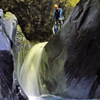
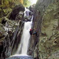
Zu Beginn Dunkelklamm, später offener, abwechslungsreich.
Großes Einzugsgebiet mit Wasserfassung.
+41 41875 05 2 (auf Deutsch!)
Ggf. Infos zu Wartungen, keine Begehungserlaubnis.
Dark gorge at the beginning, later more open, varied.
Large catchment area with water catchment.
+41 41875 05 2 (in German!)
Information on maintenance if necessary, no access permit.
luglio - settembre
Est
60.00km²
Sintesi:
traduzione alternativa
➜
Lingua originale
Zu Beginn Dunkelklamm, später offener, abwechslungsreich.
Großes Einzugsgebiet mit Wasserfassung.
+41 41875 05 2 (auf Deutsch!)
Ggf. Infos zu Wartungen, keine Begehungserlaubnis.
Dark gorge at the beginning, later more open, varied.
Large catchment area with water catchment.
+41 41875 05 2 (in German!)
Information on maintenance if necessary, no access permit.
Accesso:
traduzione alternativa
➜
Lingua originale
Von Altdorf nach Isenthal (gebührenpflichtiger Parkplatz); vom Parkplatz steil und kurvenreich hinauf bis zu Brücke über den Bach (700 m ü.N) - Achtung auf zeitliche Regelung der Auffahrt!. Bei Holzstapel Parkmöglichkeit.
From Altdorf to Isenthal (paid parking lot); from the parking lot steep and winding up to the bridge over the stream (700 m above sea level) - pay attention to the time regulation of the driveway! Parking at the woodpile.
Avvicinamento (2 min):
traduzione alternativa
➜
Lingua originale
An der Brücke auf Treppe hinunter in den Bach.
At the bridge, take the steps down into the stream.
Giro (4 h):
traduzione alternativa
➜
Lingua originale
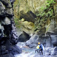
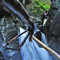
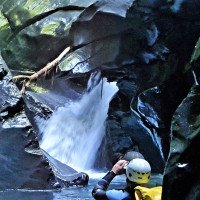
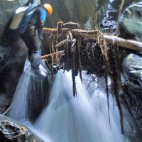
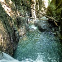
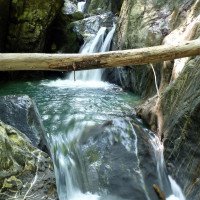
Oben sehr schön eng geschnitten, ab dem 2. Drittel dann offener , gegen Ende ermüdendes Abklettern.
Very nice tight cut at the top, then more open from the 2nd third onwards, tiring downclimb towards the exit.
Ritorno (10 min):
traduzione alternativa
➜
Lingua originale
Den Bach ganz hinauslaufen, unter der Straßenbrücke durch, dann re. hinauf zur Straße und zum Parkplatz.
Walk all the way out along the stream, under the road bridge, then right up to the road and the parking lot.
Coordinate:
Inizio del canyon
46.9124°, 8.57651°
↓↑
DMS: 46° 54" 44.64', 8° 34" 35.44'
DM: 46° 54.744", 8° 34.591"
Google Maps
Svizzera Topografica
DMS: 46° 54" 44.64', 8° 34" 35.44'
DM: 46° 54.744", 8° 34.591"
Google Maps
Svizzera Topografica
Fine del canyon
46.9183°, 8.5925°
↓↑
DMS: 46° 55" 5.88', 8° 35" 33'
DM: 46° 55.098", 8° 35.55"
Google Maps
Svizzera Topografica
DMS: 46° 55" 5.88', 8° 35" 33'
DM: 46° 55.098", 8° 35.55"
Google Maps
Svizzera Topografica
Parcheggio in uscita
46.91739°, 8.59532°
↓↑
DMS: 46° 55" 2.6', 8° 35" 43.15'
DM: 46° 55.043", 8° 35.719"
Google Maps
Svizzera Topografica
DMS: 46° 55" 2.6', 8° 35" 43.15'
DM: 46° 55.043", 8° 35.719"
Google Maps
Svizzera Topografica
Parcheggio all'entrata
46.91222°, 8.57669°
↓↑
DMS: 46° 54" 43.99', 8° 34" 36.08'
DM: 46° 54.733", 8° 34.601"
Google Maps
Svizzera Topografica
DMS: 46° 54" 43.99', 8° 34" 36.08'
DM: 46° 54.733", 8° 34.601"
Google Maps
Svizzera Topografica
Letteratura:
Mappa
1:25000
Libro Canyoning
Emmanuel Belut / Laurence Boyé / Thomas Guigon
Association Openbach
2015
9782746679450
Libro Canyoning
F. Baumgartner / A. Brunner / D. Zimmermann
2010
Info sul canyon Cwiki
Info sul canyon Descente
Info sul canyon Ropewiki
Info sul canyon Schlucht.ch
07.09.2024
alex.arnold
⭐
★★★★★
📖
★★★
⚓
★★★
💧
Alto
Completato ✔
nessuna traduzione disponibile
Automatisch importiert von Descente-Canyon.com für Canyon Isenthal
No information of the powerstation. Uncool dudes. Awesome conditions
(Quelle: https://www.descente-canyon.com/canyoning/canyon-debit/21336/observations.html)
24.08.2024
Zürcher Ismael
⭐
★★★★★
📖
★★★
⚓
★★★
nessuna traduzione disponibile
Automatisch importiert von Schlucht.ch für Canyon Isitaler Bach, Wasserstand: "Mittel" Verankerungen: "io"
(Quelle: https://schlucht.ch/schluchten-der-schweiz-liste/1054-isitaler-bach)
24.08.2024
ismä
⭐
★★★★★
📖
★★★
⚓
★★★
💧
Normale
Completato ✔
traduzione alternativa
➜
Lingua originale
Sprünge waren machbar.
Jumps were feasible.
23.08.2024
Matthias Holzinger
⭐
★★★★★
📖
★★★
⚓
★★★
nessuna traduzione disponibile
Automatisch importiert von Schlucht.ch für Canyon Isitaler Bach, Wasserstand: "mittel-hoch" Verankerungen: "gut"
2 Haken ergänzt, sonst alles gut. Etwas trübes Wasser und das erste Drittel recht rutschig.
(Quelle: https://schlucht.ch/schluchten-der-schweiz-liste/1054-isitaler-bach)
23.08.2024
Matthias Holzinger
⭐
★★★★★
📖
★★★
⚓
★★★
💧
Alto
Completato ✔
traduzione alternativa
➜
Lingua originale
Etwas rutschig, sonst tip-top
Slightly slippery, otherwise tip-top
09.03.2023
System User
⭐
★★★★★
📖
★★★
⚓
★★★
nessuna traduzione disponibile
Daten importiert von https://canyon.carto.net/cwiki/bin/view/Canyons/IsitalerbachCanyon.html
Nuovo rapporto
Riportare brevemente e concisamente le informazioni più importanti dell'ultimo tour o importanti informazioni attuali sul canyon. Se necessario con link a video, foto, ecc..
*
*
*
Esc
Del
Idrologia:


