v4 a2 II
2h35
5min
2h30
0min
500m
380m
120m
35m
1x40m
5
2000m
Auto necessaria
Valutazione:
★★★★★
3.6 (9)
Info:
★★★
3 (6)
Belay:
★★★
3 (6)
Sintesi:
traduzione alternativa
➜
Lingua originale
Anfangs lange Gehpassage, daher siehe Tipp/ 2. Möglichkeit; sehr schöner eingeschnittener Mittelteil; bei höheren Wasserstand (labilen Wetter) sehr gefährlich/lebensgefährlich!; sehr schöne Halbtagestour; beste Sonneneinstrahlung ab Mittag; Wasserableitung im oberen Abschnitt durch „Enel“, daher meist wenig Wasser in der Schlucht; mehrere Bohrhaken für Geländerseil-Aufbau vorhanden; es ist öfters vorgekommen das unvorhergesehen Wasser in die Schlucht abgelassen worden ist. Die Abseilpassagen werden dann richtig anspruchsvoll!
Initially long walking passage, therefore see tip / 2nd possibility; very nice cut middle part; at higher water levels (unstable weather) very dangerous / life-threatening!; very nice half-day tour; best sunlight from midday; water drainage in the upper part by "Enel", therefore usually little water in the canyon; several pitons for traverese rope construction available; it has often happened that unforeseen water has been drained into the canyon. The rappel passages are then really demanding!
Ovest
Sintesi:
traduzione alternativa
➜
Lingua originale
Anfangs lange Gehpassage, daher siehe Tipp/ 2. Möglichkeit; sehr schöner eingeschnittener Mittelteil; bei höheren Wasserstand (labilen Wetter) sehr gefährlich/lebensgefährlich!; sehr schöne Halbtagestour; beste Sonneneinstrahlung ab Mittag; Wasserableitung im oberen Abschnitt durch „Enel“, daher meist wenig Wasser in der Schlucht; mehrere Bohrhaken für Geländerseil-Aufbau vorhanden; es ist öfters vorgekommen das unvorhergesehen Wasser in die Schlucht abgelassen worden ist. Die Abseilpassagen werden dann richtig anspruchsvoll!
Initially long walking passage, therefore see tip / 2nd possibility; very nice cut middle part; at higher water levels (unstable weather) very dangerous / life-threatening!; very nice half-day tour; best sunlight from midday; water drainage in the upper part by "Enel", therefore usually little water in the canyon; several pitons for traverese rope construction available; it has often happened that unforeseen water has been drained into the canyon. The rappel passages are then really demanding!
Accesso:
traduzione alternativa
➜
Lingua originale
ca. 5min+ 20min Auto überstellen
Von Tolmezzo fährt man auf der Bundesstraße SS52b in Nördlicher Richtung, Richtung „Austria“ -->kurz nach Tolmezzo sieht man li das Gefängnis und re eine Shell Tankstelle -->von hier fährt man genau 1,9Km bis man nach einer scharfen re-li Kurve bei einem Haus re abbiegt und zum Enel Kraftwerk kommt --> hinter dem Kraftwerk kann man gut Parken. Hier Wasserstand kontrolliert werden --> dafür geht man ca. 50m von Schluchtenausgang bis zur letzten Stufe, hinein --> das Wasser sollte hier ruhig in den letzten Gumpen fließen. Am besten wählt man den Zustieg zu Fuss , falls nicht fährt man mit dem zweiten PKW Richtung Tolmezzo --> es empfiehlt sich den Ortskern, auf der Bundesstraße zu umfahren --> beim nächsten Verkehrsknoten nimmt man die Ausfahrt Tolmezzo --> weiter bis zum kleinen Kreisverkehr --> hier re -->gerade aus beim Lidl vorbei, bis zum Schild Illegro (Abzweigung li) --> ab hier folgt man der Straße hoch bis zur Ortschaft Illegro --> nach der Ortstafel biegt man gleich li ab Richtung Kirche (schmale Gasse)--> vor der Kirche nimmt man die Abzweigung.li. „S. Florian“ bis zum Friedhof -->hier parkt man das Auto( auf ca. 580Hm)
about 5min+ 20min transfer car
From Tolmezzo you drive on the SS52b in northern direction, direction "Austria" -->shortly after Tolmezzo you see the prison on the left and a Shell gas station on the right -->from here you drive exactly 1,9Km until you turn right after a sharp bend near a house and come to the Enel power station -->behind the power station you can park well -->before you drive up with the second car to the entry, the water level should be checked -->for this you go approx. 50m from the exit of the gorge to the last step --> the water should flow calmly into the last pool --> after checking the water level, take the second car in the direction of Tolmezzo --> it is recommended to drive around the center of the village, at the next traffic junction take the Tolmezzo exit --> continue to the small traffic circle --> turn right --> straight on past the Lidl supermarket until you reach the sign for Illegro (turn left) --> from here follow the road up to the village of Illegro --> after the town sign turn immediately left in the direction of the church (narrow lane) --> before the church take the turnoff.left "S. Florian" until the cemetery --> here you park the car (at approx. 580Hm).
Avvicinamento (5 min):
traduzione alternativa
➜
Lingua originale
(zu Fuß: 35-40min)
1. Möglichkeit:
Vom Friedhof geht man den Wanderweg in wenigen Minuten zum Bach hinab --> Einstieg auf ca. 500Hm vor der Steinbrücke re.
Tipp/ 2. Möglichkeit (ca. 35-40min):
Um sich die ganze Autoüberstellung und Bachwanderung von Ort Illegro bis zur ersten Abseilstelle zu sparen, kann man direkt neben dem Ausstieg beim Enel Kraftwerk der Pipeline auf steilen Stufen durch den Stollen hoch folgen (keine Lampe notwendig). Nach dem Stollen geht es flach bis zum Ausgleichsbecken. Am Becken angekommen führt ein Eisensteg über die Betonverbauung. Danach wird das Becken logischerweise links umgangen. !!! Noch vor der nächsten Eisenbrücke/Bach haltet man Ausschau nach der Canyoning Markierung am Baum links (blauer Punkt auf weißem Hintergrund). Ab hier folgt man der Markierung und sichtbaren Pfad geradewegs steil hoch durch den Wald bis zum ersten Waldrücken. Am Rücken nicht weiter links aufwärts gehen, sondern recht abwärts den Pfad folgen. Nach kurzer Zeit geht es abermals links haltend hoch auf einen zweiten Waldrücken (bei der Ruine ist man zu hoch), bevor es dann endgültig steil abwärts zum Bach geht. Nach einer kurzen Strecke im Bachbett steht man schon vor der ersten Abseilstelle.
(Achtung!!! Durch umgefallene Bäume ist der Hauptpfad nicht immer leicht sichtbar, jedoch kommen in größeren Abständen bis zum Bach immer wieder Canyoning Markierungen auf Bäumen.
Access: (approx. 5min/35-40min)
1st possibility:
From the cemetery, walk down the trail to the creek in a few minutes --> entry at about 500Hm before the stone bridge on the right.
Tip/ 2nd possibility (approx. 35-40min):
To save yourself all the car transfer and river walk from Ort Illegro to the first rappel point, you can follow the pipeline up steep steps through the tunnel right next to the exit at the Enel power plant (no lamp needed). After the tunnel, the path is flat until you reach the equalization basin. Once at the basin, an iron footbridge leads over the concrete obstruction. After that, the basin is logically bypassed on the left. !!! Before the next iron bridge/stream, look out for the canyoning marker on the tree on the left (blue dot on white background). From here follow the marking and visible path straight up steeply through the forest to the first forest ridge. At the ridge do not continue left uphill, but follow the path right downhill. After a short while, keep left again and go up to a second forest ridge (at the ruin you are too high), before it finally goes steeply down to the stream. After a short stretch in the streambed you are already in front of the first abseiling point.
(Attention!!! Due to fallen trees, the main path is not always easy to see, but at greater intervals up to the stream there are always canyoning markings on trees.
Giro (2 h 30):
traduzione alternativa
➜
Lingua originale
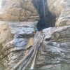
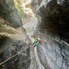
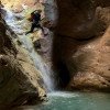
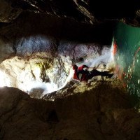
Die Tour beginnt an der Steinbrücke auf ca. 500Hm und führt für ca. 20-25min durch offenes Gelände. In diesem Abschnitt kommt man nach ca. 10min an der Wasserableitung „Enel“ vorbei (das meiste Wasser wird hier abgeleitet. Die Mauer kann an der re Seite abgeklettert werden bevor man den Rest der Gehstrecke bis zur 1. Abseilstelle zurücklegt.Wählt man den Zustieg zufuss erreicht man ca 3min vor dem ersten Abseiler den Bach. Mit einem Geländerseil kommt man sicher zum ausgesetzten Stand auf der li Seite, bevor man sich 35m in den Gumpen abseilt. Nach dieser höchsten Stelle folgt gleich 10m Abseiler in den zweiten schönen Gumpen. Danach kommen einige kleinen Stufen und Gumpen im offenen Gelände bevor es im Mittelteil für ca. 100m so richtig eingeschnitten wird. Der eingeschnittene Teil birgt keine technischen Probleme. Nach einem Zufluss von li hat man eine kurze Wegstrecke bis zu den nächsten 3 Abseilstellen die von kurzen Gehpassagen unterbrochen werden. Am Schluss verengt sich die Schlucht nochmals. Die letzte Stufe wird durch Fehlen eines Bohrhakens geschickt abgeklettert, bevor es in kürze aus der Schlucht, zum Kraftwerk „Enel“ (Parkplatz)geht.
approx. 2,5h
The tour starts at the stone bridge at about 500Hm and leads for about 20-25min through open terrain. In this part you will pass the water drainage "Enel" after about 10min (most of the water is drained here. The wall can be downclimbed on the right side before walking the rest of the walking passages to the 1st rappel point. With a traverese rope you get safely to the exposed belaystation on the left side, before you rappel 35m into the pool. After this highest point follows immediately 10m rappel into the second beautiful pool. After that there are some small steps and pools in the open terrain before it is really cut in the middle part for about 100m. The cut part does not pose any technical problems. After an inflow from the left, there is a short stretch to the next 3 abseils, which are interrupted by short walking passages. At the end, the canyon narrows again. The last step is cleverly downclimbed due to the absence of a piton, before leaving the canyons in a short time to the power station "Enel" (parking lot).
Ritorno (0 min):
traduzione alternativa
➜
Lingua originale
Der Ausstieg der Schlucht ist direkt beim Enel Kraftwerk vor der Brücke re auf ca. 380Hm.
approx. 0min
The exit of the canyon is directly at the Enel power plant before the bridge on the right at about 380Hm.
Coordinate:
Inizio del canyon
(cwiki_1)
Parcheggio all'entrata
(cwiki_1)
Parcheggio in uscita
Parkplatz bei ENEL Kraftwerk (cwiki)
Fine del canyon
(cwiki_1)
Letteratura:
Libro Canyoning
Ingo Neumann / Alfred Wieser / Franz Karger / Reinhard Ranner
2004
http://www.edition-neumann.com
Info sul canyon ACA
Info sul canyon Cwiki
Info sul canyon Descente
Info sul canyon Ropewiki
Altro info sul canyon
Altro info sul canyon
01.11.2024
MirkoT
⭐
★★★★★
📖
★★★
⚓
★★★
🌊
Folle
Completato ✕
nessuna traduzione disponibile
Automatisch importiert von Descente-Canyon.com für Canyon Frondizzon
La centrale del bacino di Tramba ha livello d'acqua a sfioro. La centrale ha la griglia della presa intasata viste le ultime forti precipitazioni di due settimane fa e quindi il bacino scarica tutta l'acqua nel rio Frondizzon.Per info aggiornate, chiamare il numero +39042786129 e chiedere di parlare con la persona reperibile.
(Quelle: https://www.descente-canyon.com/canyoning/canyon-debit/21759/observations.html)
31.08.2024
Sietse Winter
⭐
★★★★★
📖
★★★
⚓
★★★
💧
Basso
Completato ✔
traduzione alternativa
➜
Lingua originale
In het eeste stuk canyon was er zeer weinig water, tot dat een andere waterval veel water erbij gaf voor de laatste paar abseils.
Haken in goede toestand.
In the first part of the canyon there was very little water, until another waterfall added a lot of water for the last few abseils.
Hooks in good condition.
23.08.2024
AlvaroCanyon
⭐
★★★★★
📖
★★★
⚓
★★★
💧
Basso
Completato ✔
nessuna traduzione disponibile
Automatisch importiert von Descente-Canyon.com für Canyon Frondizzon
Alvaro Canyon
(Quelle: https://www.descente-canyon.com/canyoning/canyon-debit/21759/observations.html)
29.06.2024
Sandra66
⭐
★★★★★
📖
★★★
⚓
★★★
💧
Normale
Completato ✔
nessuna traduzione disponibile
Automatisch importiert von Descente-Canyon.com für Canyon Frondizzon
Petit filet dans la première partie puis debit correct + à partir de l affluent après l oscuros
(Quelle: https://www.descente-canyon.com/canyoning/canyon-debit/21759/observations.html)
27.06.2024
Bernhard
⭐
★★★★★
📖
★★★
⚓
★★★
💧
Alto
Completato ✔
traduzione alternativa
➜
Lingua originale
Anstieg via Stollen cooles Ambiente aber nachher sehr rutschig im Wald
Oberer Teil des Frondizzon sehr wenig trübes Wasser
Wir hatten Glück und der Zufluss vom Damm (großer Wasserfall in der Mitte ) war aktiv und so hatten wir ab dort einen super Wasserstand
Zweimal abseilen direkt im Wasserstrahl/ aber ohne Probleme machbar
Ascent via the tunnel cool ambience but afterwards very slippery in the forest
Upper part of the Frondizzon very little turbid water
We were lucky and the inflow from the dam (big waterfall in the middle) was active and so we had a superiore water level from there on
Two rappels directly in the water jet/ but doable without problems
24.06.2024
Rick Paapy
⭐
★★★★★
📖
★★★
⚓
★★★
💧
Basso
Completato ✔
nessuna traduzione disponibile
Fast decent on Friday, waterlevel was low, all anchors good did the whole canyon in 1 hour.
22.06.2024
CandyBear
⭐
★★★★★
📖
★★★
⚓
★★★
💧
Normale
Completato ✔
nessuna traduzione disponibile
Automatisch importiert von Descente-Canyon.com für Canyon Frondizzon
(Quelle: https://www.descente-canyon.com/canyoning/canyon-debit/21759/observations.html)
28.04.2024
Wolfgang
⭐
★★★★★
📖
★★★
⚓
★★★
💧
Alto
Completato ✔
traduzione alternativa
➜
Lingua originale
Altri utenti sono stati: Pavel Urbanek
Aktuell sehr viel Wasser in der Schlucht ; war aber alles noch gut zu bewältigen.
Da auch im oberen Teil schon sehr viel Wasser war nehme ich an das der "Damm" bei der Ableitung zum Speichersee "geöffnet " oder beschädigt ist.
Currently a lot of water in the canyon; but everything was still manageable.
Since there was already a lot of water in the upper part, I assume that the "dam" at the drainage to the reservoir is "open" or damaged.
Altri utenti sono stati: Pavel Urbanek
13.08.2023
Kevin Sindberg
⭐
★★★★★
📖
★★★
⚓
★★★
💧
Basso
Completato ✔
traduzione alternativa
➜
Lingua originale
Von oben begangen, wobei (mit der Erfahrung jetzt) die Variante zwei sehr empfehlenswert ist; die 20min shuttlen können sie getrost gespart werden.
Ansonsten eine schöne Schlucht mit sehr entspanntem Wasserstand.
Eignet sich gut für eine Halbtagestour (ca. 2,5-3h)
From the top walked, whereby (with the experience now) the variant two is highly recommended; the 20min shuttlen they can be confidently saved.
Otherwise, a beautiful gorge with very relaxed water level.
Is well suited for a half-day tour (about 2.5-3h)
04.08.2023
Andreas Bramböck
⭐
★★★★★
📖
★★★
⚓
★★★
💧
Basso
Completato ✔
traduzione alternativa
➜
Lingua originale
Aufstieg über Variante 2 (durch Stollen) ist Top.
Aufgrund der Wasserableitung, war das wahrscheinlich die einzige Tour die heute in der Gegend sicher machbar war.
Ascent via variant 2 (through tunnels) is top.
Due to the water drainage, this was probably the only tour that was safely doable today in the area.
16.07.2023
Rok
⭐
★★★★★
📖
★★★
⚓
★★★
💧
Basso
Completato ✔
traduzione alternativa
➜
Lingua originale
Sehr wenig Wasser, aber trotzdem lohnend. Sehr trüb bzw. milchig. Viele Sprünge möglich. Absicherung perfekt.
Very little water, but still worthwhile. Very turbid or milky. Many jumps possible. Protection perfect.
09.03.2023
System User
⭐
★★★★★
📖
★★★
⚓
★★★
nessuna traduzione disponibile
Info: Teile der Canyonbeschreibung wurden automatisiert übernommen. Konkret die Felder Weblinks, Koordinaten, Rating, Ort, Länge des Canyon, Einfachseil Mindestens von https://canyon.carto.net/cwiki/bin/view/Canyons/RioFrondizzonCanyon.html und https://www.descente-canyon.com/canyoning/canyon/21759
09.03.2023
System User
⭐
★★★★★
📖
★★★
⚓
★★★
nessuna traduzione disponibile
Daten importiert von https://www.canyoning.or.at/index.php/liste-aller-canyons/61-rio-frondizzon
Nuovo rapporto
Riportare brevemente e concisamente le informazioni più importanti dell'ultimo tour o importanti informazioni attuali sul canyon. Se necessario con link a video, foto, ecc..
*
*
*
Esc
Del
Idrologia:
