v4 a4 III
4h5
1h20
2h30
15min
1480m
1250m
230m
50m
a piedi
Valutazione:
★★★★★
2.1 (1)
Info:
★★★
0 ()
Belay:
★★★
0 ()
Sintesi:
traduzione alternativa
➜
Lingua originale
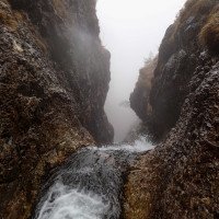
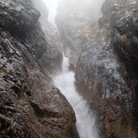
Steile Klamm im zerfressenen Kalk.
Kann mit einer der benachbarten Touren kombiniert werden
Steep gorge in eroded limestone.
Can be combined with one of the neighboring tours
Calcare
Sintesi:
traduzione alternativa
➜
Lingua originale
Steile Klamm im zerfressenen Kalk.
Kann mit einer der benachbarten Touren kombiniert werden
Steep gorge in eroded limestone.
Can be combined with one of the neighboring tours
Accesso:
traduzione alternativa
➜
Lingua originale
Von Tolmezzo über Villa Santina Richtung Sappada. Unmittelbar nach der Brücke in Forni Avoltri rechts abzweigen und der Straße bis zu einem Parkplatz vor dem Marmor Steinbruch folgen.
From Tolmezzo via Villa Santina in the direction of Sappada. Immediately after the bridge in Forni Avoltri turn right and follow the road to a parking lot in front of the marble quarry.
Avvicinamento (1 h 20):
traduzione alternativa
➜
Lingua originale
Über die Forststrasse durchs Tal bergauf. Oberhalb der kurzen Klamm 'Stretta di Fleons' rechts abzweigen und dem Wanderweg 142 bis zur Almfläche der Casera Sissanis di Sotto folgen. Auf der Alm Viehspuren folgend bis zum Schluchtbeginn absteigen. Man haltet sich am besten immer am orogr. rechten Ufer des ersten Zuflusses.
Go uphill along the forest road through the valley. Above the short gorge 'Stretta di Fleons' turn right and follow trail 142 to the alpine pasture of Casera Sissanis di Sotto. On the pasture descend following the cattle tracks to the beginning of the gorge. It is best to keep to the orographic right bank of the first tributary.
Giro (2 h 30):
traduzione alternativa
➜
Lingua originale
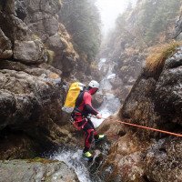
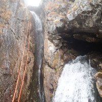
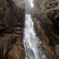
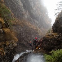
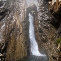
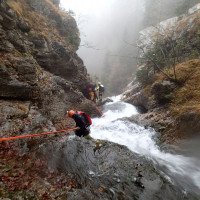
Kontinuierliche Abfolge von Abseilstellen ohne viel Gehstrecken.
* 10m von Baum rechts
* 15m von Haken rechts, unten Wasserhöhle mit einigen an zusätzlichen Wasser
* 15m von Haken links
* 5m von Ringhaken rechts oben in Hängebecken abseilen
* 35m von Haken rechts abseilen, nächster Stand ist oberhalb von siphonierten Block. Seilabzugsprobleme und sehr scharfer Fels
* 12m von Haken rechts oben abseilen
* 30m von Ringhaken rechts abseilen
* 10m Abseilen von Ringhaken rechts zu Hängestand rechts, dann 20m abwärts ins Becken. Kann auch nur als Umlenkung verwendet werden
* 2m Rutsche
* 22m von Haken links
* 50m von Haken rechts, unten direkt durch den Wasserstrahl. Seilabzugsprobleme
* 30m von Normalhaken rechts
* 15m von Klemmblockschlinge links
* 40m von Haken links.
Ab hier öffnet sich die Schlucht wieder und man kann nach links ausqueren. Im Bachbett noch 2-3 Baumabseilstellen.
Continuous sequence of rappels without much walking passages.
* 10m from tree on the right
* 15m from anchor right, below water cave with some at additional water
* 15m from anchor left
* rappel 5m from ring hook on the top right into hanging pools
* 35m from anchor right rappel, next belay is above siphoned block. Rope pull problems and very sharp rock.
* 12m rappel from anchor on top right side
* rappel 30m from rappel hook on right side
* 10m rappel from ring hook right to hanging belaystation right, then 20m down into pool. Can also be used as a redirection only
* 2m slide
* 22m from anchor left
* 50m from anchor right, down directly through the water stream. Rope pull off problems
* 30m from normal hook right
* 15m from terminal block sling left
* 40m from anchor left.
From here the canyon opens again and you can cross out to the left. In the streambed still 2-3 tree rappels.
Ritorno (15 min):
traduzione alternativa
➜
Lingua originale
Nach links zu Forstweg und über diesen retour zum Zustiegsweg
Turn left to the forest path and return to the access path.
Coordinate:
Inizio del canyon
Parcheggio Entrata e uscita
Parkplatz bei Steinbruch
Fine del canyon
Info sul canyon Cwiki
09.03.2023
System User
⭐
★★★★★
📖
★★★
⚓
★★★
nessuna traduzione disponibile
Daten importiert von https://canyon.carto.net/cwiki/bin/view/Canyons/RioSissanisCanyon.html
Idrologia:
