v4 a3 III
3h45
1h
2h30
15min
820m
660m
160m
22m
2x30m
14
700m
a piedi
Valutazione:
★★★★★
3.1 (7)
Info:
★★★
2.4 (5)
Belay:
★★★
2.4 (5)
Sintesi:
traduzione alternativa
➜
Lingua originale
Abwechslungsreicher Abseilcanyon
Varied rappel canyon
Est
2.60km²
Sintesi:
traduzione alternativa
➜
Lingua originale
Abwechslungsreicher Abseilcanyon
Varied rappel canyon
Accesso:
traduzione alternativa
➜
Lingua originale
Wir verlassen die Autobahn A 14 (Bregenz - Feldkirch) an der Ausfahrt 18 (Dorrnbirn Süd) und fahren auf der Lustenauerstr. in östlicher Richtung nach Dornbirn hinein. 2,8 km nach der Autobahnausfahrt kommen wir an die Kreuzung mit der Hatlerstr. und fahren dort geradeaus weiter in die Hintere Achmühlerstraße. Auf dieser kommen wir nach 700 m auf die Brücke über die Dornbirner Ach und biegen 100 m weiter dann rechts ab auf die Gütlestraße. Vorbei an der Karrenseilbahn (350m ab Abzweigung) kommen wir nach insgesamt 2,3 km (ab Abzweigung)zu der Brücke über die Ache. Links geht es weiter zum Gütle, wir fahren aber rechts über den Bach und noch 1,3 km, zuletzt steil bergauf, fast bis zur Brücke über die Rappenlochschlucht. Noch vor der Brücke das Auto an geeigneter Stelle - Park- und Halteverbote beachten - abstellen. Haben wir ein zweites Auto und wollen nicht durch die Alplochklamm zurück, können wir mit diesem noch 2,2 km in Richtung Ebnit (bei der Verzweigung rechts haltend) weiter fahren und es dort für den Rücktransport abstellen (am Gegenhang sieht man den Spätenbach). Der Tunnel kommt erst 200 m später.
We leave the freeway A 14 (Bregenz - Feldkirch) at exit 18 (Dorrnbirn Süd) and drive on the Lustenauerstr. in eastern direction into Dornbirn. 2.8 km after the freeway exit we come to the intersection with Hatlerstr. and continue straight ahead into Hintere Achmühlerstraße. After 700 m we reach the bridge over the Dornbirner Ach and 100 m further on we turn right into the Gütlestraße. Passing the Karren cable car (350m from the turn-off), after a total of 2.3 km (from the turn-off) we reach the bridge over the Ache. To the left we continue to the Gütle, but we go right over the brook and another 1.3 km, finally steeply uphill, almost to the bridge over the Rappenlochschlucht. Still before the bridge, park the car in a suitable place - observe parking and stopping bans. If we have a second car and do not want to return through the Alplochklamm, we can continue with it for another 2.2 km in the direction of Ebnit (keeping to the right at the junction) and park it there for the return trip (on the opposite slope you can see the Spätenbach). The tunnel comes only 200 m later.
Avvicinamento (1 h):
traduzione alternativa
➜
Lingua originale
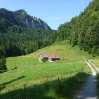
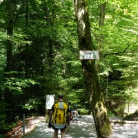
Vom nordwestlichen Ende der Rappenlochbrücke - bei der ersten Verzweigung rechts auf dem Forstweg bleiben - folgen wir etwa 45 Min. lang dem Forstweg bis zu Spätenbachalpe (etwa 2,3 km ab Rappenlochbrücke). Von der Alpe in Richtung OSO die Wiese am baumbestandenen Seitenbach entlang abwärts und an geeigneter Stelle vor der Verengung in den Bach abklettern. Siehe Wikiloc unter "Links".
Eine attraktive Alternative im Zustieg bietet der sog. Wassermannweg, siehe Fotos u. Video der Begehung vom 25.07.2014 sowie https://www.komoot.de/discover/Wassermanns-Weg/@47.3729840,9.7726890/tours?max_distance=30000&sport=hike&map=true&toursThroughHighlight=83147&focusedTour=8085240
From the northwestern exit of the Rappenloch bridge - stay on the forest road to the right at the first fork - follow the forest road for about 45 min. to Spätenbachalpe (about 2.3 km from Rappenloch bridge). From the alp in the direction of OSO downclimb the meadow along the tree-lined side stream and at a suitable point downclimb into the stream before the constriction. See Wikiloc under "Links".
An attractive alternative in the access offers the so-called Aquarius path, see photos and video of the ascent of 25.07.2014 and https://www.komoot.de/discover/Wassermanns-Weg/@47.3729840,9.7726890/tours?max_distance=30000&sport=hike&map=true&toursThroughHighlight=83147&focusedTour=8085240.
Giro (2 h 30):
traduzione alternativa
➜
Lingua originale
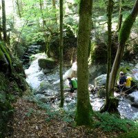
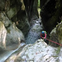
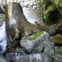
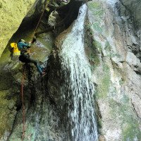
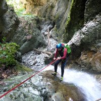
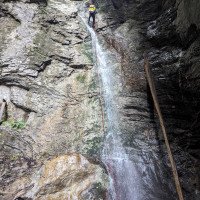
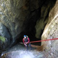
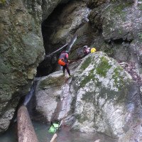
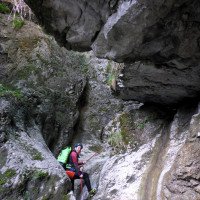
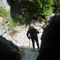
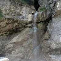
In der Engstelle der erste Abseiler in der relativ offenen Schlucht, dem dann noch 13 weitere folgen, bis hinunter in die Dornbirner Ach.
In the narrows, the first rappel in the relatively open canyon, followed by 13 more, down to the Dornbirner Ach.
Ritorno (15 min):
traduzione alternativa
➜
Lingua originale
Entweder die Ach durchqueren und am Gegenhang etwa 25 Höhenmeter hinauf zur Forststraße (wo ggf. das zweite Auto steht) und weiter durch die Alplochklamm zum Auto (Siehe Wikiloc unter "Links".
Alternativ in der Dornbirner Ach abwärts , später die Alplochklamm durchschwimmen und beim E-Werk Ebensand (an der Stauwurzel des Staufensees) rechts hinaus, am See auf dem der Zufahrtsstraße rechts entlang und später hinauf zum Auto jenseits der Rappenlochbrücke (1 Std. Dornbirner Ach mit Alplochklamm + 15 Min zur Rappenlochbrücke).
Either cross the Ach and on the opposite slope about 25 meters in altitude up to the forest road (where possibly the second car is) and continue through the Alplochklamm to the car (See Wikiloc under "Links".
Alternatively in the Dornbirner Ach downhill, later swim through the Alplochklamm and at the Ebensand power station (at the root of the Staufensee dam) out to the right, along the lake on the access road to the right and later up to the car beyond the Rappenlochbrücke (1 hour Dornbirner Ach with Alplochklamm + 15 min to the Rappenlochbrücke).
Coordinate:
Fine del canyon
47.3706°, 9.7722°
↓↑
DMS: 47° 22" 14.16', 9° 46" 19.92'
DM: 47° 22.236", 9° 46.332"
Google Maps
Austria Topografica
DMS: 47° 22" 14.16', 9° 46" 19.92'
DM: 47° 22.236", 9° 46.332"
Google Maps
Austria Topografica
Inizio del canyon
47.370862°, 9.768458°
↓↑
DMS: 47° 22" 15.1', 9° 46" 6.45'
DM: 47° 22.252", 9° 46.107"
Google Maps
Austria Topografica
DMS: 47° 22" 15.1', 9° 46" 6.45'
DM: 47° 22.252", 9° 46.107"
Google Maps
Austria Topografica
Parcheggio in uscita
47.3704°, 9.77295°
↓↑
DMS: 47° 22" 13.44', 9° 46" 22.62'
DM: 47° 22.224", 9° 46.377"
Google Maps
Austria Topografica
DMS: 47° 22" 13.44', 9° 46" 22.62'
DM: 47° 22.224", 9° 46.377"
Google Maps
Austria Topografica
Parcheggio all'entrata
47.3837°, 9.77914°
↓↑
DMS: 47° 23" 1.32', 9° 46" 44.9'
DM: 47° 23.022", 9° 46.748"
Google Maps
Austria Topografica
DMS: 47° 23" 1.32', 9° 46" 44.9'
DM: 47° 23.022", 9° 46.748"
Google Maps
Austria Topografica
Letteratura:
Mappa
1:50000
Mappa
1:25000
Mappa
Mappa
1:50000
Info sul canyon Cwiki
Info sul canyon Descente
Info sul canyon Ropewiki
Mappa
Info sul canyon Schlucht.ch
27.07.2024
Christoph Cramer
⭐
★★★★★
📖
★★★
⚓
★★★
💧
Basso
Completato ✔
traduzione alternativa
➜
Lingua originale
Stände in Ordnung, Pools flach.
Beaches in order, pools shallow.
13.08.2023
Bastien P.
⭐
★★★★★
📖
★★★
⚓
★★★
💧
Basso
Completato ✔
traduzione alternativa
➜
Lingua originale
Sehr Wenig bis kein Wasser ab der Wasserfassung (C20). Dadurch verliert die Schlucht an Attraktivität.
Beschreibung wird demnächst angepasst
Very little to no water from the water intake (C20). This makes the gorge less attractive.
Description will be adapted soon
13.08.2023
Daniel Sturm
⭐
★★★★★
📖
★★★
⚓
★★★
💧
Normale
Completato ✔
traduzione alternativa
➜
Lingua originale
Stände i.O. überwiegend Kettenstände. Die Wasserfassung ist aktuell voll offen entsprechend kein Wasser im unteren Teil. Beide Rutschen waren machbar.
Stands i.O. mainly chain stands. The water intake is currently fully open accordingly no water in the lower part. Both slides were doable.
23.07.2023
Wolfgang Streicher
⭐
★★★★★
📖
★★★
⚓
★★★
💧
Normale
Completato ✔
traduzione alternativa
➜
Lingua originale
Stände ok. Handlauf zum höchsten Abseiler erneuerungsbedürftig.
Letzter Abschnitt des Zustiegs nicht mehr über die Wiese unterhalb der Spätenbachalpe, sondern über die Wiese nördlich davon. Beim Wegweiser vor der Alpe links ab und über die Wise (Spur) hinunter, dann Seitenbach nach rechts queren und durch den Wald - Elektrozaun - hinunter zum Einstieg.
Falls Fußweg durch die Rappenlochschlucht, von der Dornbirner Ach direkt hinauf zur Straße.
Stands ok. Handrail to the highest rappel in need of renewal.
Last section of the approach no longer over the meadow below the Spätenbachalpe, but over the meadow north of it. At the signpost in front of the alp, turn left and descend via the Wise (track), then cross Seitenbach to the right and through the forest - electric fence - down to the entrance.
If footpath through the Rappenlochschlucht, from the Dornbirner Ach directly up to the road.
01.06.2023
Thorsten K.
⭐
★★★★★
📖
★★★
⚓
★★★
💧
Normale
Completato ✕
traduzione alternativa
➜
Lingua originale
Falscher Eintrag
Incorrect entry
09.03.2023
System User
⭐
★★★★★
📖
★★★
⚓
★★★
nessuna traduzione disponibile
Info: Teile der Canyonbeschreibung wurden automatisiert übernommen. Konkret die Felder Weblinks, Koordinaten, Rating, Länge des Canyon, Einfachseil Mindestens von https://www.descente-canyon.com/canyoning/canyon/22284
09.03.2023
System User
⭐
★★★★★
📖
★★★
⚓
★★★
nessuna traduzione disponibile
Daten importiert von https://canyon.carto.net/cwiki/bin/view/Canyons/SpaetenbachCanyon.html
Nuovo rapporto
Riportare brevemente e concisamente le informazioni più importanti dell'ultimo tour o importanti informazioni attuali sul canyon. Se necessario con link a video, foto, ecc..
*
*
*
Esc
Del
Idrologia:
nessuna traduzione disponibile
https://vowis.vorarlberg.at/stationsInfo/tbl_Abflussstationen.aspx
