un po' difficile
Rio de lis Cladis
v4 a2 IV
5h10
1h40
3h20
10min
950m
530m
420m
43m
2x50m
19
1100m
Valutazione:
★★★★★
2.1 (3)
Info:
★★★
2.5 (2)
Belay:
★★★
1.5 (2)
Sintesi:
traduzione alternativa
➜
Lingua originale
Steiler Abseilcanyon im Raccolana-Tal der 19 Abseilstellen, wenig Wasser und schöne Ausblicke auf den Cimone bietet.
Steep rappel canyon in the Raccolana Valley that offers 19 rappels, little water and beautiful views of the Cimone.
Sintesi:
traduzione alternativa
➜
Lingua originale
Steiler Abseilcanyon im Raccolana-Tal der 19 Abseilstellen, wenig Wasser und schöne Ausblicke auf den Cimone bietet.
Steep rappel canyon in the Raccolana Valley that offers 19 rappels, little water and beautiful views of the Cimone.
Accesso:
traduzione alternativa
➜
Lingua originale
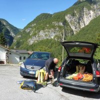
Von Chiusaforte kommend ins Raccolana Tal Richtung Sella Nevea fahren. Dem Wegweiser nach Pezzeit folgen - knapp vor Ende der Straße Parkmöglichkeit links (GPS 46' 24' 0.38 - 13' 21' 23.64).
Coming from Chiusaforte, enter the Raccolana valley in the direction of Sella Nevea. Follow the sign for Pezzeit - just before the exit of the road parking on the left (GPS 46' 24' 0.38 - 13' 21' 23.64).
Avvicinamento (1 h 40):
traduzione alternativa
➜
Lingua originale
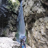
Bei einem weißen Wegweiser bergwärts über Wiesen dem Weg 633 folgen (anfangs nur sehr undeutliche Spuren). Bei einem Marienbildnis überquert man einen Bachlauf und steigt zunächst Richtung Westen auf. Nach einer Linkskurve führt der Steig bald in die Schlucht des Rio de lis Cladis. Nach etwa 40min überquert man den Bach - Einstiegsmöglichkeit falls nur der untere Teil gegangen werden soll. \nWeiter steil und stellenweise mit Drahtseilen versichert über einen Schrofensporn hinauf bevor der Weg in einen weniger steilen Buchenwald führt. Nach der zweiten Verflachung auf etwa 960m Seehöhe (GPS 46.393583N, 13.362433) steigt man weglos über steilen Wald rechts in die Schlucht ab.\nDie erste Abseilstelle befindet sich nach einem Wasserfall auf der linken Schluchtseite (GPS 46' 23' 34.93 - 13' 21' 41.43).
At a white signpost, follow trail 633 uphill across meadows (initially only very indistinct tracks). At a statue of the Virgin Mary, cross a stream and climb initially in a westerly direction. After a left turn, the path soon leads into the canyon of Rio de lis Cladis. After about 40 minutes you cross the stream - entry point if you want to go only the lower part. \nFurther steep and in places secured with wire ropes up a crag before the path leads into a less steep beech forest. After the second flattening at about 960m above sea level (GPS 46.393583N, 13.362433) you descend without a path over steep forest to the right into the canyon.\nThe first rappel point is after a waterfall on the left side of the canyon (GPS 46' 23' 34.93 - 13' 21' 41.43).
Giro (3 h 20):
traduzione alternativa
➜
Lingua originale
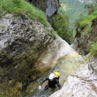
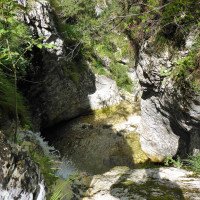
5 Meter abseilen und auf die andere Seite der Schlucht queren wo sich der nächste Abseilpunkt (14m) befindet. Bis zur Kreuzung mit dem Wanderweg folgen noch 7 Abseilstellen bis 20m (Kettenstände). Nach der Wegkreuzung werden die Abseilstellen höher und die Sicherungen schlechter (je 2 Expansionshaken).\nAbseilreihenfolge: 10m, 6m, 25m, 20m, 5m, 33m, 10m. Ein steinschlaggefährdeter 35m Abseiler bringt uns zur Mündung eines Nebenbachs (Bachname ab hier Rio Impresis). Im Rio Impresis gehts noch über einen schönen 43m Wasserfall in die Tiefe bevor ein letzter 5m Abseiler folgt. Nach kurzer Blockhüpferei über Riesenkiesel links über einen Steig aussteigen.
Rppel 5 meters and cross to the other side of the canyon where the next anchor (14m) is located. Until the intersection with the hiking trail there are 7 more rappels up to 20m (chain anchors). After the crossing with the path, the rappels become higher and the belays worse (2 expansion hooks each).\nRespel sequence: 10m, 6m, 25m, 20m, 5m, 33m, 10m. A 35m rappel with a high risk of falling rocks brings us to the mouth of a side stream (from here on the stream is called Rio Impresis). In Rio Impresis we go over a beautiful 43m waterfall into the depths before a last 5m rappel follows. After a short boulder hopping over giant pebbles, get off on the left via a path.
Ritorno (10 min):
traduzione alternativa
➜
Lingua originale
Über den Steig zurück Richtung Weg 633 den man bei dem Marienbildnis erreicht.
Take the path back towards path 633, which you reach at the statue of the Virgin Mary.
Coordinate:
Inizio del canyon
Parcheggio Entrata e uscita
Pezzeit
Fine del canyon
Punto di passaggio
46.393582°, 13.362433°
↓↑
DMS: 46° 23" 36.9', 13° 21" 44.76'
DM: 46° 23.615", 13° 21.746"
Google Maps
DMS: 46° 23" 36.9', 13° 21" 44.76'
DM: 46° 23.615", 13° 21.746"
Google Maps
Wanderweg verlassen weglos rechts runter in die Schlucht
Letteratura:
Mappa
IGMI 25/V - 14 Monte Canin II-SE, 1:25 000
Mappa
Tabacco Nr. 18; Alpi Carniche Orientali - Canal del Ferro; 1/25 000
Libro Canyoning
Canyoning Alpi Giulie
Franco Longo
2011
Italia: Zemola inf., Vinadia, Chiantone, Picchions,Lumiei, Novarza, Frondizzon,Leale inf., Pissanda,
Favarinis, Lavarie,Chiampeit, Stivane, Nero, Alba, Tralba inf.,Simon inf., Cuestis, Belepeit, Mulin,
Brussine, Patoc, Rivis, Costa Stretta, Sbrici, Lis Cladis, Malinberg, Pliz, Torto, Trincea
Slovenia: Predelica, Fratarica, Susec, Kozjak, Brus-Rocica, Smast, Sopotnica, Jerecica, Gremecica
(kein Inhalts- oder Stichwortverzeichnis, keine Seitenangaben)
Info sul canyon Cwiki
Info sul canyon Ropewiki
AIC Catasto
Altro info sul canyon
Altro info sul canyon
06.05.2024
Rick Paapy
⭐
★★★★★
📖
★★★
⚓
★★★
💧
Basso
Completato ✔
nessuna traduzione disponibile
Altri utenti sono stati: Pavel Urbanek
We did whole canyon needs more water to be fun. Checked all anchors and changed all the ropes in the lower part.
Altri utenti sono stati: Pavel Urbanek
02.04.2023
Horst Lambauer
⭐
★★★★★
📖
★★★
⚓
★★★
💧
Basso
Completato ✔
traduzione alternativa
➜
Lingua originale
Haben wie wir in die Schlucht gekommen sind keinen Haken gefunden und einen Ring or. re gesetzt. Der obere Teil hat sehr gute Stände (innox Kettenstände) unterer Teil hat teilweise alte Seile drin. Seilreststücke und Borset mitnehmen!
Have as we came into the gorge have not found a hook and set a ring or. re. The upper part has very good stands (innox chain stands) lower part has partly old ropes in it. Rope remnants and Borset take with you!
09.03.2023
System User
⭐
★★★★★
📖
★★★
⚓
★★★
nessuna traduzione disponibile
Daten importiert von https://canyon.carto.net/cwiki/bin/view/Canyons/RiodelisCladisCanyon.html
Idrologia:


