v2 a3 II
2h35
0min
2h30
5min
860m
670m
190m
15m
1x30m (2x15m)
8
1100m
Auto facoltativa
Valutazione:
★★★★★
3.3 (7)
Info:
★★★
2.6 (5)
Belay:
★★★
2.2 (6)
Sintesi:
traduzione alternativa
➜
Lingua originale
großes Einzugsgebiet; Notausstiege wenig und schwierig; kaltes, klares Wasser; viele Abkletterpassagen in verblockten Gelände; einige Sprungmöglichkeiten; gute Standplätze an den wichtigsten Stellen/Stufen; mehrere Durchstiegslöcher; Granitschlucht;
Info Kraftwerkspülung 052858127 (in der Regel kein Spülung untertags, da stark kommerziell begangen);
Large catchment area; emergency exits few and difficult; cold, clear water; many downclimbs in blocked terrain; some possible jumps; good footholds at key points/steps; several manholes; granite gorge;
Info power station flushing 052858127 (usually no flushing during the day, as heavily commercialized);
giugno - ottobre
12-16 Ore
Nord
Granito
Sintesi:
traduzione alternativa
➜
Lingua originale
großes Einzugsgebiet; Notausstiege wenig und schwierig; kaltes, klares Wasser; viele Abkletterpassagen in verblockten Gelände; einige Sprungmöglichkeiten; gute Standplätze an den wichtigsten Stellen/Stufen; mehrere Durchstiegslöcher; Granitschlucht;
Info Kraftwerkspülung 052858127 (in der Regel kein Spülung untertags, da stark kommerziell begangen);
Large catchment area; emergency exits few and difficult; cold, clear water; many downclimbs in blocked terrain; some possible jumps; good footholds at key points/steps; several manholes; granite gorge;
Info power station flushing 052858127 (usually no flushing during the day, as heavily commercialized);
Accesso:
traduzione alternativa
➜
Lingua originale
Von der Intal-Autobahn A12 bei Wiesing (Ausfahrt 39) abfahren und die lange Bundestraße ins Zillertal in Richtung Mayrhofen fahren. Von der Umfahrungsstraße Mayrhofen (im Zillertal) links Richtung Ginzling abbiegen. Durch die Ortschaft Finkenberg fahren und am Ortsende Tafel gleich links die Straße Richtung Forellenhof Linde hinunter. Hier kann ein Rad abgestellt werden (PKW von Wirtshausbetreiber nicht erwünscht!). Mit dem PKW fährt man zurück zur Hauptstraße und weiter hinauf. Bei der Brücke (Km 35) Gibt es eine kleine Parknische (max. 2 Autos). Da die Schlucht sehr stark von Canyoning- und Badegästen frequentiert wird, muss damit gerechnet werden, dass die wenigen Parkmöglichkeiten entlang der Schlucht besetzt sind. Unsere Empfehlung ist daher ein Überstellungsfahrzeug oder Bike am großen Schotterparkplatz (in Finkenberg) vor der Brücke/E-Werk zu parken und die Schlucht komplett durchzuwandern. Sollte man das Glück haben einen Parkplatz neben der Schlucht zu finden kann schon vorher aus der Schlucht ausgestiegen werden (siehe Ausstiegsmöglichkeit 2).
Leave the A12 Intal freeway at Wiesing (exit 39) and take the long federal road into the Zillertal valley in the direction of Mayrhofen. From the Mayrhofen bypass (in the Zillertal) turn left towards Ginzling. Drive through the village of Finkenberg and at the end of the village Tafel immediately left down the road towards Forellenhof Linde. Here you can park a bike (car not desired by innkeeper!). By car, return to the main road and continue uphill. At the bridge (Km 35) there is a small parking niche (max. 2 cars). Since the canyon is very much frequented by canyoning and bathing guests, it must be expected that the few parking spaces along the canyon are occupied. Our recommendation is therefore to park a shuttle car or bike at the large gravel parking place (in Finkenberg) in front of the bridge/plant and hike the canyon completely. If you are lucky enough to find a parking lot next to the canyon, you can get out of the canyon beforehand (see exit option 2).
Avvicinamento (0 min):
traduzione alternativa
➜
Lingua originale
Kurz oberhalb der Steinbrücke beim oberen Ende des Harpfnerwandtunnels einsteigen. (unterhalb vom Schrägwehr)
Enter just above the stone bridge at the upper exit of the Harpfnerwand tunnel. (below the inclined weir)
Giro (2 h 30):
traduzione alternativa
➜
Lingua originale
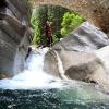
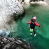
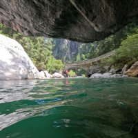
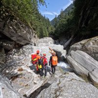
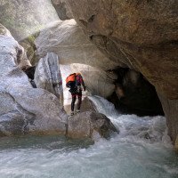
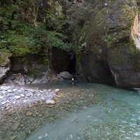
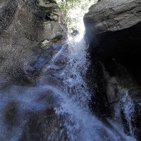
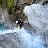
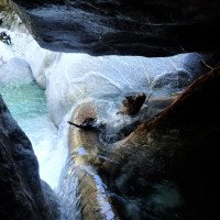
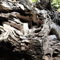
Die Zemmschlucht ist ein schöner aquatischer Wander- und Schwimmcanyon im Granitgestein. Fast alle Stufen können abgeklettert oder abgeseilt bzw. gerutscht oder gesprungen werden. Die relativ einfache Schlucht zieht viel Canyoning-Anfänger und Badegäste an. An manchen heißen Wochenendtagen kann es daher auch schon mal vorkommen das man sich an den Abkletterstellen/Abseilstufen anstellen muss. Im gesamten ist die Zemmschlucht einen Halbtagesausflug auf jeden Fall wert. Seit 2021 ist der Wasserdurchsatz (von riesigen Pumpspeicher-Kraftwerken reguliert) ca. doppelt so groß als früher, aber stellt kein Problem dar, da man nie direkt im Wasserstrahl abseilen muss. Wenn man Sonne in der Schlucht haben will, sollte man am besten zur Mittagszeit einsteigen!
The Zemm Gorge is a beautiful aquatic hike and swim canyon in granite rock. Almost all steps can be downclimbed or rappelled or slid or jumped. The relatively easy canyon attracts a lot of novice canyoneers and swimmers. On some hot weekend days it can happen that you have to queue at the downclimb/abseil steps. In general, the Zemmschlucht is worth a half-day trip in any case. Since 2021, the water flow (regulated by huge pumped-storage power plants) is about double what it used to be, but doesn't pose a problem because you never have to rappel directly in the water stream. If you want sun in the canyon, it's best to get in at lunchtime!
Ritorno (5 min):
traduzione alternativa
➜
Lingua originale
Entweder man geht die ganze Schlucht durch und steigt links vor dem Elektrizitätswerk aus (Parkmöglichkeit bei der der Hauptstraße/Schotterparkplatz vor der Brücke) oder man steigt bei einem Zufluss von links aus, wo sich die Schlucht öffnet und folgt den Weg bis zur Straße hinauf. Die kommerziellen Gruppen steigen über einen steilen Weg durch den Wald direkt zur Rechtskurve bei der Canyoning-Anbieter-Hütte aus (schwieriger zu finden).
Either go all the way through the canyon and get off on the left before the power plant (parking at the main road/gravel parking place before the bridge) or get off at a tributary from the left where the canyon opens and follow the path up to the road. Commercial groups exit via a steep path through the forest directly to the right turn at the canyoneering provider's hut (more difficult to find).
Coordinate:
Inizio del canyon
47.1366°, 11.8211°
↓↑
DMS: 47° 8" 11.76', 11° 49" 15.96'
DM: 47° 8.196", 11° 49.266"
Google Maps
Austria Topografica
DMS: 47° 8" 11.76', 11° 49" 15.96'
DM: 47° 8.196", 11° 49.266"
Google Maps
Austria Topografica
(descente_1)
Fine del canyon
47.146°, 11.8295°
↓↑
DMS: 47° 8" 45.6', 11° 49" 46.2'
DM: 47° 8.76", 11° 49.77"
Google Maps
Austria Topografica
DMS: 47° 8" 45.6', 11° 49" 46.2'
DM: 47° 8.76", 11° 49.77"
Google Maps
Austria Topografica
(descente_2)
Fine del canyon alternativo
47.1538°, 11.8363°
↓↑
DMS: 47° 9" 13.68', 11° 50" 10.68'
DM: 47° 9.228", 11° 50.178"
Google Maps
Austria Topografica
DMS: 47° 9" 13.68', 11° 50" 10.68'
DM: 47° 9.228", 11° 50.178"
Google Maps
Austria Topografica
(descente_4)
Letteratura:
Libro Canyoning
Werner Baumgarten
2013
Libro Canyoning
Werner Baumgarten
2010
Libro Canyoning
Alexander Riml / Gunnar Amor
2012
Info sul canyon ACA
Info sul canyon Cwiki
Info sul canyon Descente
Altro info sul canyon
Info sul canyon Ropewiki
11.09.2024
www.verdon.de
⭐
★★★★★
📖
★★★
⚓
★★★
🌊
Folle
Completato ✔
nessuna traduzione disponibile
Automatisch importiert von Descente-Canyon.com für Canyon Zemmschlucht
Tout d'abord, une remarque : ceux qui ont noté ce canyon 4,0 ont soit fait une erreur de frappe, soit sont des entreprises de canyoning locaux qui veulent pousser leur tour ou region.Nous avons descendu l'intégralité de ce que l'on appelle le canyon, en fait c'est un large lit de rivière avec de gros blocs qui forment ici et là une cascade et à d'autres endroits des syphons dangereux. Dans l'ensemble, il n'y a que peu de rappels de faible hauteur et, du point de vue de la technique du canyon, on est peu sollicité. Il faut faire preuve de beaucoup de prudence en raison du fort courant. Les points positifs sont une roche très belle et extrêmement adhérente et une eau d'une propreté éclatante et d'une couleur superbe.
(Quelle: https://www.descente-canyon.com/canyoning/canyon-debit/22380/observations.html)
11.09.2024
Casa Vento Madeira
⭐
★★★★★
📖
★★★
⚓
★★★
💧
Alto
Completato ✔
traduzione alternativa
➜
Lingua originale
Wir sind den gesamten sogenannten Canyon hinabgestiegen, der eigentlich ein breites Flussbett mit großen Blöcken ist, die hier und da einen Wasserfall und an anderen Stellen gefährliche Syphone bilden. Insgesamt gibt es nur wenige Abseilstellen mit geringer Höhe, und canyontechnisch wird man kaum gefordert. Aufgrund der starken Strömung muss man sehr vorsichtig sein. Positiv zu bermerken sind ein sehr schöner, extrem griffiger Fels und ein blitzsauberes Wasser mit einer tollen Farbe.
We descended the entire so-called canyon, which is actually a wide river bed with large boulders that form a waterfall here and there and dangerous syphons in other places. Overall, there are only a few abseiling points with little height, and there are hardly any technical challenges in the canyon. You have to be very careful due to the strong current. On a positive note, the rock is very nice and extremely grippy and the water is sparkling clean and a great color.
30.08.2024
GeorgB
⭐
★★★★★
📖
★★★
⚓
★★★
💧
Normale
Completato ✔
traduzione alternativa
➜
Lingua originale
Bis ganz unten gegangen. Die kommerziellen Touren steigen vor bzw unmittelbar nach dem 15m Wasserfall mit markanten Seilgeländer aus. Unmittelbar davor versteckt sich der schönste Sprung der Klamm. Rechts über Drahtseil und Klammern auf die Oberseite der Blöcke und dann 8m in ein tiefes Becken. Der schönste Abseiler ist im unteren Teil, der neben zwei recht hohen Sprungmöglichkeiten leider auch viele Abkletterpassagen beinhaltet.
Walked all the way down. The commercial tours exit before or immediately after the 15m waterfall with its striking rope traverse. The most beautiful jump in the gorge is hidden directly in front of it. To the right over wire rope and gorges to the top of the boulders and then 8m into a deep pool. The most beautiful rappel is in the lower part, which unfortunately also contains many downclimbs in addition to two quite high possible jumps.
29.08.2024
tieske
⭐
★★★★★
📖
★★★
⚓
★★★
💧
Alto
Completato ✔
nessuna traduzione disponibile
Automatisch importiert von Descente-Canyon.com für Canyon Zemmschlucht
from the bridge to the point where groups exit(400m before the bridge) its beautiful, but you have to like climbing rocks.
(Quelle: https://www.descente-canyon.com/canyoning/canyon-debit/22380/observations.html)
23.08.2024
Elke Osswald
⭐
★★★★★
📖
★★★
⚓
★★★
💧
Normale
Completato ✔
traduzione alternativa
➜
Lingua originale
Altri utenti sono stati: Michael Wenzel
Ca 400 m vor der Zemmbachbrücke ist rechts von Mayrhofen kommend eine gute Parkmöglichkeit. Von da ca 5 Minuten zu Fuss der Straße entlang zum Einstieg.
Approx. 400 m before the Zemmbach bridge there is a good parking area on the right coming from Mayrhofen. From there it is a 5-minute walk along the road to the entry point.
Altri utenti sono stati: Michael Wenzel
11.08.2024
xarri_off
⭐
★★★★★
📖
★★★
⚓
★★★
💧
Normale
Completato ✔
nessuna traduzione disponibile
Automatisch importiert von Descente-Canyon.com für Canyon Zemmschlucht
(Quelle: https://www.descente-canyon.com/canyoning/canyon-debit/22380/observations.html)
25.06.2024
Der Insel Affe
⭐
★★★★★
📖
★★★
⚓
★★★
💧
Alto
Completato ✔
traduzione alternativa
➜
Lingua originale
!!!Bei höhe Wasser (vl auch sonst) muss unbedingt aufgepasst auf Siphons!!!
Obere Teil relative geil, kristal klares Wasser, ein paar kurze Abseile sowie Sprung und Rutsche, gute Sicherung.
Sind ganz bis Kraftwerk gegangen... untere Teil ist eher ein Blockkletterei über Felsen, schlecht gesichert. Teilweise alte Haken auf abgebrochene Steine scheint viele neue Felsbruch.
Youtube: @DerInselAffeCanyoning Video kommt bald
!!!At high water (vl also otherwise) you have to watch out for siphons!!!!
Upper part relatively cool, crystal clear water, a few short rappels as well as jump and slide, good protection.
We went all the way to the power station... The lower part is more of a block climb over rocks, poorly secured. Partly old anchors on broken rocks seems to be many new broken rocks.
Youtube: @DerInselAffeCanyoning Video coming soon
15.06.2024
Martina
⭐
★★★★★
📖
★★★
⚓
★★★
💧
Alto
Completato ✔
nessuna traduzione disponibile
Automatisch importiert von Descente-Canyon.com für Canyon Zemmschlucht
It is better to go to this canyon when it is warm and sunny.We had higher water flow so we stopped before the canyon started to narrow and exited the canyon where the agencies ended.
(Quelle: https://www.descente-canyon.com/canyoning/canyon-debit/22380/observations.html)
24.08.2023
Patrick Summerer
⭐
★★★★★
📖
★★★
⚓
★★★
💧
Normale
Completato ✔
traduzione alternativa
➜
Lingua originale
Haben bei Parkplätze in der Rechtskurve unterhalb des Canyoninganbieters geparkt, von da kommt man in 20min der Straße nach zur Brücke beim Einstieg.
Den Ausstieg, den die kommerziellen Gruppen nutzen, der steil nach oben direkt zur Kurve führt, haben wir nicht gefunden. Viel mehr Wasserdurchsatz als vor ein paar Jahren durch EU-Verordnung, aber keine Abseilstelle ist direkt im Wasser.
Have parked at parking spaces in the right bend below the canyoning provider, from there you come in 20min of the road to the bridge at the entrance.
The exit that the commercial groups use, which leads steeply up directly to the bend, we have not found. Much more water flow than a few years ago by EU regulation, but no rappel point is directly in the water.
14.08.2023
Pat fritz
⭐
★★★★★
📖
★★★
⚓
★★★
💧
Normale
Completato ✔
traduzione alternativa
➜
Lingua originale
Oberste teil ist sehr schön. Unterste teil ist absolut nicht Empfehlenswert, viel abklettern und richtigen Weg/Stände sucherei.
Upper part is very nice. Lower part is absolutely not recommendable, a lot of climbing and searching for the right way/stalls.
09.03.2023
System User
⭐
★★★★★
📖
★★★
⚓
★★★
nessuna traduzione disponibile
Info: Teile der Canyonbeschreibung wurden automatisiert übernommen. Konkret die Felder Weblinks, Koordinaten, Rating, Ort, Länge des Canyon, Einfachseil Mindestens von https://canyon.carto.net/cwiki/bin/view/Canyons/ZemmschluchtCanyon.html und https://www.descente-canyon.com/canyoning/canyon/22380
09.03.2023
System User
⭐
★★★★★
📖
★★★
⚓
★★★
nessuna traduzione disponibile
Daten importiert von https://www.canyoning.or.at/index.php/liste-aller-canyons/510-zemmschlucht
Nuovo rapporto
Riportare brevemente e concisamente le informazioni più importanti dell'ultimo tour o importanti informazioni attuali sul canyon. Se necessario con link a video, foto, ecc..
*
*
*
Esc
Del
Idrologia:
