un po' difficile
Castiglione
v4 a3 III
2h50
10min
2h30
10min
330m
170m
160m
33m
2x 35m
8
1500m
a piedi
Valutazione:
★★★★★
2.8 (2)
Info:
★★★
0 ()
Belay:
★★★
0 ()
Sintesi:
traduzione alternativa
➜
Lingua originale
Abseilcanyon mit ganzjährigem Wasserdurchsatz
Rappel canyon with water flow all year round
Nord-Est
Calcare
Sintesi:
traduzione alternativa
➜
Lingua originale
Abseilcanyon mit ganzjährigem Wasserdurchsatz
Rappel canyon with water flow all year round
Accesso:
traduzione alternativa
➜
Lingua originale
Wir verlassen die A 3 (Neapel - Reggio di Calabria) an der Ausfahrt Mormanno/Scalea und nehmen die N 504 in südwestlicher Richtung (Papasidero, Scalea). Nach 17 km erreichen wir Papasidero im Lao-Tal. Etwa 400 m vor Papasidero biegen wir in einer scharfen Rechtskurve links ab (Wegweiser: 'C. da Vitimoso') auf ein enges Sträßchen und kommen nach etwa 1 km zu einer Brücke, wo wir das untere Fahrzeug abstellen.Mit dem zweiten Fahrzeug geht es weiter in Serpentinen etwa 900 m bergauf.
Bei einem Betonklotz mit Wasserhahn biegen wir rechts ab und fahren die Piste noch 1100 m bis zu einem Haus auf der linken Seite. Hier das zweite Fahrzeug abstellen.
We leave the A 3 (Naples - Reggio di Calabria) at the Mormanno/Scalea exit and take the N 504 in a southwesterly direction (Papasidero, Scalea). After 17 km we reach Papasidero in the Lao Valley. About 400 m before Papasidero we turn left in a sharp right turn (sign: 'C. da Vitimoso') on a narrow road and after about 1 km we come to a bridge where we park the lower vehicle.With the second vehicle we continue in serpentines about 900 m uphill.\n\At a concrete block with a water tap we turn right and drive the slope for another 1100 m to a house on the left. Park the second vehicle here.
Avvicinamento (10 min):
traduzione alternativa
➜
Lingua originale
Vor dem Haus führt links in südlicher Richtung ein Pfad zuerst leicht bergauf, dann hinunter zu einer Brücke über den Castiglione. Um den schönen ersten Wasserfall 'mit zu nehmen', macht es Sinn, nicht von der Brücke hinein zu seilen, sondern dem Weg noch etwa 50 m weiter zu folgen, um dann in den Bach hinein zu queren.
In front of the house, a path leads to the left in a southerly direction, first slightly uphill, then down to a bridge over the Castiglione. In order to 'take in' the beautiful first waterfall, it makes sense not to rope in from the bridge, but to follow the path for another 50 m or so, and then cross into the stream.
Giro (2 h 30):
traduzione alternativa
➜
Lingua originale
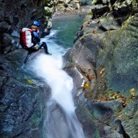
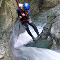
Attraktiver Canyon, teilweise eng, mit einer luxuriösen Seilrolle zur Seilschonung am abschließenden 33-m-Abseiler.
Attractive canyon, narrow in places, with a luxurious pulley to protect the rope on the final 33 m rappel.
Ritorno (10 min):
traduzione alternativa
➜
Lingua originale
Nach dem 33-m-Wasserfall im Bachbett abwärts, später dann am orogrf. linken Ufer des von rechts kommenden Baches aufwärts bis zum Picknickplatz an der Straßenbrücke.
After the 33 m waterfall in the streambed down, then later on the orogrf. left bank of the stream coming from the right up to the picnic area at the road bridge.
Coordinate:
Inizio del canyon
Fine del canyon
Parcheggio all'entrata
(descente_3)
Parcheggio in uscita
(descente_4)
Letteratura:
Mappa
IGMI 25/V - 220 Papasidero I-SE, 1:25 000
Libro Canyoning
Le tour de l´Europe en Canyon. T2 - Ligurie, Italia centrale et du sud, Sicile, Sardaigne, Balkans....
Stéphane Coté / Caracal et les Sancho Panza
2009
Info sul canyon Cwiki
Info sul canyon Descente
Info sul canyon Ropewiki
Altro info sul canyon
09.03.2023
System User
⭐
★★★★★
📖
★★★
⚓
★★★
nessuna traduzione disponibile
Info: Teile der Canyonbeschreibung wurden automatisiert übernommen. Konkret die Felder Weblinks, Koordinaten, Rating, Länge des Canyon, Einfachseil Mindestens von https://www.descente-canyon.com/canyoning/canyon/21996
09.03.2023
System User
⭐
★★★★★
📖
★★★
⚓
★★★
nessuna traduzione disponibile
Daten importiert von https://canyon.carto.net/cwiki/bin/view/Canyons/CastiglioneCanyon.html
Idrologia:


