difficile
Charabotte
v5 a2 II
3h
10min
2h30
20min
710m
540m
170m
70m
2x60m
5
150m
Auto necessaria
Valutazione:
★★★★★
2.1 (2)
Info:
★★★
0 ()
Belay:
★★★
0 ()
Sintesi:
traduzione alternativa
➜
Lingua originale
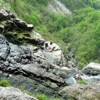
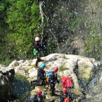
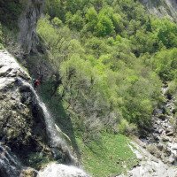
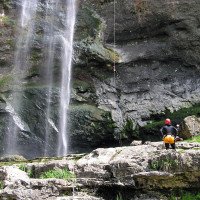
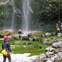
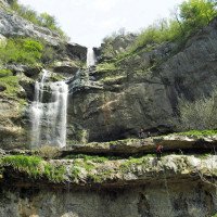
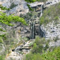
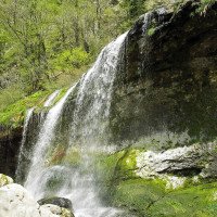
Wasserfall-Abseilcanyon, oberhalb des Zustiegs Kläranlage.
Waterfall rappel canyon
Sud-Ovest
Sintesi:
traduzione alternativa
➜
Lingua originale
Wasserfall-Abseilcanyon, oberhalb des Zustiegs Kläranlage.
Waterfall rappel canyon
Accesso:
traduzione alternativa
➜
Lingua originale
Nach der Umfahrung von Genf auf der Schweizer N 1 nach der Landesgrenze auf der A 40 in Richtung Lyon, Dijon, Paris, Nach 25 km (ab Grenze)die Abfahrt 11 (Bellegarde Center) nehmen in Richtung Fragny, Seyssel. 6 km weiter am Ortsausgang von Mons rechts ab auf die D 992 und durch Seyssel und Culoz (weitere 23 km), wo man auf der D 904 (Richtung Bourg-en-Bresse) zusätzliche 8,5 km weiterfährt bis Artemare (insgesamt 62 km ab Grenze).\nWir fahren weitere 9 km auf der N 04 und stoßen dann auf die N 54, der wir (rechts) in Richtung Amberieu-le-Bugey folgen. 17 km weiter biegen wir rechts ab nach Tenay. Hier folgen wir einige Kilometer der D 21 in östlicher Richtung, um dann auf die D 53 nach Chaley abzubiegen. Durch Chaley weiter am orograf. re. Ufer der Albarine aufwärts kommen wir zum Weiler Charabotte. Weiter geht es auf einer kleinen Straße den Fluss entlang, bis diese ihn schließlich überquert. Vor der Brücke links auf der großen Fläche das untere Fahrzeug abstellen.\nMit dem anderen Auto zurück, bis wir am Ortseingang von Chaley links abbiegen. Nach wenigen hundert Metern stoßen wir wieder auf die von Tenay kommende D 21. Links, in Richtung Hauteville-Lompness geht es aufwärts. Wo sich die Straße bei Erreichen der Höhe durch den Bergriegel gefressen hat - Belvedere -, unmittelbar danach in der Rechtskurve das zweite Fahrzeug abstellen.
After bypassing Geneva on the Swiss N 1 after the border on the A 40 in the direction of Lyon, Dijon, Paris, After 25 km (from the border)take exit 11 (Bellegarde Center) in the direction of Fragny, Seyssel. 6 km further, at the exit of Mons, turn right on the D 992 and go through Seyssel and Culoz (another 23 km), where you continue on the D 904 (direction Bourg-en-Bresse) for an additional 8.5 km until Artemare (a total of 62 km from the border).\nWe continue on the N 04 for another 9 km and then join the N 54, which we follow (on the right) in the direction of Amberieu-le-Bugey. 17 km further on we turn right to Tenay. Here we follow the D 21 in an easterly direction for a few kilometers and then turn onto the D 53 to Chaley. Through Chaley further up the orographic right bank of the Albarine we come to the hamlet of Charabotte. Continue on a small road along the river until it finally crosses it. Before the bridge, park the lower car on the left in the large area.\nBack with the other car until we turn left at the entrance of Chaley. After a few hundred meters, we rejoin the D 21 coming from Tenay.\nTo the left, in the direction of Hauteville-Lompness, we go up. Where the road has eaten through the mountain bar when reaching the height - Belvedere -, immediately after, in the bend to the right, park the second car.
Avvicinamento (10 min):
traduzione alternativa
➜
Lingua originale
Von der Straßenkurve in nördlicher Richtung auf Wegen zur Albarine und dem Einstieg.
From the road bend in a northerly direction on paths to the albarine and the entry.
Giro (2 h 30):
traduzione alternativa
➜
Lingua originale
Wegen Abwassereinleitung aus der oberhalb des Einstiegs gelegenen Kläranlage wird die Abfolge hoher Wasserfälle relativ selten begangen.\nVor die Straße durch den Bergriegel stößt, zieht ein Pfad links (nordwärts) hinunter zum Wasserfall bis unter die erste Kaskade (evtl. auch Not-Ausstieg)\nGut zu kombinieren mit dem nahen Canyon de Chaley.
Due to wastewater discharge from the sewage treatment plant located above the entry, the sequence of high waterfalls is relatively rarely walked.\nBefore the road pushes through the mountain bar, a path on the left (northward) descends to the waterfall to below the first cascade (possibly also emergency exit)\nGood to combine with the nearby Canyon de Chaley.
Ritorno (20 min):
traduzione alternativa
➜
Lingua originale
Nach dem letzten Abseiler und einem kurzen Stück im Flussbett rechts hinaus auf einen Pfad und auf diesem zum unteren Fahrzeug.
After the last rappel and a short stretch in the riverbed, turn right onto a path and follow it to the lower vehicle.
Coordinate:
Inizio del canyon
Fine del canyon
Parcheggio all'entrata
Parcheggio in uscita
Letteratura:
Mappa
3231 OT, Ambérieu-en-Bugey, 1:25 000
Mappa
IGN TOP25 3230 OT, Nantua - Hauteville-Lompnes/Nord Bugey, 1:25 000
Mappa
IGN Série Orange 3229, Nantua, 1:50 000
Libro Canyoning
Canyons et cascades de l'Ain. Groupe Speleo Hauteville-Lompnes, B. Hugon, D. Gritti, P. Flochon, 2002
2002
Info sul canyon Cwiki
Info sul canyon Descente
Info sul canyon Ropewiki
Gallería
Info sul canyon FFME
21.06.2024
BAB adventure
⭐
★★★★★
📖
★★★
⚓
★★★
💧
Normale
Completato ✔
nessuna traduzione disponibile
Automatisch importiert von Descente-Canyon.com für Canyon Charabotte
RAS si ce n’est qu’il faut bien choisir sa ligne (RD/RG) pour ne pas avoir de problème d’accès, car il y a des points / relais partout.
(Quelle: https://www.descente-canyon.com/canyoning/canyon-debit/2170/observations.html)
11.05.2024
Jo M
⭐
★★★★★
📖
★★★
⚓
★★★
💧
Normale
Completato ✔
nessuna traduzione disponibile
Automatisch importiert von Descente-Canyon.com für Canyon Charabotte
Garé au moulin de charabotte, montée par les tunnels du train fantôme. Descente rive gauche en suivant le topo canyon de canyoning-bugey.fr. Rééquipement propre de ce début d'année. Pas trouvé le relai du 1er rappel de 25m. 4h du départ au retour à la voiture.
(Quelle: https://www.descente-canyon.com/canyoning/canyon-debit/2170/observations.html)
09.03.2023
System User
⭐
★★★★★
📖
★★★
⚓
★★★
nessuna traduzione disponibile
Info: Teile der Canyonbeschreibung wurden automatisiert übernommen. Konkret die Felder Weblinks, Koordinaten, Rating, Länge des Canyon, Einfachseil Mindestens von https://www.descente-canyon.com/canyoning/canyon/2170
09.03.2023
System User
⭐
★★★★★
📖
★★★
⚓
★★★
nessuna traduzione disponibile
Daten importiert von https://canyon.carto.net/cwiki/bin/view/Canyons/CharabotteCanyon.html
Idrologia:
