Paese:
Slovenija / Slovenia
Regione: Zahodna Slovenija / Western Slovenia
Sottoregione: Goriška / Gorizia Statistical Region
Città: Zaga
v2 a2 II
2h30
30min
2h
0min
480m
370m
110m
25m
2x30m (1x40m/1x20m)
6
1000m
a piedi
Valutazione:
★★★★★
3.5 (6)
Info:
★★★
3 (4)
Belay:
★★★
3 (4)
Sintesi:
traduzione alternativa
➜
Lingua originale
Kurze aber sehr schöne Schlucht; sauberes Wasser; Kalkgestein; leider sehr viel begangen; fast im ganzen Verlauf Notausstiege; kurzer Zustieg; 18m Rutsche (?); eher offene Schlucht; gute Alternative wenn andere Schluchten zu viel Wasser führen.
Short but very beautiful canyon; clean water; limestone; unfortunately very much walked; almost in the entire course emergency exits; short access; 18m slide (?); rather open canyon; good alternative if other canyons too much water.
Parti
Nome
Difficoltà
Avvicinamento
Giro
Ritorno
Sintesi:
traduzione alternativa
➜
Lingua originale
Kurze aber sehr schöne Schlucht; sauberes Wasser; Kalkgestein; leider sehr viel begangen; fast im ganzen Verlauf Notausstiege; kurzer Zustieg; 18m Rutsche (?); eher offene Schlucht; gute Alternative wenn andere Schluchten zu viel Wasser führen.
Short but very beautiful canyon; clean water; limestone; unfortunately very much walked; almost in the entire course emergency exits; short access; 18m slide (?); rather open canyon; good alternative if other canyons too much water.
Accesso:
traduzione alternativa
➜
Lingua originale
Von der Ortschaft Bovec in südliche Richtung die Bundesstraße Richtung Nova Gorica --> immer re. neben der Soca entlang --> nach dem Ort Zaga aber noch vor Serpenica kommt li. ein großer Parkplatz und re. gegenüber eine unscheinbare Schotterstraße in den Wald --> diese bis zum Ende folgen --> Parkplatz (380Hm).
approx. 15min
From the village of Bovec in a southerly direction along the main road towards Nova Gorica --> always to the right along the Soca --> after the village of Zaga but before Serpenica there is a large parking lot to the left and to the right opposite an inconspicuous gravel road into the forest --> follow this to the exit --> parking lot (380Hm).
Avvicinamento (30 min):
traduzione alternativa
➜
Lingua originale
Vom Parkplatz aus sieht man schon die letzten Stufen der Schlucht 18m/2m/3m --> von hier geht es den Ausgeschilderten Wanderweg hoch --> man hat immer wieder Einblicke in die Schlucht --> zuerst li. haltend geht es dann aber re. über eine Steinmauer --> den Schildern folgend bis auf ca. 550Hm (größere ebene Waldbodenfläche) --> hier li. den Weg ri. Bachbett folgen und über steiles Geröllfeld mit Seilgeländer bis auf ca. 480Hm (Einstieg) absteigen.
approx. 30min
From the parking lot you can already see the last steps of the canyon 18m/2m/3m --> from here it goes up the signposted hiking trail --> you have again and again views into the canyon --> first keeping to the left it goes but then to the right over a stone wall --> following the signs to about 550Hm (larger flat forest floor area) --> here to the left follow the path ri. streambed and descend over steep boulder field with rope traverse to about 480Hm (entry).
Giro (2 h):
traduzione alternativa
➜
Lingua originale
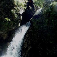
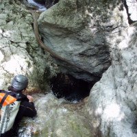
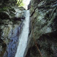
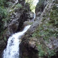
In der Schlucht angekommen geht es gleich mit vielen kl. Rutschen und Gumpen los --> die Rutschen sind max. 3m hoch und können zum Teil auch umgangen oder abgeseilt werden --> da die Schlucht sehr viel begangen wird, wurden Fixseile für Umgehungen angebracht --> im ganzen Schluchtenverlauf gibt es Ein- und Ausstiegsmöglichkeiten --> die höchste Abseilstelle C25 li ist im Mittelteil und mit Seilgeländer gesichert (li. Umgehen auch möglich) --> es folgen mehrere kl. Sprünge und Rutschen + Abseiler am Fixseil --> im unteren Teil trifft man auf die schon am Zustieg überquerte Steinbrücke dort befindet sich eine 15m Abseilstelle (re. gut umgehbar) --> nach ein paar Kletterpassagen steht man vor einen großen Klemmblock unter dem das Wasser abfällt (C10 abseilen oder rutschen) (!!! Bei hohen Wasserstand!) --> weiteres Abklettern und ein Abseiler mit 18m kündigen den Ausgang der Schlucht an (ein Teil der 18m werden auch gerne gerutscht, ist aber mit Vorsicht zu genießen da die Rutsche fast senkrecht verläuft, der Gumpen ist zwar tief jedoch sehr schmal) --> vor dem Ausstiegsgumpen hat man noch 2 Sprünge die man auch abklettern kann (rutschig!).
approx. 2h
Arrived in the canyon it starts immediately with many small slides and pools --> the slides are max. 3m high and can be partly rappelled or bypassed --> because the canyon is walked a lot, fixed ropes were installed for bypasses --> in the whole canyon course there are entry and exit points --> the highest rappel point C25 left is in the middle part and secured with rope traverses (left. (left. Bypassing also possible) --> several small jumps and slides + rappel on fixed ropes follow --> in the lower part you meet the stone bridge already crossed at the access there is a 15m rappel point (right. After a few climbing passages you are in front of a large clamping block under which the water falls (C10 rappel or slide) (!!! If the water level is high!).) --> further downclimbing and a rappel with 18m announce the exit of the canyon (part of the 18m are also gladly rappelled, but is to be enjoyed with caution because the slide runs almost vertically, the pool is deep but very narrow) --> before the exit pool you have 2 jumps that you can also downclimb (slippery!).
Ritorno (0 min):
traduzione alternativa
➜
Lingua originale
Ausstieg direkt am Parkplatz auf 370Hm.
approx. 0min
Exit directly at the parking lot at 370Hm.
Coordinate:
Inizio del canyon
(cwiki_1)
Fine del canyon
(cwiki_1)
Letteratura:
Libro Canyoning
Ingo Neumann / Alfred Wieser / Franz Karger / Reinhard Ranner
2004
http://www.edition-neumann.com
Info sul canyon ACA
Info sul canyon Cwiki
Info sul canyon Descente
Info sul canyon Ropewiki
Sconosciuto
20.10.2024
Cavert
⭐
★★★★★
📖
★★★
⚓
★★★
🌊
Folle
Completato ✔
nessuna traduzione disponibile
Automatisch importiert von Descente-Canyon.com für Canyon Susec
(Quelle: https://www.descente-canyon.com/canyoning/canyon-debit/2703/observations.html)
20.09.2024
giangi
⭐
★★★★★
📖
★★★
⚓
★★★
💧
Normale
Completato ✔
nessuna traduzione disponibile
Automatisch importiert von Descente-Canyon.com für Canyon Susec
(Quelle: https://www.descente-canyon.com/canyoning/canyon-debit/2703/observations.html)
26.08.2024
Klara Skopal
⭐
★★★★★
📖
★★★
⚓
★★★
💧
Normale
Completato ✔
traduzione alternativa
➜
Lingua originale
Waren um kurz vor 8 die erste startende Gruppe - beim Ausstieg 1h 25 später war der komplette Parkplatz voll, also früher starten zahlt sich aus.
Dieses Jahr fast kein Kies in den Pools, konnten eigentlich fast alles springen/rutschen (trotz biiiisschen weniger Wasser als normal), beim Rest gab es neue Fixseile.
We were the first group to start shortly before 8am - at the exit 1h 25 later the entire parking lot was full, so it pays to start early.
Almost no gravel in the pools this year, we were actually able to jump/slide almost everything (despite a bit less water than normal), the rest had new fixed ropes.
23.08.2024
Emeline
⭐
★★★★★
📖
★★★
⚓
★★★
💧
Basso
Completato ✔
nessuna traduzione disponibile
Automatisch importiert von Descente-Canyon.com für Canyon Susec
Canyon très sympa, eau assez chaude, équipement nickel. Le canyon peut se commencer plus haut que la description avec 2 cordes de 40m. Sur la marche d’approche, ne pas prendre le chemin des guides, continuez un chemin qui monte toujours en RG jusqu’à passer devant un petit hameau, le chemin redescend juste après et on arrive au départ (20 à 30min de marche en plus). Dans cette partie il y a une cascade d’une vingtaine de mètres, une de 10m environ puis une cascade d’environ 35mètres (on avait 2x40m). Cette partie n’est pas faite par les guides donc vous serez seul.
(Quelle: https://www.descente-canyon.com/canyoning/canyon-debit/2703/observations.html)
06.08.2024
M'ilien
⭐
★★★★★
📖
★★★
⚓
★★★
💧
Normale
Completato ✔
nessuna traduzione disponibile
Automatisch importiert von Descente-Canyon.com für Canyon Susec
Fait en soirée pour échapper à la foule (à 17h et quelques au parking, encore 18 véhicules de pros !). Jolie descente facile quand on est tout seuls ;) Suréquipé, il est possible de contourner les deux grandes (prévoir un gros 2*25m pour la première depuis le relais du haut). Bien vérifier les sauts/tob, tout ne passe pas !
(Quelle: https://www.descente-canyon.com/canyoning/canyon-debit/2703/observations.html)
28.07.2024
Kubik125
⭐
★★★★★
📖
★★★
⚓
★★★
💧
Normale
Completato ✔
nessuna traduzione disponibile
Automatisch importiert von Descente-Canyon.com für Canyon Susec
A very bussy canyon, but nice and easy to do. Jumps, slides, rappels.
(Quelle: https://www.descente-canyon.com/canyoning/canyon-debit/2703/observations.html)
29.05.2024
daniel albrecht
⭐
★★★★★
📖
★★★
⚓
★★★
💧
Alto
Completato ✔
traduzione alternativa
➜
Lingua originale
schöner Fun Canyon. Bei uns hatten alle Rutschen und Pools reichlich Wasser. Fixseile, bis auf das letzte, sahen alle sehr neu aus.
beautiful fun canyon. All slides and pools had plenty of water. Fixed ropes, except for the last one, all looked very new.
02.08.2023
Jakob Pavli
⭐
★★★★★
📖
★★★
⚓
★★★
💧
Normale
Completato ✔
traduzione alternativa
➜
Lingua originale
sehr stark komerziell begangen. höllen-rutche zu ende eher mit seil zu machen, pool zugekiest,1m tief
very heavily commercialized. höllen-rutche to end rather with rope to make, pool zugekiest,1m deep
09.03.2023
System User
⭐
★★★★★
📖
★★★
⚓
★★★
nessuna traduzione disponibile
Info: Teile der Canyonbeschreibung wurden automatisiert übernommen. Konkret die Felder Weblinks, Koordinaten, Rating, Ort, Länge des Canyon, Einfachseil Mindestens von https://canyon.carto.net/cwiki/bin/view/Canyons/SusecPotokCanyon.html und https://www.descente-canyon.com/canyoning/canyon/2703
09.03.2023
System User
⭐
★★★★★
📖
★★★
⚓
★★★
nessuna traduzione disponibile
Daten importiert von https://www.canyoning.or.at/index.php/liste-aller-canyons/97-susec
23.06.2022
Martin Jasek
⭐
★★★★★
📖
★★★
⚓
★★★
💧
Normale
Completato ✔
nessuna traduzione disponibile
Nice short canyon, I felt like in aquapark, several jumps and slides, but very commercial, it can took much longer when several groups before you in canyon.
Nuovo rapporto
Riportare brevemente e concisamente le informazioni più importanti dell'ultimo tour o importanti informazioni attuali sul canyon. Se necessario con link a video, foto, ecc..
*
*
*
Esc
Del
Idrologia:


