v4 a3 II
5h35
5min
5h
30min
930m
430m
500m
35m
2x40m
17
2200m
Auto necessaria
Valutazione:
★★★★★
2.1 (1)
Info:
★★★
0 ()
Belay:
★★★
0 ()
Sintesi:
traduzione alternativa
➜
Lingua originale
Wilder Abseilcanyon
Wild rappel canyon
Est
Sintesi:
traduzione alternativa
➜
Lingua originale
Wilder Abseilcanyon
Wild rappel canyon
Accesso:
traduzione alternativa
➜
Lingua originale
Auf der A 1 (via Mailand) oder der A 21 (via Brescia) nach Piacenza (südliche Ausfahrt). Auf einer Umgehungsstraße im Süden um die Stadt herum, dann auf der SS 45 durch das Val di Trebbia über Bobbio nach Marsaglia. Vor der Brücke links auf die SP 586 ('Chiavari').Etwa bei km 12 bzw. 600m nach dem Ortsende von Salsominore sollte man das untere Auto abstellen. 900 m weiter geht es bei Ruffinati rechts ab über den Aveto und hinauf nach Lisore. Dabei überquert man den Rio Lisore unterhalb einer Wasserentnahmestelle (Ausstieg oberer Abschnitt, Zustieg unterer Abschnitt).
Hier kann man sich die direkt unterhalb der Straße liegende 30-m-Abseilstelle anschauen. Dort, wo bei der weiteren Auffahrt erneut (nach 3,6 km) der Rio Lisore gekreuzt wird, ist der Einstieg.Ein geeigneter Parkplatz findet sich etwa 100 m weiter in einer Rechtskurve.
Take the A1 (via Milan) or the A21 (via Brescia) to Piacenza (southern exit). On a bypass to the south around the city, then on the SS 45 through the Val di Trebbia via Bobbio to Marsaglia. Before the bridge, turn left on SP 586 ('Chiavari').At about km 12 or 600m after the end of Salsominore, you should park the lower car. 900m further on, at Ruffinati, turn right over the Aveto and go up to Lisore. You will cross the Rio Lisore below a water intake (exit upper part, access lower part). \nHere you can take a look at the 30 m rappel point located directly below the road. The entry is at the point where the Rio Lisore is crossed again (after 3.6 km) during the further ascent. A suitable parking area can be found about 100 m further on in a bend to the right.
Avvicinamento (5 min):
traduzione alternativa
➜
Lingua originale
vgl. oben
cf. above
Giro (5 h):
traduzione alternativa
➜
Lingua originale
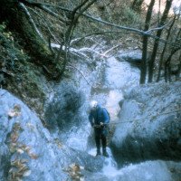
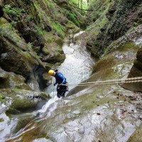
Größtenteils offener Canyon in Waldgelände, 'Kiesellatscher' (weil Unwetter im Frühjahr 2001 viel Geschiebe abgelagert hat, deshalb auch kaum Sprünge machbar).Nicht sehr attraktiv.
Besser der untere Abschnitt ab der Straße bis zum Rio Aveto.
Siehe Fotos u. Videos
Mostly open canyon in forest terrain, 'Kiesellatscher' (because storm in spring 2001 deposited a lot of debris, therefore hardly feasible jumps).Not very attractive.\n\nBetter the lower part from the road.
Ritorno (30 min):
traduzione alternativa
➜
Lingua originale
Bei der Mündung in den Aveto durchquert man diesen und trifft auf das unten geparkte Auto.
Man kann das Durchschwimmen des Aveto vermeiden, wenn man nach dem Ausstieg rechts hinaufzieht, bis man den Steilabbruch rechts oberhalb umgehen kann. In diesem Falle wäre das untere Fahrzeug etwa 1,1 km nach der Aveto-Brücke bei Ruffinati abzustellen.
At the confluence with the Aveto, you cross it and meet the car parked below. \nMan can avoid swimming through the Aveto if, after the exit, you pull up to the right until you can avoid the steep drop on the right above. In this case, the lower car would have to be parked about 1.1 km after the Aveto bridge at Ruffinati.
Coordinate:
Inizio del canyon
Fine del canyon
Partenza alternativa del canyon
unterer Abschnitt
Parcheggio in uscita
Letteratura:
Mappa
IGMI 25/V - 197 Ferriere III, 1:25 000
Info sul canyon Cwiki
Info sul canyon Descente
Info sul canyon Ropewiki
Gallería
Gallería
Altro info sul canyon
09.03.2023
System User
⭐
★★★★★
📖
★★★
⚓
★★★
nessuna traduzione disponibile
Daten importiert von https://canyon.carto.net/cwiki/bin/view/Canyons/LisoreCanyon.html
Idrologia:


