v5 a5 VI
8h5
1h50
6h
15min
960m
470m
490m
36m
36
3500m
Specialità:
§ Divieto Diga (scarico automatico)
§ Divieto Diga (scarico automatico)
Valutazione:
★★★★★
4.2 (5)
Info:
★★★
2.7 (3)
Belay:
★★★
2.3 (3)
Sintesi:
traduzione alternativa
➜
Lingua originale
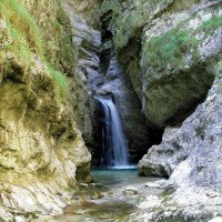
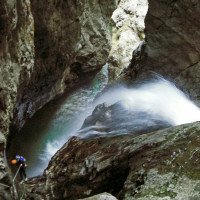
Der Extremklassiker. Eng eingeschnittene, aquatische Schlucht von grossem Anspruch und Länge. Landschaftlich sehr schön und abgelegen. Nur wenige Notausstiege möglich.
Es gibt den oberen Teil und den unteren Teil, der beim Staudamm beginnt. Der Staudamm ist verbunden mit Lago del Mis und wird verwendet wenn es im Nebental Probleme gibt. D.h. man sollte nur in die Schlucht gehen, wenn das Wetter stabil ist und vor allem im unteren Teil nicht zu viel Zeit verbringen um eine mögliche Gefährdung zu reduzieren.
The extreme classic. Narrowly cut aquatic canyon of great demand and length. Very scenic and remote. Only a few emergency exits possible.
There is the upper part and the lower part that starts at the dam. The dam is connected to Lago del Mis and is used when there are problems in the side valley. I.e. you should only go into the canyon when the weather is stable and especially do not spend too much time in the lower part to reduce possible danger.
Accesso:
traduzione alternativa
➜
Lingua originale
Von Belluno kommend auf der SS 203 Richtung Agordo durch das Cordevole Tal. Parkplatz im Bereich La Muda, nach der Hängebrücke über den Torrente Cordevole. (Tip: Hier ist man gerade Außerhalb des Nationalparks, d.h. man hat hier auch kein Problem zu nächtigen und direkt gegenüber gibt es eine Bar / ein Restaurant, bei der man am Abend Essen kann bzw. die ab 6:30 - 7:00 offen hat für ein Frühstück.
Coming from Belluno on the SS 203 direction Agordo through the Cordevole Valley. Parking in the area La Muda, after the suspension bridge over the Torrente Cordevole. (Tip: Here you are just outside the National Park, i.e. you have here also no problem to spend the night and directly opposite there is a bar / restaurant where you can eat in the evening or which is open from 6:30 - 7:00 for breakfast.
Avvicinamento (1 h 50):
traduzione alternativa
➜
Lingua originale
Orographisch rechts entlang markierten Wanderweg Nr. 546 aufwärts, anfangs steil durch Wald. Nach ca. einer halben Stunde kommt man zur Abzweigung zum Staudamm für den unteren Teil. Für den oberen Teil folgt man dem Weg weiter hangaufwärts. Bei ca 940 Hm gibt es eine noch kaum ersichtliche Abzweigung auf den Weg 545 hier jedoch entlang des Schluchtverlaufs auf dem Weg 546 bleiben(Wegpfeil Val Clusa Weg 546). Ab jetzt geht man ohne viel Höhenverlust immer dem WEg entlang bis man bei 960Hm immer näher an den Bach kommt und ohne große Probleme einsteigen kann (siehe Koordinaten)
Der Weg ist generell klar ersichtlich, Schäden vom Waldbrand gibt es keine mehr. Bei einer Stelle besteht eine mögliche Absturzgefahr, dieser ist aber gut mit Stahlseilen versichert.
Orographically right along marked trail no. 546 uphill, initially steep through forest. After about half an hour you come to the turnoff to the dam for the lower part. For the upper part, follow the path uphill. At about 940 m there is a barely visible turnoff to path 545, but here you stay along the course of the gorge on path 546 (path arrow Val Clusa path 546). From now on you go without much loss of altitude always along the path until at 960Hm you come closer and closer to the stream and can enter without major problems (see coordinates).
The path is generally clearly visible, there is no more damage from the forest fire. At one point there is a possible risk of falling, but this is well secured with steel ropes.
Giro (6 h):
traduzione alternativa
➜
Lingua originale
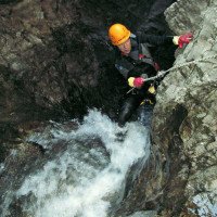
Am Anfang ist Val Clusa noch eine relativ offen Waldschlucht. Das ändert sich aber nach den ersten 6 Abseilern, wo sich die Schlucht zusehens verengt und tiefer eingeschnitten wird. Generell hat man während der Tour nur wenige Möglichkeiten aus der Schlucht heraus zu kommen.
Nach ca 18 Abseilern bzw. 27 Abseilern im oberen Teil findet man Möglichkeit or. re. aus der Schlucht raus zu kommen.
Nach ca 29 Abseilern sind gelbe Tafeln montiert und or. re. führt der Weg raus wo man auf den Staudamm gelangt. Dieser Weg sollte nicht übesehen werden, denn sollte der Staudamm aktiv sein und Wasser gestaut sein, so kann es sein, dass man nicht mehr aus dem Stausee rauskommt, weil die Leitern in einem Schacht sind, der nur zugänglich ist wenn der Staudamm leer ist.
Für den oberen Teil sollte man ca 4h-5h einplanen.
Sollte man die Tafeln übersehen und in den Pool springen, dann folgt noch ein weitere Abseiler eher man im Staubecken ankommt und vor dem Staudamm steht. Bei unserer Begehung (15.8.2023) hatten wir das Glück, dass der Staudamm offen war, d.h. man konnte ohne Probleme durch den Staudamm durchgehen und so in den unteren Teil gelangen bzw. die Leiter im Schacht gelangen für einen etwaigen Ausstieg.
Der Staudamm ist automatisch gesteuert und auch als Überlauf mit dem Lago del Mis verbunden, d.h. man sollte generell im unteren Teil nicht trödeln, da selbst wenn das Staubecken offen ist und das Wasser ok ist durch eine technische Störung etc. Wasser in die Clusa geleitet wird.
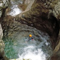
Der untere Teil ist etwas aquatischer als der obere Teil aber sehr schön eingeschnitten. Insgesamt besteht hat der untere Teil 7 Abseiler, höchster 30m.
Für den unteren Teil sollte man ca 1,5h einplanen.
At the beginning, Val Clusa is still a relatively open forest canyon. But this changes after the first 6 rappels, where the canyon narrows and becomes deeper. In general, during the tour you have only a few possibilities to get out of the canyons.
After about 18 rappels or 27 rappels in the upper part, there is a possibility to get out of the canyon ortographic right.
After about 29 rappels there are yellow signs and ortographic right the path leads out to the dam. This path should not be overlooked, because if the dam is active and water is dammed, it may not be possible to get out of the reservoir, because the ladders are in a shaft, which is only accessible when the dam is empty.
For the upper part you should plan about 4h-5h.
If you miss the signs and jump into the pool, then another rappel follows before you reach the reservoir and stand in front of the dam. During our ascent (15.8.2023) we were lucky that the dam was open, i.e. one could pass through the dam without any problems and thus get to the lower part or reach the ladder in the shaft for a possible exit.
The dam is automatically controlled and also connected as an overflow with the Lago del Mis, i.e. one should generally not dawdle in the lower part, because even if the reservoir is open and the water is ok due to a technical malfunction etc.. Water is directed into the Clusa.
The lower part is a bit more aquatic than the upper part but very nicely incised. In total the lower part has 7 rappel, highest 30m.
For the lower part you should plan about 1.5h.
Ritorno (15 min):
traduzione alternativa
➜
Lingua originale
Unter der Brücke der SR203 durch bis zum Torrente Cordevole und am besten rechts (in fließrichtung von Torrente Cordevole) für ca 50m. Hier die Böschung rauf zur Straße hinauf und bei der Straße zum Parkplatz retour (ca 15 min)
Go under the bridge of SR203 until Torrente Cordevole and turn right (in the direction of Torrente Cordevole) for about 50m. Here up the embankment to the road and return by the road to the parking lot (about 15 min).
Coordinate:
Inizio del canyon
Canyon Start oben
Parcheggio all'entrata
Einstiegsparkplatz
Fine del canyon
Letteratura:
Mappa
1:25000
Mappa
1:25000
Mappa
1:25000
Libro Canyoning
Simon Flower
Cicerone
2012
Northern Italy and Ticino
Libro Canyoning
Pascal van Duin
2011
Libro Canyoning
Pascal van Duin
Edizioni TopCanyon
2009
100 Beschreibungen
Libro Canyoning
Stéphane Coté / Caracal et les Sancho Panza
2008
Libro Canyoning
Maurizio Biondi / Francesco Cacace / Roberto Schenone
Adriambiente
2000
978-8890026010
Libro Canyoning
Michele Sivelli / Mario Vianelli
1988
Libro Canyoning
Matteo Bortot, Roberto Sartor
ViviDolomiti
2019
978-8899106669
45 Canyon-Beschreibungen
Info sul canyon Cwiki
Info sul canyon Descente
Info sul canyon Ropewiki
Altro info sul canyon
Altro info sul canyon
Altro info sul canyon
Altro info sul canyon
Rapporto di viaggio (ad es. blogpost)
Rapporto di viaggio (ad es. blogpost)
15.10.2024
Yan09Martiiin
⭐
★★★★★
📖
★★★
⚓
★★★
🌊
Folle
Completato ✔
nessuna traduzione disponibile
Automatisch importiert von Descente-Canyon.com für Canyon Clusa
Gros débit pour le sup, très gros sous la prise d'eau.Cette dernière est toujours ouverte a cause du tronc.Nous avons sauté dans les 2 vasques en amont.Équipement excelent dans tout le canyon.Très grande course beaucoup plus exigeante et technique que soffia...Beaucoup de sauts possibles ou rappels trop courts. :)
(Quelle: https://www.descente-canyon.com/canyoning/canyon-debit/2531/observations.html)
31.08.2024
MirkoT
⭐
★★★★★
📖
★★★
⚓
★★★
💧
Alto
Completato ✔
nessuna traduzione disponibile
Automatisch importiert von Descente-Canyon.com für Canyon Clusa
Flusso forte e molto freddo dalla confluenza del Canton dei Pez. Tutto il resto ok.
(Quelle: https://www.descente-canyon.com/canyoning/canyon-debit/2531/observations.html)
02.08.2024
Jeanne
⭐
★★★★★
📖
★★★
⚓
★★★
💧
Normale
Completato ✔
nessuna traduzione disponibile
Automatisch importiert von Descente-Canyon.com für Canyon Clusa
DC+Nous n'avons pas fait la partie inférieure à cause du débit sous la prise d'eau
(Quelle: https://www.descente-canyon.com/canyoning/canyon-debit/2531/observations.html)
27.07.2024
Peter Lampacher
⭐
★★★★★
📖
★★★
⚓
★★★
💧
Alto
Completato ✔
traduzione alternativa
➜
Lingua originale
Alles gut, noch recht viel Wasser.
Vor dem Staudamm ausgestiegen.
All good, still quite a lot of water.
Got out in front of the dam.
05.07.2024
mikkel
⭐
★★★★★
📖
★★★
⚓
★★★
🌊
Folle
Completato ✔
nessuna traduzione disponibile
Automatisch importiert von Descente-Canyon.com für Canyon Clusa
We made it through the army of ticks. Lot of water in the superior part. We made it through the hard parts and we used unverified exit. It was not easy. Dont recommend the exit. As the flow was really high dont want to imagine how much water was there after intake from neighbor canyon. We spend 7 hours in the canyon.
(Quelle: https://www.descente-canyon.com/canyoning/canyon-debit/2531/observations.html)
22.06.2024
Madie Ga
⭐
★★★★★
📖
★★★
⚓
★★★
🌊
Folle
Completato ✕
nessuna traduzione disponibile
Does not look doable, water changed from blue to brown overnight, and 4 times the flow
13.08.2023
Horst Lambauer
⭐
★★★★★
📖
★★★
⚓
★★★
Completato ✔
traduzione alternativa
➜
Lingua originale
Canyoninformation komplett überarbeitet und auf aktuelle Gegebenheiten angepasst.
Canyon information completely revised and adapted to current conditions.
09.03.2023
System User
⭐
★★★★★
📖
★★★
⚓
★★★
nessuna traduzione disponibile
Info: Teile der Canyonbeschreibung wurden automatisiert übernommen. Konkret die Felder Weblinks, Koordinaten, Rating, Länge des Canyon, Einfachseil Mindestens von https://www.descente-canyon.com/canyoning/canyon/2531
09.03.2023
System User
⭐
★★★★★
📖
★★★
⚓
★★★
nessuna traduzione disponibile
Daten importiert von https://canyon.carto.net/cwiki/bin/view/Canyons/ValClusaCanyon.html
17.08.2022
Bubtore
⭐
★★★★★
📖
★★★
⚓
★★★
💧
Basso
Completato ✔
traduzione alternativa
➜
Lingua originale
Ich finde den Fels irgendwie nicht so toll zum anschauen, aber die Becken sind cool, und viele Sprünge (nur ein einzelner Abseiler wenn man wild drauf ist).
I somehow don't find the rock that great to look at, but the pools are cool, and lots of jumps (just a single rappel if you're wild about it).
Nuovo rapporto
Riportare brevemente e concisamente le informazioni più importanti dell'ultimo tour o importanti informazioni attuali sul canyon. Se necessario con link a video, foto, ecc..
*
*
*
Esc
Del
Idrologia:


