Paese:
Italia / Italy
Regione: Sardegna
Sottoregione: provincia dell'Ogliastra / Province of Ogliastra
Città: Talana
v4 a2 II
4h30
0min
3h
1h30
740m
380m
360m
37m
2x40m
16
Auto facoltativa
Valutazione:
★★★★★
3.2 (4)
Info:
★★★
3 (1)
Belay:
★★★
3 (1)
Sintesi:
traduzione alternativa
➜
Lingua originale
Rosa Granit, im Hochsommer trocken; in kalten Monaten nur mit Neopren! Bei viel Wasser sehr gefährlich; Viel loses Gestein an den Schluchtenhängen; Hohe Steinschlaggefahr! Nur bei stabilen Wetter einsteigen; Einige rutschige Stellen und Abkletterpassagen; Innox Klebehaken und Kettenstände; einer der techn. Anspruchsvollsten Schluchten in Sardinien
Pink granite, in high summer dry; in cold months only with neoprene!; With much water very dangerous; Much loose rock on the canyon slopes; High risk of falling rocks!; Only in stable weather enter; Some slippery places and downclimb; Innox glued anchors and chain anchors; One of the techn. most demanding canyons in Sardinia
Nord-Est
Granito
Sintesi:
traduzione alternativa
➜
Lingua originale
Rosa Granit, im Hochsommer trocken; in kalten Monaten nur mit Neopren! Bei viel Wasser sehr gefährlich; Viel loses Gestein an den Schluchtenhängen; Hohe Steinschlaggefahr! Nur bei stabilen Wetter einsteigen; Einige rutschige Stellen und Abkletterpassagen; Innox Klebehaken und Kettenstände; einer der techn. Anspruchsvollsten Schluchten in Sardinien
Pink granite, in high summer dry; in cold months only with neoprene!; With much water very dangerous; Much loose rock on the canyon slopes; High risk of falling rocks!; Only in stable weather enter; Some slippery places and downclimb; Innox glued anchors and chain anchors; One of the techn. most demanding canyons in Sardinia
Accesso:
traduzione alternativa
➜
Lingua originale
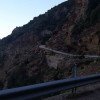
Von Arbatax ausgehend zuerst auf der SS198 in Richtung Westen. Nach 2,1km rechts abbiegen auf SP27. Nach etwa 17min auf der SP27 (15,7km) biegt man rechts in die Ortschaft „Villagrande Strisaili“ in die „Via Roma“ ab. Man fährt auf der „Via Roma“ in die Ortschaft rein. Auf dieser Straße bleibt man kurz bis man in der Ortschaft auf die „Via Giuseppe Mazzini“ abbiegen muss (3 Stöckiges Haus mit dem Restaurant „Sapori di Sardenga“ und dem Schild „campo sportivo“. Die „Via Giuseppe Mazzini“ führt aus Villagrande raus in Richtung Bergstraße (man fährt an dem nicht zu übersehenden Fußballplatz vorbei). Von der Einfahrt vom Fußballplatz fährt man dann für 4,6 km auf der teilweise beschädigten Straße bis man zu einer Brücke mit Ausweiche/Parkmöglichkeit kommt. Hier befindet sich direkt der Einstieg zur Bacu Sa Figu. Alternativ auch von Talana möglich, jedoch nicht ratsam da Straße extrem Steinschlag gefährdet und Abrutsch-gefährdet. Nichts für Fahranfänger oder Angsthasen
About 40min
From Arbatax, first take the SS198 towards the west. After 2.1km turn right on SP27. After about 17min on SP27 (15.7km) turn right in the village "Villagrande Strisaili" in the "Via Roma". You enter the village on "Via Roma". Stay on this road for a short while until you reach "Via Giuseppe Mazzini" (3-story building with the restaurant "Sapori di Sardenga" and the sign "campo sportivo"). The "Via Giuseppe Mazzini" leads out of Villagrande in the direction of the mountain road (you pass the soccer field which cannot be overlooked). From the entrance of the soccer field you drive for 4,6 km on the partly damaged road until you reach a bridge with a parking possibility. Here is directly the entry to the Bacu Sa Figu. Alternatively possible from Talana, but not advisable because the road is extremely vulnerable to falling rocks and slipping. Not for novice drivers or scaredy-cats.
Avvicinamento (0 min):
traduzione alternativa
➜
Lingua originale
Direkt vom Parkplatz, bei der Brücke auf 777m or. rechts in den Bach absteigen.
0 min.
Directly from parking lot, at the bridge at 777m or. descend right into the stream.
Giro (3 h):
traduzione alternativa
➜
Lingua originale
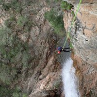
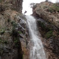
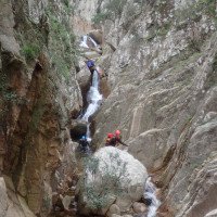
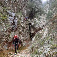
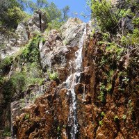
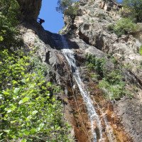
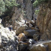
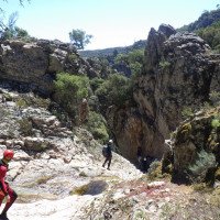
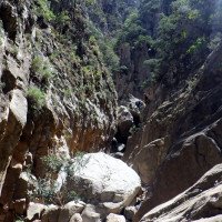
Der oberste Teil der Schlucht ist sehr diskontinuierlich, man überwindet 3 Abseilstellen von 25m/5m/4m, die jeweils von Geh- und Abkletterstellen in verblockten Geländer unterbrochen werden. Mehre Autowracks entlang der oberen Schluchtenhänge erinnern entweder an schlechte Fahrkünste oder südländische Entsorgungsmethoden. Die Standplätze bei den höheren Abseilstellen in der Schlucht können über ein abziehbares Seilgeländer gut und sicher erreicht werden. Ab der Stelle wo der Granit sich rosa färbt verengt sich die Schlucht. Hier wird die Schlucht auch kontinuierlicher, reizvoller und technisch anspruchsvoller. Es folgen mehrere Abseilstellen in der Wasserführung. Besonders erwähnenswert ist die Schlüsselstelle mit 2 schmalen kurz aufeinander folgenden Rinnen unterbrochen von einer kleinen Stufe, die bei höheren Wasserdurchfluss unangenehm/gefährlich werden können. Bei der 2. Rinne (ca 26m) kann das Seil beim Abzug leicht hängen bleiben. Für besseren Seilabzug gibt es bei der Hälfte der Rinne links eine Lasche mit Ring (Abzug im tiefen Gumpen). Nach den 2 Rinnen wird es nicht mehr so spektakulär. Es folgen mehrere kurze Abseilstellen (max. 15m) und Abkletterpassagen, bevor sich die Schlucht zunehmend öffnet. Ab hier folgt man eher links dem Bach ohne großen Höhenverlust, bis zum linken Zufluss „Baccu Troccosuloai“. Man sichtet große Steinmandl im Bachbett. Ausstieg links auf ca 380m. (!Hier könnte man die Tour noch fortsetzen um den 2. Teil der Schlucht zu begehen + ca 3 Stunden Schlucht und eine Stunde Fußweg bis Parkplatz 2 bei Donte Coa’e Serra; 2. PKW notwendig mit 14km Überstellung über Ortschaft Talana)
3h
The top part of the canyon is very discontinuous, overcoming 3 rappels of 25m/5m/4m, each interrupted by walking and downclimbs in blocked railings. Several car wrecks along the upper canyon slopes remind either of bad driving skills or southern disposal methods. The belays at the higher rappels in the canyon can be reached easily and safely via a removable rope traverse. From the point where the granite turns pink, the canyon narrows. Here the canyon also becomes more continuous, attractive and technically demanding. Several rappelling points in the water flow follow. Particularly worth mentioning is the key passage with 2 narrow short successive chutes interrupted by a small step, which can become unpleasant/dangerous at higher water flow. At the 2nd chute (approx. 26m) the ropes can easily get stuck during the pull-off. For better rope retrival there is a lug with a ring at the left half of the chute (pull off in the deep pool). After the 2 chutes it becomes less spectacular. Several short rappels (max. 15m) and downclimbs follow, before the canyon opens up more and more. From here you follow the stream more to the left without much loss of height, until the left tributary "Baccu Troccosuloai". You can see large stones in the streambed. Exit on the left at about 380m. (! Here you could continue the tour to walk the 2nd part of the canyon + about 3 hours canyon and one hour walk to parking lot 2 at Donte Coa'e Serra; 2nd car necessary with 14km transfer via village Talana)
Ritorno (1 h 30):
traduzione alternativa
➜
Lingua originale
Auf ca. 380m steigt man links aus dem Bach aus und folgt kurz dem Zufluss „Baccu Troccosuloai“. Man quert den Zuflussbach und trifft auf der orogr. li Seite auf eine breite Forststraße. Dieser Forststraße folgt man für ca. 1h bergauf (vorbei an 2 Häusern/Picknickplatz) „Casermetta Soberine“ 550m bis zur Straße. Auf der Straße angekommen folgt man dieser links für ca 20-25min bis zur Brücke/Einstiegsparkplatz. Alternativ: Es kann auch über den beschilderten Wanderweg 531 zur Straße hochgegangen werden.
about 1,5h
At about 380m you get out of the brook on the left and follow briefly the tributary "Baccu Troccosuloai". You cross the tributary stream and meet a wide forest road on the or left side. Follow this forest road uphill for about 1h (passing 2 houses/picnic area) "Casermetta Soberine "550m to the road. Once on the road, follow it on the left for about 20-25min to the bridge/parking entry. Alternative: It is also possible to go up to the road via the signposted trail 531.
Coordinate:
Inizio del canyon
(cwiki_1)
Parcheggio in uscita
Parkplatz bei Infoschild (cwiki)
Parcheggio all'entrata
Parkplatz bei Brücke (cwiki)
Fine del canyon
(cwiki_1)
Info sul canyon ACA
Info sul canyon Cwiki
Info sul canyon Descente
Info sul canyon Ropewiki
Altro info sul canyon
27.03.2025
odo38BaboulDawaniSaut Mont
⭐
★★★★★
📖
★★★
⚓
★★★
💧
Normale
Completato ✔
nessuna traduzione disponibile
Automatisch importiert von Descente-Canyon.com für Canyon Baccu Sa Figu
RasPossible d'installer un guidé sur les deux dernières grandes verticales (2 points).La C21 et la C37
(Quelle: https://www.descente-canyon.com/canyoning/canyon-debit/2888/observations.html)
27.03.2025
odo38BaboulDawani
⭐
★★★★★
📖
★★★
⚓
★★★
💧
Normale
Completato ✔
nessuna traduzione disponibile
Automatisch importiert von Descente-Canyon.com für Canyon Baccu Sa Figu
Ras
(Quelle: https://www.descente-canyon.com/canyoning/canyon-debit/2888/observations.html)
21.03.2025
jimmy347
⭐
★★★★★
📖
★★★
⚓
★★★
💧
Normale
Completato ✔
nessuna traduzione disponibile
Automatisch importiert von Descente-Canyon.com für Canyon Baccu Sa Figu
DC puis DC+ a parti du confluent. La cascade finale coule fort :)
(Quelle: https://www.descente-canyon.com/canyoning/canyon-debit/2888/observations.html)
08.11.2024
Peter Lampacher
⭐
★★★★★
📖
★★★
⚓
★★★
💧
Basso
Completato ✔
traduzione alternativa
➜
Lingua originale
Herbstliche Begehung bei wenig Wasser. 1 Auto, Zufahrt über Villagrande S. mit normalem PKW machbar.
Beschreibung Ausstieg ist korrekt, Koordinaten nicht ganz.
N 40.007 E 9.5077 ist genau bei den Steinmännchen beim Ausstieg.
Autumn ascent with little water. 1 car, access via Villagrande S. feasible with a normal car.
Exit description is correct, coordinates not quite.
N 40.007 E 9.5077 is exactly at the cairns at the exit.
30.05.2024
Paskal rider
⭐
★★★★★
📖
★★★
⚓
★★★
💧
Basso
Completato ✔
nessuna traduzione disponibile
Automatisch importiert von Descente-Canyon.com für Canyon Baccu Sa Figu
Très beau canyon dans un décor de granite rose , avec beaucoup d’eau il doit être dingue .Le topo n’est pas à jour il est totalement possible d’aller jusqu’en haut du canyon avec la voiture du coup il y a zéro marche d’approche .L’équipement est impeccable .Pour le retour nous avons choisi de continuer dans le canyon jusqu’à la route et tout est nickel et encore très beau , sinon il y a un chemin très bien marqué après le dernier rappel dans un toboggan magnifique.
(Quelle: https://www.descente-canyon.com/canyoning/canyon-debit/2888/observations.html)
27.04.2024
6Squal
⭐
★★★★★
📖
★★★
⚓
★★★
💧
Basso
Completato ✔
nessuna traduzione disponibile
Automatisch importiert von Descente-Canyon.com für Canyon Baccu Sa Figu
(Quelle: https://www.descente-canyon.com/canyoning/canyon-debit/2888/observations.html)
09.03.2023
System User
⭐
★★★★★
📖
★★★
⚓
★★★
nessuna traduzione disponibile
Info: Teile der Canyonbeschreibung wurden automatisiert übernommen. Konkret die Felder Weblinks, Koordinaten, Rating, Ort von https://canyon.carto.net/cwiki/bin/view/Canyons/BacuSaFiguCanyon.html
09.03.2023
System User
⭐
★★★★★
📖
★★★
⚓
★★★
nessuna traduzione disponibile
Daten importiert von https://www.canyoning.or.at/index.php/liste-aller-canyons/443-bacu-sa-figu
04.05.2017
Christian Balla
⭐
★★★★★
📖
★★★
⚓
★★★
💧
Alto
Completato ✔
traduzione alternativa
➜
Lingua originale
Schöner Canyon! Schon die Zufahrt ist ein Abentuer! Beim Umparken ist das latschen durch das Bachbett recht müßig.
Fotos zur Tour: https://www.christian-balla.de/SaFigu
Beautiful canyon! Even the access road is an adventure! It's quite tedious to traipse through the streambed when parking.
Photos of the tour: https://www.christian-balla.de/SaFigu
Nuovo rapporto
Riportare brevemente e concisamente le informazioni più importanti dell'ultimo tour o importanti informazioni attuali sul canyon. Se necessario con link a video, foto, ecc..
*
*
*
Esc
Del
Idrologia:
