un po' difficile
Cañón de los Pozos Dorados
v4 a3 III
3h50
1h
2h
50min
2310m
2005m
305m
40m
1x40+1x45
9
650m
a piedi
Valutazione:
★★★★★
0 ()
Info:
★★★
0 ()
Belay:
★★★
0 ()
Sintesi:
traduzione alternativa
➜
Lingua originale
Landschaftlich schöner Abseilcanyon ohne erwähnenswerte Sprung- oder Rutschmöglichkeiten
Scenic rappel canyon with no jumps or slides worth mentioning
Sud-Ovest
Sintesi:
traduzione alternativa
➜
Lingua originale
Landschaftlich schöner Abseilcanyon ohne erwähnenswerte Sprung- oder Rutschmöglichkeiten
Scenic rappel canyon with no jumps or slides worth mentioning
Accesso:
traduzione alternativa
➜
Lingua originale
von Jardin Zentrum zur Cascada La Escalera idR mit 2WD möglich, Route siehe: https://www.google.de/maps/dir/5.5994311,-75.8190846/Cascada+La+Escalera,+Jard%C3%ADn,+Antioquia,+Kolumbien/@5.6080918,-75.8219246,5082m/data=!3m2!1e3!4b1!4m9!4m8!1m0!1m5!1m1!1s0x8e46540b29a90965:0xd2f3fb8360d87a5f!2m2!1d-75.8038329!2d5.6178888!3e2?entry=ttu
from Jardin center to Cascada La Escalera usually possible with 2WD, route see: https://www.google.de/maps/dir/5.5994311,-75.8190846/Cascada+La+Escalera,+Jard%C3%ADn,+Antioquia,+Kolumbien/@5.6080918,-75.8219246,5082m/data=!3m2!1e3!4b1!4m9!4m8!1m0!1m5!1m1!1s0x8e46540b29a90965:0xd2f3fb8360d87a5f!2m2!1d-75.8038329!2d5.6178888!3e2?entry=ttu
Avvicinamento (1 h):
traduzione alternativa
➜
Lingua originale
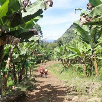
Von der Cascada Escalera nehmen wir den weiterführenden Feldweg. Dieser endet bei einem Wohnhaus. Weiter geht es auf einem Pfad, derauf den Pfad trifft, der bei ropewiki eingezeichnet ist (ropewiki hat anderen Parkplatz und damit einen teilweise anderen Zustieg). Weiter auf dem ropewiki-Pfad zum Einstieg.
From the Cascada Escalera, take the dirt road that continues. This exits at a residential house. Continue on a path that meets the path marked on ropewiki (ropewiki has a different parking lot and thus a partially different access). Continue on the ropewiki path to the entry point.
Giro (2 h):
traduzione alternativa
➜
Lingua originale
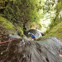
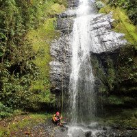
Abfolge von Abseilern, siehe Video u. Fotos. Wir steigen früher aus dem Bach als bei ropewiki vorgesehen.
Sequence of rappels, see video and photos. We path out of the stream earlier than planned on ropewiki.
Ritorno (50 min):
traduzione alternativa
➜
Lingua originale
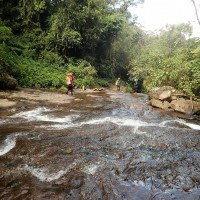
Links führt eine deutlich Spur auf die Uferböschung und weiter, bis wir auf den ropewiki-Pfad treffen. Auf diesem dann aber nicht links, sondern rechts über den Bach und hinauf zu unserem Zustiegspfad. Hier dann links zurück zum Auto.
On the left, a clear track leads onto the embankment and further on until we reach the ropewiki path. However, do not turn left on this path, but right across the stream and up to our access path. Turn left here back to the car.
Coordinate:
Parcheggio Entrata e uscita
5.617889°, -75.803932°
↓↑
DMS: 5° 37" 4.4', -76° 11" 45.84'
DM: 5° 37.073", -76° 11.764"
Google Maps
DMS: 5° 37" 4.4', -76° 11" 45.84'
DM: 5° 37.073", -76° 11.764"
Google Maps
am Fuße der Cascada la Escalera, ohne den Durchgangsverkehr zu behindern
Inizio del canyon
5.624967°, -75.78685°
↓↑
DMS: 5° 37" 29.88', -76° 12" 47.34'
DM: 5° 37.498", -76° 12.789"
Google Maps
DMS: 5° 37" 29.88', -76° 12" 47.34'
DM: 5° 37.498", -76° 12.789"
Google Maps
nach der Bachquerung zunächst noch am orograf. linken Hang noch etwas aufwärts
Fine del canyon
5.622219°, -75.789889°
↓↑
DMS: 5° 37" 19.99', -76° 12" 36.4'
DM: 5° 37.333", -76° 12.607"
Google Maps
DMS: 5° 37" 19.99', -76° 12" 36.4'
DM: 5° 37.333", -76° 12.607"
Google Maps
siehe Beschreibung Rückweg
Idrologia:


