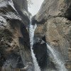
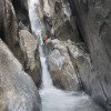
difficile
Radeinbach
Paese:
Schweiz / Switzerland
Regione: Kanton St. Gallen
Sottoregione: Wahlkreis Sarganserland
Città: Vättis
v5 a5 V
9h5
1h
8h
5min
1750m
970m
780m
28m
0m
Cablecar
Valutazione:
★★★★★
4.6 (4)
Info:
★★★
2 (1)
Belay:
★★★
1.7 (3)
Sintesi:
traduzione alternativa
➜
Lingua originale
Langer Abseilcanyon mit vielen Abseilern, Bergbahnzustieg und ostseitiger Ausrichtung
Long rappel canyon with lots of rappels, mountain lift access and east-facing orientation
Sintesi:
traduzione alternativa
➜
Lingua originale
Langer Abseilcanyon mit vielen Abseilern, Bergbahnzustieg und ostseitiger Ausrichtung
Long rappel canyon with lots of rappels, mountain lift access and east-facing orientation
Accesso:
traduzione alternativa
➜
Lingua originale
Wir verlassen die A12 (Sargans-Chur) über die Ausfahrt Bad Ragaz, fahren durch das Zentrum von Ragaz hinauf nach Pfäfers und in's Val Tamina. Vorbei am Stausee biegen wir noch vor der Ortschaft Vättis rechts ab zur Talstation der Vättnerberg-Seilbahn. Hier parken wir unser Auto.
We leave the A12 (Sargans-Chur) via the Bad Ragaz exit, drive through the center of Ragaz up to Pfäfers and into the Val Tamina. Passing the reservoir we turn right before the village of Vättis to the valley station of the Vättnerberg cable car. Here we park our car.
Avvicinamento (1 h):
traduzione alternativa
➜
Lingua originale
Mit der Bergbahn fahren wir nun aufwärts. Die Bahn ist in Betrieb vom 15.Mai bis 15. Oktober jeweils ab 07.30 Uhr. Tel. Kontakt über +41(0)794483851.\nOben angekommen (1585m Höhe) nehmen wir den Wen zu den Häusern von Grasplon (1630m Höhe) und weiter zum Weiler Hütten (1780m Höhe). Auf 1860m Höhe gabelt sich der Wanderweg und wir halten linkshinunter zum Bach (Einstieg).
With the mountain railroad we now go up. The cable car is in operation from 15 May to 15 October from 07:30. Tel. contact +41(0)794483851.\nOn arrival at the top (1585m altitude) we take the Wen to the houses of Grasplon (1630m altitude) and further to the hamlet of Hütten (1780m altitude). At 1860m altitude the trail forks and we keep left down to the stream (entry).
Giro (8 h):
traduzione alternativa
➜
Lingua originale
Im offenen Bachbett geht es bis auf eine Höhe von 1650m abwärts; dann beginnt der canyoningmäßige Abstieg mit Abklettern, Rutschen und Abseilern.\nEtwa 65 Abseiler erwarten uns, kein Abseiler höher als 30m. Nur im oberen Bereich sind 2 Notausstiege eröffnet. Nicht immer lässt sich ein Abseilen im Strahl vermeiden. Gegen Ende der Tour findet man alledings häufiger Alternativmöglichkeiten (neben oder im Strahl). Vor einer Brücke steigen wir nach rechts auf einen Pfad aus.
In the open streambed it goes down to a height of 1650m; then the canyoning-like downclimb with rappel, slide and downclimb begins.\nAbout 65 rappel await us, no rappel higher than 30m. Only in the upper area 2 emergency exits are opened. It is not always possible to avoid rappeling in the beam. Towards the exit of the tour you will find more often alternative possibilities (next to or in the beam). Before a bridge we exit to the right onto a path.
Ritorno (5 min):
traduzione alternativa
➜
Lingua originale
Den Pfad hinunter zur Talstation der Bergbahn.
Down the path to the bottom station of the mountain railroad.
Coordinate:
Inizio del canyon
46.9336°, 9.44135°
↓↑
DMS: 46° 56" 0.96', 9° 26" 28.86'
DM: 46° 56.016", 9° 26.481"
Google Maps
Svizzera Topografica
DMS: 46° 56" 0.96', 9° 26" 28.86'
DM: 46° 56.016", 9° 26.481"
Google Maps
Svizzera Topografica
Fine del canyon
46.9238°, 9.4581°
↓↑
DMS: 46° 55" 25.68', 9° 27" 29.16'
DM: 46° 55.428", 9° 27.486"
Google Maps
Svizzera Topografica
DMS: 46° 55" 25.68', 9° 27" 29.16'
DM: 46° 55.428", 9° 27.486"
Google Maps
Svizzera Topografica
Letteratura:
Mappa
1:25000
Libro Canyoning
Emmanuel Belut / Laurence Boyé / Thomas Guigon
Association Openbach
2015
9782746679450
Libro Canyoning
F. Baumgartner / A. Brunner / D. Zimmermann
2010
Libro Canyoning
Info sul canyon Cwiki
Info sul canyon Descente
Info sul canyon Ropewiki
Info sul canyon Schlucht.ch
22.09.2024
Alex Engelhardt
⭐
★★★★★
📖
★★★
⚓
★★★
💧
Normale
Completato ✔
traduzione alternativa
➜
Lingua originale
Alle Haken OK, ein paar könnten ersetzt werden. Zu zweit 6 Stunden im Bach gewesen ohne besondere Vorkommnisse.
All anchors OK, a few could be replaced. Two of us spent 6 hours in the stream without any particular incidents.
07.09.2024
charly67
⭐
★★★★★
📖
★★★
⚓
★★★
💧
Normale
Completato ✔
nessuna traduzione disponibile
Automatisch importiert von Descente-Canyon.com für Canyon Radeinbach
RAS, belle journée de septembre
(Quelle: https://www.descente-canyon.com/canyoning/canyon-debit/22008/observations.html)
11.08.2024
Gunz
⭐
★★★★★
📖
★★★
⚓
★★★
nessuna traduzione disponibile
Automatisch importiert von Schlucht.ch für Canyon Radeinbach, Wasserstand: "Gut" Verankerungen: "In Ordnung."
Alles gut. Keine Haken nachgebessert. Die Positionierung der Haken ist nicht immer nachvollziehbar.
(Quelle: https://schlucht.ch/schluchten-der-schweiz-liste/1047-radeinbach)
11.08.2024
haraldgunz
⭐
★★★★★
📖
★★★
⚓
★★★
💧
Normale
Completato ✔
nessuna traduzione disponibile
Automatisch importiert von Descente-Canyon.com für Canyon Radeinbach
Alle Haken vorhanden. Platzierung ist nicht immer nachvollziehbar. Also gut schauen..
(Quelle: https://www.descente-canyon.com/canyoning/canyon-debit/22008/observations.html)
30.09.2023
Wolfgang
⭐
★★★★★
📖
★★★
⚓
★★★
💧
Alto
Completato ✔
traduzione alternativa
➜
Lingua originale
Es empfiehlt sich schon am Vortag einen Seilbahnplatz telefonisch zu reservieren; dann klappt das alles sehr gut:
Lauter Einzelhaken aber in guten Zustand ,..mehr Wasser als erwartet aber gut machbat
It is advisable to reserve a cable car place by phone the day before; then everything works out very well:
Loud single hooks but in good condition ,..more water than expected but well machbat
30.09.2023
Inga
⭐
★★★★★
📖
★★★
⚓
★★★
🌊
Folle
Completato ✔
traduzione alternativa
➜
Lingua originale
Heute begangen. Wasserstand trotz keiner Niederschläge in den vergangenen Tagen sportlichsportlich 🥳
Haken soweit i.O.
Today committed. Water level despite no precipitation in recent days sporty 🥳.
Hook so far i.O.
09.03.2023
System User
⭐
★★★★★
📖
★★★
⚓
★★★
nessuna traduzione disponibile
Info: Teile der Canyonbeschreibung wurden automatisiert übernommen. Konkret die Felder Weblinks, Koordinaten, Rating, Länge des Canyon, Einfachseil Mindestens von https://www.descente-canyon.com/canyoning/canyon/22008
09.03.2023
System User
⭐
★★★★★
📖
★★★
⚓
★★★
nessuna traduzione disponibile
Daten importiert von https://canyon.carto.net/cwiki/bin/view/Canyons/RadeinbachCanyon.html
Nuovo rapporto
Riportare brevemente e concisamente le informazioni più importanti dell'ultimo tour o importanti informazioni attuali sul canyon. Se necessario con link a video, foto, ecc..
*
*
*
Esc
Del
Idrologia:


