un po' difficile
Vajo dell’Orsa (superiore)
v3 a4 IV
4h
30min
3h15
15min
640m
350m
290m
25m
2x30m/ 1x20m
25
4000m
Auto facoltativa
Valutazione:
★★★★★
4.4 (13)
Info:
★★★
2.5 (10)
Belay:
★★★
2.9 (11)
Sintesi:
traduzione alternativa
➜
Lingua originale
Ab dem Mittelteil sehr schön und eingeschnitten; viele rutschige Stellen; Überstellungsfahrzeug sehr Empfehlungswert; viele mögliche Rutschen und Sprünge; Felschaos im unteren Teil; Teil 1 bei höheren Wasserstand gefährlich; nur wenige Ausstiegsmöglichkeiten jedoch gut markierter Notausstieg im eingeschnittenen Teil der Schlucht.
From the middle part very beautiful and cut; many slippery places; shuttle car highly recommended; many possible slides and jumps; rock chaos in the lower part; part 1 at higher water levels dangerous; only a few exit options but well marked emergency exit in the cut part of the canyon.
Parti
Nome
Difficoltà
Avvicinamento
Giro
Ritorno
Sud-Est
Sintesi:
traduzione alternativa
➜
Lingua originale
Ab dem Mittelteil sehr schön und eingeschnitten; viele rutschige Stellen; Überstellungsfahrzeug sehr Empfehlungswert; viele mögliche Rutschen und Sprünge; Felschaos im unteren Teil; Teil 1 bei höheren Wasserstand gefährlich; nur wenige Ausstiegsmöglichkeiten jedoch gut markierter Notausstieg im eingeschnittenen Teil der Schlucht.
From the middle part very beautiful and cut; many slippery places; shuttle car highly recommended; many possible slides and jumps; rock chaos in the lower part; part 1 at higher water levels dangerous; only a few exit options but well marked emergency exit in the cut part of the canyon.
Accesso:
traduzione alternativa
➜
Lingua originale
Von Torbole --> Autobahn ri. Verona/Affi --> bei Brentino abfahren --> in die Ortschaft Brentino fahren (liegt oberhalb der Bundesstraße/Wasserkanals) --> in der Ortschaft folgt man der Straße rechts bis zum alten Kraftwerk (ENEL) (zuerst Asphalt dann Schotter) --> am Ende der Sackgasse steht man am Eisentor vor dem nostalgischen Wasserkraftwerk wo man das Überstellungsfahrzeug stehen lässt --> mit dem 2. PKW fährt man aus der Ortschaft auf die Bundes Straße 450 Richtung Affi --> an Ort Canale vorbei --> Straße hoch Richtung Ferarra Monte Baldo (ca. 30min. Von P1 zu P2) --> nach der Ortschaft Spiazzi (Wallfahrtsort) fährt man noch ca. 3Km bis zur zweiten kleinen Häusergruppe bei einer links Kurve -->hier muss man rechts nach dem Schild Localita Fraine Basse Ausschau halten --> neben dem Ausfahrtsspiegel hängt auch das gelbe Schild mit den Namen Vajo dell’Orsa --> wenn möglich Auto in der Nähe Parken (ca. 880Hm).
approx. 1h
From Torbole --> freeway to Verona/Affi --> exit at Brentino --> drive into the village of Brentino (above the main road/water canal) --> in the village follow the road on the right to the old power station (ENEL) (first asphalt then gravel) --> at the exit of the cul-de-sac you will find the iron gate in front of the nostalgic hydroelectric power station where you leave the shuttle car --> with the 2nd car you leave the village on the main road 450 to Affi --> pass the village of Canale --> drive up the road to Ferarra Monte Baldo --> take the second shuttle car to Monte Baldo. With the second car you leave the village on the federal road 450 in the direction of Affi --> pass the village of Canale --> drive up the road in the direction of Ferarra Monte Baldo (approx. 30min. from P1 to P2) --> after the village of Spiazzi (place of pilgrimage) you drive approx. 3Km to the second small group of houses at a left bend --> here you have to look out on the right for the sign Localita Fraine Basse --> next to the exit mirror hangs also the yellow sign with the name Vajo dell'Orsa --> if possible park your car nearby (approx. 880Hm).
Avvicinamento (30 min):
traduzione alternativa
➜
Lingua originale
Vom Parkplatz geht man zur Einfahrt mit den Schildern --> zwischen den Häusern durch --> Wanderweg talwärts folgen --> Beim Baum mit dem Schild ‘Per la Valle’ (schlecht lesbar) re. weiter --> man geht an einer Felswand vorbei und trifft etwas weiter unten auf ein Fixseil --> nach kurzer Zeit steht man im Bachbett (ca. 680Hm) --> man folgt den Wasserlauf bis zu den ersten Stufen der Tour.
approx. 30min
From the parking lot go to the entrance with the signs --> pass between the houses --> follow the trail downhill --> at the tree with the sign 'Per la Valle' (badly readable) continue to the right --> you pass a rock wall and a little further down you meet a fixed rope --> after a short time you are standing in the streambed (approx. 680Hm) --> you follow the watercourse to the first steps of the tour.
Giro (3 h 15):
traduzione alternativa
➜
Lingua originale
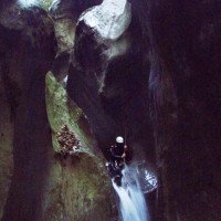
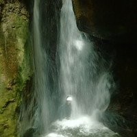
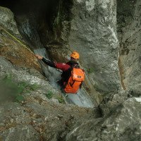
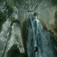
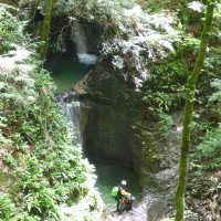
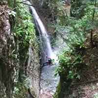
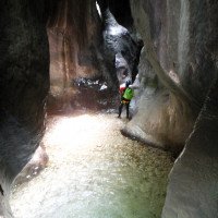
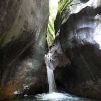
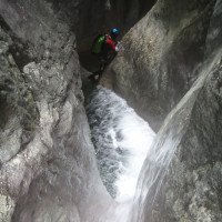
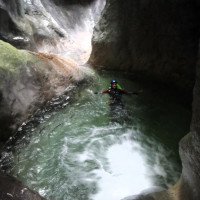
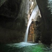
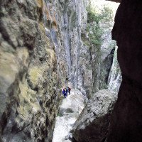
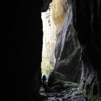
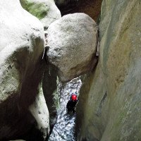
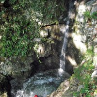
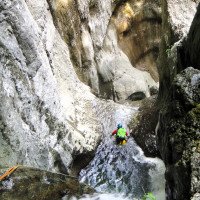
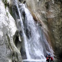
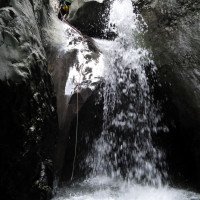
Nach den ersten Stufen hat man einen längeren rutschigen Gehabschnitt mit kleinen Toboggans bevor man in den schöneren Teil der Schlucht gelangt. An der Stelle wo sich die Schlucht verengt kommt wohl der schönste Teil der Schlucht. Hier kommen mehrere Abseilstellen die meist gerutscht oder gesprungen werden können. Das Wasser ist hier meist sehr sauber so dass man die Tiefe gut abschätzen kann. Die Schlucht wird von Clubs angeboten daher hat man meist gute Kettenstände, Bohrhaken und mehrere Fixseile in der Schlucht. Der Mittelteil ist sehr eingeschnitten und schön. Danach folgt ein Felslabyrinth wo man sich den Weg abkletternd und Abseilend suchen muss. Höchste Abseilstelle im Felslabyrinth ca. 18m (an dieser Stelle läuft das Wasser unterirdisch Weiter). Ein gigantischer Klemmblock markiert den Schlussteil des Labyrinths. Danach öffnet sich die Schlucht hier hat man die Möglichkeit die nächsten Stufen über ein Fixseil li. zu umgehen. Im unteren Teil der Tour kommt noch eine schöne Kaskade (10m/S10 +25m) und eine Abseilstelle von 10m über mehrere Steine. Nach kurzer Gehstrecke kommt man zum Punkt 1 der den Ausstieg markiert. Hier wird re durch den Felsspalt aus der Schlucht ausgestiegen (ca. 350Hm). Lohnenswert ist auch der untere Teil der Schlucht (siehe Vajo dell’orsa inferiore).
approx. 2,5-4h
After the first steps you have a longer slippery walking section with small toboggans before you reach the more beautiful part of the canyon. At the point where the canyon narrows comes probably the most beautiful part of the canyon. Here come several rappelling points which can be mostly slid or jumped. The water here is usually very clean so that you can easily estimate the depth. The canyon is offered by clubs so you usually have good chain anchors, pitons and several fixed ropes in the canyon. The middle part is very cut and beautiful. After that follows a rock labyrinth where you have to find your way by rappeling and climbing down. Highest abseiling point in the rock labyrinth about 18m (at this point the water walks underground). A gigantic clamping block marks the final part of the labyrinth. After that the canyon opens up and here you have the possibility to bypass the next steps via a fixed rope on the left. In the lower part of the tour there is another beautiful cascade (10m/S10 +25m) and an abseil of 10m over several stones. After a short walking passages you come to point 1 which marks the exit. Here you exit right through the crevice out of the canyon (about 350Hm). Worthwhile is also the lower part of the canyon (see Vajo dell'orsa inferiore).
Ritorno (15 min):
traduzione alternativa
➜
Lingua originale
Um zum ENEL Kraftwerk zu kommen folgt man den deutlichen Wanderweg. Nach ca. 15min. und mehreren Bachüberquerungen steht man am Parkplatz/Kraftwerk auf ca. 280Hm. Hat man kein Überstellungsfahrzeug, so geht man weiter Richtung Dorfplatz und am Brunnen re. vorbei. Ab hier folgt man den Wahlfahrtsweg (unzählige Stufen)hoch bis zur Kirche. Bei der Ortschaft Spiazzi folgt man dann der Straße bis zum PKW (je nach Kondition 1 bis 2 Stunden).
about 15min
To get to the ENEL power plant, follow the clear hiking trail. After approx. 15min. and several brook crossings one stands at the parking lot/power station on approx. 280Hm. If you don't have a shuttle car, continue towards the village square and pass the fountain on the right. From here you follow the optional path (countless steps) up to the church. At the village of Spiazzi you follow the road to the car (depending on your condition 1 to 2 hours).
Coordinate:
Inizio del canyon
Parcheggio all'entrata
Fine del canyon
Parcheggio in uscita
Letteratura:
Libro Canyoning
Stéphane Coté / Caracal et les Sancho Panza
2008
Libro Canyoning
Pascal van Duin
Edizioni TopCanyon
2009
100 Beschreibungen
Libro Canyoning
Stéphane Coté / Caracal et les Sancho Panza
2007
124 Canyon-Beschreibungen
Libro Canyoning
Maurizio Biondi / Francesco Cacace / Roberto Schenone
Adriambiente
2000
978-8890026010
Libretto di canyoning
AIC
2024
Booklet des Canyoning Treffens in Südtirol 2024 - Beschreibungen übernommen nach freundlicher Genehmigung
Info sul canyon ACA
Gallería
Info sul canyon Descente
Info sul canyon Cwiki
Altro info sul canyon
Altro info sul canyon
Altro info sul canyon
Info sul canyon Ropewiki
Altro info sul canyon
06.10.2024
Marcin
⭐
★★★★★
📖
★★★
⚓
★★★
💧
Normale
Completato ✔
traduzione alternativa
➜
Lingua originale
Dobre stanowiska. Dużo poręczówek zostawionych przez przewodników. Nabite tabliczki z numerami zjazdów. Wyraźnie oznaczony wycof ewakuacyjny po pierwszej części.
Good positions. Lots of handrails left by guides. Nabbed plates with numbers of descents. Clearly marked evacuation withdrawal after the first part.
11.08.2024
Peisen
⭐
★★★★★
📖
★★★
⚓
★★★
💧
Basso
Completato ✔
traduzione alternativa
➜
Lingua originale
Altri utenti sono stati: Simone Steffke Daniela Rossi DaRaph
Shuttle nicht lohnenswert, der Zustieg per Pedes jedoch schon.
Sprünge und Rutschen gut machbar.
Aus unserer Sicht eher ein A3 canyon
Shuttle not worthwhile, but access on foot is.
Jumps and slides are easy to do.
From our point of view rather an A3 canyon
Altri utenti sono stati: Simone Steffke Daniela Rossi DaRaph
09.08.2024
Giga
⭐
★★★★★
📖
★★★
⚓
★★★
💧
Normale
Completato ✔
traduzione alternativa
➜
Lingua originale
Alles top
all top
08.08.2024
David Mason
⭐
★★★★★
📖
★★★
⚓
★★★
💧
Normale
Completato ✔
nessuna traduzione disponibile
Excellent limestone canyon. A must-do. Just a3. Many abseils can be toboggans and jumps. Shuttle not required, just walk up, it’s a nice walk.
06.08.2024
Peter
⭐
★★★★★
📖
★★★
⚓
★★★
💧
Alto
Completato ✔
Altri utenti sono stati: Oliver Beatrice
Torrente spettacolare! Acqua limpida ed abbondante, ma non da nessun problema.
Altri utenti sono stati: Oliver Beatrice
04.08.2024
Bina
⭐
★★★★★
📖
★★★
⚓
★★★
💧
Normale
Completato ✔
traduzione alternativa
➜
Lingua originale
Altri utenti sono stati: Fred Patrik Bartel
Sind auf der orografisch linken Seite hochgelaufen (Gewohnheit), mit schönem Blick aufs Kloster (Sonntag um 12Uhr hört man den Gottesdienst).
Schlucht erstaunlicherweise nicht rutschig.
Immer wieder schön.
Walked up the orographic left side (habit), with a beautiful view of the monastery (you can hear the church service at 12 noon on Sundays).
Surprisingly, the canyon is not slippery.
Always beautiful.
Altri utenti sono stati: Fred Patrik Bartel
28.07.2024
Thorsten K.
⭐
★★★★★
📖
★★★
⚓
★★★
💧
Normale
Completato ✔
traduzione alternativa
➜
Lingua originale
Altri utenti sono stati: Sebastian Gaebert
Der Sup. Ist sehr beeindruckend mit hohen Felswänden und sehr eng eingeschnitten. Haken sind im guten Zustand. Wir waren mit 2 Auto unterwegs und sind hochgefahren. Zustand vom oberen Parkplatz schlecht markiert. Wir sind deutlich vor dem Beginn im Bach gelandet könnten aber Problemlos bis zum eigentlichen Einstieg dem Wasser folgen. Wunderschöne Tour und Inf wurde natürlich auch mit gemacht.
The superiore is very impressive with high rock faces and very narrow cuts. Anchors are in good condition. We were traveling with 2 cars and drove up. Condition of the upper parking lot poorly marked. We ended up in the stream well before the start but could follow the water to the actual entry without any problems. Wonderful tour and inferiore was of course also included.
Altri utenti sono stati: Sebastian Gaebert
11.07.2024
Marosffy Dániel
⭐
★★★★★
📖
★★★
⚓
★★★
💧
Normale
Completato ✔
nessuna traduzione disponibile
The biggest problem is the transfer (even worse, the walk up), otherwise technically rather simple. But entertaining.
30.06.2024
Clemens Krabacher
⭐
★★★★★
📖
★★★
⚓
★★★
💧
Normale
Completato ✔
traduzione alternativa
➜
Lingua originale
Altri utenti sono stati: Gregor Bernsteiner Manuel Reindl Rainer
Vajo dell‘ Orsa begangen - alles top!!
Vajo dell' Orsa committed - everything top!!!
Altri utenti sono stati: Gregor Bernsteiner Manuel Reindl Rainer
13.09.2023
Jakob Pavli
⭐
★★★★★
📖
★★★
⚓
★★★
💧
Basso
Completato ✔
traduzione alternativa
➜
Lingua originale
Alles tip-top...cca 2 stunden zu fuss hoch, 3 stunden runter.
Everything tip-top...cca 2 hours walk up, 3 hours down.
18.08.2023
Nico Schneider
⭐
★★★★★
📖
★★★
⚓
★★★
💧
Normale
Completato ✔
traduzione alternativa
➜
Lingua originale
Sehr schöne und vielseitige Tour mit einigen Rutschen und Sprüngen.
Very nice and versatile tour with some slides and jumps.
09.03.2023
System User
⭐
★★★★★
📖
★★★
⚓
★★★
nessuna traduzione disponibile
Daten importiert von https://www.canyoning.or.at/index.php/liste-aller-canyons/89-vajo-dell-orsa-superiore
05.07.2019
Christian Balla
⭐
★★★★★
📖
★★★
⚓
★★★
💧
Normale
Completato ✔
traduzione alternativa
➜
Lingua originale
Ein faszinierender Canyon. Hier muss man einfach einmal eine Canyoningtour gemacht haben
Video zur Tour:
https://www.youtube.com/watch?v=9lwWHYkw5tE
A fascinating canyon. You simply must have done a canyoning tour here at least once
Video of the tour:
https://www.youtube.com/watch?v=9lwWHYkw5tE
Nuovo rapporto
Riportare brevemente e concisamente le informazioni più importanti dell'ultimo tour o importanti informazioni attuali sul canyon. Se necessario con link a video, foto, ecc..
*
*
*
Esc
Del
Idrologia:


