v4 a3 II
3h55
50min
3h
5min
780m
570m
210m
45m
2x50m
10
1700m
a piedi
Valutazione:
★★★★★
2.6 (2)
Info:
★★★
3 (1)
Belay:
★★★
2 (1)
Sintesi:
traduzione alternativa
➜
Lingua originale
Wasserreicher Abseilcanyon, kaltes Wasser, glitschig
Watery rappel canyon, cold water, slippery
Sud-Est
Sintesi:
traduzione alternativa
➜
Lingua originale
Wasserreicher Abseilcanyon, kaltes Wasser, glitschig
Watery rappel canyon, cold water, slippery
Accesso:
traduzione alternativa
➜
Lingua originale
Von Breil-sur-Roya auf der N204 nordwärts in Richtung Tende, Cuneo. Kurz nach der Ortschaft Fontan (bis dahin etwa 8 km), nehmen wir die D 42, die links (nordwestwärts) in Richtung Berghe abgeht. Die Straße quert die Céva und steigt in Serpentinen bergan. Nach der dritten Serpentine führt die Straße unter einem Eisenbahnviadukt hindurch. Bei der folgenden Rechtskehre das Auto auf einer großen ebenen Fläche unmittelbar an der Bahntrasse abstellen.
From Breil-sur-Roya on the N204 north towards Tende, Cuneo. Shortly after the village of Fontan (about 8 km until then), we take the D42, which turns left (northwest) towards Berghe. The road crosses the Céva and climbs in switchbacks. After the third switchback, the road passes under a railroad viaduct. At the following rightward haipin bend, park the car on a large flat area right next to the railroad track.
Avvicinamento (50 min):
traduzione alternativa
➜
Lingua originale
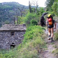
Wir gehen die Straße weiter bergan bis zur darüberliegenden, übernächsten Rechtskehre (rote Kartenmarkierung "W"). Von da führt ein Weg zum Weiler Paioret. Nach dem letzten Gebäude nehmen wir den Pfad links hinunter. Ein Stück weit folgen wir der Wasserleitung und nehmen dann die Spur hinunter zum Bachbettbis zu einer Brücke.
We continue up the road to the rightward haipin bend above (red map mark "W"). From there a path leads to the hamlet of Paioret. After the last building, we take the path down to the left. For a bit we follow the water pipe and then take the track down to the streambed.
Giro (3 h):
traduzione alternativa
➜
Lingua originale
5-8 Abseiler. Den 45-m-Fall mit Zwischenstand nach ca. 18m anschließend 6m vor dem Becken ein Umlenker um sicher aus dem Wasserstrahl zu bleiben alt. Kann von dem Umlenkerstand gesprungen werden.
5-8 rappel. The 45m drop can be rappelled on the left via an intermediate step (-18m) outside the water. Some possible jumps.
Ritorno (5 min):
traduzione alternativa
➜
Lingua originale
Bei einer betonierten Mauer oro. Links aussteigen um anschließend durch einen kleinen Tunnel (Stirnlampe nützlich) durchqueren. Anschließend (aktive) Bahngleise vorsichtig queren direkt zum Parkplatz.
At an old water intake with a small dam turn left, through a small pedestrian tunnel (headlamp useful) directly to the parking lot.
Coordinate:
Inizio del canyon
Fine del canyon
Parcheggio Entrata e uscita
Letteratura:
Mappa
1:25000
Libro Canyoning
Jean François Fiorina / Franck Jourdan
2007
Libro Canyoning
Roberto Coppo - Luca Dallari - Roberto Schenone
2005
Libro Canyoning
Christophe Folléas / Brigitte Gimenez
2004
Libro Canyoning
Jean François Fiorina / Franck Jourdan / Jean Claude Juda
2004
2-9520630-2-8
Info sul canyon Cwiki
Info sul canyon Descente
Info sul canyon Ropewiki
Gallería
Info sul canyon FFME
Sconosciuto
18.06.2024
Bastien P.
⭐
★★★★★
📖
★★★
⚓
★★★
💧
Basso
Completato ✔
traduzione alternativa
➜
Lingua originale
Altri utenti sono stati: daniel albrecht Patrick Klarner
Beschreibung aktualisiert.
Abwechslungsreiche Schlucht mit einem 40m Abseiler als absolutes Highlight.
Insgesamt sehr rutschig.
Description updated.
Varied canyon with a 40m rappel as an absolute highlight.
Very slippery overall.
Altri utenti sono stati: daniel albrecht Patrick Klarner
09.03.2023
System User
⭐
★★★★★
📖
★★★
⚓
★★★
nessuna traduzione disponibile
Daten importiert von https://canyon.carto.net/cwiki/bin/view/Canyons/CevaCanyon.html
Nuovo rapporto
Riportare brevemente e concisamente le informazioni più importanti dell'ultimo tour o importanti informazioni attuali sul canyon. Se necessario con link a video, foto, ecc..
*
*
*
Esc
Del
Idrologia:


