v4 a4 IV
3h50
45min
3h
5min
310m
200m
110m
22m
2x30m
10
200m
a piedi
Valutazione:
★★★★★
4.3 (11)
Info:
★★★
2.7 (6)
Belay:
★★★
2.8 (9)
Sintesi:
traduzione alternativa
➜
Lingua originale
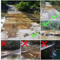
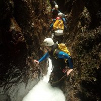
Aquatische, kalte, technisch anspruchsvolle Schlucht; Sicheres Abseilen im Wasser und das Umgehen von einem starken Wasserstrahl muss definitiv gekonnt werden. Die Leale wird von einen unterirdischen See und mehreren Kammern gespeist, in Jahren mit langen schneereichen Winter ist eine Begehung meist ausgeschlossen da aus den Speichern zu viel Wasser in die Schlucht gelangt; großes Einzugsgebiet, bei höheren Wasserstand sehr gefährlich; Empfehlung-> kleine Gruppen; mögl. Notausstieg li. vor der 2. Engstelle beim Zufluss Riu dal Boschet, einige schöne Auswaschungen und Engstellen; Der Wasserstand kann gut bei der Furt vor dem Parkplatz abgeschätzt werden. Das Wasser sollte maximal 1/3 der Furt überspülen. Beim Referenzbild ist die Schlucht von versierten Canyonauten ohne Probleme zu machen.
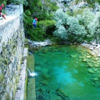
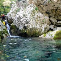
Ein weiterer Indikator für den Wasserstand ist die Staumauer. Wenn das Wasser aus den Auslässen rauskommt, die sich ca. 3m über dem Gumpen befindet, steigt man definitiv besser nicht ein.
Sicher einer der Juwelen in Friaul für Aquatik-Fans.
Aquatic, cold, technically demanding canyon; safe rappel in the water and bypassing a strong water jet must definitely be skilled. The Leale is fed by an underground lake and several chambers, in years with long snowy winters, a walk is usually excluded because from the reservoirs too much water enters the canyon; large catchment area, at higher water levels very dangerous; Recommendation-> small groups; possible emergency exit left before the 2.narrow point at the tributary Riu dal Boschet, some beautiful washouts and narrow points; .
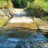
The water level can be well estimated at the ford before the parking lot. The water should wash over a maximum of 1/3 of the ford. In the reference picture, the canyon can be done by experienced canyoneers without any problems.
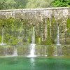
Another indicator of the water level is the dam wall. When the water comes out of the outlets, which is about 3m above the pool, you definitely better not get in.
Certainly one of the jewels in Friuli for aquatic fans.
Est
Sintesi:
traduzione alternativa
➜
Lingua originale
Aquatische, kalte, technisch anspruchsvolle Schlucht; Sicheres Abseilen im Wasser und das Umgehen von einem starken Wasserstrahl muss definitiv gekonnt werden. Die Leale wird von einen unterirdischen See und mehreren Kammern gespeist, in Jahren mit langen schneereichen Winter ist eine Begehung meist ausgeschlossen da aus den Speichern zu viel Wasser in die Schlucht gelangt; großes Einzugsgebiet, bei höheren Wasserstand sehr gefährlich; Empfehlung-> kleine Gruppen; mögl. Notausstieg li. vor der 2. Engstelle beim Zufluss Riu dal Boschet, einige schöne Auswaschungen und Engstellen; Der Wasserstand kann gut bei der Furt vor dem Parkplatz abgeschätzt werden. Das Wasser sollte maximal 1/3 der Furt überspülen. Beim Referenzbild ist die Schlucht von versierten Canyonauten ohne Probleme zu machen.
Ein weiterer Indikator für den Wasserstand ist die Staumauer. Wenn das Wasser aus den Auslässen rauskommt, die sich ca. 3m über dem Gumpen befindet, steigt man definitiv besser nicht ein.
Sicher einer der Juwelen in Friaul für Aquatik-Fans.
Aquatic, cold, technically demanding canyon; safe rappel in the water and bypassing a strong water jet must definitely be skilled. The Leale is fed by an underground lake and several chambers, in years with long snowy winters, a walk is usually excluded because from the reservoirs too much water enters the canyon; large catchment area, at higher water levels very dangerous; Recommendation-> small groups; possible emergency exit left before the 2.narrow point at the tributary Riu dal Boschet, some beautiful washouts and narrow points; .
The water level can be well estimated at the ford before the parking lot. The water should wash over a maximum of 1/3 of the ford. In the reference picture, the canyon can be done by experienced canyoneers without any problems.
Another indicator of the water level is the dam wall. When the water comes out of the outlets, which is about 3m above the pool, you definitely better not get in.
Certainly one of the jewels in Friuli for aquatic fans.
Accesso:
traduzione alternativa
➜
Lingua originale
Von Tolmezzo fährt man über die Bundesstraße S512 Richtung Cavazzo --> weiter am See vorbei--> nach dem See re abbiegen Richtung Alesso -->von Alesso fährt man weiter nach Avasinis --> nachdem man den Torrente Leale überquert hat, biegt man bei der ersten Gelegenheit re ab --> die Schotterstraße führt bis zum Bach, wo man den Wasserstand kontrollieren kann. Das Wasser sollte nicht mehr als 1/3 der Breite und nicht mehr als 2-3cm (in der Höhe) über die Verbauung laufen(siehe Foto zur Einschätzung, bei diesem Wasserstand ist die Schlucht aquatisch aber ohne Probleme machbar) Nach der Wasserstandkontrolle überquert man den Bach --> am Ende der Schotterstraße parkt man den PKW am Waldrand. (N46.299787, E13.041642)
From Tolmezzo, take the S512 main road towards Cavazzo --> continue past the lake --> after the lake, turn right towards Alesso -->from Alesso, continue towards Avasinis --> after crossing Torrente Leale, turn right at the first opportunity --> the dirt road leads to the stream where you can check the water level. The water should not walk more than 1/3 of the width and not more than 2-3cm (in height) over the shoring(see photo for estimation, at this water level the canyon is aquatic but doable without problems) After the water level check you cross the creek --> at the exit of the gravel road you park the car at the edge of the forest. (N46.299787, E13.041642)
Avvicinamento (45 min):
traduzione alternativa
➜
Lingua originale
Vom Parkplatz geht man den gut sichtbaren Weg bis zur Stauwehr. Ca 50m vor der Wehr geht man durch die Leale und wechselt somit auf die or. re Seite. Hier erkennt man gleich die klar sichtbaren Steigspuren, die or. re. hinaufführen. Man folgt dem Weg und kommt rauf zur Staumauer. Danach folgt man der Leale bachaufwärts für ca. 5 min bis man zum Schluchtausgang kommt.
Hier beginnt ein ausgetretener Steig or. li., der zuerst steil nach oben führt. Man folgt dem Steig der or. li. die Leale hochgeht für ca. 25 min und kommt dann direkt zum Bachbett der Leale.
Im Bachbett angekommen, geht man dann weiter bachaufwärts entlang den tief in den Fels gebohrten Gumpen bis or. li. der Riu dal Boschet in die Leale kommt. Hier wechselt man wieder auf die or. re. Seite und geht weiter bachaufwärts bis man Steigspuren erkennt, die bergauf führen. Man folgt dem teilweise mit blau-weißen Markierungen kenntlich gemachten, meist rutschigen, Steig steil bergauf. Immer eher rechts halten in Richtung Leale, da hier auch Wege nach links abzweigen, die nicht zum Einstieg führen. Nach ca. weiteren 10-15 min zweigt der Steig rechts ab hinunter zum Bachbett. Wenn man den Steig folgt kommt auch nach ca. 50m zum Bachbett, wo man sich aber von einem Baum hinunter seilen muss (nicht empfohlen).
approx. 45min
From the parking lot, follow the clearly visible path to the weir. About 50m before the dam you go through the Leale and thus change to the or. right side. Here you can immediately see the clearly visible tracks that lead up to the ortographic right. Follow the path up to the dam wall. Then follow the Leale upstream for about 5 minutes until you reach the canyon exit.
Here begins a well-trodden path or. left, which leads steeply upwards at first. Follow the path ortographic left up the Leale for about 25 min and then you come directly to the streambed of the Leale.
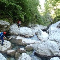
Once in the streambed, continue upstream along the pools bored deep into the rock until the Riu dal Boschet enters the Leale on the orographic left. Here you change back to the or. right side and continue upstream until you see climbing tracks that lead uphill. Follow the path, which is partly marked with blue and white markings and is mostly slippery, steeply uphill. Always keep to the right in the direction of Leale, as paths branch off to the left here that do not lead to the entry. After about another 10-15 min the path branches off to the right down to the streambed. If you follow the path, you will reach the streambed after about 50m, where you have to rope down from a tree (not recommended).
Giro (3 h):
traduzione alternativa
➜
Lingua originale
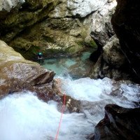
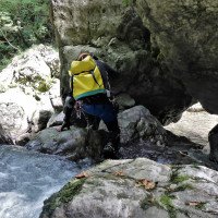
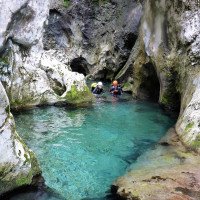
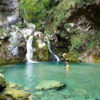
Im Bachbett angekommen sieht man gleich einen dunkel-türkisen Gumpen, der in den Stein gebohrt wurde. Dies ist der erste 3m-Sprung, wo man mit dem durchaus frischen Wasser der Leale in Kontakt kommt. Achtung wenn nicht gesprungen sondern abgeklettert wird. Es befindet sich oberhalb des Sprungs ein Siphon, aus dem man definitiv nicht mehr rauskommt und der von oben nur bei genauem Schauen erkenntlich ist. Wenn man in die Leale springt, braucht man sich über den Siphon keine Gedanken machen, weil der Gumpen genau der Ausgang vom Siphon ist.
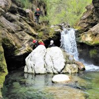
Es folgt eine weitere 1m-Stufe, die ganz vorsichtig gesprungen werden kann mit Arschbombe – wegen Steinen in Gumpen, sowie einem weiteren Sprung in den Gumpen. Man kommt zum ersten Abseiler (SOS10) der sich or.li. oben befindet.
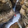
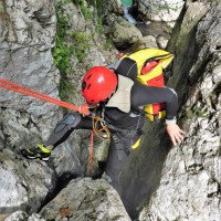
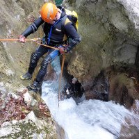
Diese Stelle stellt schon die erste Herausforderung dar, da man unten zwingend in den oft sehr stark gebündelten Wasserstrahl kommt und der in einem turbulenten Gumpen mündet. Achtung: es befinden sich auch Steine in dem Gumpen. Am besten versucht man hier hinter den Wasserstrahl reinzuseilen und dann li.od.re den Wasserstrahl zu umgehen.
Die SOS10 Abseilstelle kann vom Einstieg aus eingesehen werden. Wenn man schon beim Einstieg das Gefühl hat, dass viel Wasser in der Schlucht ist, empfiehlt es sich, dass zumindest eine Person beim Einstieg wartet um ein Seil für einen Not-Aufstieg im Notfall aufzubauen.
Es folgt eine schöne Schwimmpassage, die zu einem Abseiler oder 8m-Sprung führt. Und schon ist der obere Teil – der aber absolut lohnenswert ist – vorbei. Man folgt wieder für 200m der Leale und kommt vorbei an der Mündung des Rio dal Boschet.
Sollte man im oberen Teil schon Probleme mit dem Wasser gehabt haben, oder ein Gruppenmitglied überfordert gewesen sein, sollte man hier or.li. wieder die Schlucht verlassen, wo man vorher beim Zustieg zum Bachbett gekommen ist! Der untere Teil birgt Abseiler, die zwingend im Wasser zu machen sind, ist stark eingeschnitten und hat keine Notausstiege sowie Bereiche, wo man sich vom Wasser in Sicherheit bringen kann.
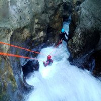
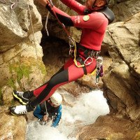
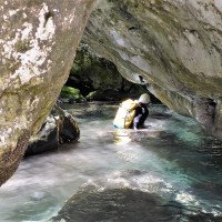
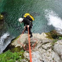
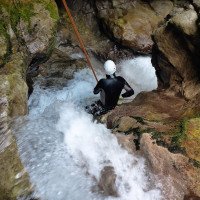
Der untere Teil beginnt mit einem 6m-Abseiler und nach einer kurzen Kletter- und Schwimmpassage verengt sich die Schlucht. Man kommt zur 18m-Abseilstelle, die zwingend im Wasser zu machen ist. Der Abseiler kann nicht vom Stand aus eingesehen werden. Nach einer kleinen Schwimmstrecke kommt man zu einer kleinen Stufe (SOS 6), die auch abgeklettert werden kann. Danach folgt einer der spektakulärsten stellen in der Leale. Die Abseilstelle SOS5 befindet sich or. li. sehr weit ausgesetzt und kann nur kletternd auf rutschigem Felse erreicht werden. Es gibt einige Klebehaken, die man unbedingt verwenden sollte und die zum Aufbau eines Seilgeländers dienen. Hat man die Abseilstelle erreicht, geht es weiter mit dem Wohl spektakulärsten Abseiler. Das Wasser rauscht durch einen sehr engen Kanal und man muss bei der Stufe mit etwas Abseilgeschick es schaffen or. li. bei der Stufe rauszukommen, um von der Stufe weiter abzuseilen. Hierfür kann man einige Steine als Griffe verwenden, um rauszukommen. Die Stelle ist deshalb herausfordernd, weil wenn hier das Gleichgewicht verloren wird, kommt man direkt in den gebündelten Wasserstrahl, in den man nicht reinkommen will!
Nach einer kleinen Schwimmstelle kommt man zu einer Felsrampe, wo mit etwas Suchen die 2 Klebehaken zum Aufbau des Seilgeländers gefunden werden. Nach Aufbau des Seilgeländers zu der 6m-Abseilstelle (SOS4) kommt ein enger Wasserkanal, den man durch Ausspreizen abklettern muss. Nach einer kleinen Schwimmstrecke kommt man zu der Abseilstelle (SOS3), die trocken absolviert werden kann. Wenn hier nicht zu viel Wasser ist, kann man auch direkt zur Abbruchkante gehen wo das Wasser runter rauscht von hier aus in den Gumpen springen.
Die nächste Abseilstelle ist or. re. sehr weit oben angebracht. Ein Klebehaken hilft hier beim Kletteraufstieg.
Schon kommt man zur letzten Abseilstelle, die sich bei einem großen Klemmblock befindet. Wenn wenig Wasser in der Schlucht ist, kann man zum Kettenstand (or.li.) gehen, der sich direkt am Klemmblock befindet. Achtung: hier kommt man zwingend in den wuchtigen Wasserstrahl!
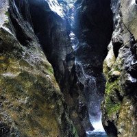
Bei mehr Wasser sollte man unter dem Klemmblock durchgehen und den Kettenstand benützen mit der SOS1-Plakette. Dieser befindet sich zwar ein bisschen ausgesetzt, dafür kommt man erst weiter unten in den Wasserstrahl und kann diesen durch Ausspreizen umgehen. Ist man im Gumpen folgt die letzte Schwimmstrecke durch eine wunderbare dunkle Engstelle.
Ist man aus der Schwimmstrecke draußen, öffnet sich die Schlucht und man befindet sich genau an der Stelle, wo man beim Zustieg or.li. steil aufwärts gegangen ist. Wie schon beim Zustieg folgt man der Leale für ca. 5 min, bis man wieder bei der Staumauer ist, die mit einem beherzten Sprung auch gesprungen werden kann.
3h
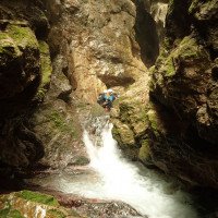
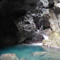
Arrived in the streambed, you immediately see a dark turquoise pool drilled into the stone. This is the first 3m jump, where you come into contact with the quite fresh water of the Leale. Attention if you are not jumping but downclimbing. There is a siphon above the jump, from which you definitely cannot get out and which is only visible from above if you look closely. If you jump into the leale, you don't need to worry about the siphon, because the pool is exactly the exit from the siphon.
Another 1m step follows, which can be jumped very carefully with ass bomb - because of stones in pools, as well as another jump into the pool. One comes to the first rappel (SOS10) which is located orographic left at the top.
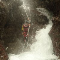
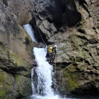
This place is already the first challenge, because at the bottom you have to jump into the often very strong water jet, which ends in a turbulent pool. Attention: there are also stones in the pool. It is best to try to abseil behind the water jet and then to avoid the water jet on the left or right.
The SOS10 rappel point can be seen from the entry. If you have the feeling that there is a lot of water in the canyon already at the entry, it is recommended that at least one person waits at the entry to set up a rope for an emergency ascent.
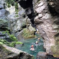
A nice swimming passage follows, leading to a rappel or 8m jump. And already the upper part - but absolutely worthwhile - is over. You follow the Leale again for 200m and pass the mouth of the Rio dal Boschet.
If you have already had problems with the water in the upper part, or a group member has been overwhelmed, you should leave here or.left again the canyon, where you came before at the access to the streambed! The lower part has rappels that must be done in the water, is heavily cut and has no emergency exits and areas where you can get away from the water to safety.
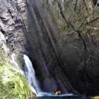
The lower part starts with a 6m rappel and after a short climbing and swimming passage the canyon narrows. You come to the 18m rappel, which is mandatory to do in the water. The rappel cannot be seen from the belaystation. After a small swim, you come to a small step (SOS 6), which can also be downclimbed. After that follows one of the most spectacular places in the Leale. The abseil SOS5 is located or. left very far exposed and can be reached only climbing on slippery rock. There are some glued anchors that should be used to set up a rope traverse. Once you have reached the rappel, you continue with what is probably the most spectacular rappel. The water rushes through a very narrow channel and you have to manage with some rappel skill to get out or. left at the step to continue rappelling from the step. For this you can use some stones as handholds to get out. The place is challenging because if you lose your balance here, you will get directly into the bundled water jet, which you don't want to get into!
After a small swimming spot you come to a rock ramp, where with some searching you find the 2 glued anchors to set up the rope traverse. After setting up the rope traverse to the 6m rappel point (SOS4) there is a narrow water channel, which you have to downclimb by spreading out. After a short swim you come to the abseil point (SOS3), which can be completed dry. If there is not too much water here, you can also go directly to the edge where the water rushes down and jump into the pool.
The next rappel point is located or. right very far up. A glued anchor helps here to climb up.
Already you come to the last rappel point, which is located at a large clamping block. If there is little water in the canyon, you can go to the chain anchor (ortographic left), which is located directly at the clamping block. Attention: here you will necessarily come into the massive water jet!
If there is more water, you should go under the clamping block and use the chain anchor with the SOS1 badge. This is a little bit exposed, but you will get into the water jet further down and you can avoid it by spreading out. Once you are in the pool, the last part of the swim is through a wonderful dark narrow section.
Once you are out of the swim section, the canyon opens and you are exactly at the place where you went steeply uphill during the access ortographic left. As with the access, follow the leale for about 5 min until you are back at the dam wall, which can also be jumped with a spirited jump.
Ritorno (5 min):
traduzione alternativa
➜
Lingua originale
Einfach wie beim Zustieg dem Weg bis zum Parkplatz folgen.
approx. 5min
Just follow the path to the parking lot as for the access.
Coordinate:
Inizio del canyon
Parcheggio Entrata e uscita
Parkplatz nach Wiese (cwiki)
Fine del canyon
Letteratura:
Libro Canyoning
Simon Flower
Cicerone
2012
Northern Italy and Ticino
Altro
AIC
2022
34 Canyonbeschreibungen, Friuli Venezia Giulia
Info sul canyon ACA
Info sul canyon Cwiki
Info sul canyon Descente
Gallería
Gallería
Gallería
Altro info sul canyon
Altro info sul canyon
Rapporto di viaggio (ad es. blogpost)
Info sul canyon Ropewiki
AIC Catasto
Altro info sul canyon
04.03.2025
Rick Paapy
⭐
★★★★★
📖
★★★
⚓
★★★
💧
Basso
Completato ✔
nessuna traduzione disponibile
Altri utenti sono stati: Pavel Urbanek
Everything tip topi
One down climb would be awkward with high water, because anchor is not there anymore.
If you walking up follow the canyon you enter the canyon not at the start missing 1 or 2 waterfalls.
Altri utenti sono stati: Pavel Urbanek
23.02.2025
Horst Lambauer
⭐
★★★★★
📖
★★★
⚓
★★★
💧
Normale
Completato ✔
traduzione alternativa
➜
Lingua originale
Altri utenti sono stati: Wolfgang
Alles tip top. Haben beim Zustieg ein paar Äste entfernt und ein Fixseil für den Abstieg zum oberen Start ergänzt.
Everything tip top. We removed a few branches on the access and added a fixed rope for the descent to the upper start.
Altri utenti sono stati: Wolfgang
22.09.2024
Horst Lambauer
⭐
★★★★★
📖
★★★
⚓
★★★
💧
Normale
Completato ✔
traduzione alternativa
➜
Lingua originale
Sind den Bach inkl. dem oberen Teil gegangen. Haben ein Fixseil ergänzt beim Weg runter zum oberen einstieg. Nach dem oberen Teil haben wir noch die letzten 3 Sprünge vom Rio Amula. Hierfür geht man ca 30 Hm or. re. vom Rio Amula rauf. Dann weiter in den unteren Teil der Leale. Sehr schön, alle Stände tip top
Walked the stream including the upper part. We added a fixed rope on the way down to the upper entry. After the upper part we still have the last 3 jumps from Rio Amula. For this you go up about 30 meters ortographic right from Rio Amula. Then on to the lower part of the Leale. Very nice, all stands tip top
01.09.2024
Marosffy Dániel
⭐
★★★★★
📖
★★★
⚓
★★★
💧
Normale
Completato ✔
nessuna traduzione disponibile
Access to the usual parking lot is possible but not obvious, due to damage of the gravel road at the last 100m. If you are worried about your car, park before the ford.
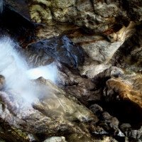
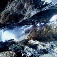
Today the ford was completely dry (picture 1), but that did not mean that the canyon was too. I'd call it the lower end of normal. More optical than practical threat, but the water was definitely there (picture 2 at the bottom of the crux - rappel No. 5).
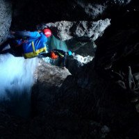
Some technical help at the awkward downclimb after No. 4 (picture 3) would be great.
12.08.2024
Jason Walker
⭐
★★★★★
📖
★★★
⚓
★★★
💧
Basso
Completato ✔
nessuna traduzione disponibile
The causeway/ford gauge is quite misleading currently. Today it was well and truly dry, and not even close to water flowing over it, and I'd call it the high end of low. Maybe even a low-medium.
All anchors super nice. Many times a handrail is a safe idea (and the anchors are provided for it). A few jumps to be had too!
Looking at the post (with pictures of the crux) below - we had similar levels today.
04.08.2024
Matteo Zocca
⭐
★★★★★
📖
★★★
⚓
★★★
💧
Alto
Completato ✔
nessuna traduzione disponibile
Automatisch importiert von Descente-Canyon.com für Canyon Leale
(Quelle: https://www.descente-canyon.com/canyoning/canyon-debit/23460/observations.html)
16.07.2024
Klara Skopal
⭐
★★★★★
📖
★★★
⚓
★★★
💧
Alto
Completato ✕
traduzione alternativa
➜
Lingua originale
Furt fast auf die ganze Breite überspült
Ford flooded across almost the entire width
15.07.2024
Klara Skopal
⭐
★★★★★
📖
★★★
⚓
★★★
💧
Alto
Completato ✕
traduzione alternativa
➜
Lingua originale
Zufahrt zum Parkplatz ist leider nicht mehr ganz möglich, da ca 100m davor der Weg weggebrochen/gespült ist und dort jetzt ne Stufe über nen halben Meter drin ist.
Leider sowohl die Furt nach den Regenfällen der letzten Woche fast auf die ganze Breite überspült, die mittleren zwei im Wasser liegenden Steine ganz unter Wasser, sowie bei der Staumauer auch aus dem oberen Loch Wasser, daher sind wir ihn dann leider gar nicht gegangen.
Von unten ließ sich nur gleich sagen (Bilder lassen sich leider grad nicht hochladen), dass extrem viel Kies drin
is sowie sieht das Flussbett über der Staumauer vollkommen anders aus.
Unfortunately, access to the parking lot is no longer quite possible, as the path about 100m in front of it has broken away/washed away and there is now a step over half a meter in it.
Unfortunately, after last week's rainfall, the ford was flooded almost across its entire width, the middle two stones lying in the water were completely under water, and there was also water in the upper hole at the dam wall, so unfortunately we didn't walk it at all.
The only thing we could tell from the bottom (unfortunately we can't upload pictures at the moment) was that there was a lot of gravel in it.
and the riverbed above the dam looks completely different.
02.09.2023
Horst Lambauer
⭐
★★★★★
📖
★★★
⚓
★★★
💧
Basso
Completato ✔
nessuna traduzione disponibile
Alles tip top
22.08.2023
Klara Skopal
⭐
★★★★★
📖
★★★
⚓
★★★
💧
Normale
Completato ✔
traduzione alternativa
➜
Lingua originale
Kettenstände alle in einwandfreiem Zustand,
Wasserstand eher niedrig, keine problematischen Stellen, Wasserstand bei der Indikatorstelle unten bei Zufahrt siehe Bild. Beim Staudamm nur Wasserfluss durch die unterste Stufe.
Chain stands all in perfect condition,
Water level rather low, no problematic spots, water level at indicator point down by access road see picture. At the dam only water flow through the lowest stage.
21.05.2023
Max H.
⭐
★★★★★
📖
★★★
⚓
★★★
💧
Alto
Completato ✕
traduzione alternativa
➜
Lingua originale
Unsere Gruppe ist beim Staudamm (siehe Bild) umgedreht. Die andere Gruppe hat ihn dann versucht und Alex hat dankenswerter Infos zur Schlüsselstelle gepostet (siehe Fotos).
Our group turned around at the dam (see picture). The other group then tried it and Alex has thankfully posted info on the key spot (see photos).
09.03.2023
System User
⭐
★★★★★
📖
★★★
⚓
★★★
nessuna traduzione disponibile
Info: Teile der Canyonbeschreibung wurden automatisiert übernommen. Konkret die Felder Weblinks, Koordinaten, Rating, Ort, Länge des Canyon, Einfachseil Mindestens von https://canyon.carto.net/cwiki/bin/view/Canyons/TorrenteLealeCanyon.html und https://www.descente-canyon.com/canyoning/canyon/23460
09.03.2023
System User
⭐
★★★★★
📖
★★★
⚓
★★★
nessuna traduzione disponibile
Daten importiert von https://www.canyoning.or.at/index.php/liste-aller-canyons/73-torrente-leale
18.08.2022
Bubtore
⭐
★★★★★
📖
★★★
⚓
★★★
💧
Basso
Completato ✔
traduzione alternativa
➜
Lingua originale
Komischer Canyon, all 200 m sieht es wieder komplett anders aus. Landschaftlich top.
Strange canyon, every 200 m it looks completely different again. Top scenic.
Nuovo rapporto
Riportare brevemente e concisamente le informazioni più importanti dell'ultimo tour o importanti informazioni attuali sul canyon. Se necessario con link a video, foto, ecc..
*
*
*
Esc
Del
Idrologia:


