Paese:
Österreich / Austria
Regione: Tirol
Sottoregione: Bezirk Schwaz
Città: Achenkirch (A), Lenggries (D)
v4 a4 III
3h5
1h15
1h30
20min
975m
865m
110m
28m
2x35m
8
600m
a piedi
Valutazione:
★★★★★
3.5 (6)
Info:
★★★
3 (3)
Belay:
★★★
2.5 (4)
Sintesi:
traduzione alternativa
➜
Lingua originale
Abseilcanyon. Begehung wird idR. im Hühnerbach fortgesetzt.
Überkommene gängige Bezeichnung Pitzbach, nach der amtlichen österreichischen Gewässerkarte allerdings Rotwandersbach. Der Pitzbach ist nur ein linker Seitenbach des Rotwandersbach, der im Zuge dieser Tour überhaupt nicht berührt wird. Die falsche Bezeichnung rührt daher, dass in der damaligen Alpenvereinskarte nur der Seitenbach als Pitzbach bezeichnet war und man deshalb offenbar annahm, das sei der Hauptbach.
Rappel canyon. Ascent is usually continued in the Hühnerbach.
Nord
Sintesi:
traduzione alternativa
➜
Lingua originale
Abseilcanyon. Begehung wird idR. im Hühnerbach fortgesetzt.
Überkommene gängige Bezeichnung Pitzbach, nach der amtlichen österreichischen Gewässerkarte allerdings Rotwandersbach. Der Pitzbach ist nur ein linker Seitenbach des Rotwandersbach, der im Zuge dieser Tour überhaupt nicht berührt wird. Die falsche Bezeichnung rührt daher, dass in der damaligen Alpenvereinskarte nur der Seitenbach als Pitzbach bezeichnet war und man deshalb offenbar annahm, das sei der Hauptbach.
Rappel canyon. Ascent is usually continued in the Hühnerbach.
Accesso:
traduzione alternativa
➜
Lingua originale
Von Bad Tölz über Lenggries zum Sylvensteinsee. Dort nach links und 5,6 km auf der B 307 in Richtung Achensee. Unmittelbar nach der Straßenbrücke über den Walchen (Achenbach) rechts das Fahrzeug abstellen.
Alternativ Zufahrt vom Achensee auf der B 181 in Richtung Lenggries (17,4 km ab Camping Achensee).
From Bad Tölz via Lenggries to the Sylvensteinsee. There turn left and 5.6 km on the B 307 in the direction of Achensee. Immediately after the road bridge over the Walchen (Achenbach) park the vehicle on the right. Alternatively, access from Achensee on the B 181 in the direction of Lenggries (17.4 km from Camping Achensee).
Avvicinamento (1 h 15):
traduzione alternativa
➜
Lingua originale
Vom Parkplatz den Forstweg nehmen, der in westlicher Richtung auf den Hühnerbach zuläuft. Dann hoch über dem Hühnerbach in südlicher Richtung.Wo rechts eine grasbewachsene Piste zum Bach hinabführt (etwas über 900 m üNN), ist der Ausstieg. Zum Einstieg geht man gute 10 Min. weiter auf der Forststraße bis zu einer Weggabelung. Hier bleibt man rechts und sucht ein paar Meter weiter den Pfad, der rechts zum Bach hinführt.
From the parking lot take the forest road that runs in a westerly direction towards the Hühnerbach. Then high above the Hühnerbach in a southerly direction.where on the right a grassy slope leads down to the stream (a little over 900 m above sea level), is the exit. For the entry, continue on the forest road for about 10 minutes until you reach a fork in the road. Here you stay on the right and look for the path a few meters further on, which leads to the stream on the right.
Giro (1 h 30):
traduzione alternativa
➜
Lingua originale
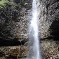
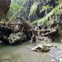
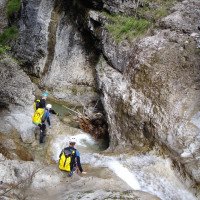
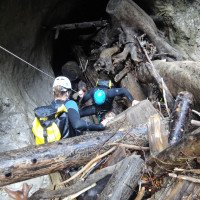
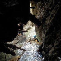
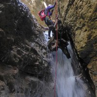
Insgesamt 8 Abseiler, eine Engstelle gegen Ende der Tour und idR viel Holz im Bach. Bei dem 28m-Abseiler gibt es alternativ rechts eine ca. 35m-Abseilmöglickeit, die allerdings meist recht wasserarm ist.
A total of 8 rappel, a narrow passage towards the exit of the tour and idR much wood in the stream. At the 28m rappel there is alternatively on the right an approx. 35m rappelmöglickeit.
Ritorno (20 min):
traduzione alternativa
➜
Lingua originale
Rechts hinaus auf die kaum mehr als solche erkennbare Piste, die auf den Zustiegsweg trifft. Auf diesem zurück zum Auto.
Alternativ Fortsetzung im Hühnerbach.
Turn right onto the dirt road, which is hardly recognizable as such anymore and meets the access path. On this back to the car. Alternatively, continue in the Hühnerbach.
Coordinate:
Inizio del canyon
47.5643°, 11.6054°
↓↑
DMS: 47° 33" 51.48', 11° 36" 19.44'
DM: 47° 33.858", 11° 36.324"
Google Maps
Austria Topografica
DMS: 47° 33" 51.48', 11° 36" 19.44'
DM: 47° 33.858", 11° 36.324"
Google Maps
Austria Topografica
Parcheggio Entrata e uscita
47.5823°, 11.6173°
↓↑
DMS: 47° 34" 56.28', 11° 37" 2.28'
DM: 47° 34.938", 11° 37.038"
Google Maps
Austria Topografica
DMS: 47° 34" 56.28', 11° 37" 2.28'
DM: 47° 34.938", 11° 37.038"
Google Maps
Austria Topografica
Fine del canyon
47.5675°, 11.6015°
↓↑
DMS: 47° 34" 3', 11° 36" 5.4'
DM: 47° 34.05", 11° 36.09"
Google Maps
Austria Topografica
DMS: 47° 34" 3', 11° 36" 5.4'
DM: 47° 34.05", 11° 36.09"
Google Maps
Austria Topografica
Letteratura:
Mappa
Bayerisches Landesvermessungsamt, UK L30 (1 : 50 000), Karwendelgebirge
Mappa
Bayerisches Landesvermessungsamt, Blatt 8435 (1 : 25 000), Fall
Mappa
Bayerisches Landesvermessungsamt, Blatt 8435 (1 : 25 000), Fall
Mappa
ÖK 2217, Hinterriß, 1:25000
Libro Canyoning
Tiroler Canyoningführer
Alexander Riml / Gunnar Amor
2012
Libro Canyoning
Canyoning in Bayern und Tirol
Werner Baumgarten
2010
Libro Canyoning
Canyoning in Bayern und Tirol (2. Auflage)
Werner Baumgarten
2013
Info sul canyon Cwiki
Info sul canyon Descente
Altro info sul canyon
13.10.2024
Christian Haas
⭐
★★★★★
📖
★★★
⚓
★★★
💧
Alto
Completato ✔
traduzione alternativa
➜
Lingua originale
Altri utenti sono stati: Sommer Andi
Wasserstand nach Regen der letzten Tage erhöht, aber noch gut machbar.
Sicherungen alle in gutem Zustand.
Toll wie immer!
Water level increased after rain in the last few days, but still manageable.
Fuses all in good condition.
Great as always!
Altri utenti sono stati: Sommer Andi
14.07.2024
Manfred Reg
⭐
★★★★★
📖
★★★
⚓
★★★
💧
Normale
Completato ✔
traduzione alternativa
➜
Lingua originale
Alle Verankerungen wurden neu gesetzt , doppelt mit Kette und sogar Numerierung… Top
All anchorages have been reset, double with chain and even numbered... Top
14.06.2024
Martina
⭐
★★★★★
📖
★★★
⚓
★★★
💧
Normale
Completato ✔
nessuna traduzione disponibile
Automatisch importiert von Descente-Canyon.com für Canyon Pitzbach
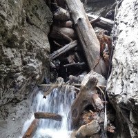
More snow on the top of the mountain than we expected in middle of the June. The water was clear but very cold. Canyon is easy, nice, with some jumps, and nice abseiling. Don't be surprised by stuck trees and stumps in the canyon. On some of them there are already created jams (stairs) for easier abseiling - thank you for that!
(Quelle: https://www.descente-canyon.com/canyoning/canyon-debit/22166/observations.html)
28.04.2024
Max
⭐
★★★★★
📖
★★★
⚓
★★★
🌊
Folle
Completato ✔
traduzione alternativa
➜
Lingua originale
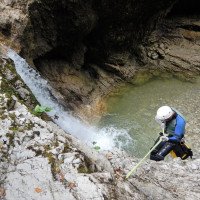
Wasserstand durch Schneeschmelze enorm hoch. Sind vor der Engstelle am Ende der Schlucht ausgestiegen. Sehr unangenehmer Rücklauf - siehe 2 Bild.
Water level enormously high due to melting snow. We got out before the narrow section at the exit of the canyon. Very unpleasant return flow - see 2 picture.
06.04.2024
Montie
⭐
★★★★★
📖
★★★
⚓
★★★
💧
Alto
Completato ✔
nessuna traduzione disponibile
First pool is getting deeper again, can be jumped from the middle. Slide may be possible, the water level was too high to try it out. Not yet deep enough to jump from the top again. Second jump doable with bent knees. Some trees in the way after the winter. Anchor on the high rappel was loose, tightened it again. Other anchors are all fine. Rope at the tree-block is gone, new one should be installed. Downclimbing with a rope is easier and almost safer than rapelling here. Final jump is deep enough to jump.
09.03.2023
System User
⭐
★★★★★
📖
★★★
⚓
★★★
nessuna traduzione disponibile
Info: Teile der Canyonbeschreibung wurden automatisiert übernommen. Konkret die Felder Weblinks, Koordinaten, Rating, Länge des Canyon, Einfachseil Mindestens von https://www.descente-canyon.com/canyoning/canyon/22166
09.03.2023
System User
⭐
★★★★★
📖
★★★
⚓
★★★
nessuna traduzione disponibile
Daten importiert von https://canyon.carto.net/cwiki/bin/view/Canyons/PitzbachCanyon.html
Idrologia:

1 Anmarsch, vorbei an der...
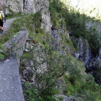
2 Blick in die Hühnerbachs...

3 der Abseiler/Sprung vom...
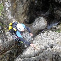
4 Es geht los mit der Engs...

5

6
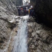
7

8

9

10 dann Laufstrecke

11
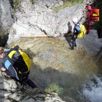
12 hier entweder links ne...
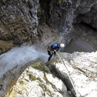
13 links die C30
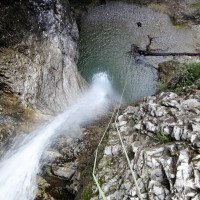
14 dito

15 dito, Blick zurück
16 dito

17 von rechts der Hauptbac...

18
19
20
21

22

31 die Totholzverklausung
32
33
24
25

26 letzter Abseiler im Pit...
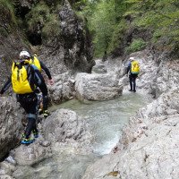
27
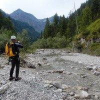
28 reechts aussteigen auf...
