non così difficile
Rio Storto
v3 a3 III
2h30
0min
2h30
0min
1100m
980m
120m
20m
2x30
7
1000m
Auto necessaria
Valutazione:
★★★★★
3.6 (4)
Info:
★★★
2 (2)
Belay:
★★★
1.5 (2)
Sintesi:
traduzione alternativa
➜
Lingua originale
Schöner enger Canyon mit klarem Wasser. Leider zum Zeitpunkt unserer Begehung mit einigem Holz drinnen (vor allem im oberen Teil). Sehr schöne enge Passagen mit einer traumhaften Mündung in den türkis-blauen Sauris-Stausee. Darf nur bei stabilem Wetter begangen werden, da nur maximal eine Fluchtstelle in der Mitte der Schlucht existiert und teilweise die Engstellen nur einen Meter breit sind. Durchaus lohnenswert.
Nice narrow canyon with clear water. Unfortunately, at the time of our walk with some wood inside (especially in the upper part). Very nice narrow passages with a gorgeous mouth into the turquoise-blue Sauris reservoir. Must be done only in stable weather, as there is only one escape point in the middle of the canyon and some of the narrows are only one meter wide. Quite worthwhile.
Accesso:
traduzione alternativa
➜
Lingua originale
Von Tolmezzo fährt man ca 22km (20min) bis Ampezzo. Direkt in Ampezzo biegt man rechts ab in Richtung Sauris. Der kurvigen Straße, die zum Schluss durch ein paar enge Tunnels führt, folgt man für weitere 10km (ca 15 min) bis man direkt beim Sauris-Staudamm ankommt. Hier biegt man links ab und fährt über die Staumauer des Sauris-Staudamms.
Direkt nach der Staumauer fährt man in einen sehr engen Tunnel (Achtung bei Gegenverkehr gibt es praktisch keine Ausweichen). Von der Einfahrt des Tunnels weg fährt man für weitere 1,2 km durch den Tunnel und auf der Straße weiter und bei der ersten 180°-Kurve biegt man rechts in den Schotterweg ein. Man fährt den Schotterweg ca 200m rein, bis man zu einer Brücke kommt die direkt über den Rio Storto führt, wo dieser in den Sauris-Stausee mündet. Nach der Brücke kann man gut auf der rechten Seite alle Autos parken bis auf die, die man zum shutteln benötigt.
Bei der Brücke sollte man auch den Wasserstand des Rio Storto kontrollieren. Die Schlucht ist über lange Teile sehr eng und bietet nur wenig Fluchtmöglichkeiten. Nur bei stabilem Wetter einsteigen.
(Koordinaten: N 46.442402, E 012.725270)
Um zum Einstieg zu gelangen fährt man vom unteren Parkplatz wieder die 200m zurück auf die Straße und fährt rechts hangaufwärts. Auf dieser Straße folgen dann gleich nachdem man den Schotterweg verlassen hat 3 Serpentinen gefolgt von einer längeren Geraden. Nach ziemlich genau 2km (noch bevor die nächsten Serpentinen anfangen!) führt rechts ein Forstweg rein (mit Fahrverbotsschild um das sich keiner kümmert). Hier biegt man ab und fährt ca 200m auf dem Forstweg über die erste betonierte Furt über den Rio Plan Pizzul und direkt danach findet man auf der linken Seite einen großen Holzablegeplatz wo man perfekt parken kann. (Koordinaten: N 46.432698, E 012.724778)
From Tolmezzo you drive about 22km (20min) to Ampezzo. Directly in Ampezzo turn right in the direction of Sauris. Follow the winding road, which leads through a few narrow tunnels, for another 10km (approx. 15min) until you arrive directly at the Sauris dam. Here you turn left and drive over the dam wall of the Sauris dam.
Immediately after the dam wall you enter a very narrow tunnel (be careful with oncoming traffic there is practically no way out). From the entrance to the tunnel, drive through the tunnel for another 1.2 km and continue on the road. At the first 180° bend, turn right onto the gravel road. Follow the dirt road for about 200m until you reach a bridge that leads directly over the Rio Storto, where it flows into the Sauris reservoir. After the bridge you can park all your cars on the right side except for the ones you need for the shuttles.
At the bridge you should also check the water level of the Rio Storto. The canyon is very narrow over long parts and offers only few escape possibilities. Enter only in stable weather.
(Coordinates: N 46.442402, E 012.725270)
To get to the entry from the lower parking lot, drive back 200m to the road and turn right up the slope. On this road, immediately after leaving the gravel road, there are 3 serpentines followed by a longer straight. After almost exactly 2km (before the next switchbacks begin!) a forest road leads in on the right (with a no driving sign that no one cares about). Here you turn off and drive about 200m on the forest road over the first concrete ford over the Rio Plan Pizzul and directly after that you will find a large wooden parking area on the left side where you can park perfectly. (Coordinates: N 46.432698, E 012.724778)
Avvicinamento (0 min):
traduzione alternativa
➜
Lingua originale
Direkt beim oberen Parkplatz folgt man den Forstweg für ein paar Meter. Bei der nächsten betonierten Furt, die über den Rio Storto führt kann man in diesen einsteigen.
0 min
Directly from the upper parking lot, follow the forest road for a few meters. At the next concrete ford that crosses the Rio Storto you can enter it.
Giro (2 h 30):
traduzione alternativa
➜
Lingua originale
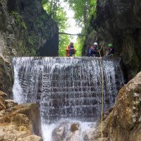
Man geht in dem offenen Bachbett ca 300m bis man zum ersten sanften Abbruch kommt. Hier klettert man entweder vorsichtig ab oder verwendet den Baum hinter einen als Abseilpunkt (15 m).
Nach einer weiteren kleinen Gehstrecke einer kleinen Rutsche und einem flachen 15m-Abseiler in einer engen Rinne, verengt sich die Schlucht zusehens. Wer bei diesem Abseiler bereits Probleme mit dem Wasser hat sollte hier umdrehen und die Tour abbrechen! Hat man diese Stelle passiert hat man für längere Zeit keine Möglichkeit mehr gut aus dem Canyon zu kommen und es folgen mehrere enge Stellen.
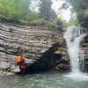
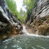
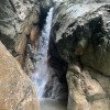
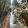
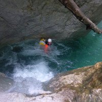
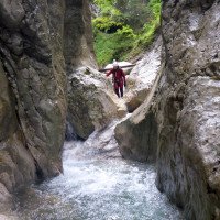
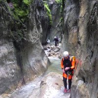
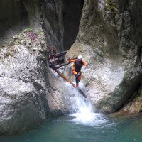
In dieser sehr schönen engen Passage folgen einige kleine Schwimmstrecken, Abkletterpassage, Sprünge und Rutschen. Leider waren bei unserer Begehung gerade in dieser Passage einiges an Holz drinnen was das Vergnügen leicht getrübt hat. Die enge Passage endet mit dem höchsten Abseiler der Schlucht (19m) und es folgt eine kleine Gehstrecke mit Blockchaos, dass abgeklettert werden muss. Hier könnte sich die vermutlich einzige Fluchtmöglichkeit in der Schlucht befinden, da die nächste Engstelle bis zum Schluchtenausgang führt.
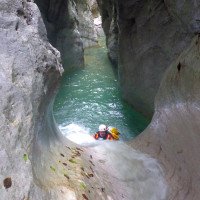
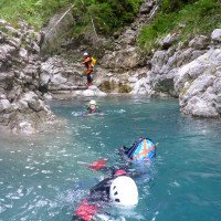
Der weitere enge Schluchtenverlauf kann entweder mit einer kleinen Rutsche oder, wenn man or links ein bisschen raufklettert, auch als 4m-Sprung begonnen werden kann. In dieser engen Passage findet man weitere kleinere Rutschen, Sprünge, kleinere Schwimmstrecken, wie auch 2 kleinere Abseiler vor. Nach einem Zulauf or. li. folgt ein weiterer flacher 15m-Abseiler, sowie ein kleiner Sprung. Es folgt ein engeres, durch hohe Wände gesäumtes Bachbett in dem man ca 70m geht, ehe man zu letzten Abseiler bei einem Holzwehr in der Schlucht kommt. Danach folgen ca 60m Geh-, Kletter- und kleinere Schwimmpassagen ehe man unter der Brücke bei der Mündung des Rio Storto in den Sauris-Stausee ankommt.
about 2,5h
You walk in the open streambed for about 300m until you come to the first gentle break. Here you either climb down carefully or use the tree behind you as anchor (15m).
After another small walking passages of a small slide and a shallow 15m rappel in a narrow chute, the canyon narrows more and more. If you already have problems with the water during this rappel, you should turn around here and stop the tour! Once you have passed this point, you have for a long time no possibility to get out of the canyon well and several narrow places follow.
In this very nice narrow passage follow some small swimming sections, downclimb, jumps and slides. Unfortunately, there was some wood in this passage during our ascent, which slightly spoiled the pleasure. The narrow passage ends with the highest rappel of the canyon (19m) and it follows a small walking passages with block chaos that must be rappelled. Here could be probably the only escape in the canyon, as the next narrow passage leads to the canyons exit.
The further narrow passage of the canyon can be started either with a small slide or, if you climb up or left a bit, also as a 4m jump. In this narrow passage you will find more smaller slides, jumps, smaller swimming sections, as well as 2 smaller rappels. After an inlet ortographic left follows another shallow 15m rappel, as well as a small jump. A narrower streambed follows, lined by high walls, in which one walks about 70m, before one comes to the last rappel at a wooden weir in the canyon. After that there are 60m of walking, climbing and smaller swimming passages before arriving under the bridge at the mouth of the Rio Storto in the Sauris reservoir.
Ritorno (0 min):
traduzione alternativa
➜
Lingua originale
Man schwimmt im Sauris-Stausee ca 40m und geht dann am or.li. Ufer die Böschung hinauf bis zum Parkplatz wo die Autos stehen.
You swim in the Sauris reservoir for about 40m and then walk on the ortographic left. Bank up the embankment to the parking lot where the cars are.
Coordinate:
Inizio del canyon
(cwiki_1)
Parcheggio in uscita
Parkplatz nach Brücke Rio Storto (cwiki)
Parcheggio all'entrata
Parkmöglichkeit bei Forststraßenabzweigung (cwiki)
Fine del canyon
(cwiki_1)
Info sul canyon ACA
Info sul canyon Cwiki
Info sul canyon Descente
Info sul canyon Ropewiki
AIC Catasto
27.08.2024
Montie
⭐
★★★★★
📖
★★★
⚓
★★★
💧
Basso
Completato ✔
nessuna traduzione disponibile
I don't quite understand the car shuttle option. Perhaps if you are staying in Sauris, otherwise the drive over with 2 cars is so much more effort, and costs so much more than just walking up (we walked up on the road, which is not busy at all, took us 30 min at a slow pace).
Canyon has an open-narrow-open-narrow pattern. The second narrow part is longer and more beautiful. At the "high" rappel in the first narrow part, do NOT tread on the right side (I was looking for an anchor on the big block on the right at which point a part of the floor gave way and plummeted down, almost taking me with it). There are only some loose rocks covering a large hole. They will not hold you! Better anchor point needed at this rappel.
Otherwise the amount of trees in the canyon was not that bad. Never seen so many frogs in my life though, literally thousands upon thousands. Some pools were absolutely filled with (tiny) frogs.
All in all a great canyon which could use a bit of work.
09.03.2023
System User
⭐
★★★★★
📖
★★★
⚓
★★★
nessuna traduzione disponibile
Info: Teile der Canyonbeschreibung wurden automatisiert übernommen. Konkret die Felder Weblinks, Koordinaten, Rating, Ort, Länge des Canyon, Einfachseil Mindestens von https://canyon.carto.net/cwiki/bin/view/Canyons/RioStortoCanyon.html und https://www.descente-canyon.com/canyoning/canyon/23820
09.03.2023
System User
⭐
★★★★★
📖
★★★
⚓
★★★
nessuna traduzione disponibile
Daten importiert von https://www.canyoning.or.at/index.php/liste-aller-canyons/505-rio-storto
Idrologia:
