un po' difficile
Navegna
Paese:
Schweiz / Switzerland
Regione: Kanton Tessin / Cantone Ticino
Sottoregione: Bezirk Locarno
Città: Brione sopra Minusio
v4 a3 III
5h10
5min
5h
5min
700m
250m
450m
45m
2x 50m
26
1200m
Auto facoltativa
Valutazione:
★★★★★
3.4 (2)
Info:
★★★
2 (1)
Belay:
★★★
0 ()
Sintesi:
traduzione alternativa
➜
Lingua originale
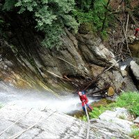
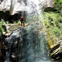
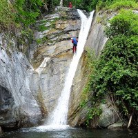
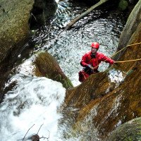
Abseilcanyon in den Vororten von Locarno
Rappel canyon in the suburbs of Locarno
maggio - ottobre
10-14 Ore
Sud
Sintesi:
traduzione alternativa
➜
Lingua originale
Abseilcanyon in den Vororten von Locarno
Rappel canyon in the suburbs of Locarno
Accesso:
traduzione alternativa
➜
Lingua originale
Von Locarno hinauf nach Minusio. Am unteren Ortsrand von Brione sopra Minusio unteres Fahrzeug abstellen (siehe Kartenskizze bei Nizzolas Eldorado Ticino, S. 291).
Mit dem zweiten Fahrzeug durch Brione sopra Minusio in Serpentinen aufwärts. Bei der Straßenbrücke auf 467 m ü.NN Wasserpegel prüfbar. Weiter in Richtung Viona. Auf 700 m üNN erreicht man nach einer Rechtskurve (Rechts Gasthaus, links etwas unterhalb offene Kapelle den Bach. Hier zweites Fahrzeug an geeigneter Stelle (in der Schweiz sind nur wenige Plätze geeignet - alles "privat") abstellen.
From Locarno up to Minusio. Park the lower vehicle at the lower edge of Brione sopra Minusio (see map sketch in Nizzola's Eldorado Ticino, p. 291).
With the second vehicle through Brione sopra Minusio in serpentines upwards. At the road bridge at 467 m a.s.l. water level checkable. Continue in the direction of Viona. At 700 m a.s.l., after a bend to the right (inn on the right, open chapel a little below on the left), you reach the stream. Here second vehicle in a suitable place (in Switzerland, only a few places are suitable - all "private") park.
Avvicinamento (5 min):
traduzione alternativa
➜
Lingua originale
Von der Straße neben der Kapelle (nördlich davon) wenige Treppen hinab zum Wehr mit alter Wasserableitung.
From the road next to the chapel (north of it) few stairs down to the dam with old water drainage.
Giro (5 h):
traduzione alternativa
➜
Lingua originale
Wie Nizzola in seinem Buch schreibt, am besten im Frühjahr oder nach Regenfällen begehen.
Relativ viel Totholz in der Schlucht. Nur vor der Straßenbrücke bei 467 m ü.NN wiederholt gute Ausstiegsmöglichkeiten. Ab da dann auch - vorübergehend - leichte Geruchsbelästigung. Von der ganzen Siedlung, die die Schlucht durchquert, sieht man außer den Straßenbrücken fast nichts.
As Nizzola writes in his book, best to walk in spring or after rains.
Relatively much deadwood in the canyon. Only before the road bridge at 467 m above sea level repeatedly good exit possibilities. From there on also - temporarily - slight odor nuisance. From the whole settlement that crosses the canyon, you see almost nothing except the road bridges.
Ritorno (5 min):
traduzione alternativa
➜
Lingua originale
Auf 240 m üNN (unmittelbar nach der Unterquerung der 4. Straßenbrücke rechts hinaus auf den Fußweg (jenseits der Fußgängerbrücke links an der Kunststeinwand moderner Brunnen)und auf dem Weg in südwestlicher Richtung zur Straße und dem Auto.
At 240 m a.s.l. (immediately after passing under the 4th road bridge, turn right out onto the footpath (beyond the footbridge on the left at the artificial stone wall modern fountain)and on the path in a southwesterly direction to the road and the car.
Coordinate:
Inizio del canyon
46.1912°, 8.82176°
↓↑
DMS: 46° 11" 28.32', 8° 49" 18.34'
DM: 46° 11.472", 8° 49.306"
Google Maps
Svizzera Topografica
DMS: 46° 11" 28.32', 8° 49" 18.34'
DM: 46° 11.472", 8° 49.306"
Google Maps
Svizzera Topografica
Fine del canyon
46.1802°, 8.8244°
↓↑
DMS: 46° 10" 48.72', 8° 49" 27.84'
DM: 46° 10.812", 8° 49.464"
Google Maps
Svizzera Topografica
DMS: 46° 10" 48.72', 8° 49" 27.84'
DM: 46° 10.812", 8° 49.464"
Google Maps
Svizzera Topografica
Partenza alternativa del canyon
46.1903°, 8.8237°
↓↑
DMS: 46° 11" 25.08', 8° 49" 25.32'
DM: 46° 11.418", 8° 49.422"
Google Maps
Svizzera Topografica
DMS: 46° 11" 25.08', 8° 49" 25.32'
DM: 46° 11.418", 8° 49.422"
Google Maps
Svizzera Topografica
Parcheggio all'entrata
46.19169°, 8.82262°
↓↑
DMS: 46° 11" 30.08', 8° 49" 21.43'
DM: 46° 11.501", 8° 49.357"
Google Maps
Svizzera Topografica
DMS: 46° 11" 30.08', 8° 49" 21.43'
DM: 46° 11.501", 8° 49.357"
Google Maps
Svizzera Topografica
Parcheggio in uscita
46.18002°, 8.82258°
↓↑
DMS: 46° 10" 48.07', 8° 49" 21.29'
DM: 46° 10.801", 8° 49.355"
Google Maps
Svizzera Topografica
DMS: 46° 10" 48.07', 8° 49" 21.29'
DM: 46° 10.801", 8° 49.355"
Google Maps
Svizzera Topografica
Letteratura:
Mappa
1:25000
Libro Canyoning
Associazione Italiana Canyoning
2013
Libro Canyoning
F. Baumgartner / A. Brunner / D. Zimmermann
2010
Libro Canyoning
Anna Nizzola / Luca Nizzola
2010
Libro Canyoning
Matthias Holzinger & Thomas Guigon
Pixartprinting.ch
2020
Info sul canyon Cwiki
Info sul canyon Descente
Info sul canyon Ropewiki
Info sul canyon Swisscanyon
Info sul canyon Schlucht.ch
23.03.2024
Lucki
⭐
★★★★★
📖
★★★
⚓
★★★
nessuna traduzione disponibile
Automatisch importiert von Schlucht.ch für Canyon Navegna, Wasserstand: "mittel" Verankerungen: "Ok"
Nur Superiore gemacht.
Standplatz (R13) oben am Einstieg fehlt… kann aber abgeklettert werden.
(Quelle: https://schlucht.ch/schluchten-der-schweiz.html?cid=101)
05.04.2023
Daniel Sturm
⭐
★★★★★
📖
★★★
⚓
★★★
Completato ✕
traduzione alternativa
➜
Lingua originale
Koordinaten und Beschreibung bearbeitet.
Coordinates and description edited.
09.03.2023
System User
⭐
★★★★★
📖
★★★
⚓
★★★
nessuna traduzione disponibile
Info: Teile der Canyonbeschreibung wurden automatisiert übernommen. Konkret die Felder Weblinks, Koordinaten, Rating, Länge des Canyon, Einfachseil Mindestens von https://www.descente-canyon.com/canyoning/canyon/2675
09.03.2023
System User
⭐
★★★★★
📖
★★★
⚓
★★★
nessuna traduzione disponibile
Daten importiert von https://canyon.carto.net/cwiki/bin/view/Canyons/NavegnaCanyon.html
Nuovo rapporto
Riportare brevemente e concisamente le informazioni più importanti dell'ultimo tour o importanti informazioni attuali sul canyon. Se necessario con link a video, foto, ecc..
*
*
*
Esc
Del
Idrologia:


