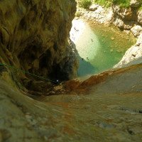
un po' difficile
Palvico
Paese:
Italia / Italy
Regione: Trentino-Alto Adige
Sottoregione: Trento / Provincia autonoma di Trento
Città: Storo
v4 a4 III
2h20
0min
2h15
5min
540m
400m
140m
45m
2x50m/1x20m
7
500m
Auto facoltativa
Valutazione:
★★★★★
4 (11)
Info:
★★★
2.7 (9)
Belay:
★★★
2.8 (9)
Sintesi:
traduzione alternativa
➜
Lingua originale
Schöne Kalkschlucht mit sauberem Wasser; kurze eindrucksvolle Schlucht mit 45m Schlußabseiler; mehrere Grotten und tiefe Gumpen; gut kombinierbar mit Rio Val.
Beautiful lime canyon with clean water; short impressive canyon with 45m final rappel; several grottoes and deep pools; well combinable with Rio Val.
Sud-Ovest
Calcare
45.50km²
Sintesi:
traduzione alternativa
➜
Lingua originale
Schöne Kalkschlucht mit sauberem Wasser; kurze eindrucksvolle Schlucht mit 45m Schlußabseiler; mehrere Grotten und tiefe Gumpen; gut kombinierbar mit Rio Val.
Beautiful lime canyon with clean water; short impressive canyon with 45m final rappel; several grottoes and deep pools; well combinable with Rio Val.
Accesso:
traduzione alternativa
➜
Lingua originale
Von Torbole --> Riva --> bei Kreisverkehr ri. Storno --> Straße ri. Albola Pass --> durch kleine Ortschaft --> vorbei am See (Lagodi Ledro) --> durch Ortschaft --> immer geradeaus --> Straße überquert den Bach (Palvico) --> Einstieg re. bei Schotterausweiche Km 47,5 --> zum schutteln 2. Auto über die kurvige Straße hinunter fahren bis in einer li. Kurve ein Stein mit Km 50 auftaucht --> hier re. schmale Straße zurück fahren bis zum Picknickplatz (Parkplatz)--> hier kann man nach kurzer Gehstrecke den letzen 50m Wasserfall und die tatsächliche Wassermenge sehen. Hat man keinen 2. PKW gibt es die Möglichkeit nach der Tour zu Fuß einen sehr steilen Weg (orograpisch rechts) zurück zum oberen Parkplatz zu nehmen.
From Torbole --> Riva --> at traffic circle ri. Storno --> road ri. Albola mountain pass --> through small village --> past the lake (Lagodi Ledro) --> through village --> always straight ahead --> road crosses the stream (Palvico) --> entry r. at gravel turnout Km 47.5 --> to chute 2. Car over the curvy road down until in a left bend a stone with Km 50 appears --> here r. narrow road back to the picnic area (parking lot)--> here you can see after a short walking passages the last 50m waterfall and the actual amount of water. If you don't have a 2nd car there is the possibility to take a very steep path (orographically right) back to the upper parking lot after the tour on foot.
Avvicinamento (0 min):
traduzione alternativa
➜
Lingua originale
Direkt neben der Schotterausweiche bei Km 47,5 in den Bach einsteigen.
Wählt man den alternativen Parkplatz und parkt in der Spitzkehre steigt man kurz zum Bach hin ab, und steigt direkt am Wehr ein.
Enter the creek right next to the gravel turnout at km 47.5.
If you choose the alternative parking lot and park in the hairpin bend, you descend briefly to the dam and enter directly at the weir.
Giro (2 h 15):
traduzione alternativa
➜
Lingua originale
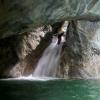
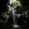
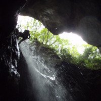
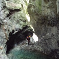
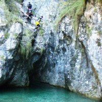
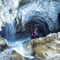
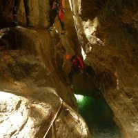
Die Tour beginnt mit einer Gehstrecke und Kletterei über große Felsblöcke. An einer 3m Stufe findet man ein Fixseil zum abklettern. Es folgen 2 Schwimmpassagen mit kleinen Rutschen in enger werdender Schlucht. Bei der Grotte angekommen kann die 10m Stufe abgeseilt oder gerutscht werden. Nach dem großen Gumpen in der Grotte öffnet sich die Schlucht. Hier hat man die Möglichkeit die nächste 10m Stufe über Fixseile (re) bis zu einen 8m Sprung (Achtung Wassertiefe!) zu umgehen. Nach dem Sprung (Abseiler) kommt die Wehranlage mit möglichem Notausstieg.
Das ist der Beginn des unteren Teils (siehe alternativer Canyon Start).
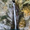
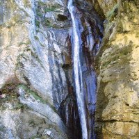
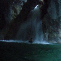
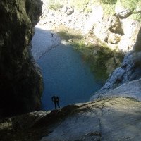
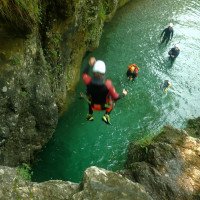
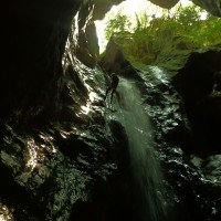
Auf der li Mauerseite befindet sich der Stand für die 20m Stufe. Hier wird meist 15m abgeseilt und 5m in den tiefen Gumpen gerutscht. In der Grotte schwimmt man zu der nächsten 25m Abseilstelle (li oder re). Eingeschlossen von hohen Felswänden folgt ein 6m Sprung in einen großen Gumpen. Dann kommt ein schmaler 5m Spalt den man abklettert oder abseilt. Jetzt steht man am Finalwasserfall (45m). Hier kann man li. außerhalb vom Wasser oder re. im Wasser zum großen Wasserbecken abseilen (zum Abziehen empfiehlt sich ein 60m Seil). Nach kurzer Gehstrecke im flachen Bachbett kann man am Schluss der Tour mit Anlauf noch einen 6m Sprung von der Staumauer in den letzten Gumpen machen.
The tour begins with walking passages and climbing over large boulders. At a 3m step you will find a fixed rope for downclimbing. This is followed by 2 swimming passages with small slides in a narrowing canyon. Arrived at the grotto, the 10m step can be rappelled or slid. After the big pool in the grotto the canyon opens. Here you have the possibility to bypass the next 10m step via fixed ropes (right) up to an 8m jump (attention water depth!). After the jump (rappel) comes the weir with possible emergency exit.
This is the beginning of the lower part (see alternative canyon start).
On the left side of the wall is the belaystation for the 20m steps. Here you mostly rappel 15m and slide 5m into the deep pool. In the grotto, swim to the next 25m rappel (left or right). Enclosed by high rock walls follows a 6m jump into a large pool. Then there is a narrow 5 m gap which can be rappelled or climbed down. Now you are at the final waterfall (45m). Here you can rappel to the left outside the water or to the right in the water to the large water basin (a 60m rope is recommended for pulling off). After a short walking passages in the shallow streambed, at the end of the tour you can take a running jump of 6m from the dam wall into the last pool.
Ritorno (5 min):
traduzione alternativa
➜
Lingua originale
Man steigt bei der künstlichen Stufe re aus und folgt den Weg zurück zur Metallbrücke. Diese überqueren und zurück zum Parkplatz (Überstellungsfahrzeug) gehen.
Get off at the artificial step on the right and follow the path back to the metal bridge. Cross it and go back to the parking lot (shuttle car).
Coordinate:
Inizio del canyon
(cwiki_1)
Parcheggio all'entrata
Parkplatz nach einer Brücke
Parcheggio in uscita
Parkplatz bei Fußgängerbrückehttps://opentopomap.org/#marker=15/45.84286/10.58641
Fine del canyon
Parcheggio all'entrata
45.84281°, 10.59465°
↓↑
DMS: 45° 50" 34.12', 10° 35" 40.74'
DM: 45° 50.569", 10° 35.679"
Google Maps
DMS: 45° 50" 34.12', 10° 35" 40.74'
DM: 45° 50.569", 10° 35.679"
Google Maps
Parkplatz für unteren (eingeschnittenen) Teil, ab Kraftwerksauslass
Partenza alternativa del canyon
Start nach Wasserfassung
Info sul canyon ACA
Info sul canyon Cwiki
Info sul canyon Descente
Altro info sul canyon
Altro info sul canyon
Altro info sul canyon
Info sul canyon Ropewiki
Altro info sul canyon
22.09.2024
MartijnandRenee
⭐
★★★★★
📖
★★★
⚓
★★★
💧
Normale
Completato ✔
nessuna traduzione disponibile
Automatisch importiert von Descente-Canyon.com für Canyon Palvico
All equipment OK, fractioned last descent possible (I didn't measure rope lengths)
(Quelle: https://www.descente-canyon.com/canyoning/canyon-debit/2607/observations.html)
25.08.2024
Gregor Bernsteiner
⭐
★★★★★
📖
★★★
⚓
★★★
💧
Normale
Completato ✔
traduzione alternativa
➜
Lingua originale
Sehr schön
Alle Becken voll mit Kies, kaum Sprünge möglich,
Top Absicherung (Kettenstände, Seilgeländer).
Die ersten kommerziellen Anbieter sind ab 08:30 Uhr in der Schlucht
Very nice
All pools full of gravel, hardly any jumps possible,
Top protection (chain anchors, rope traverses).
The first commercial providers are in the canyon from 08:30 am
08.08.2024
LeTrolle
⭐
★★★★★
📖
★★★
⚓
★★★
💧
Normale
Completato ✔
nessuna traduzione disponibile
Automatisch importiert von Descente-Canyon.com für Canyon Palvico
(Quelle: https://www.descente-canyon.com/canyoning/canyon-debit/2607/observations.html)
05.08.2024
Perfoman
⭐
★★★★★
📖
★★★
⚓
★★★
💧
Normale
Completato ✔
nessuna traduzione disponibile
Automatisch importiert von Descente-Canyon.com für Canyon Palvico
Pas du tout été déçu par le torrente Palvico dont j’avais beaucoup entendu parler et qui m’avait été recommandé par des amis l’ayant descendu à plusieurs reprises…Les deux encaissements sont de toutes beauté, l’eau ce jour était « fraîche » et le débit relativement conséquent…Équipement pléthorique vu que c’est l’usine à BE locaux…On a réussi à s’intercaler entre deux groupes afin de ne pas trop attendre au relais de la C50 finale qui se termine sur la place municipale des baigneurs locaux / étrangers…La note est amplement justifiée, petit bémol un peu trop court à mon goût (2h00 à 5 sans se presser).
(Quelle: https://www.descente-canyon.com/canyoning/canyon-debit/2607/observations.html)
31.07.2024
Thorsten K.
⭐
★★★★★
📖
★★★
⚓
★★★
💧
Normale
Completato ✔
traduzione alternativa
➜
Lingua originale
Altri utenti sono stati: Sebastian Gaebert
Diesmal waren wir Nachmittags in der Schlucht nachdem wir erst Rio Val gemacht haben und der andere Stand der Sonne hat die Schlucht wieder in neuem Licht erstrahlen lassen!! Wenn man sie kombiniert dann bei Val auf die Straße aussteigen anstatt lange dem Bachbett zu folgen. Palvico ist ein guter Kontrast zu Val und die Abkühlung kann man nach der Vertikalität und den exponierten Stände gut gebrauchen.
This time we were in the canyon in the afternoon after doing Rio Val and the different position of the sun made the canyon shine in a new light again!!! If you combine them then get out onto the road at Val instead of following the streambed for a long time. Palvico is a good contrast to Val and you can use the cooling down after the verticality and the exposed stands.
Altri utenti sono stati: Sebastian Gaebert
29.07.2024
Thorsten K.
⭐
★★★★★
📖
★★★
⚓
★★★
💧
Normale
Completato ✔
traduzione alternativa
➜
Lingua originale
Altri utenti sono stati: Sebastian Gaebert
Schöne kurze Tour (1h15min statt 2h15min). Haken und Seilgeländer im guten Zustand. Hier wurde viel eingebohrt aber der Canyon wird auch viel kommerziell Begangen. Die Grotten sind extrem schön und beim aktuellen Wasserstand ist der 45er Abschluss Wasserfall auch im Strahl einfach.
Nice short tour (1h15min instead of 2h15min). Anchors and rope traverses in good condition. A lot of drilling has been done here but the canyon is also used a lot commercially. The caves are extremely beautiful and at the current water level the 45m waterfall is also easy in the stream.
Altri utenti sono stati: Sebastian Gaebert
01.07.2024
mikkel
⭐
★★★★★
📖
★★★
⚓
★★★
💧
Normale
Completato ✔
nessuna traduzione disponibile
Automatisch importiert von Descente-Canyon.com für Canyon Palvico
After dam flow decreases a lot. All anchors ok. Lot of them have multiple options.
(Quelle: https://www.descente-canyon.com/canyoning/canyon-debit/2607/observations.html)
25.06.2024
Sandra66
⭐
★★★★★
📖
★★★
⚓
★★★
🌊
Folle
Completato ✕
nessuna traduzione disponibile
Automatisch importiert von Descente-Canyon.com für Canyon Palvico
Nous sommes allés observer la cascade finalIl y a trop d eau 2 gerbes sortent de la cascade Avec ce débit impossible de descendre dans l'actif Nous ne connaissons pas le canyon nous avons choisi de ne pas le parcourir
(Quelle: https://www.descente-canyon.com/canyoning/canyon-debit/2607/observations.html)
07.06.2024
Madie Ga
⭐
★★★★★
📖
★★★
⚓
★★★
💧
Normale
Completato ✔
nessuna traduzione disponibile
It’s a nice canyon but very short, and over rigged, too many ropes left on bolts through the whole canyon which take away the beauty
05.06.2024
Jennes
⭐
★★★★★
📖
★★★
⚓
★★★
💧
Normale
Completato ✔
nessuna traduzione disponibile
Automatisch importiert von Descente-Canyon.com für Canyon Palvico
Eq ok, took alternative put in
(Quelle: https://www.descente-canyon.com/canyoning/canyon-debit/2607/observations.html)
02.06.2024
roelvm
⭐
★★★★★
📖
★★★
⚓
★★★
🌊
Folle
Completato ✔
nessuna traduzione disponibile
Automatisch importiert von Descente-Canyon.com für Canyon Palvico
Did the upper part of the canyon a day after storm. White water conditions. A lot of water was added at the dam right before the second part so we exited as the lower part woul be too dangerous in this flow.
(Quelle: https://www.descente-canyon.com/canyoning/canyon-debit/2607/observations.html)
02.06.2024
Roelvm
⭐
★★★★★
📖
★★★
⚓
★★★
💧
Alto
Completato ?
nessuna traduzione disponibile
Did the upper part of the canyon a day after storm. White water conditions. A lot of water was added at the dam right before the second part so we exited as the lower part would be too dangerous in this flow.
27.04.2024
Vincent Van Quickelberghe
⭐
★★★★★
📖
★★★
⚓
★★★
💧
Normale
Completato ✔
nessuna traduzione disponibile
Automatisch importiert von Descente-Canyon.com für Canyon Palvico
(Quelle: https://www.descente-canyon.com/canyoning/canyon-debit/2607/observations.html)
24.09.2023
Anja Rot
⭐
★★★★★
📖
★★★
⚓
★★★
💧
Normale
Completato ✔
nessuna traduzione disponibile
Altri utenti sono stati: Rick Paapy
Would rate canyon V3 A3 III, with normal flows take the right anchor point on the last waterfall, tiny bit too much walking. We did the shuttle walking, it took 30 min.
Altri utenti sono stati: Rick Paapy
02.09.2023
Glitzi
⭐
★★★★★
📖
★★★
⚓
★★★
💧
Normale
Completato ✔
traduzione alternativa
➜
Lingua originale
Alle Stände sind in tollem Zustand.
Viele rutschige Stellen.
All stands are in great condition.
Many slippery places.
04.07.2023
Daniel Sturm
⭐
★★★★★
📖
★★★
⚓
★★★
💧
Basso
Completato ✔
traduzione alternativa
➜
Lingua originale
Sehr schöne Schlucht. Ab dem Staudamm begangen. Fast zu viel Metall drin. Fixseile aus Kette.
Very beautiful gorge. Walked from the dam. Almost too much metal in it. Fixed ropes from chain.
09.03.2023
System User
⭐
★★★★★
📖
★★★
⚓
★★★
nessuna traduzione disponibile
Info: Teile der Canyonbeschreibung wurden automatisiert übernommen. Konkret die Felder Weblinks, Koordinaten, Rating, Ort, Länge des Canyon, Einfachseil Mindestens von https://canyon.carto.net/cwiki/bin/view/Canyons/PalvicoCanyon.html und https://www.descente-canyon.com/canyoning/canyon/2607
09.03.2023
System User
⭐
★★★★★
📖
★★★
⚓
★★★
nessuna traduzione disponibile
Daten importiert von https://www.canyoning.or.at/index.php/liste-aller-canyons/84-palvico
06.07.2019
Christian Balla
⭐
★★★★★
📖
★★★
⚓
★★★
💧
Normale
Completato ✔
traduzione alternativa
➜
Lingua originale
Ein faszinierender Canyon. Hier muss man einfach einmal eine Canyoningtour gemacht haben.
Video zur Tour:
https://www.youtube.com/watch?v=iZ9c8StYAmg
A fascinating canyon. You simply have to have done a canyoning tour here.
Video of the tour:
https://www.youtube.com/watch?v=iZ9c8StYAmg
Nuovo rapporto
Riportare brevemente e concisamente le informazioni più importanti dell'ultimo tour o importanti informazioni attuali sul canyon. Se necessario con link a video, foto, ecc..
*
*
*
Esc
Del
Idrologia:
nessuna traduzione disponibile
Erster Teil mit Wasser, aber entsprechend ausgestattet. Für die zweite hängt alles von der Wasserfassung am Damm ab. Korrektes Niveau im Sommer.
