non così difficile
Wappbach
Paese:
Deutschland / Germany
Regione: Oberbayern / Upper Bavaria
Sottoregione: Landkreis Berchtesgadener Land
Città: Bayerisch Gmain
v3 a2 I
2h5
30min
1h30
5min
820m
560m
260m
15m
2x30m
15
1000m
a piedi
Specialità:
Famiglia_adatta § Parcheggio a pagamento
Famiglia_adatta § Parcheggio a pagamento
Valutazione:
★★★★★
2.8 (4)
Info:
★★★
2.8 (4)
Belay:
★★★
2 (3)
Sintesi:
traduzione alternativa
➜
Lingua originale
Kurze, kleingliedrige, max. 40m tief eingeschnittene, anfängertaugliche Schlucht mit vielen Rutschmöglichkeiten und kleinen Abseilstufen im Lattengebirge. Mehrere Notausstiege auf beiden Schluchtenseiten möglich.
Short, small canyon with a maximum depth of 40m, suitable for beginners with many slides and small abseiling steps in the Lattengebirge. Several emergency exits possible on both sides of the gorge.
Nord
Calcare
Sintesi:
traduzione alternativa
➜
Lingua originale
Kurze, kleingliedrige, max. 40m tief eingeschnittene, anfängertaugliche Schlucht mit vielen Rutschmöglichkeiten und kleinen Abseilstufen im Lattengebirge. Mehrere Notausstiege auf beiden Schluchtenseiten möglich.
Short, small canyon with a maximum depth of 40m, suitable for beginners with many slides and small abseiling steps in the Lattengebirge. Several emergency exits possible on both sides of the gorge.
Accesso:
traduzione alternativa
➜
Lingua originale
Von Salzburg West über die Walserberg Bundesstraße bis zur Abbiegung links Richtung Großgmain (alternativ kann auch über Salzburg süd-Grödig-Fürstenbrunn nach Großgmain gefahren werden. Dann weiter auf der Großgmainer Landesstraße bis zur Ortschaft Großgmain, Bayerisch Gmain (Landesgrenze). Gleich nach der Grenze links weiter bis zur Bundesstraße 20. Hier rechts abbiegen und nach ca. 200m links abbiegen (Beschilderung Bahnhof/Wanderzentrum). Ab hier folgt man immer der Straße mit der Beschilderung Wanderzentrum Bayerisch Gmain. Am Ende der Sackgasse ist ein kostenpflichtiger Parkplatz (3Std/€3,-).
From Salzburg West via the Walserberg Bundesstraße to the turn-off on the left towards Großgmain (alternatively, you can also drive to Großgmain via Salzburg Süd-Grödig-Fürstenbrunn. Then continue on the Großgmainer Landesstraße to the village of Großgmain, Bayerisch Gmain (state border). Immediately after the border, continue left until you reach Bundesstraße 20, turn right here and after approx. 200m turn left (signposted Bahnhof/Wanderzentrum). From here, follow the road with the signs to the Bayerisch Gmain hiking center. There is a paid parking lot at the exit of the dead end (3h/€3,-).
Avvicinamento (30 min):
traduzione alternativa
➜
Lingua originale
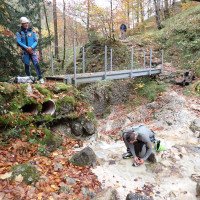
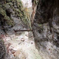
Vom Parkplatz aus folgt man dem Wanderweg mit der Beschilderung Alpgartensteig der nach kurzer Zeit zum Wappbach und einer Metallbrücke (Ausstieg) führt. Von der Metallbrücke aus kann man entweder den orographisch linken oder rechten Weg neben dem Bach hochwandern (Alpgarten Rundweg) da beide Wege etwa gleich weit bis zur oberen Metallbrücke (Einstieg) führen.
From the parking lot, follow the hiking trail signposted Alpgartensteig, which after a short time leads to the Wappbach stream and a metal bridge (exit). From the metal bridge, you can either hike up the orographic left or right path next to the stream (Alpgarten circular trail) as both paths lead about the same distance to the upper metal bridge (entry).
Giro (1 h 30):
traduzione alternativa
➜
Lingua originale
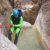
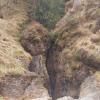
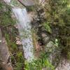
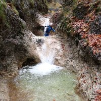
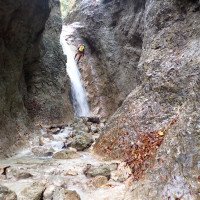
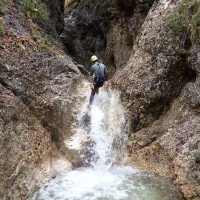
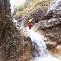
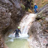
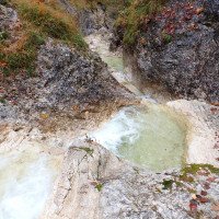
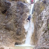
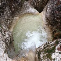
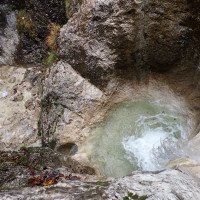
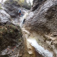
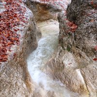
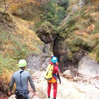
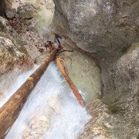
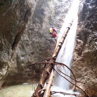
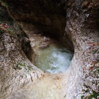
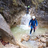
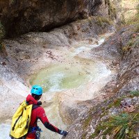
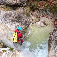
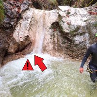
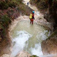
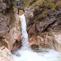
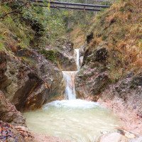
Der Wappbach ist der Unterlauf vom Alpgartenbach und liegt gerade schon auf Deutscher Seite wo Canyoning offiziell verboten ist (Der Alpgartenbach selbst ist leider uninteressant). Die Schlucht ist ideal für eine kurze Vormittags- oder Nachmittagstour und kann auch gut mit Anfänger oder Kinder begangen werden. Gleich nach der Metallbrücke beim Einstieg kommen in einer engeren Passage zwei kleine Rutschen und eine der zwei höchsten Abseilstellen (C15). Es folgt eine kleine Stufe und eine längere offene Gehpassage bevor die Schlucht wieder etwas enger wird. Im nächsten Abschnitt folgen mehrere kleine Stufen die abgeseilt, gerutscht oder abgeklettert werden können. Die nächste höhere Abseilstelle (C10) kann alternativ auch links trocken abgeseilt werden. Nun folgt der schönste Teil der Tour, ein längerer eingeschnittener Abschnitt mit der zweiten 15m hohen Abseilstelle im Wasserlauf die 90° um die Kurve geht, schöne Auswaschungen und einige kleine Rutschen. Nach einer weiteren offenen Gehpassage kommt noch eine lässige Abseilstelle (C10) mit Dusche unter einem Klemmblock und dem letzten Eingeschnitten Schluchtenabschnitt wo sich noch viele kleine Rutschen und Abseilstellen befinden. Nach unten hin öffnet sich die Schlucht immer mehr und man erreicht die untere Metallbrücke wo man sich entscheiden kann ob man aussteigt oder noch die letzte Abseilstelle überwinden möchte. Achtung! in einer der letzten Gumpen in denen gerutscht werden kann (ca. 100m vor der Brücke) befindet sich ein Metallstück (Okt.2023)
The Wappbach is the lower course of the Alpgartenbach and is located on the German side where canyoning is officially prohibited (the Alpgartenbach itself is unfortunately not interesting). The canyon is ideal for a short morning or afternoon tour and is also suitable for beginners or children. Immediately after the metal bridge at the entry point, there are two small slides and one of the two highest abseiling points (C15) in a narrow passage. This is followed by a small step and a longer open walking passage before the canyon narrows again. In the next part, there are several small steps that can be rappelled, slid or downclimbed. The next higher rappel (C10) can alternatively be dry rappelled on the left. Now follows the most beautiful part of the tour, a longer parts with the second 15m high abseil in the watercourse that goes 90° around the bends, beautiful washouts and some small slides. After another open walking passage, there is a casual abseil (C10) with a shower under a clamping block and the last incised gorge section where there are still many small slides and abseils. Towards the bottom, the canyon opens up more and more and you reach the lower metal bridge where you can decide whether you want to get out or overcome the last abseil. Attention! In one of the last pools where you can slide (approx. 100m before the bridge) there is a piece of metal (Oct.2023).
Ritorno (5 min):
traduzione alternativa
➜
Lingua originale
Entweder vor oder nach der Metallbrücke (letzte Abseilstelle) rechts aussteigen und dem Wanderweg in Kürze zum Parkplatz folgen.
Either before or after the metal bridge (last abseiling point) get off to the right and follow the hiking trail to the parking lot.
Coordinate:
Inizio del canyon
47.705412°, 12.892764°
↓↑
DMS: 47° 42" 19.48', 12° 53" 33.95'
DM: 47° 42.325", 12° 53.566"
Google Maps
DMS: 47° 42" 19.48', 12° 53" 33.95'
DM: 47° 42.325", 12° 53.566"
Google Maps
Fine del canyon
47.714121°, 12.896191°
↓↑
DMS: 47° 42" 50.84', 12° 53" 46.29'
DM: 47° 42.847", 12° 53.771"
Google Maps
DMS: 47° 42" 50.84', 12° 53" 46.29'
DM: 47° 42.847", 12° 53.771"
Google Maps
Parcheggio Entrata e uscita
47.715915°, 12.898467°
↓↑
DMS: 47° 42" 57.29', 12° 53" 54.48'
DM: 47° 42.955", 12° 53.908"
Google Maps
DMS: 47° 42" 57.29', 12° 53" 54.48'
DM: 47° 42.955", 12° 53.908"
Google Maps
13.04.2025
Elias Eberl
⭐
★★★★★
📖
★★★
⚓
★★★
💧
Normale
Completato ✔
traduzione alternativa
➜
Lingua originale
Schöner Bach ohne nennenswerte Komplikationen. Ausstieg oft möglich. Sicherungen einfach aber ok. Beim 90⁰ Fall über die Gumpe abseilen, ca 10m. Kaum Holz drin, jedoch recht rutschig.
Beautiful stream with no complications worth mentioning. Exit often possible. Belays simple but ok. At the 90⁰ fall, rappel over the pool, approx. 10m. Hardly any wood in it, but quite slippery.
05.10.2024
Max H.
⭐
★★★★★
📖
★★★
⚓
★★★
💧
Alto
Completato ✕
traduzione alternativa
➜
Lingua originale
Altri utenti sono stati: Erik Weisz László Szabó
Von Begehung aufgrund des erhöhten Wasserstand nicht passend zur Gruppenkonstellation abgesehen
No inspection due to the increased water level not fitting the group constellation
Altri utenti sono stati: Erik Weisz László Szabó
10.07.2024
Montie
⭐
★★★★★
📖
★★★
⚓
★★★
💧
Normale
Completato ✔
nessuna traduzione disponibile
I was positively surprised by this one, more fun and nicer than I expected! Unfortunately almost none of the pools are very deep, so slide and jump with care.. Video in the links section.
06.06.2024
Jason Walker
⭐
★★★★★
📖
★★★
⚓
★★★
💧
Alto
Completato ✔
nessuna traduzione disponibile
Altri utenti sono stati: Enya Schaefer
Moderately high level, on the drop though. Chilly water. Numerous loose- single expansion bolt anchors in questionable rock. Many of the pools below what appear to be slides are quite full of sand, and the odd sneaky rock. Put in is more like 820m and we took out at the bridge at 650m.
Altri utenti sono stati: Enya Schaefer
05.11.2023
Thomas Fras
⭐
★★★★★
📖
★★★
⚓
★★★
💧
Normale
Completato ✔
traduzione alternativa
➜
Lingua originale
Die Schlucht ist eher unbekannt aber ganz nett. Wenn man nur wenig Zeit hat oder mit Kindern eine Schlucht machen möchte. Zu berücksichtigen ist dass die Tour grenznah schon in Deutschland liegt wo ja Canyoning eigentlich nicht erlaubt ist. Dafür ist die Tour aber ausreichend gut eingerichtet. Ca. die Hälfte der Stufen können abgeklettert oder gerutscht werden.
The gorge is rather unknown but quite nice. If you only have a little time or want to do a gorge with children. It should be noted that the tour is close to the border in Germany, where canyoning is not actually permitted. However, the tour is sufficiently well equipped. About half of the steps can be climbed or slid down.
Nuovo rapporto
Riportare brevemente e concisamente le informazioni più importanti dell'ultimo tour o importanti informazioni attuali sul canyon. Se necessario con link a video, foto, ecc..
*
*
*
Esc
Del
Idrologia:
