un po' difficile
Ta'ab
v4 a3 IV
5h10
10min
4h
1h
490m
380m
110m
50m
1200m
Auto facoltativa
Valutazione:
★★★★★
4 (3)
Info:
★★★
2 (1)
Belay:
★★★
2 (1)
Sintesi:
traduzione alternativa
➜
Lingua originale
Canyon zum Abseilen, Abklettern und Schwimmen
Canyon for rappel, downclimb and swim
Nord-Est
Sintesi:
traduzione alternativa
➜
Lingua originale
Canyon zum Abseilen, Abklettern und Schwimmen
Canyon for rappel, downclimb and swim
Accesso:
traduzione alternativa
➜
Lingua originale
Von Muscat etwa 145 km auf der Autobahn "17" in Richtung Sur (Süden). Bei der Ausfahrt Fins verlassen wir die Autobahn, aber nicht nach Fins, sondern in Richtung Gebirge und Wusal. Wir fahren nun 8,6 km und kommen zu den Häusern von Al Marfas (das ist die zweite Siedlung links der Piste über der Schlucht). Hier stellen wir unser (ggf. erstes) Auto ab.
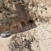
Mit dem zweiten (oder zu Fuß) geht es dann noch 1,1 km weiter, wo dann links eine Piste abzweigt. Auf dieser Piste kann man bis knapp vor der Ortschaft Ta'ab fahren, letzter Teil steil, steinig und nahe am Abgrund (4x4 notwendig).
From Muscat about 145 km on the highway "17" in the direction of Sur (south). At the Fins exit we leave the highway, but not towards Fins, but towards the mountains and Wusal. We now drive 8.6 km and come to the houses of Al Marfas (this is the second settlement on the left of the dirt road above the canyon). Here we park our (possibly first) car.
With the second car (or on foot) we continue for another 1.1 km, where a dirt road branches off to the left. You can drive on this track until just before the village of Ta'ab, the last part is steep, stony and close to the abyss (4x4 necessary).
Avvicinamento (10 min):
traduzione alternativa
➜
Lingua originale
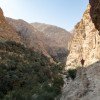
Über einen alten Zunächst queren wir das vor uns liegende Wadi und nehmen dann jenseits weiter den Weg zum Joch hinauf. Vom Joch kann man in das Wadi Ta'ab hinunterschauen und wir nehmen den alten Pfad, der uns - bisweilen kaum mehr erkennbar - hinunterführt zu der aufgegebene Ortschaft Ta'ab. Hier steigen wir in das Flussbett ein.
We cross the wadi in front of us via an old first and then take the path on the other side up to the yoke. From the yoke you can look down into the Wadi Ta'ab and we take the old path that leads us - sometimes barely recognizable - down to the abandoned village of Ta'ab. Here we enter the riverbed.
Giro (4 h):
traduzione alternativa
➜
Lingua originale
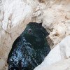
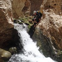
Zunächst ist Wandern und Abklettern angesagt, bis wir zum ersten Abseiler (50 m) kommen. Auf den Block, von dem in den Topf abgeseilt wird, kommt man von der linken Felsschulter. Hier das Seil oben an dem kleinen Baum einhängen. Unten angelangt stehen wir in einer riesigen Marmita trampa. Aus ihr klettert der Erste mit Hilfe einiger Haken und einer Kette heraus und ermöglicht den Nachkommenden einen Ausstieg mit Seilhilfe. Es folgt der 2. Abseiler (35 m) auf einen kleinen Absatz über dem Gumpen (von hier Sprung möglich), danach noch 3 kleinere (je 10 m etwa). Schwimmen, Rutschen und Springen bieten sich mehrfach an. Wir sehen dann links oben einen naturgegebenen "Tunnel" und haben nun die erste Ausstiegsmöglichkeit erreicht.
Man kann das Wadi auch noch ein gutes Stückweiter absteigen (etwa 3 Stunden) bis zur aufgegebenen Ortschaft Harima. Dabei kann man einen Blick auf eine Höhlenöffnung werfen. Ab Harima folgen wir einer Wasserleitung, die schließlich im Wadi endet. Hier suchen wir uns links hinauf den Ausstieg zur Straße. Will man diese Variante gehen, muss man das untere Auto schon 7,1 km nach der Autobahn bei einer links abgehenden Piste abstellen.
At first, hiking and downclimbing are the order of the day until we come to the first rappel (50 m). The block from which you rappel into the pot is reached from the left shoulder of the rock. Attach the rope to the small tree at the top. At the bottom we stand in a huge Marmita trampa. The first climber climbs out of it with the help of a few anchors and a chain, allowing the next climber to make an exit with rope assistance. This is followed by the 2nd rappel (35 m) onto a small ledge above the pool (jumping is possible from here), then 3 smaller ones (about 10 m each). Swim, slide and jump several times. We then see a natural "tunnel" at the top left and have now reached the first exit option.
You can also descend the wadi a little further (about 3 hours) to the abandoned village of Harima. Here you can take a look at a cave opening. From Harima, we follow a water pipe that finally exits the wadi. Here we look for the exit to the road on the left. If you want to take this route, you have to park the lower car just 7.1 km after the highway at a dirt road on the left.
Ritorno (1 h):
traduzione alternativa
➜
Lingua originale
200 m Klettern - ca. 60 Höhenmeter - (bis 3+) erwarten uns, Haken zur Sicherung sind vorhanden. 2020 war auch ein Fixseil an der steilsten Stelle drin. Zweckmäßigerweise legt der Vorsteigende an den etwas exponierten Passagen jeweils einen Handlauf mittels Karabiner oder Expressschlingen. Dann stehen wir wieder oben bei den Häusern und unserem Auto.
200 m of climbing - approx. 60 vertical meters - (up to 3+) await us, anchors for securing are available. In 2020, there was also a fixed rope at the steepest point. It makes sense for the lead climber to place a handrail using carabiners or quickdraws on the somewhat exposed passages. Then we are back at the top by the houses and our car.
Coordinate:
Inizio del canyon
Parcheggio all'entrata
P1 alt (bis016) für Zustieg
Parcheggio all'entrata
P1 neu (nach Straßenbau) 2018 (?)
Parcheggio in uscita
P2 für Ausstieg
Fine del canyon
Letteratura:
Mappa
https://climbing7.files.wordpress.com/2014/05/1-accc3a8s-taab-canyon.jpg
Mappa
https://goo.gl/photos/GzDyxWTo2hPHTRNh9 (Lageplan)
Libro Canyoning
Khaled Abdul Malak, Canyoning in Oman - 12 EXCEPTIONAL WADIS, 2014
Info sul canyon Cwiki
Info sul canyon Descente
Info sul canyon Ropewiki
Altro info sul canyon
Altro info sul canyon
09.03.2023
System User
⭐
★★★★★
📖
★★★
⚓
★★★
nessuna traduzione disponibile
Info: Teile der Canyonbeschreibung wurden automatisiert übernommen. Konkret die Felder Weblinks, Koordinaten, Rating, Länge des Canyon, Einfachseil Mindestens von https://www.descente-canyon.com/canyoning/canyon/23154
09.03.2023
System User
⭐
★★★★★
📖
★★★
⚓
★★★
nessuna traduzione disponibile
Daten importiert von https://canyon.carto.net/cwiki/bin/view/Canyons/TaabCanyon.html
25.02.2020
GeorgB
⭐
★★★★★
📖
★★★
⚓
★★★
💧
Basso
Completato ✔
traduzione alternativa
➜
Lingua originale
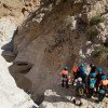
Auf der neuen Straße bis zum Parkplatz oberhalb des Dorfes wo wir erst mal eine Parkmöglichkeit finden mussten, vor uns war nämlich eine geführte Tour drin, die mit 4 Geländewagen hergefahren ist. Schlucht selbst sehr schön, über die das erste Trockenbecken kommt man mittels einer stabilen Kette raus. Hohe Sprungmöglichkeit (16m) in der Mitte der Klamm. Rückweg war mit einen Fixseil gesichert, Kletterschwierigkeiten max. II
On the new road to the parking lot above the village where we first had to find a place to park, because there was a guided tour in front of us, which drove here with 4 off-road vehicles. The gorge itself is very beautiful, you can get out via the first dry basin using a sturdy chain. High jump (16m) in the middle of the gorge. The way back was secured with a fixed rope, climbing difficulty max. II
Idrologia:

1

2 unser Nachtlager

3 hier wird gerade eine ne...

4 Erster Blick in die Sch...

5 das ist sie

6 hinunter zu der verlasse...

7

8 wir haben uns von oben a...

9 Vom Klemmblock in den Gr...

10 und jenseits wieder hin...
11

12 nächster Abseiler

13

14 Gumpen mit Wasserdurchs...

15 der Fun spielt hier nur...

16 das Auge wird befriedig...

17 nächster Abseiler

18

19
20

21

22

23

24

25

26

27

28

29 noch ein Abseiler

30 dann klettern wir links...
