non così difficile
Rio Ponte de Muro
v2 a3 II
1h38
20min
1h15
3min
570m
470m
100m
20m
2x30
8
a piedi
Valutazione:
★★★★★
3.6 (16)
Info:
★★★
2.8 (14)
Belay:
★★★
2.7 (15)
Sintesi:
traduzione alternativa
➜
Lingua originale
Eine sehr schöne, logistisch gut gelegene Anfängerschlucht, die auch schnell am Ende eines Tages noch auf der Heimfahrt nach Österreich begangen werden kann und die erst im April 2022 erstbegangen wurde. Klares Wasser, nette Stelle bei der Naturbrücke; Wasserableitung beim Einstieg; großes Einzugsgebiet; Exposition Ost.
A very nice, logistically well located beginner's canyon, which can also be quickly climbed at the exit of a day still on the way home to Austria and which was first climbed only in April 2022. Clear water, nice place at the natural bridge; water drainage at the entry; large catchment area; exposure east.
Est
Calcare
Sintesi:
traduzione alternativa
➜
Lingua originale
Eine sehr schöne, logistisch gut gelegene Anfängerschlucht, die auch schnell am Ende eines Tages noch auf der Heimfahrt nach Österreich begangen werden kann und die erst im April 2022 erstbegangen wurde. Klares Wasser, nette Stelle bei der Naturbrücke; Wasserableitung beim Einstieg; großes Einzugsgebiet; Exposition Ost.
A very nice, logistically well located beginner's canyon, which can also be quickly climbed at the exit of a day still on the way home to Austria and which was first climbed only in April 2022. Clear water, nice place at the natural bridge; water drainage at the entry; large catchment area; exposure east.
Accesso:
traduzione alternativa
➜
Lingua originale
Auf der Autobahn A23 die Ausfahrt Pontebba nehmen. Der SS13 für ca 6 km in Richtung Udine folgen, bis man über eine Brücke mit leichter Linksbiegung fährt, die den Rio Ponte de Muro überbrückt. Taleinwärts ist eine große Eisenbahnbrücke zu sehen die 2 Tunnel miteinander verbindet und ebenfalls über den Rio Ponte de Muro führt. Hier kann man direkt nach der Brücke neben der Straße SS13 parken. Achtung nicht die Ausfahrt des Hauses verstellen!
Parkplatz: N46.461656 E013.295242
On the A23 freeway, take the Pontebba exit. Follow the SS13 for about 6 km in the direction of Udine, until you cross a bridge with a slight left turn, which bridges the Rio Ponte de Muro. In the valley you can see a large railroad bridge that connects 2 tunnels and also crosses the Rio Ponte de Muro. Here you can park directly after the bridge next to the road SS13. Attention do not block the exit of the house!
Parking: N46.461656 E013.295242
Avvicinamento (20 min):
traduzione alternativa
➜
Lingua originale
Die Brücke über die SS13 zurück gehen und links (bei der Wandertafel) der asphaltierten Straße kurz bergauf folgen. (Wasserleitung unter der Eisenbahnbrücke von unter ersichtlich). Gleich bei der ersten (rechts)Kurve den Wanderweg 428 und nicht der Straße vom Videoüberwachten Kraftwerk, folgen! Der Weg führt oberhalb der Schlucht und parallel zur Straße leicht bergauf. Nach kurzem Aufstieg führt der Weg über die Schlucht auf die andere Seite. Hier dann nochmals kurz hoch durch den Wald bis zur kleinen Wehrstufe mit Wasserableitung hochgehen. Einstieg orographisch rechts auf ca. 570m (N46.462745 E013.286961). Bitte unbedingt auf dem Wanderweg bleiben --> sonst Ärger mit Kraftwerksbetreiber.
Go back over the bridge over the SS13 and follow the asphalt road on the left (at the hiking sign) briefly uphill. (Water pipe under the railroad bridge visible from below). Immediately at the first (right) bend follow the hiking trail 428 and not the road from the video-monitored power plant! The trail leads above the canyon and parallel to the road slightly uphill. After a short ascent, the trail leads across the canyon to the other side. Here then go up again briefly through the forest to the small weir step with water drainage. Entry orographically on the right at about 570m (N46.462745 E013.286961). Please stay on the hiking trail --> otherwise trouble with the power plant operator.
Giro (1 h 15):
traduzione alternativa
➜
Lingua originale
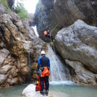
Direkt bei der Staumauer befindet sich or. li. bei einem großen Felsen der erste Ring von dem man ca 15m in einen großen Gumpen abseilt. Das Seil sollte verlängert werden um auch noch den nächsten Gumpen von dieser Abseilstelle zu überwinden.
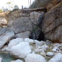
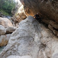
Danach folgt eine kleine Abkletter- und Gehstrecke. Man kommt zu einem großen Klemmblock, der eine Naturbrücke für den Wanderweg bildet, den man davor hochgegangen ist.
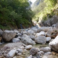
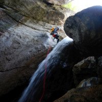
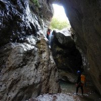
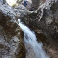
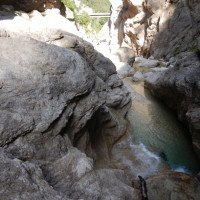
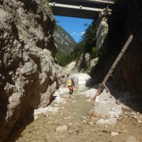
Hier verengt sich die Schlucht und man kommt zur schönsten Stelle der Schlucht, ein ca. 17m Abseiler direkt im Wasser (optional links außerhalb der Wasserführung) in eine kleine höhlenartige Passage. Es folgt ein kleiner 5m-Abseiler or. li. bevor man zu einem großen Felsen kommt, bei dem sich der nächste Abseilring etwas versteckt dahinter befindet. Es folgen 2 Abseilstellen direkt im Wasser und eine schöne kleine enge Abkletter- und Geh-Passage. Nach der letzten Abseilstelle folgt noch ein kleines Blockchaos über das ab geklettert werden muss, ehe man sich schon wieder unter der Eisenbahnbrücke befindet. Die Schlucht wird am besten auf der rechten Seite direkt unterhalb der Straßenbrücke auf ca. 470m verlassen.
Directly at the dam wall is or. left at a large rock the first ring from which you rappel about 15m into a large pool. The ropes should be extended to overcome the next pool from this abseiling point.
After that follows a small downclimb and walking passages. You come to a large clamping block that forms a natural bridge for the hiking trail that you climbed before.
Here the canyon narrows and you come to the most beautiful part of the canyon, a rappel of about 17m directly in the water (optionally on the left outside the water flow) into a small cave-like passage. This is followed by a small 5m rappel or. left before you come to a large rock, where the next rappel ring is somewhat hidden behind it. This is followed by 2 rappels directly in the water and a nice little narrow downclimb and walk passage. After the last rappelling point follows another small block chaos over which must be climbed down, before you are already back under the railroad bridge. The canyon is best left on the right side directly below the road bridge at about 470m.
Ritorno (3 min):
traduzione alternativa
➜
Lingua originale
Direkt rechts unterhalb der Straßenbrücke (SS13) kurz steil hoch zum Parkplatz.
Just below the road bridge (SS13) on the right, a short steep climb to the parking lot.
Coordinate:
Parcheggio Entrata e uscita
46.461656°, 13.295242°
↓↑
DMS: 46° 27" 41.96', 13° 17" 42.87'
DM: 46° 27.699", 13° 17.715"
Google Maps
DMS: 46° 27" 41.96', 13° 17" 42.87'
DM: 46° 27.699", 13° 17.715"
Google Maps
Inizio del canyon
46.462745°, 13.286961°
↓↑
DMS: 46° 27" 45.88', 13° 17" 13.06'
DM: 46° 27.765", 13° 17.218"
Google Maps
DMS: 46° 27" 45.88', 13° 17" 13.06'
DM: 46° 27.765", 13° 17.218"
Google Maps
Info sul canyon ACA
Info sul canyon Ropewiki
05.04.2025
Kris Klein
⭐
★★★★★
📖
★★★
⚓
★★★
💧
Normale
Completato ✔
traduzione alternativa
➜
Lingua originale
Alles tip top, schöne einfache Schlucht. Sehr einfacher Zustieg. Morgens Sonne
Everything tip top, beautiful easy canyon. Very easy access. Sun in the morning
28.08.2024
Montie
⭐
★★★★★
📖
★★★
⚓
★★★
💧
Normale
Completato ✔
nessuna traduzione disponibile
Surprisingly great tour! Great for your last day; leave early, get the morning sun in the canyon, and drive home after. Water was very cold, but very clean. Lots of nice jumps. Really enjoyed this one a lot!
15.08.2024
Daniel
⭐
★★★★★
📖
★★★
⚓
★★★
💧
Normale
Completato ✔
traduzione alternativa
➜
Lingua originale
Kanion bardzo dobrze wyposażony w stanowiska zjazdowe, duże możliwości wyboru. Łatwe dojście szlakiem. Polecam wejście rano, kanion ekspozycja wschodnia.
The canyon very well equipped with downhill positions, a lot of choices. Easy access by trail. I recommend entering in the morning, canyon eastern exposure.
10.08.2024
Marosffy Dániel
⭐
★★★★★
📖
★★★
⚓
★★★
💧
Basso
Completato ✔
nessuna traduzione disponibile
Ideal for quick and easy tours, very short in every detail. The upper part is pretty, the lower lacks real interest (except for industry fans). Rigging is fine all the way.
04.08.2024
Péter Bonczi
⭐
★★★★★
📖
★★★
⚓
★★★
💧
Normale
Completato ✔
traduzione alternativa
➜
Lingua originale
Korábbi látogatásom óta (28.04.2024) a felszerelés megváltozott. Minden ereszkedés 2 pontos standdal van felszerelve és bevezető szárak is ki lettek alakítva. Az utlosó 2 ereszkedés standja átkerült a jobb oldalra. Jelenleg van több lehetőség az ugrásra. Szép kék víz, jó áramlással.
Since my previous visit (28.04.2024) the equipment has changed. All descents are equipped with a 2-point stand and lead-in stems have been added. The stall for the last 2 descents has been moved to the right. There are now more possibilities for the jump. Nice blue water with good current.
03.08.2024
Thomas Fras
⭐
★★★★★
📖
★★★
⚓
★★★
💧
Normale
Completato ✔
traduzione alternativa
➜
Lingua originale
Altri utenti sono stati: Corina
Die Schlucht wurde komplett neu abgesichert (Italienische Standard). An allen Abseilstellen befinden sich mehrere Schlaganker (Ringe). Zum Teil aber nicht mehr dort wo sie bei der Erstbegehung gesetzt wurden.
The canyon has been completely re-secured (Italian standard). There are several anchor points (rings) at all abseiling points. However, some of them are no longer where they were placed on the first ascent.
Altri utenti sono stati: Corina
16.07.2024
Jan
⭐
★★★★★
📖
★★★
⚓
★★★
💧
Normale
Completato ✔
traduzione alternativa
➜
Lingua originale
Alles ok. Zustiegsweg beginnt der Jahreszeit geschuldet leicht "zuzuwachsen".
Everything ok. Due to the time of year, the access path starts to become slightly "overgrown".
16.07.2024
Klara Skopal
⭐
★★★★★
📖
★★★
⚓
★★★
💧
Normale
Completato ✔
traduzione alternativa
➜
Lingua originale
Süßer kleiner Canyon, Beschreibung war super, Aufstieg leicht zu finden. Gestein sehr rutschig, haben keinen Vergleich hinsichtlich Wasserstand, da zum 1.Mal gegangen, aber war alles gut machbar trotz ein zwei Abseilern direkt im Wasserstrahl.
Wasserqualität absolut köstlich+glasklar sowie ziemlich kalt. Zwischenzeitlich mancher Abseiler auch gut abkletterbar, selten mal ein kleiner Sprung hier oder da. Trotzdem nett, offen, sonnig und schön :)
Cute little canyon, description was superiore, easy to find the ascent. Rock very slippery, have no comparison regarding water level, as it was the first time, but everything was well doable despite two rappels directly in the water jet.
Water quality absolutely delicious + crystal clear and quite cold. In the meantime, some rappels were also easy to climb, rarely a small jump here or there. Still nice, open, sunny and beautiful :)
05.07.2024
Wolfgang
⭐
★★★★★
📖
★★★
⚓
★★★
💧
Normale
Completato ✔
traduzione alternativa
➜
Lingua originale
Problemlos begangen
Easy to walk on
08.06.2024
Andi Schober
⭐
★★★★★
📖
★★★
⚓
★★★
💧
Normale
Completato ✔
traduzione alternativa
➜
Lingua originale
Sicherungen alle ok, Wasserstand ok in anderen Bächen der Region derzeit deutlich mehr Wasser.
Fuses all ok, water level ok in other streams in the region currently significantly more water.
29.05.2024
Thomas Fras
⭐
★★★★★
📖
★★★
⚓
★★★
💧
Alto
Completato ✔
traduzione alternativa
➜
Lingua originale
Alle Haken im guten Zustand, super schön auch mit etwas mehr Wasser 😉, immer schön am Wanderweg bleiben dann gibt es auch keinen Zoff mit dem Kraftwerks Betreiber 😜+ unten nach der Tour rechts zur Brücke (Auto) hoch.
All anchors in good condition, superiore beautiful even with a little more water 😉, always stay on the hiking trail then there is no trouble with the power plant operator 😜+ down after the tour right to the bridge (car) up.
05.05.2024
Georg Rudelstorfer
⭐
★★★★★
📖
★★★
⚓
★★★
💧
Alto
Completato ✔
traduzione alternativa
➜
Lingua originale
Altri utenti sono stati: Theresa Prandstätter
Etwas erhöhter Wasserstand; Begehung ohne Probleme möglich. Wir sind am Ende der Schlucht links bei der Autobrücke ausgestiegen dafür muss man ca. 2m über betonierte Felsen klettern und die Leitplanke überqueren. Koordinaten aus Text eingetragen.
Slightly higher water level; can be walked without problems. We got out at the exit of the canyon on the left by the car bridge, but you have to climb about 2m over concreted rocks and cross the crash barrier. Coordinates entered from text.
Altri utenti sono stati: Theresa Prandstätter
04.05.2024
GeorgB
⭐
★★★★★
📖
★★★
⚓
★★★
💧
Alto
Completato ✔
traduzione alternativa
➜
Lingua originale
Altri utenti sono stati: Thomas Prettner
Viel Wasser und wenig Kies. Mehrere kleine Sprünge möglich
Lots of water and little gravel. Several small jumps possible
Altri utenti sono stati: Thomas Prettner
28.04.2024
Péter Bonczi
⭐
★★★★★
📖
★★★
⚓
★★★
💧
Normale
Completato ✔
traduzione alternativa
➜
Lingua originale
Minden stand rendben. Jó folyás. Hideg víz.
All the stalls are in order. Good flow. Cold water.
23.09.2023
Clarissa Linder
⭐
★★★★★
📖
★★★
⚓
★★★
Completato ✔
traduzione alternativa
➜
Lingua originale
Stände in gutem Zustand.
Stands in good condition.
20.05.2023
Thomas Fras
⭐
★★★★★
📖
★★★
⚓
★★★
💧
Normale
Completato ✔
traduzione alternativa
➜
Lingua originale
Zwei neue Borhaken gesetzt.
Two new boron hooks set.
09.03.2023
System User
⭐
★★★★★
📖
★★★
⚓
★★★
nessuna traduzione disponibile
Daten importiert von https://www.canyoning.or.at/index.php/liste-aller-canyons/579-rio-ponte-de-muro
Nuovo rapporto
Riportare brevemente e concisamente le informazioni più importanti dell'ultimo tour o importanti informazioni attuali sul canyon. Se necessario con link a video, foto, ecc..
*
*
*
Esc
Del
Idrologia:


