facile
Serra
v2 a2 III
5h15
10min
5h
5min
560m
200m
360m
12m
1x30m
7
2500m
Auto facoltativa
Valutazione:
★★★★★
1.9 (3)
Info:
★★★
3 (1)
Belay:
★★★
3 (1)
Sintesi:
traduzione alternativa
➜
Lingua originale
Offenen Schlucht zum Abklettern, Abseilen und Baden
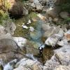
Open canyon for downclimbing, rappeling and swimming
Sud
Sintesi:
traduzione alternativa
➜
Lingua originale
Offenen Schlucht zum Abklettern, Abseilen und Baden
Open canyon for downclimbing, rappeling and swimming
Accesso:
traduzione alternativa
➜
Lingua originale
Zwischen Viareggio und (Marina di) Massa liegt das Städtchen Forte dei Marmi an der Küste. Hier verlässt man die A 12 (Ausfahrt 'Versilia') und steuert von da in nordöstlicher Richtung die Kleinstadt Seravezza an (ca. 7 km ab Autobahnausfahrt). Vor der Brücke über den Fluss nehmen wir die links einmündende Straße in Richtung Azzano, die uns westlich am Zentrum von Seravezza vorbeiführt und das Tal der Serra hinaufzieht. Etwa 1,5 km nach Seravezza durchfahren wir das kleine Straßendorf Malbacco. Dann passieren wir einen großen Steinbruch (zur rechten). Etwa 1,5 km hinter Malbacco sieht man links unten den Serra in einem breiten Kiesbett dahinfließen. Etwa 200 m, nachdem die Serra wieder in ihrem enges Flussbett gedrängt ist, zweigt links eine Piste zum Fluss ab. Etwa 300 m weiter und etwa 200 m vor einer Linkskurve, wo die Straße einen von rechts herabkommenden Bach quert, stellen wir das erste Fahrzeug ab. Man sollte sich die Mühe machen, zum Fluss hinunterzugehen, um sich die Ausstiegsstelle einzuprägen (Ausstiegshöhe 200 m ü.NN).Mit dem zweiten Fahrzeug geht es weiter, bis sich die Straße in einer Haarnadelkurve nach Süden wendet. Hier das obere Fahrzeug abstellen (380m üNN).
The small coastal town of Forte dei Marmi is located between Viareggio and (Marina di) Massa. Leave the A12 here (exit 'Versilia') and head north-east towards the small town of Seravezza (approx. 7 km from the highway exit). Before the bridge over the river, take the road on the left towards Azzano, which leads west past the center of Seravezza and up the Serra valley. About 1.5 km after Seravezza, we pass through the small roadside village of Malbacco. We then pass a large quarry (on the right). About 1.5 km after Malbacco, you can see the Serra flowing down to the left in a wide gravel bed. About 200 m after the Serra has been forced back into its narrow riverbed, a track branches off to the left towards the river. About 300 m further on and about 200 m before a left-hand bend, where the road crosses a stream coming down from the right, we park the first vehicle. You should take the trouble to walk down to the river to memorize the exit point (exit altitude 200 m above sea level) and continue with the second vehicle until the road turns south in a hairpin bend. Park the upper vehicle here (380 m above sea level).
Avvicinamento (10 min):
traduzione alternativa
➜
Lingua originale
Wir nehmen die Piste, die in der Haarnadelkurve abzweigt und uns in Richtung NNO zum Bach führt. Das ist der Einstieg für den unteren Abschnitt (Einstiegshöhe 370 m ü.NN).
Falls man auch den oberen, nicht gerade überwältigenden, Abschnitt mitnehmen möchte, fährt man nach der Haarnadelkurve nun in südlicher Richtung noch gute 250 m weiter, bis links eine Piste abzweigt (zur Casa Henraux und zum Polla dell'Altissimo). Diese fahren bzw. gehen wir bis zur Schranke (vor Beginn der Serpentinen). Dort kommen wir dann links auf einer Piste zum 'Bach'-Bett (560 m ü.NN).
We take the slope that branches off in the hairpin bend and leads us in a NNE direction to the stream. This is the entry point for the lower part (entry altitude 370 m a.s.l.) If you also want to take the upper, not exactly overwhelming, part, continue in a southerly direction for a good 250 m after the hairpin bend until a slope branches off to the left (to Casa Henraux and Polla dell'Altissimo). Follow this road to the barrier (before the start of the hairpin bends). There we turn left on a dirt road to the 'Bach' bed (560 m above sea level).
Giro (5 h):
traduzione alternativa
➜
Lingua originale
Wandern, Abklettern un Abseilen in einem weitgehend offenem Bachbett.
Hiking, downclimbing and rappeling in a largely open streambed.
Ritorno (5 min):
traduzione alternativa
➜
Lingua originale
An der besichtigten (und evtl. mit Steinmännchen markierten) Ausstiegsstelle links hinaus zur Straße.
At the exit point visited (and possibly marked with cairns) turn left out to the road.
Coordinate:
Inizio del canyon
Fine del canyon
Parcheggio all'entrata
für Integralbegehung (alternativer Zustieg)
Parcheggio in uscita
Partenza alternativa del canyon
für Integralbegehung
Parcheggio all'entrata
für den unteren Abschnitt
Letteratura:
Mappa
Edizioni Multigraphic nº 101 Alpi Apuane, 1:25 000
Mappa
Edizioni Multigraphic nº 102 Alpi Apuane, 1:25 000
Mappa
IGMI 25/V, 96 Monte Altissimo II-SO, 1:25 000
Info sul canyon Cwiki
Info sul canyon Descente
Info sul canyon Ropewiki
AIC Catasto
Altro info sul canyon
Altro info sul canyon
09.03.2023
System User
⭐
★★★★★
📖
★★★
⚓
★★★
nessuna traduzione disponibile
Info: Teile der Canyonbeschreibung wurden automatisiert übernommen. Konkret die Felder Weblinks, Koordinaten, Rating, Länge des Canyon, Einfachseil Mindestens von https://www.descente-canyon.com/canyoning/canyon/22457
09.03.2023
System User
⭐
★★★★★
📖
★★★
⚓
★★★
nessuna traduzione disponibile
Daten importiert von https://canyon.carto.net/cwiki/bin/view/Canyons/SerraCanyon.html
26.08.2022
Andreas
⭐
★★★★★
📖
★★★
⚓
★★★
💧
Normale
Completato ✔
traduzione alternativa
➜
Lingua originale
Schöner Angfängercanyon
Beautiful fishing canyon
Idrologia:


