difficile
Rio Margherita (Margarethenbach)
v5 a1 II
3h15
1h
2h
15min
550m
330m
220m
66m
1x60m/ 1x50m (2x50)
8
880m
Auto facoltativa
Valutazione:
★★★★★
2.7 (4)
Info:
★★★
2 (1)
Belay:
★★★
2 (2)
Sintesi:
traduzione alternativa
➜
Lingua originale
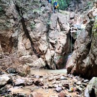
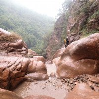
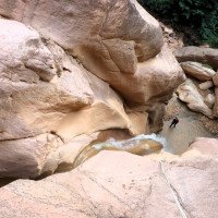
Kurze vertikale Süd-westlich ausgerichtete Schlucht mit meist sehr wenig Wasser (oft reicht ein kurzer Neopren); Manche Standplätze sind ausgesetzt, jedoch in sehr guten Zustand (Pro Canyon); Zwischenstand bei der höchste Abseilstelle; der Mittelteil ist der schönste und anspruchsvollste Teil; von Sand gefärbtes Kalkgestein, meist griffig. Das Wasser ist meistens trüb.
Short vertical south-west facing canyon with mostly very little water (often a short neoprene is enough); some belays are exposed but in very good condition (Pro Canyon); intermediate belay at the highest rappel point; the middle section is the most beautiful and challenging part; sand colored limestone, mostly grippy.
aprile - ottobre
5.00km²
Sintesi:
traduzione alternativa
➜
Lingua originale
Kurze vertikale Süd-westlich ausgerichtete Schlucht mit meist sehr wenig Wasser (oft reicht ein kurzer Neopren); Manche Standplätze sind ausgesetzt, jedoch in sehr guten Zustand (Pro Canyon); Zwischenstand bei der höchste Abseilstelle; der Mittelteil ist der schönste und anspruchsvollste Teil; von Sand gefärbtes Kalkgestein, meist griffig. Das Wasser ist meistens trüb.
Short vertical south-west facing canyon with mostly very little water (often a short neoprene is enough); some belays are exposed but in very good condition (Pro Canyon); intermediate belay at the highest rappel point; the middle section is the most beautiful and challenging part; sand colored limestone, mostly grippy.
Accesso:
traduzione alternativa
➜
Lingua originale
Von Bozen kommend fährt man auf der Bundesstraße Richtung Meran. Nach dem Ort Siebeneich (Settequerce) kommt links die Firma Unifx. Dort links einbiegen zum unteren Parkplatz. Etwas weiter gibt es rechts einen Weg der direkt mit einer Schranke abgesperrt ist hier könnte theoretisch mit einem Auto geparkt werden.
Der untere alte Parkplatz ist jetzt Privatstraße und die Möglichkeiten mit Steinen blockiert.
Hat man einen 2. PKW, so fährt man vom P1 bei Unifix Richtung Meran weiter. Am Kreisverkehr die erste Ausfahrt und nach ca. 300 m rechts der Bergstraße Richtung Mölten folgen. Nach der 4. Serpentinenkurve bzw. nach dem Tunnel kommt rechts eine Abzweigung. Die schmale asphaltierte Straße gewinnt schnell an Höhe. Nach einer kleinen Brücke biegt man dann reechts zum Maor Hof ab, wo man nach freundlichen Fragen das Auto parkt (ca. 580Hm).
2024 ist die Straße direkt nach der Abzweigung "gesperrt" wäre aber theoretisch befahrbar (Stand August). Alternativ kann direkt vor dem Durchfahrt verboten Schild geparkt werden (max 2 Autos)
Coming from Bolzano, take the main road in the direction of Merano. Directly before the sign "Klaus" (still before the inn Oberspeiser) a small asphalted road branches off to the right, which leads to 2 houses. At the exit of the street where the house with the No. 25 stands, one has before the ruin a small parking possibility.
If you have a 2nd car, continue from P1 at "Klaus" in the direction of Merano. Still before the beautiful church of Terlan goes right a mountain road direction Mölten. After the 4th serpentine curve or after the tunnel, there is a fork on the right. The narrow asphalt road quickly gains altitude. At the beginning one keeps. After a small bridge you then turn right to Maor Hof, where you park the car after friendly questions (approx. 580Hm).
Avvicinamento (1 h):
traduzione alternativa
➜
Lingua originale
(mit 2. PKW ca. 10min.)
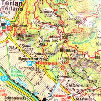
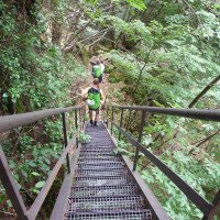
Zu Fuß: Man folgt von Haus Nr. 25 (Siehe Wegpunkt) den anfangs gut markierten Wanderweg Richtung „Montigl“ hoch (großes Fahrverbotsschild). Nach einigen steilen Höhenmeter und schöner Aussicht auf Berg und Tal, gelangt man zu einer Forststraße, die man nur kurz folgt, bevor der Weg, nur schlecht erkennbar, re wieder in den Wald abzweigt (Wanderwegmarkierung am Stein). Über den verfallenen und zum Teil verwachsenen Wanderweg gelangt man leicht linkshaltend über den Walrücken zu einer Weinreben mit Umzäunung, die schon zum Moar Hof gehört. Ein Tor mit der Wandermarkierung weist den Weg bis zum Maor Hof (auf ca. 580Hm). Hinter dem Hof folgt man den Weg Nr. 10 Richtung „Siebeneich“ hinunter. Man quert den Bach und geht bis zur Staumauer (mit Eisenstiegen). Unterhalb der Staumauer auf ca. 550Hm liegt der Einstieg
Alternativ kann auch Orographisch links des Baches aufsteigen. Hierfür durch das Gut gehen und dem Wanderweg Steil nach oben folgend, wenn man auf die Straße trifft kurz nach rechts, dann wieder dem Wanderweg folgen. Trifft man erneut auf die Straße weiter dem Wanderweg folgen und an der nächsten Möglichkeit auf ca. 430 HM links halten. Diesem Weg bis zum Einstieg in den Bach folgen.
Vor der Tour kann der Wasserstand in der Nähe des P1 kontrolliert werden. Dazu geht man die Privatstraße nach oben zum Bach.
without Schutteln about 1h, with 2nd car about 10min.
On foot: From house no. 25 you follow the initially well-marked hiking trail in the direction of "Montigl" up (large no-driving sign). After a few steep meters and a beautiful view of the mountain and the valley, you reach a forest road, which you follow only briefly before the path branches off to the right into the forest again (hiking trail marking on the stone). Following the dilapidated and partly overgrown hiking trail, you reach a vineyard with fencing, which already belongs to the Moar farm, keeping slightly to the left over the ridge of the whale. A gate with the hiking mark shows the way to the Maor farm (at about 580Hm). Behind the farm you follow the path no. 10 down towards "Siebeneich". Cross the stream and walk to the dam wall (with iron steps). Below the dam wall at approx. 550Hm is the entry.
Before the tour you can check the water level near P1. To do this, go right to the creek (exit) at the no-driving sign.
Giro (2 h):
traduzione alternativa
➜
Lingua originale
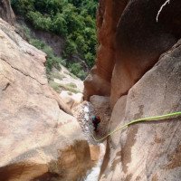
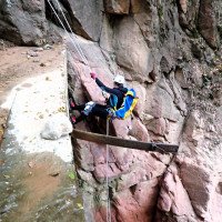
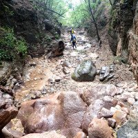
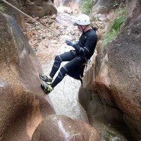
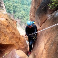
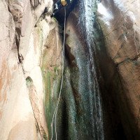
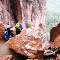
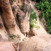
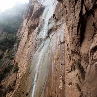
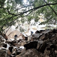
Die Tour beginnt mit einigen Abkletterpassagen und kurzen Abseilstellen. Die anfangs nicht so berauschend sind. Jedoch ist der technische Mittelteil mit seiner grandiosen Aussicht/Tiefblick, sehr lohnenswert. Hier warten mehrere aufeinander folgende Abseilstellen auf den erfahrenen Canyonauten (20, 20, 50, 27m). Die Ankunftsbecken sind meist sandig und flach. Nach dem letzten ca. 27m Abseilstelle kommt ein großer Fels der rechts umgangen wird oder unter dem man hindurch klettert. Mit letztem Blick zurück auf der schönen vertikalen Teil folgt der nicht so angenehme Schlussteil. Bis zum Ausstieg auf ca. 300Hm müssen noch mehrere Abkletterstellen und kurze Gehabschnitte überwunden werden. Eine Wasserableitung und ein Wassertank auf der rechten Seite markieren den Ausstieg (ca. 330Hm).
The tour starts with some downclimb and short rappels. Which are not so exhilarating at first. However, the technical middle section with its magnificent view / deep view, very worthwhile. Here, several successive rappels await the experienced canyoneers (20,20, 50, 27m). The arrival pools are mostly sandy and shallow, but the water is clean. After the last approx. 27mAbseilsstelle comes a large rock that re bypassed or climbed under. With last view back on the beautiful vertical part follows the not so pleasant final part. Until the exit at about 300Hm, several downclimbs and short walking sections must be overcome. A water drainage and a water tank on the right side mark the exit (approx. 330Hm).
Ritorno (15 min):
traduzione alternativa
➜
Lingua originale
Vom Wassertank gelangt man über den sichtbaren Weg in Kürze zum Parkplatz. (Tipp: Hat man nur 1 PKW, so kann das Material mit dem Auto zuerst zum Maor Hof hochgefahren werden. Dann fährt man zum Ausstiegsparkplatz und geht über den Wanderweg hoch. Trinken für Aufstieg einberechnen).
From the water tank you can reach the parking lot shortly via the visible path. (Tip: If one has only 1 car, the material can be driven up to the Maor farm by car first. Then drive to the parking exit and walk up via the hiking trail. Include drinking for ascent).
Coordinate:
Inizio del canyon
Fine del canyon
Parcheggio Entrata e uscita
46.512383°, 11.267513°
↓↑
DMS: 46° 30" 44.58', 11° 16" 3.05'
DM: 46° 30.743", 11° 16.051"
Google Maps
DMS: 46° 30" 44.58', 11° 16" 3.05'
DM: 46° 30.743", 11° 16.051"
Google Maps
Alternativ Richtung Parkplatz von der Hauptstraße abbiegen und die erste Rechts "hinter" Unifix vorbei auf einem Schotterplatz in den Feldern parken.
Parcheggio all'entrata
46.525226°, 11.269549°
↓↑
DMS: 46° 31" 30.81', 11° 16" 10.38'
DM: 46° 31.514", 11° 16.173"
Google Maps
DMS: 46° 31" 30.81', 11° 16" 10.38'
DM: 46° 31.514", 11° 16.173"
Google Maps
Parken nur nach ausdrücklicher GENEHMIGUNG durch die netten Menschen vom Maor Hof! Zwingend fragen, ob es okay ist!
Letteratura:
Mappa
1:25000
Mappa
1:50000
Mappa
1:25000
Mappa
1:25000
Libro Canyoning
Pascal van Duin
2011
Libro Canyoning
Pascal van Duin
Edizioni TopCanyon
2009
100 Beschreibungen
Libretto di canyoning
AIC
2024
Booklet des Canyoning Treffens in Südtirol 2024 - Beschreibungen übernommen nach freundlicher Genehmigung
Info sul canyon ACA
Info sul canyon Cwiki
Info sul canyon Descente
Info sul canyon Ropewiki
Altro info sul canyon
Sconosciuto
Altro info sul canyon
Altro info sul canyon
04.08.2024
Performan
⭐
★★★★★
📖
★★★
⚓
★★★
💧
Normale
Completato ✔
nessuna traduzione disponibile
Automatisch importiert von Descente-Canyon.com für Canyon Margherita
Belle découverte que ce Rio Margherita en ce premier jour de Raduno 2024…La marche d’approche d’une grosse heure et 320m de D+ permet de « monter en température…Le débit ce jour était normal pour un canyon A1 ça passait crème dans le haut de la combinaison vu qu’on est jamais immergé…Les 8 rappels s’enchaînent sans temps morts, le passage de la C60 est très beau…Après le dernier rappel descendre dans le lit du ruisseau jusqu’à croiser une citerne peinte en vert en rive droite + cairn…Marche retour 12/15’ si on est stationné au niveau de l’usine UNiFIX.
(Quelle: https://www.descente-canyon.com/canyoning/canyon-debit/22021/observations.html)
03.08.2024
LeTrolle
⭐
★★★★★
📖
★★★
⚓
★★★
💧
Normale
Completato ✔
nessuna traduzione disponibile
Automatisch importiert von Descente-Canyon.com für Canyon Margherita
dc-
(Quelle: https://www.descente-canyon.com/canyoning/canyon-debit/22021/observations.html)
03.08.2024
Bina
⭐
★★★★★
📖
★★★
⚓
★★★
💧
Basso
Completato ✔
nessuna traduzione disponibile
Automatisch importiert von Descente-Canyon.com für Canyon Margherita
(Quelle: https://www.descente-canyon.com/canyoning/canyon-debit/22021/observations.html)
03.08.2024
Daniel Sturm
⭐
★★★★★
📖
★★★
⚓
★★★
💧
Basso
Completato ✔
traduzione alternativa
➜
Lingua originale
Altri utenti sono stati: Patrick Klarner Michael Geier Tim Schuster
Aktuell ist die Straße zum oberen Parkplatz gesperrt. (siehe Beschreibung)
Ein Standplatz könnte noch ein Seilgeländer benötigen. Alternativ kann vom Baum abgeseilt werden um zum Standplatz zu kommen.
Parking spaces need to be reworked. The road to the upper parking lot is currently closed.
One parking space could still need a rope traverse. Alternatively, you can get off the tree to get to the stand.
Altri utenti sono stati: Patrick Klarner Michael Geier Tim Schuster
03.08.2024
Bina
⭐
★★★★★
📖
★★★
⚓
★★★
💧
Basso
Completato ✔
traduzione alternativa
➜
Lingua originale
Altri utenti sono stati: Patrik Bartel Peisen Daniela Rossi
Anfang und Schluss nicht so schön, die Mitte aber toll. Keine Pools, leider braunes Wasser.Griffig zu gehen.
Beginning and end not so nice, but the middle is great. No pools, unfortunately brown water, easy to walk.
Altri utenti sono stati: Patrik Bartel Peisen Daniela Rossi
26.05.2023
System User
⭐
★★★★★
📖
★★★
⚓
★★★
nessuna traduzione disponibile
Der aktuelle Canyon wurde teilautomatisiert mit Canyon https://canyon.carto.net/cwiki/bin/view/Canyons/RienznbachCanyon.html zusammengeführt.
09.03.2023
System User
⭐
★★★★★
📖
★★★
⚓
★★★
nessuna traduzione disponibile
Daten importiert von https://canyon.carto.net/cwiki/bin/view/Canyons/RienznbachCanyon.html
09.03.2023
System User
⭐
★★★★★
📖
★★★
⚓
★★★
nessuna traduzione disponibile
Daten importiert von https://www.canyoning.or.at/index.php/liste-aller-canyons/65-rio-margherita-margarethenbach
Nuovo rapporto
Riportare brevemente e concisamente le informazioni più importanti dell'ultimo tour o importanti informazioni attuali sul canyon. Se necessario con link a video, foto, ecc..
*
*
*
Esc
Del
Idrologia:
nessuna traduzione disponibile
Weniger Wasser, am Besten nach Regen begehen.


