un po' difficile
Drachenmaul (Bärnbach)
v4 a3 III
5h5
1h
4h
5min
1040m
740m
300m
30m
2x40
30
400m
a piedi
Specialità:
Regenbach
Regenbach
Ingranaggi:
Utensile da trapano
Utensile da trapano
Valutazione:
★★★★★
2.7 (4)
Info:
★★★
2 (2)
Belay:
★★★
2 (2)
Sintesi:
traduzione alternativa
➜
Lingua originale
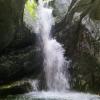
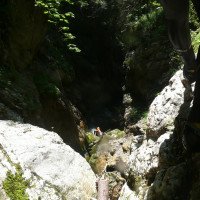
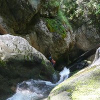
Rutschiger Waldgraben mit einigen schönen Einzelpasagen (Wasserstand/Zufluss beachten); Pegelstand bei Abseiler 9 kontrollierbar; ca. 30 Abseilstellen; Drachenmaul (Kaskade) mit wenig Lichteinfall; der lohnenswertere bzw. Interessantere Teil beginnt nach der Forststraße.
Slippery forest canyon with some nice single passages (pay attention to water level/inflow); level controllable at rappel 9; approx. 30 rappel points; dragon's mouth (cascade) with little light incidence; the more rewarding or interesting part starts after the forest road.
Sud
Calcare
Sintesi:
traduzione alternativa
➜
Lingua originale
Rutschiger Waldgraben mit einigen schönen Einzelpasagen (Wasserstand/Zufluss beachten); Pegelstand bei Abseiler 9 kontrollierbar; ca. 30 Abseilstellen; Drachenmaul (Kaskade) mit wenig Lichteinfall; der lohnenswertere bzw. Interessantere Teil beginnt nach der Forststraße.
Slippery forest canyon with some nice single passages (pay attention to water level/inflow); level controllable at rappel 9; approx. 30 rappel points; dragon's mouth (cascade) with little light incidence; the more rewarding or interesting part starts after the forest road.
Accesso:
traduzione alternativa
➜
Lingua originale
Von Abtenau auf der B166 (Pass Gschütt Str.) ri. Gossau fahren --> an der T-Kreuzung in Gossau li. (ri. Bad Goisern) abbiegen und der Romantikstr. folgen --> ca. 2 Km nach dem Ortsende kommt eine kl. Brücke (Bärnbach) --> hier re. beim Holzhandel-Transporte Kressl parken (bzw. besser gegenüber am Parkplatz/Holzlagerplatz).
From Abtenau take the B166 (Pass Gschütt Str.) towards Gossau --> at the T-junction in Gossau turn left (towards Bad Goisern) and follow the Romantikstr. --> approx. 2 km after the end of the village there is a small bridge (Bärnbach) --> park here on the right at Holzhandel-Transporte Kressl (or better opposite at the car park/wood storage area).
Avvicinamento (1 h):
traduzione alternativa
➜
Lingua originale
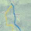
Vom Parkplatz li. den Jägerpfad neben dem Bach entlang -- Anfangs noch flach und übersichtlich wird der Weg im Wald steiler und beschwerlicher --> nach ca. 40min. (200Hm) kommt ein Forstweg (lange Materialseilbahn) --> Entweder man folgt hier dem Forstweg bis zum Bach und geht nur den (Interessanteren) unteren Teil oder man folgt li. den schmalen Pfad weiter durch den Wald um zum oberen Einstieg zu gelangen --> für den oberen Einstieg (auf ca. 1040m) den Pfad an einer geeigneten Stelle re. verlassen und in den Bach absteigen.
From the parking lot to the left along the hunter's path next to the stream -- initially still flat and clear, the path in the forest becomes steeper and more difficult --> after about 40min. (200Hm) comes a forest road (long material cable car) --> Either follow the forest road to the creek and go only the (more interesting) lower part or follow left the narrow path further through the forest to get to the upper entry --> for the upper entry (at about 1040m) leave the path at a suitable place on the right and descend into the creek.
Giro (4 h):
traduzione alternativa
➜
Lingua originale
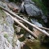
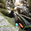
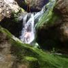
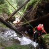
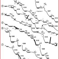
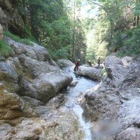
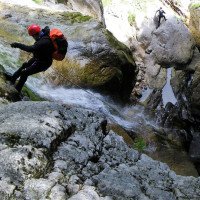
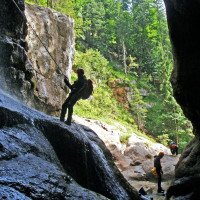
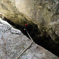
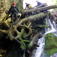
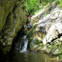
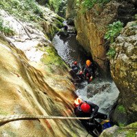
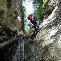
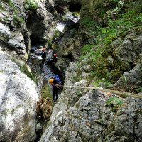
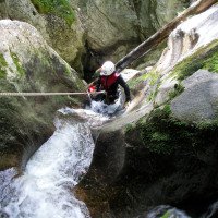
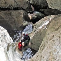
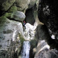
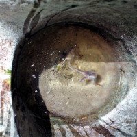
Im Bärnbach angekommen folgen nach kurzer Geh- und Kletterpasage die ersten Abseilstellen --> die höchsten und gleichzeitig schönsten Abseilstellen Stellen in der Schlucht kommen am Anfang und im unteren Teil der Schlucht vor --> die gesamte Schlucht ist sehr rutschig und die Abseiler sind meist in der Wassserführung --> mehrere verklauste Bäume müssen abgeklettert werden --> am Standplatz gibt es meist nur einen Bohrhaken mit kurzer Kette (bei unserer Begehung im gutem Zustand) --> auf das sogenannte „Drachenmaul“ (dunkle Kaskade) ist im eingeschnittenen unteren Schluchtenabschnitt--> in der Mitte der Abseilstelle gibt es eine tiefe Aushöhlung die mit etwas Geschick umgangen werden kann --> In der Schlucht gibt es viele Abseilstellen, mehrere Engstellen und bei richtigem Lichteinfall aufgrund der kontrastreichen Umgebungn ein schönes Farbenspiel --> zum Ende hin öffnet sich die Schlucht und man wandert das Bachbett entlang bis zur Staumauer.
Arrived in the Bärnbach follow after a short walking and climbing passage the first rappel points --> the highest and at the same time most beautiful rappel points in the canyon occur at the beginning and in the lower part of the canyon --> the entire canyon is very slippery and the rappel are mostly in the Wassserführung --> several entangled trees have to be downclimbed -.-> at the belaystation there is mostly only one bolthook with a short chain (in good condition during our ascent) --> on the so called "dragon's mouth" (dark cascade) is in the cut lower canyon section --> in the middle of the abseil there is a deep hollow which can be bypassed with some skill --> in the canyon there are many abseils, In the canyon there are many abseils, several narrow passages and with the right light a beautiful play of colors due to the contrasting surroundings --> towards the exit the canyon opens up and you hike along the streambed to the dam wall.
Ritorno (5 min):
traduzione alternativa
➜
Lingua originale
An der Staumauer angekommen folgt man dem Wanderweg re. in kürze zum Parkplatz zurück.
Once at the dam, follow the trail on the right back to the parking lot.
Coordinate:
Inizio del canyon
47.5997°, 13.5609°
↓↑
DMS: 47° 35" 58.92', 13° 33" 39.24'
DM: 47° 35.982", 13° 33.654"
Google Maps
Austria Topografica
DMS: 47° 35" 58.92', 13° 33" 39.24'
DM: 47° 35.982", 13° 33.654"
Google Maps
Austria Topografica
(cwiki_1)
Parcheggio Entrata e uscita
47.5895°, 13.5657°
↓↑
DMS: 47° 35" 22.2', 13° 33" 56.52'
DM: 47° 35.37", 13° 33.942"
Google Maps
Austria Topografica
DMS: 47° 35" 22.2', 13° 33" 56.52'
DM: 47° 35.37", 13° 33.942"
Google Maps
Austria Topografica
(cwiki_1)
Fine del canyon
47.5918°, 13.5648°
↓↑
DMS: 47° 35" 30.48', 13° 33" 53.28'
DM: 47° 35.508", 13° 33.888"
Google Maps
Austria Topografica
DMS: 47° 35" 30.48', 13° 33" 53.28'
DM: 47° 35.508", 13° 33.888"
Google Maps
Austria Topografica
(cwiki_1)
Info sul canyon ACA
Info sul canyon Cwiki
Info sul canyon Descente
Info sul canyon Ropewiki
26.06.2024
Susanne
⭐
★★★★★
📖
★★★
⚓
★★★
💧
Basso
Completato ✔
traduzione alternativa
➜
Lingua originale
Altri utenti sono stati: Paul Rettl Katharina Linder
Viele Verklausungen. Extrem rutschig.
Many obstructions. Extremely slippery.
Altri utenti sono stati: Paul Rettl Katharina Linder
19.05.2024
Clarissa Linder
⭐
★★★★★
📖
★★★
⚓
★★★
💧
Normale
Completato ✔
traduzione alternativa
➜
Lingua originale
Altri utenti sono stati: Julia Eising
Toller Canyon! Die meisten Stände in Ordnung, die Fixseile sind großteils nicht mehr verwendbar, könnte man nachrüsten... Die Schlucht ist wirklich sehr rutschig!
Parken hier möglich (gratis, ca. 3 Autos): https://maps.app.goo.gl/MdCZswXaWyRpL3UA7
Zustieg: einem der Wege orografisch rechts hinauf bis zur Forststraße folgen, auf dieser ein paar Meter nach rechts und dann wieder einem schmalen Steig nach oben bis zum Bachbett folgen (die Wege sind leider nicht beschildert).
Great canyon! Most of the stands are okay, the fixed ropes are mostly no longer usable, could be retrofitted... The canyon is really very slippery!
Parking possible here (free, approx. 3 cars): https://maps.app.goo.gl/MdCZswXaWyRpL3UA7
Access: follow one of the paths orographic to the right up to the forest road, follow it a few meters to the right and then follow a narrow path up to the streambed (unfortunately the paths are not signposted).
Altri utenti sono stati: Julia Eising
09.03.2023
System User
⭐
★★★★★
📖
★★★
⚓
★★★
nessuna traduzione disponibile
Info: Teile der Canyonbeschreibung wurden automatisiert übernommen. Konkret die Felder Weblinks, Koordinaten, Rating, Ort, Länge des Canyon, Einfachseil Mindestens von https://canyon.carto.net/cwiki/bin/view/Canyons/DrachenmaulCanyon.html und https://www.descente-canyon.com/canyoning/canyon/22132
09.03.2023
System User
⭐
★★★★★
📖
★★★
⚓
★★★
nessuna traduzione disponibile
Daten importiert von https://www.canyoning.or.at/index.php/liste-aller-canyons/26-drachenmaul-baernbach
Nuovo rapporto
Riportare brevemente e concisamente le informazioni più importanti dell'ultimo tour o importanti informazioni attuali sul canyon. Se necessario con link a video, foto, ecc..
*
*
*
Esc
Del
Idrologia:
